
Places to see
Iceland Attractions
Use this page to find the landmarks, landscapes, and scenic areas worth building your route around.
Useful for
Where to start
Start with one route-shaping line.
Gullfoss works best when the nearby Golden Circle stops are easy to compare, not mixed with unrelated highlights.


All place guides
Find sights worth building into your route.
Search and filter attraction pages and visual collections without mixing in route or region hubs.
What do you want to see?
Where?
Route level
Trip style
Þríhyrningur
Þríhyrningur is a three-peaked mountain above Fljótshlíð in South Iceland, best for travelers who want a quieter marked hike, wide saga-country views, and enough weather flexibility to skip it when cloud or snow wins.
Mountain hike · South Iceland · Near Fljótshlíð
Tindfjöll
Tindfjöll is a rugged mountain range beside Tindfjallajökull in South Iceland, worth adding when you want wilder Þórsmörk-area views but easy to skip on a tight classic South Coast day.
South Iceland · Mountain ridge · Þórsmörk context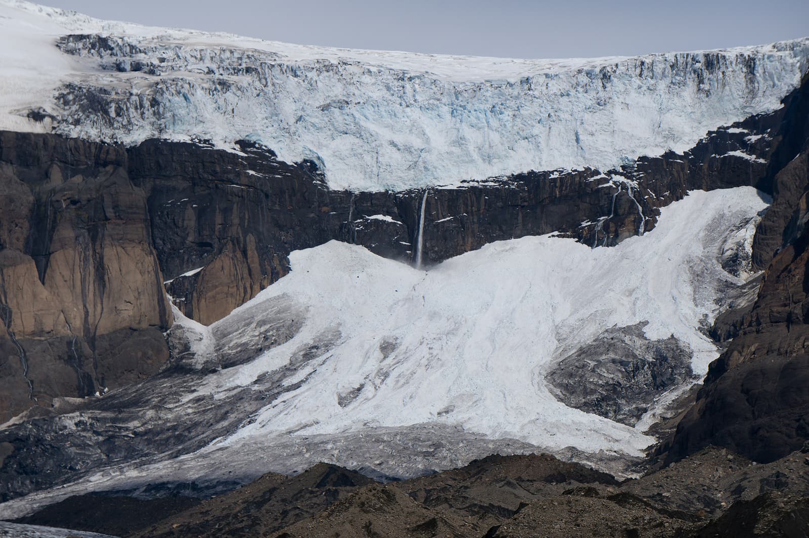
Morsárfoss
Morsárfoss is Iceland's tallest waterfall in the Skaftafell side of Vatnajökull National Park, but it is a distant, weather-dependent hiking view rather than an easy roadside stop, so plan it only for strong walkers.
Waterfall · Vatnajökull · Skaftafell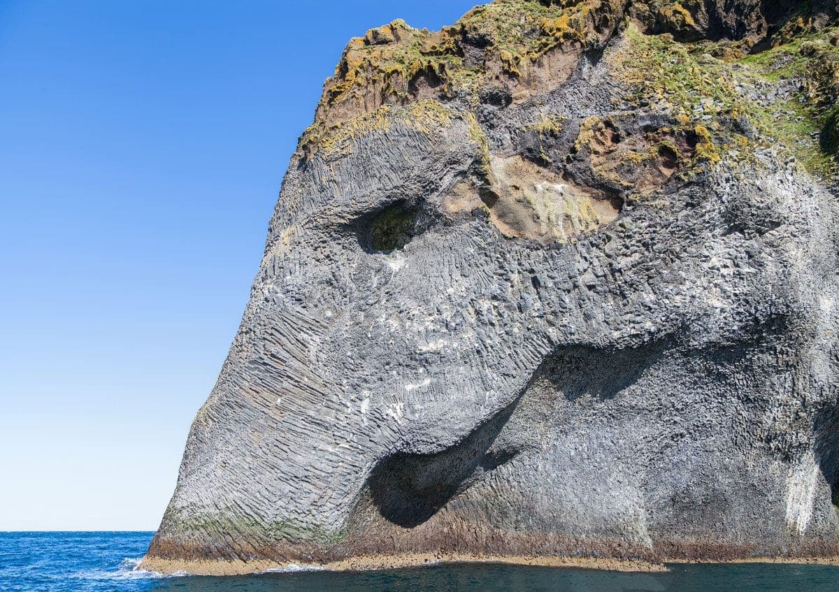
Elephant Rock
Elephant Rock is a basalt sea cliff on Heimaey in the Westman Islands, worth planning for if a boat view or island day already fits your South Coast trip.
Basalt sea cliff · Westman Islands · Boat-view landmark · South Coast add-on
Arnarker
Arnarker is a rough lava-tube cave in Leitarhraun near Þorlákshöfn, worth considering for flexible self-drive travelers who can verify access and safety, but easy to skip for a first South Coast sightseeing day.
Lava cave · Near Þorlákshöfn · Access-sensitive
Mýrdalssandur
Mýrdalssandur is the broad black-sand outwash plain east of Vík on Iceland’s South Coast, best for travelers deciding whether to pause for volcanic scale or keep time for nearby Vík-area stops.
South Iceland · Black-sand plain · Route-context stop
Hjörleifshöfði
Hjörleifshöfði is a steep South Coast headland on Mýrdalssandur near Vík, best for travelers deciding between a quick Gígjagjá cave stop and a longer rough-edged viewpoint walk nearby.
Vík-area headland · Gígjagjá cave and black-sand views · South Coast add-on · Quiet viewpoint stop
Breiðárlón Glacier Lagoon
Breiðárlón is a quiet glacier lagoon near Jökulsárlón on the southeast South Coast, worth adding when you have flexible time for a wilder glacier view and not just another rushed Ring Road photo stop.
Glacier lagoon · South Coast · Quieter stop
Nauthúsagil
Nauthúsagil is a narrow South Iceland ravine with a stream, mossy walls, and hidden waterfalls near the Seljalandsfoss area. Visit if you want an active side stop; skip it when footing, weather, or timing feel tight.
South Coast ravine · Near Seljalandsfoss · Wet canyon walk · Active hidden-gem stop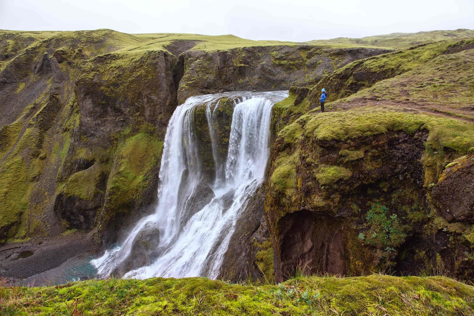
Fagrifoss
Fagrifoss is a remote waterfall near the F206 road toward Lakagígar, worth adding when vehicle choice, Highland conditions, time margins, and South Iceland route plans all make the rough detour realistic.
Highlands waterfall · F206 access · Near Lakagígar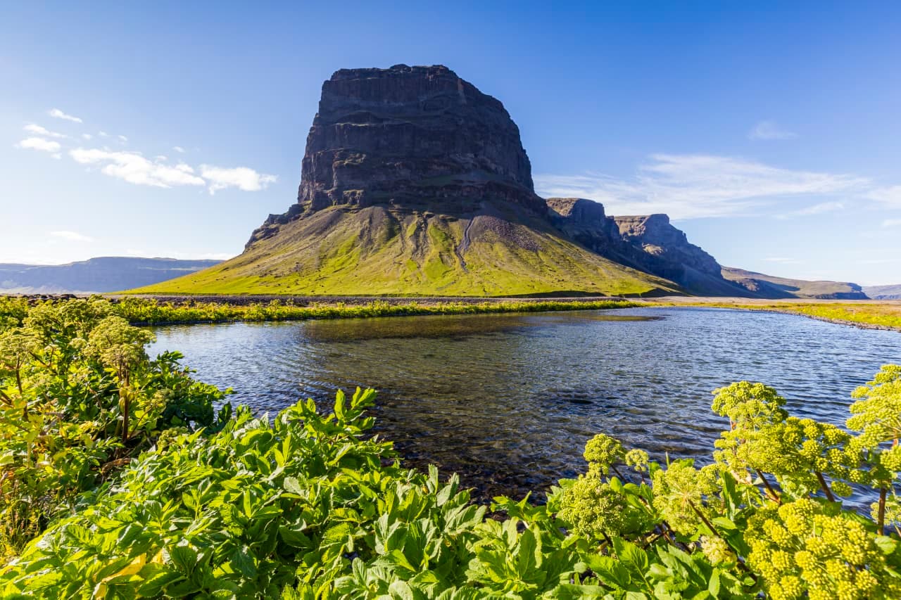
Lómagnúpur
Lómagnúpur is a steep South Coast mountain beside Route 1, best as a flexible photo pause between Kirkjubæjarklaustur and Skaftafell, with safe stopping, weather, and nearby glacier-country timing shaping the decision.
Mountain · South Iceland · South Coast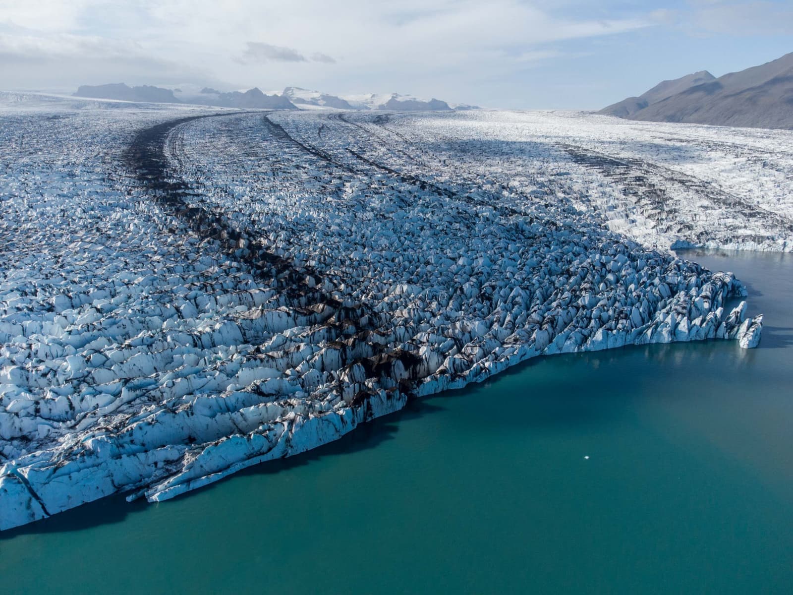
Breiðamerkurjökull
Breiðamerkurjökull is the outlet glacier behind Jökulsárlón in southeast Iceland, worth understanding for the icebergs and glacier scale, but best treated as a view or guided-access planning decision.
South Iceland · South Coast · Outlet glacier · 20-45 minutes
Ingólfsfjall
Ingólfsfjall is a steep tuff mountain near Selfoss and Hveragerði, useful as a South Iceland landmark, short viewpoint context, or hiking idea when conditions and access checks make it sensible.
Near Selfoss · Golden Circle edge · Mountain landmark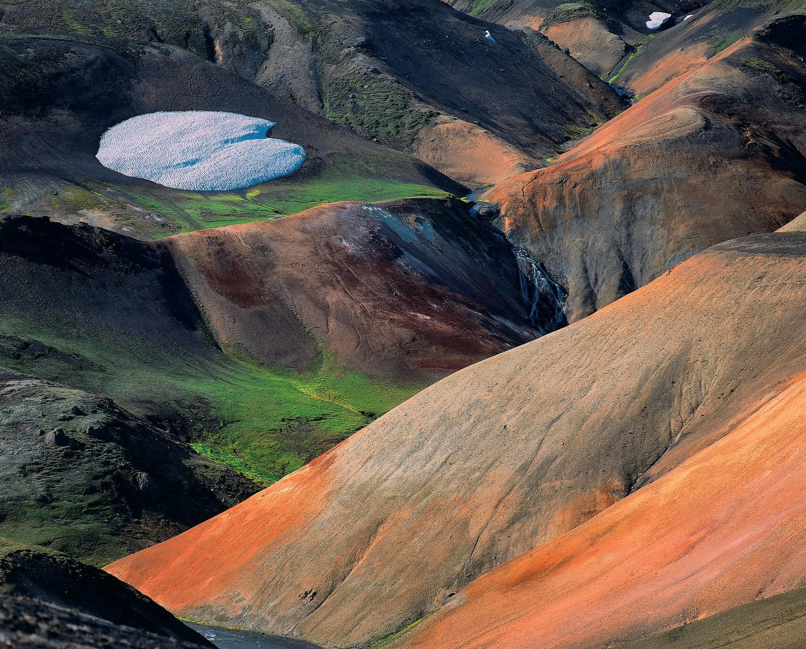
Torfajökull
Torfajökull is a remote volcanic and geothermal area in the South Iceland Highlands, worth planning when you want vivid rhyolite scenery, rough-road adventure, and enough flexibility for weather, access, and nearby Fjallabak stops.
South Iceland Highlands · Volcanic area · F-road planning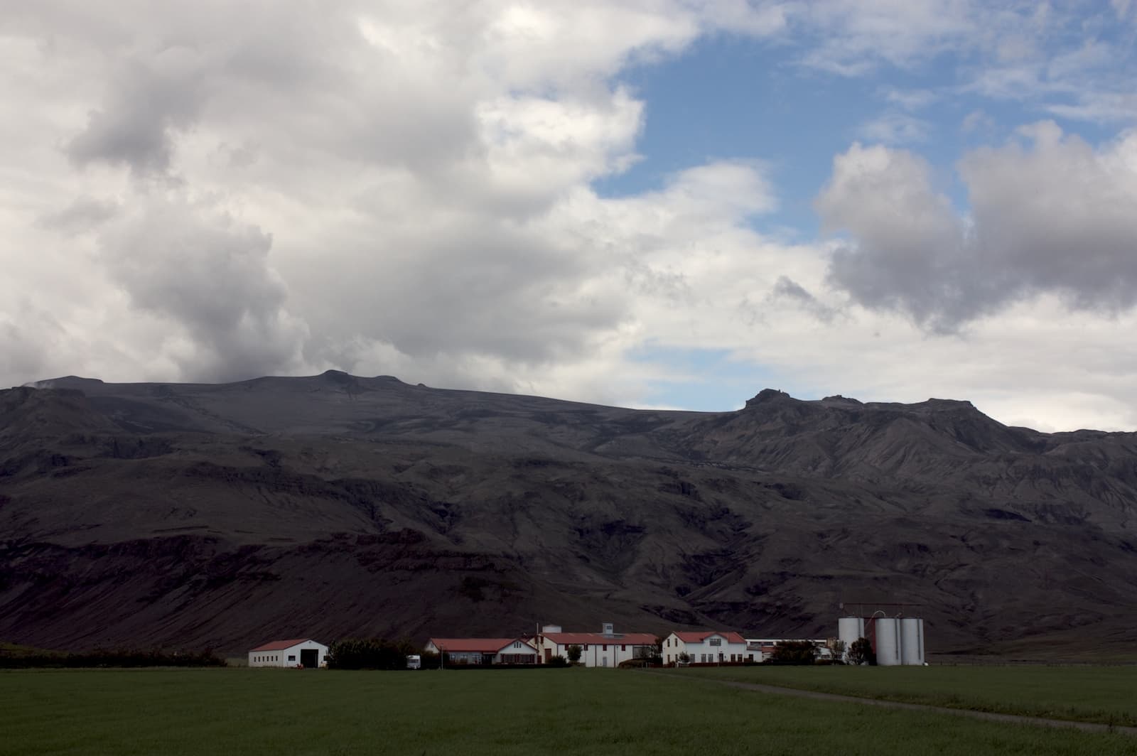
Þorvaldseyri
Þorvaldseyri is a historic South Coast farm beneath Eyjafjallajökull, worth a short, source-checked stop when you want eruption context and farm scenery between the larger waterfall and beach sights.
Historic farm · South Iceland · South Coast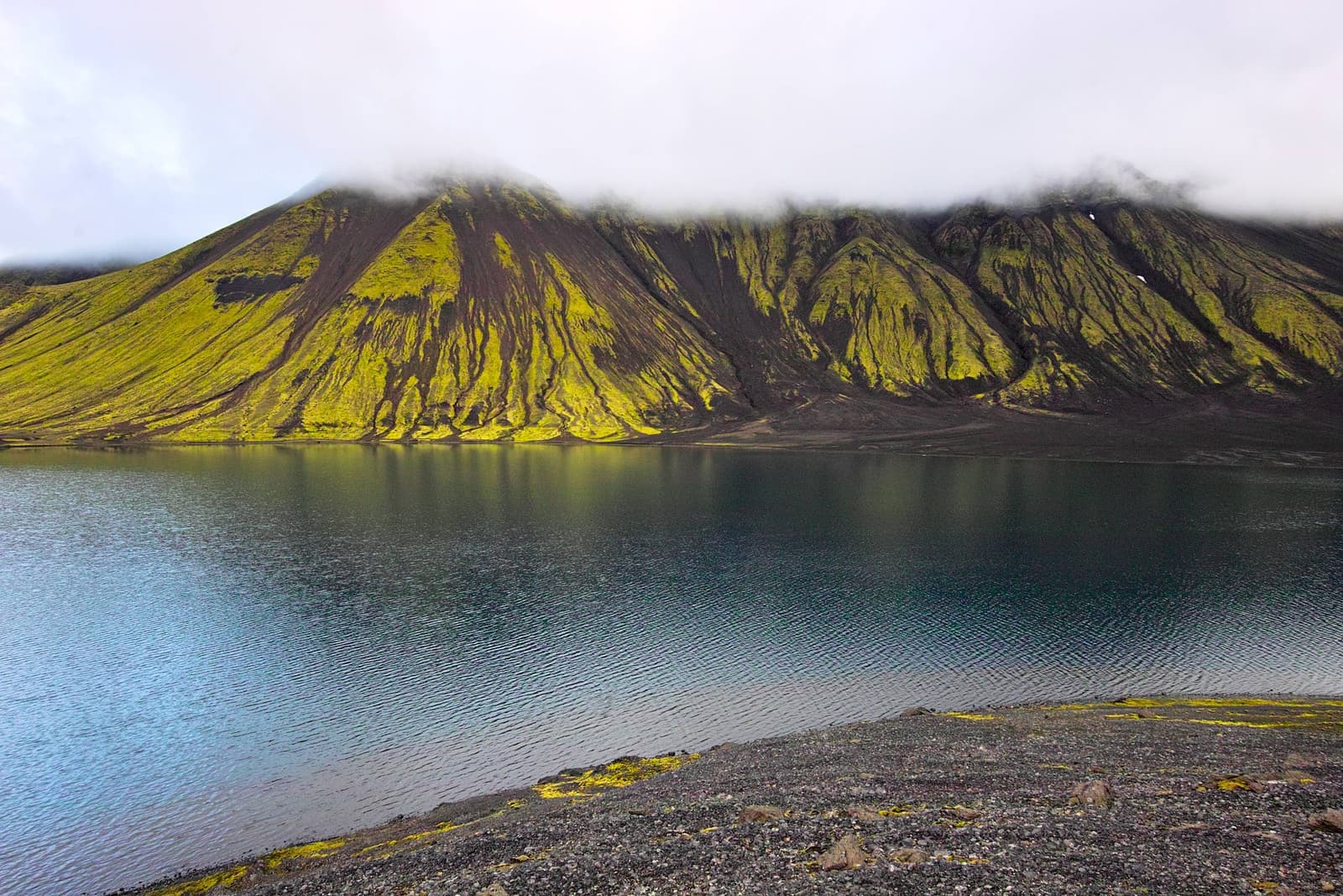
Sveinstindur
Sveinstindur is a remote Highlands mountain above Langisjór, worth adding when the day already fits F-road access, clear weather, and a short steep hike for one of the area’s strongest viewpoints.
Langisjór viewpoint · Highlands hike · F-road access
Skógar Museum
Skógar Museum is a South Coast cultural stop beside Skógafoss, useful when you want turf houses, regional artifacts, and old transport history instead of another quick waterfall-only pause.
Museum and turf houses · South Iceland · South Coast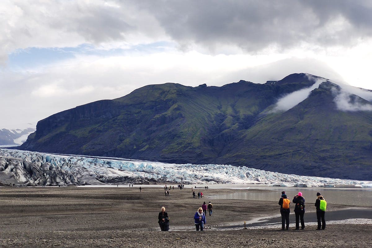
Skaftafellsjökull
Skaftafellsjökull is an outlet glacier above Skaftafell in southeast Iceland, best for travelers who want a focused glacier-viewing walk without turning the day into a guided ice activity.
Outlet glacier · Skaftafell · South Coast
Seljavallalaug
Seljavallalaug is a historic geothermal swimming pool hidden in Seljavellir valley on Iceland’s South Coast; visit for the setting and short walk, but skip it if you need spa comfort, managed bathing, or predictable conditions.
Historic pool · South Iceland · South Coast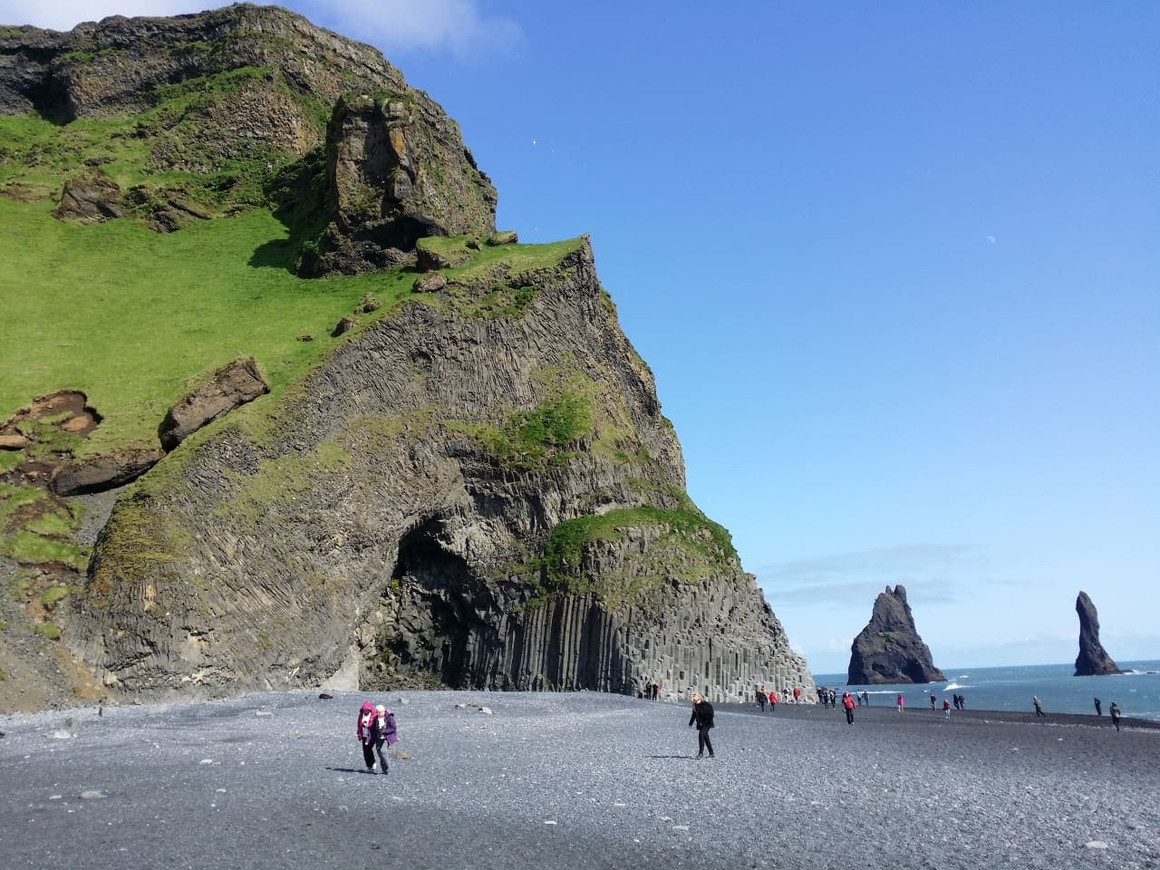
Reynisfjall
Reynisfjall is the steep tuff mountain above Vík and Reynisfjara, best for travelers who want cliff scenery, sea-stack views, puffin-season context, and a quieter South Coast pause without treating the ridge road as routine.
Vík-area mountain viewpoint · Reynisfjara and sea-stack context · South Coast scenic add-on · Weather-aware short stop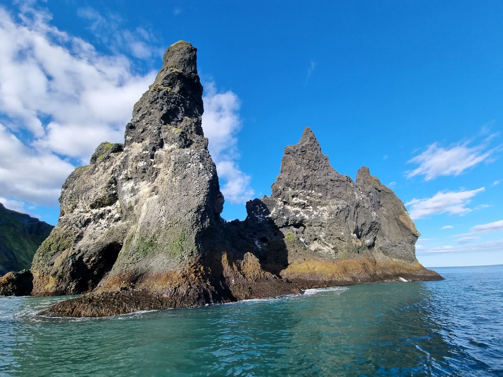
Reynisdrangar
Reynisdrangar are the basalt sea stacks off the Vík coast, best planned as a viewpoint goal near Reynisfjara where safety, viewing angle, and South Coast pacing decide the stop.
Vík-area basalt sea stacks · Reynisfjara and Reynisfjall views · South Coast scenic short stop · Safety-aware photo viewpoint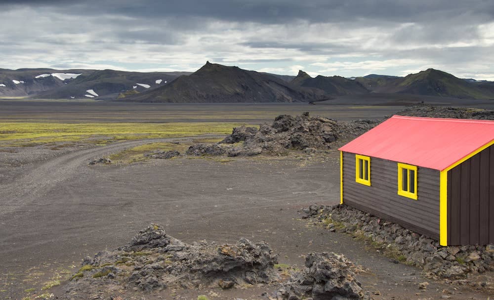
Jökulheimar
Jökulheimar is a remote hut and glacier-edge stop west of Vatnajökull, worth adding only when a summer Highlands plan, suitable vehicle, weather window, and slow-day buffer all make sense.
West Vatnajökull · Remote hut stop · Highlands detour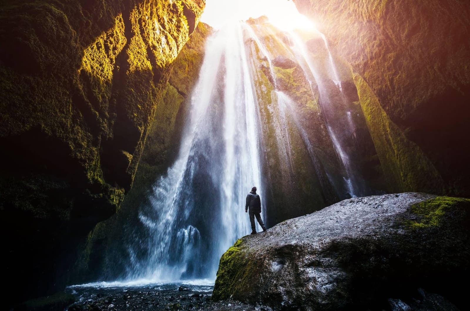
Gljúfrabúi
Gljúfrabúi is a narrow canyon waterfall beside Seljalandsfoss on the South Coast, best for travelers who want a wetter, more enclosed stop and can judge footing, spray, and timing before adding it.
South Coast waterfall · Beside Seljalandsfoss · Narrow canyon view · Wet short stop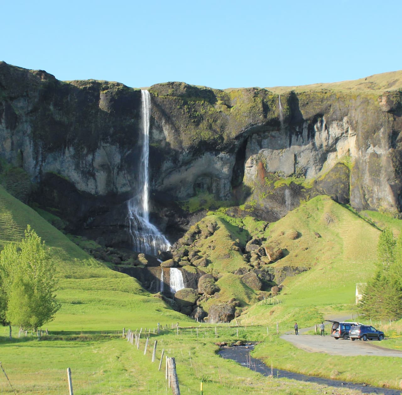
Foss á Síðu
Foss á Síðu is a slender waterfall above an old farm east of Kirkjubæjarklaustur, best as a quick South Coast pause when you want roadside scenery without adding a full hike.
South Coast · Waterfall · Short Route 1 pause · Near Kirkjubæjarklaustur
Eldhraun
Eldhraun is a vast moss-covered lava field beside Route 1 in South Iceland, useful as a short Ring Road texture stop when you want Laki eruption history without adding a full highland detour.
Lava field · South Iceland · Ring Road
Þjórsá
Þjórsá is Iceland's longest river and a South Iceland route corridor, useful when you choose a specific waterfall, valley, or river viewpoint instead of treating it as one simple stop.
South Iceland · River corridor · Self-drive decision
Laugarvatn
Laugarvatn is a small lake village on the Golden Circle, useful when you need a calmer geothermal pause, a lakeside base, or a decision about whether to add time between Þingvellir, Geysir, and Gullfoss.
Golden Circle lake · Geothermal pause · South Iceland
Skógar
Skógar is a tiny South Coast village beside Skógafoss, useful when you want to turn a famous waterfall stop into a slower cluster with culture, short walks, and route choices.
Village cluster · South Iceland · South Coast
Þórbergssetur
Þórbergssetur is a culture center and heritage museum at Hali in Suðursveit, useful when a glacier-lagoon driving day needs local history, literary context, and a calmer indoor pause near Jökulsárlón.
Hali museum · Near Jökulsárlón · Indoor Ring Road pause
Þorlákshöfn
Þorlákshöfn is a harbor town on South Iceland's southwest coast, useful when you want a quieter coastal pause, ferry-contingency context, or Lighthouse Trail stop before deciding whether the detour strengthens your day.
Harbor town · South Iceland · Coastal pause
Virkisjökull Glacier
Virkisjökull is a retreating outlet glacier near Skaftafell in southeast Iceland, worth considering when you want quieter glacier views but only if access, weather, and safety checks fit your South Coast day.
Southeast glacier · Skaftafell area · 30-90 minutes
Vestragil
Vestragil is a small gully and hot-spring area in Skaftafell, best for travelers who already have time in Vatnajökull National Park and need to decide if a quiet side stop is worth adding.
Skaftafell side stop · 30-75 minutes · Access checks matter
Tindfjallajökull
Tindfjallajökull is a remote glacier-capped volcano above South Iceland’s highland edge, worth considering when you want wild mountain views but need to decide whether a distant view is enough.
South Iceland · Glacier volcano · Highland access
Stakkholtsgjá
Stakkholtsgjá is a narrow canyon near Þórsmörk in South Iceland, reached by high-friction F-road access and river crossings; visit for the stream-bed walk and waterfall chamber only when conditions and access checks support the detour.
Canyon walk · South Iceland · Þórsmörk side
Sólheimasandur
Sólheimasandur is an exposed black-sand outwash plain on Iceland's South Coast, known for the DC-3 plane wreck; visit only if the long walk, weather, and daylight strengthen rather than crowd your route.
South Coast black sand · DC-3 wreck walk · Weather-sensitive stop · Near Skógar and Vík
Sólheimajökull Glacier
Sólheimajökull is an accessible South Coast glacier tongue where travelers can view Mýrdalsjökull ice up close, then decide whether a guided glacier walk is worth the time, cost, and safety checks.
South Coast glacier · Viewpoint or guided hike · Near Skógar and Vík · Road 221 access check
Skeiðarársandur
Skeiðarársandur is the vast black-sand outwash plain between Vatnajökull and the Atlantic, best judged as a scenic Route 1 context stop rather than a destination that replaces Skaftafell or Jökulsárlón.
South Coast · Route 1 · Black-sand plain
Öræfajökull Glacier
Öræfajökull is the glacier-covered volcano above Skaftafell in southeast Iceland, where travelers need to choose between scenic views, nearby outlet-glacier stops, or a serious guided mountain objective with official checks.
South Iceland · Glacier volcano · Skaftafell area
Mýrdalsjökull Glacier
Mýrdalsjökull is a large South Coast glacier above Katla, best planned as a route-defining landscape where travelers must choose between distant views, guided glacier access, or a simpler nearby stop.
South Iceland · Glacier and Katla · Guided access checks
Magni
Magni is a young volcanic cone on Fimmvörðuháls in South Iceland, worth considering only when you are already planning the mountain route and can handle the access, weather, time, and safety checks.
Volcanic crater · Fimmvörðuháls · South Coast
Krakatindur
Krakatindur is a jagged volcanic mountain near Hekla in South Iceland's Highlands, best for prepared summer drivers deciding whether a rough-track detour is worth the access, weather, and vehicle commitment.
Hekla-area mountain · Highland track · Remote 4x4 detour
Klettshellir
Klettshellir is a large sea cave beneath Ystiklettur in the Westman Islands, worth planning only when a boat trip, sea conditions, ferry timing, and island-day priorities all make sense.
Westman Islands · Sea cave · Boat access
Katla
Katla is an active volcano beneath Mýrdalsjökull on Iceland’s South Coast, best planned as a safety-sensitive landscape stop where the main decision is whether to view it, book guided access, or skip close plans.
South Iceland · Volcano under glacier · Safety checks
Hveragerði
Hveragerði is a geothermal town east of Reykjavík, useful as a quick stop, soft overnight base, or Reykjadalur gateway when you decide how much time to give the steam, walks, and nearby routes.
Geothermal town · South Iceland · Golden Circle edge
Hvannadalshnúkur
Hvannadalshnúkur is Iceland's highest peak, rising from Öræfajökull above Skaftafell, where travelers must choose between admiring the mountain from the South Coast or committing to a demanding guided glacier summit.
South Iceland · Highest peak · Guided glacier summit
Gígjökull
Gígjökull is the rough outlet glacier descending from Eyjafjallajökull toward Þórsmörk; visit for volcanic-glacier scale and 2010 eruption context, but only when access, weather, vehicle, and safety checks support the detour.
Outlet glacier · South Iceland · Þórsmörk side
Fljótshlíð
Fljótshlíð is a rural saga landscape east of Hvolsvöllur in South Iceland, best for travelers deciding whether a quieter side-road detour adds more than another major waterfall stop.
South Iceland · Saga landscape · Slow detour
Fjallsjökull Glacier
Fjallsjökull is an outlet glacier above Fjallsárlón in southeast Iceland, best visited as a glacier-view stop or guided ice experience, not as a casual walk onto the ice.
South Iceland · South Coast · Outlet glacier · 30-60 minutes
Fimmvörðuháls
Fimmvörðuháls is a high mountain pass between Skógafoss and Þórsmörk, worth planning when you want a serious South Coast hike and can solve weather, transport, time, and gear before committing.
Mountain pass · South Coast · Serious hike
Falljökull Glacier
Falljökull is a dramatic outlet glacier above Skaftafell in southeast Iceland, worth planning when you want close glacier scale but need to separate safe viewpoints from guided ice access.
South Iceland · Outlet glacier · Skaftafell area
Eldfell
Eldfell is the young red volcano above Heimaey in the Westman Islands, worth adding when you want a short hike, eruption history, and views that justify the ferry time.
Volcano hike · Westman Islands · 1973 eruption · South Coast add-on
Hekla
Hekla is one of South Iceland’s most famous active volcanoes, best planned as a powerful landmark and route anchor where the main decision is how close current conditions and safety guidance make sensible.
South Iceland · Active volcano · Safety checks
Surtsey
Surtsey is a protected volcanic island south of the Westman Islands, best treated as a place to understand or view from afar because public landing is prohibited and current sea conditions shape any distant viewing plan.
Protected island · UNESCO site · Westman Islands · View from afar
Hengill
Hengill is a geothermal mountain and volcanic system near Reykjavík and the Golden Circle, worth adding when you want steam, marked trails, and energy-landscape context rather than another quick roadside stop.
South Iceland · Golden Circle · Geothermal trails
Eyjafjallajökull
Eyjafjallajökull is the glacier-capped South Coast volcano made famous by the 2010 eruption; visit for route context and views, but treat glacier or summit access as serious guided terrain.
Glacier-volcano · South Iceland · South Coast
Vatnajökull Glacier and National Park
Vatnajökull is Iceland’s largest glacier and a region-scale attraction, best planned by choosing specific lagoons, outlets, hikes, or viewpoints rather than treating it as one stop, with enough flexibility for conditions and nearby route choices.
South Coast / Ring Road · Glacier and national park · Viewpoints, walks, lagoons
Svartifoss
Svartifoss is Skaftafell’s basalt-column waterfall, worth adding when you have time for a real walk rather than only quick southeast Iceland viewpoints, with enough flexibility for conditions and nearby route choices.
Skaftafell · 2-hour hike · South Coast
Skogafoss
Skógafoss is a major South Coast waterfall stop, worth planning with spray, stair-climb time, crowd timing, and nearby Kvernufoss or Skógar context, with enough flexibility for conditions and nearby route choices.
Waterfall · South Iceland · South CoastSkaftafell
Skaftafell is a Vatnajökull National Park base area, best planned around short hikes, glacier views, weather, and how much southeast Iceland time your route can spare, with enough flexibility for conditions and nearby route choices.
South Coast hiking base · Vatnajökull National Park · glacier views · marked trails
Reynisfjara
Reynisfjara is a dramatic South Coast black sand beach near Vík, best treated as a viewpoint-first stop where surf, erosion, warning lights, and local instructions control the visit.
South Coast black sand beach · Basalt columns and Reynisdrangar sea stacks · Safety-sensitive surf viewpoint · Near Vík, Dyrhólaey, and Skógafoss
Langisjór
Langisjór is a remote highland lake near Vatnajökull, worth planning only when road access, weather, vehicle choice, and a full highland day all make sense, with enough flexibility for conditions and nearby route choices.
Southern Highlands · Remote lake · Summer F-road detour
Lakagígar
Lakagígar is a remote crater row in the south Highlands, worth planning only when highland-road access, weather, vehicle choice, and enough day space align, with enough flexibility for conditions and nearby route choices.
Laki craters · F-road access · South Iceland Highlands
Kvernufoss
Kvernufoss is a quieter waterfall near Skógar, worth adding when you want a short walk and a calmer South Coast contrast to nearby Skógafoss, with enough flexibility for conditions and nearby route choices.
Waterfall · South Iceland · South Coast
Jökulsárlón Glacier Lagoon
Jökulsárlón is Iceland’s best-known glacier lagoon, worth planning as a southeast route anchor with iceberg viewing, Diamond Beach timing, weather, and nearby glacier stops in mind, with enough flexibility for conditions and nearby route choices.
South Coast · Ring Road · Glacier lagoon
Fjallsárlón Glacier Lagoon
Fjallsárlón is a quieter glacier lagoon near Vatnajökull, useful when you want iceberg views with less pressure than Jökulsárlón and enough time for southeast Iceland stops, with enough flexibility for conditions and nearby route choices.
Glacier lagoon · South Coast / Ring Road · Near Jökulsárlón
Eldgjá
Eldgjá is a remote volcanic canyon in the south Highlands, worth planning only when highland roads, weather, vehicle choice, and time margins make the detour realistic, with enough flexibility for conditions and nearby route choices.
Highlands canyon · F-road access · Ófærufoss walk
Seljalandsfoss
Seljalandsfoss is a South Coast waterfall where the path behind the falls makes timing, spray, footing, and nearby Gljúfrabúi pairing more important than a quick photo stop, with enough flexibility for conditions and nearby route choices.
South Coast waterfall · Walk-behind path when open · Near Gljúfrabúi and Skógafoss · Easy Ring Road access
Fjaðrárgljúfur Canyon
Fjaðrárgljúfur is a mossy canyon near Kirkjubæjarklaustur, worth adding when South Coast timing leaves room for a short viewpoint walk and official access guidance supports the visit, with enough flexibility for conditions and nearby route choices.
South Coast canyon · 45-90 minutes · Marked rim viewpoints
Dyrhólaey
Dyrhólaey is a South Coast headland near Vík, worth adding for elevated sea-arch, cliff, bird, and black-sand views when weather, access, and nearby Reynisfjara timing work, with enough flexibility for conditions and nearby route choices.
sea arch · cliff viewpoint · near Vík · South Coast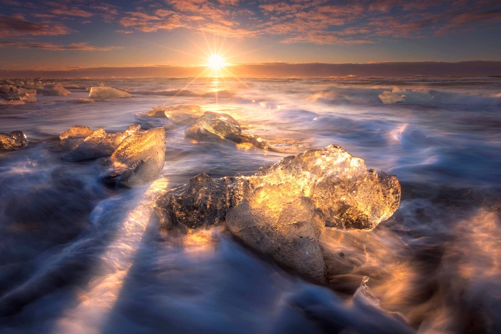
Diamond Beach
Diamond Beach is a black-sand shore beside Jökulsárlón where ice chunks wash onto the coast, best planned as a flexible glacier-lagoon pairing rather than a standalone beach stop.
black sand beach · glacier ice · Jökulsárlón pairing · southeast Ring Road
Build a trip around the places you want to see.
Once the sights are clear, use planning pages to turn them into a route with realistic timing.