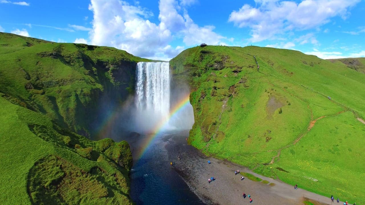
Skógafoss is a 60-meter waterfall on the South Coast, with a powerful base view, a stairway to the top and a protected series of smaller falls continuing above it.
Waterfall facts
Height and width
About 60 meters high and 25 meters wide
River
The Skógá on Iceland's South Coast
Protected
A natural monument since 1987
Time to allow
About 45-60 minutes for the base; longer with the stairs
Main choice
Base view, upper viewpoint or a separate longer hike
In this guide
Skógafoss drops from an old sea cliff
The clean 60-meter fall and open view from below make its scale easy to understand as soon as you approach.
Skógafoss is about 25 meters wide and falls from cliffs that once marked Iceland's coastline. The coast has moved farther south, leaving the waterfall above a broad, flat plain. Unlike a fall hidden inside a gorge, its full curtain is visible from the front, with the Skógá flowing away across open ground.
The waterfall was protected as a natural monument in 1987. It is also the lowest fall in a protected chain that continues for about 7 kilometers upstream. Skógafoss is therefore the lowest visible part of a much longer river landscape on Skógaheiði.
Official dimensions, former coastal-cliff geology and visitor infrastructure.
Photo guide
Skógafoss in photos
From above, Skógafoss opens onto the Skógá river and longer hiking terrain.
The base view is loud, wet and immediate
The simplest visit stays below the fall, where sound, mist and the broad curtain of water provide the main experience.
You can approach across the open riverbank until the spray becomes uncomfortable, then step back for a wider view. Waterproof outer layers help even in otherwise good weather, and a lens cloth is useful for cameras. A rainbow sometimes forms when sunlight meets the mist, but cloud and viewing angle decide whether you see one.
The open plain gives Skógafoss a clear frontal view before the path reaches the wetter riverbank.
Parking changed in 2026. Vehicles now stop outside the protected area, roughly 500 meters from the waterfall, and the old riverside lots are closed while the landscape is restored. Paid parking has begun at the new lot. Allow extra time for the approach in both directions, especially with children or limited mobility, and follow current signs and payment instructions.
Allow about 45-60 minutes for the walk, base view and return without the stairs. Give yourself longer with young children, slower walkers or icy ground.
Icelandic public broadcaster report placing the new lot about half a kilometer from the falls.
The stairs reveal the river above the fall
The upper viewpoint changes the angle completely, but it adds sustained climbing and more exposure to wind and ice.
A long stairway rises beside the eastern cliff to an observation platform near the waterfall's edge. From there, the water disappears over the lip toward the coastal plain, while the Skógá and the first part of the upstream path open behind you. The view explains the fall's position in the landscape better than the base alone.
The stairs add a demanding climb and can be skipped when footing or weather is poor.
Add roughly 30-45 minutes if you climb, pause at the platform and return. Skip it when steps are icy, wind is strong, visibility is poor or the climb exceeds your group's comfort. The base remains a complete waterfall experience; the upper view is an extension, not a requirement.
The protected waterfall series continues upstream
A short walk beyond the platform offers more quiet and context without committing to the full mountain crossing.
The marked path follows the Skógá past a sequence of smaller falls, including Hestavaðsfoss, Fosstorfufoss and Skálabrekkufoss. You can walk for a short time and return the same way. Turn around whenever time, weather or footing call for it.
Stay on the managed route. Parts of Skógaheiði have suffered vegetation damage, and the path is designed to reduce further erosion. The protected-area rules also prohibit drones without permission, restrict camping to the campsite below the waterfall and require dogs to remain on a leash.
Fimmvörðuháls is a separate mountain journey
The famous trail begins beside Skógafoss, but it is a separate mountain hike rather than part of a normal waterfall visit.
The full Fimmvörðuháls route runs 25 kilometers from Skógar to Þórsmörk, gains about 1,000 meters and crosses exposed terrain between Eyjafjallajökull and Mýrdalsjökull. Snow can remain well into summer, and fog, strong wind or sudden storms can make navigation difficult and exposed sections dangerous.
Plan it as a full-day or two-day mountain hike with transport at the far end, suitable equipment and a current trail assessment. The young craters Magni and Móði belong to that high route, not to a normal Skógafoss stop. None of those logistics are needed for the waterfall or a short riverside walk.
Official distance, elevation, seasonal range, terrain and safety guidance.
Conditions decide how much of Skógafoss to see
The waterfall itself is easy to reach from Route 1, but stairs and higher paths deserve a stricter weather check.
Use Umferðin for South Coast road conditions and the Icelandic Meteorological Office for wind, precipitation and warnings. Poor weather may still allow a short base visit even when the stairs or high trail are unsafe.
Official regional forecast and warning information.
For a nearby contrast, Kvernufoss sits in a narrower gorge near the Skógar Museum. Írárfoss is a quieter waterfall farther west, while Rútshellir is a brief stop for local history and folklore. Choose only the one that adds something different to your day.