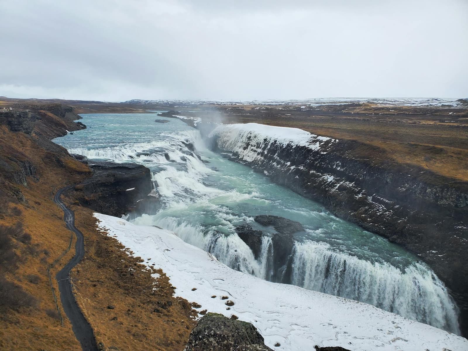
Gullfoss is a two-stage waterfall where the Hvítá river turns sharply and drops into a narrow canyon, creating a powerful view that changes noticeably between its upper and closer paths.
Waterfall facts
What it is
Two-stage waterfall and protected canyon on the Hvítá river
Drops
11 meters at the upper fall and 20 meters at the lower fall
Useful visit
About 45-75 minutes for the main viewpoints
Main conditions
Exposed wind, heavy spray and possible ice or path closures
Protected
The waterfall and canyon have been protected since 1979
In this guide
Two drops turn the Hvítá into a canyon waterfall
Gullfoss is not one vertical curtain of water. The Hvítá river descends over two angled drops, then continues through the narrow Gullfoss canyon.
The upper fall is 11 meters high and the lower fall is 20 meters. Their alignment makes part of the river appear to vanish into the ground from the main approach, although it is actually turning and dropping into the canyon. As you move between viewpoints, more of the waterfall's shape comes into view.
Hvítá carries sediment-rich glacial water through the area, so its color and force change with season and recent weather. The broader Hvítá River page explains the river beyond this one protected section.
Official protection, waterfall dimensions, geology and vegetation information.
Photo guide
Gullfoss Waterfall in photos
1 / 2
The canyon-edge view shows Gullfoss dropping through mist and dark rock.
Each viewpoint explains a different part of the falls
The high viewpoints show the complete bend in the river and canyon, while the closer path emphasizes sound, spray and the force of the lower drop.
If both levels are open, use the upper viewpoints to see the river's bend and the full shape of the canyon. The lower path leads onto a rocky ledge closer to the sound and spray, but it is wetter and more exposed. Railings and marked paths define the safe viewing area.
Visitor scale makes the size of the falls clear, while winter shows why individual paths cannot be assumed open.
Do not treat access to the closest viewpoint as guaranteed. Ice, snow, high water or maintenance can close a path while other views remain available. The visit is still worthwhile from the upper area when the lower path is unsafe or closed.
The canyon records continuing erosion
Gullfoss is protected not only for the falling water but also for the canyon, rock layers and spray-fed vegetation around it.
Hard dolerite layers lie above softer sedimentary material. Water removes loose material and undercuts the rock, helping the waterfall and canyon change over time. The protected area also contains mosses, heath and scrub that benefit from the moisture but grow slowly at this elevation.
From the closer side, the upper steps and lower drop become easier to distinguish.
Stay on the surfaced and marked paths even when an informal track appears to offer a clearer photo. Trampled vegetation can take a long time to recover, and an unmarked edge may be unstable, wet or hidden by snow.
A focused visit usually takes 45-75 minutes
Gullfoss does not require a long hike, but a very quick photo stop misses the way the view changes between levels.
Allow about 45 minutes for one or two main viewpoints at a comfortable pace. Around 60-75 minutes gives more room to move between levels, wait for a break in the spray and look into the canyon. Visitors walking slowly or dealing with winter surfaces may need longer.
This is a viewpoint visit rather than a trail destination. Brúarhlöð Canyon shows another part of the Hvítá, while Drumbó River Base is for pre-booked rafting. Neither is part of the Gullfoss viewpoint area.
Spray and ice can change the visit quickly
Gullfoss is exposed, and its own spray can make the viewpoint area feel colder and wetter than the surrounding forecast suggests.
Snow transforms the canyon, but it also makes path choice and footwear more important.
A waterproof jacket is useful even on a short visit. In winter, use footwear suited to ice and accept that the safest viewpoint may be the only sensible one. Never pass a closure or barrier to reach a photo position.
Official wind, precipitation and visibility forecast.
Geysir is the nearest major contrast
Geysir and Þingvellir are the other two major Golden Circle stops, but each offers a very different kind of visit.
The Geysir geothermal area and active Strokkur are the closest major stops and offer a clear change from water and canyon geology to hot springs and eruptions. Þingvellir adds history, rift geology and a longer walk through the landscape.