A national park shaped by law and geology

Þingvellir is both the setting of Iceland's early national assembly and one of the clearest places to see the country's active rift landscape.

The Alþing was established here around 930. For centuries, people traveled to this open plain beside the Öxará river to make laws, settle disputes and exchange news. The assembly continued to meet at Þingvellir until 1798, and the cultural landscape was added to the UNESCO World Heritage List in 2004.

Almannagjá, smaller fissures, lava, springs and Lake Þingvallavatn reveal a valley being pulled apart along the Mid-Atlantic Ridge. The history is not enclosed in one building; it lies across the same paths, cliffs and water that shape the park today.

Park identity and heritage

Follow Almannagjá to the old assembly site

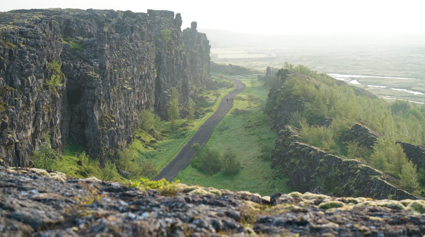
The most coherent first walk begins at Hakið, descends through Almannagjá and continues toward the old assembly site.

The main walk connects rift cliffs, water and the historic assembly landscape.
Aerial view of Almannagjá, the Öxará river and Lake Þingvallavatn at Þingvellir National Park

The main walk connects rift cliffs, water and the historic assembly landscape.

Almannagjá is the main route through the historic landscape. The path runs beneath the western rift wall and leads toward Lögberg, the Law Rock associated with the assembly's public proceedings. On-site signs help because the historic site is an open landscape of paths, water and low remains rather than a preserved medieval town.

  • Keep Almannagjá and the assembly area as the core of a short visit.
  • Add Öxarárfoss when the path and time suit your group.
  • Continue toward Þingvallakirkja for the church, river and quieter eastern side of the assembly site.
  • Treat Silfra, longer trails and lake activities as separate plans with their own current requirements.
Öxarárfoss is a natural addition to the main walk when conditions and time allow.
Öxarárfoss waterfall dropping over dark rock in Þingvellir National Park

Öxarárfoss is a natural addition to the main walk when conditions and time allow.

The assembly site is a landscape, not a single monument

Understanding the old Alþing area depends on seeing how Lögberg, the Law Council, booths, river and church related to one another.

People attending the assembly stayed in temporary booths and gathered for legal and social business across the plain. Only limited ruins remain visible, and some later structures sit over older traces. Signs and the visitor center explain what happened at places that can otherwise be difficult to recognize on the ground.

The present Þingvallakirkja was built in 1859, while the nearby residence includes buildings dating from 1930. These later landmarks do not replace the medieval story; they show that Þingvellir continued to hold national and ceremonial importance long after the old assembly moved to Reykjavík.

Reading the assembly site

The rift extends well beyond the main path

Almannagjá is the most visible feature, but it belongs to a wider fissure zone that includes the lake and faults across the valley.

Þingvellir lies in a broad down-dropped valley between major faults. The park describes this graben as about 7 kilometers wide, covered in lava roughly 10,000 years old. Continued spreading and subsidence have altered the land since the lava formed and since the Alþing first met here.

Lake Þingvallavatn gives the park much of its scale, although the main historic walk only shows part of it. Travelers interested in the lake, longer trails, fishing or diving need more time and should check the park's rules for those activities. Visiting the undeveloped Gjábakkahellir lava tube also requires separate preparation and proper cave equipment.

Rift and lake context

Match the visit length to the part of the park you want

A brief stop can show the main rift and viewpoint, while the history becomes clearer when you can walk through the assembly area without rushing.

Allow about 45-75 minutes for Hakið, part of Almannagjá and a focused look at the historic setting. This is enough for a compact visit, but it leaves little room for Öxarárfoss, the church, the visitor-center exhibition or time beside the lake.

A more useful first visit takes roughly 1.5-3 hours. That gives you time to walk through Almannagjá, stop at Lögberg, continue across the assembly site and add one or two features at a comfortable pace. A half day makes sense when longer trails, the exhibition, lake context or a booked activity are central to the visit.

Treat these as rough time estimates. Ice, wind, path work, parking choice and your group's pace can change both the route and the time needed.

Check parking, paths and weather before you go

Þingvellir is an open landscape with several parking areas, paths and activities, so the practical details depend on what you intend to do.

The Hakið visitor center is the best place to confirm current paths, parking and services.
Visitor center entrance at Hakið beside the main Þingvellir viewpoint

The Hakið visitor center is the best place to confirm current paths, parking and services.

The visitor center at Hakið stands beside the main viewpoint and the descent into Almannagjá. Check the park directly for current parking charges, exhibition hours, walking information, accessibility details and rules for activities. In winter or poor weather, also check road conditions and the South Iceland forecast before committing to the drive.

On a Golden Circle day, Þingvellir offers the history and walking that Geysir and Gullfoss do not. Give the park enough time for the main walk, and add smaller detours only if daylight, road conditions and your group's pace allow it. If geothermal infrastructure interests you, Nesjavallavirkjun east of the lake is a separate visit; it is not part of the national park walk.

Current visitor checks