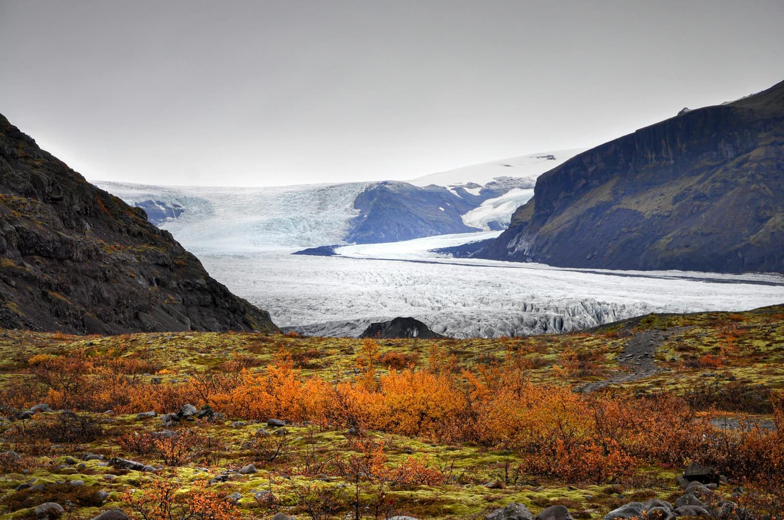
Vatnajökull is Europe's largest ice cap by volume and the central feature of a vast national park. Travelers experience it through specific outlet glaciers, marked trails and lagoons rather than at one entrance or viewpoint.
Area snapshot
Ice-cap area
About 7,500 km² in 2023, roughly 7% of Iceland
European scale
Europe's largest ice cap by volume
World Heritage
Vatnajökull National Park was inscribed by UNESCO in 2019
Main southeast areas
Skaftafell, Jökulsárlón and Fjallsárlón
Access reality
View the ice from marked land routes; use qualified guidance for travel on the glacier
In this guide
An ice cap and a national park of different scales
Vatnajökull is the ice cap. Vatnajökull National Park is the much larger protected landscape around it, with glaciers, volcanoes, rivers, canyons, trails and visitor areas spread across Iceland.
The ice cap covered about 7,500 square kilometres in 2023, or roughly 7% of Iceland, and remains Europe's largest by volume. It is formed from ice domes and many outlet glaciers. Those outlets are where most travelers actually meet Vatnajökull: the ice descends from the high interior toward accessible valleys, lagoons and lowlands.
The national park is broader than the glacier itself. It protects the interaction of ice and active volcanic systems as well as places that do not look glacial at first glance. Svartifoss, for example, is a waterfall destination inside the Skaftafell area of the park. The park joined the UNESCO World Heritage List in 2019 for the natural processes created by fire and ice.
Official visitor areas, park scope and 2019 UNESCO status.
Where travelers actually meet Vatnajökull
A useful visit starts by choosing one concrete area, not by searching for a single Vatnajökull entrance.
Three clear starting points
For marked walks
Choose Skaftafell for a year-round visitor centre, outlet-glacier views and trails of different lengths.
For floating icebergs
Choose Jökulsárlón, where Route 1 passes the lagoon and nearby Fellsfjara.
For a smaller lagoon trail
Choose Fjallsárlón for a marked 1.5 km route beside the lagoon and Fjallsjökull.
Jökulsárlón turns the scale of Vatnajökull into something immediate: glacier ice floating beside Route 1.
These places overlap, but they answer different needs. Skaftafell rewards time on foot. Jökulsárlón gives the clearest iceberg view from a major roadside visitor area. Fjallsárlón has its own marked lagoon route. They are destinations shaped by Vatnajökull, not interchangeable names for the whole glacier.
Skaftafell gives the clearest walking access
Skaftafell is the most straightforward place to combine park information, marked trails and views toward an outlet glacier.
Skaftafellsjökull is reached as a land-based viewpoint; the visible glacier is not an invitation to walk onto the ice.
Skaftafellsstofa Visitor Centre is open year-round, and rangers provide information about trails, natural features and local conditions. The official S1 Glacier Trail is a 4.1 km circuit with about 80 metres of ascent and an estimated walking time of 1 to 1.5 hours. It follows a landscape exposed by the retreat of Skaftafellsjökull rather than crossing the glacier.
Longer routes lead toward Svartifoss, Sjónarnípa and the Skaftafell highlands, but their distance and difficulty vary substantially. Use the current park trail list and visitor-centre advice instead of treating every Skaftafell walk as an easy glacier viewpoint.
Svartifoss is inside Vatnajökull National Park, which extends far beyond the ice cap itself.
Official distance, duration, ascent, difficulty and starting point.
Jökulsárlón and Fjallsárlón show the retreating edge
The southeast lagoons show what happens where outlet glaciers thin and retreat: new water, exposed sediment and icebergs moving away from the glacier front.
Fjallsárlón has a marked shore route with a close view toward Fjallsjökull.
Jökulsárlón and Fellsfjara sit on opposite sides of Route 1. Park rangers work in the area year-round, and the main lagoon has toilets and seasonal private services. The park lists a short marked route north from the main parking area, while longer paths continue across Breiðamerkursandur.
At Fjallsárlón, the official circular route is 1.5 km and estimated at 45 minutes. It follows a marked gravel path to viewpoints over Fjallsjökull and the lagoon. The park grades it challenging, a reminder that short distance does not always mean effortless terrain.
Official distance, duration, difficulty and trail description.
Glacier access depends on conditions and expertise
Viewing Vatnajökull from a marked land route is different from traveling on glacier ice, where crevasses and changing margins create hazards that are not obvious from the edge.
Do not step onto a glacier because the surface looks close or smooth. SafeTravel advises that glacier travel requires experience and proper equipment, and crevasses may be hidden by snow. If going onto the ice is the purpose of the visit, use qualified local guidance and follow current park restrictions.
Road and trail access can also change outside the glacier. The park warns that mountain weather shifts quickly and that snow, flooding, sandstorms and muddy spring ground can affect routes. Check the park, the Icelandic Met Office and Umferðin on the day rather than relying on a saved schedule.