Klettshellir is a large sea cave beneath Ystiklettur in the Westman Islands, worth planning only when a boat trip, sea conditions, ferry timing, and island-day priorities all make sense.
Quick guide
Type
Sea cave and boat-tour stop below Ystiklettur
Region
Westman Islands, off the South Coast of Iceland
Route context
Best as part of a Heimaey day, not as a normal roadside South Coast stop
Time to allow
Half day to full day once ferry travel, boat timing, weather buffer, and island stops are included
Best experience
A calm-sea boat approach that lets the cave, cliffs, water, and acoustics become the main event
Access reality
Klettshellir is water-accessed; boat operators and sea conditions decide how close the visit gets
Nearby pairings
Eldfell, Surtsey viewpoints, Seljalandsfoss, Skogafoss, Dyrholaey, and Reynisfjara
Before you go
Verify ferry, boat-operator, weather, sea-condition, road, and safety guidance before locking the day
Is Klettshellir worth planning around?
Yes, if the Westman Islands are already a real part of your route and you want the boat approach to the cliffs as much as the cave itself. No, if you only need another quick South Coast stop.
Klettshellir is not a roadside cave or a self-guided walk. It sits in the sea-cliff setting below Ystiklettur, so the experience depends on reaching Heimaey, choosing a boat trip, and accepting that wind, swell, and operator judgment shape what happens on the water.
A local Iceland travel editor would add Klettshellir for travelers who have given the Westman Islands enough time for both land and sea. They would skip it for a rushed South Coast day where Seljalandsfoss, Skogafoss, Dyrholaey, and Reynisfjara already create a full route.
Worth the stop?
When this stop makes sense
Good match for
travelers already committing time to Heimaey and the Westman Islands
visitors who want a sea-cave perspective rather than only land-based viewpoints
South Coast self-drivers with enough ferry, weather, and tour buffer
photographers and geology-focused travelers interested in cliffs, ocean caves, and acoustic spaces
Think twice if
travelers who want a guaranteed land-access cave walk
tight South Coast days where the ferry and boat trip would crowd out stronger stops
The useful choice is not just whether the cave sounds interesting. Decide whether your day has enough room for a boat-based attraction after ferry travel, weather checks, and the land stops you care about.
Klettshellir planning choices
Choice
Best use
Check first
Boat-first island day
Best when Klettshellir, cliffs, seabirds, and sea-cave acoustics are the main reason for going to Heimaey
Operator visitor details, sea conditions, weather, and ferry travel
Balanced Heimaey day
Best when the cave tour shares the day with Eldfell, harbor time, and a slower island pace
How much buffer remains after ferry travel and land-based stops
South Coast add-on
Works only when the detour does not weaken Seljalandsfoss, Skogafoss, Dyrholaey, or Reynisfjara
Road conditions, ferry notices, daylight, and return timing
Skip the cave
Choose this when boats, swell, wind, motion sensitivity, or tight logistics make the water portion the weak link
Use land-based Westman Islands stops or continue the South Coast instead
What makes the cave feel different?
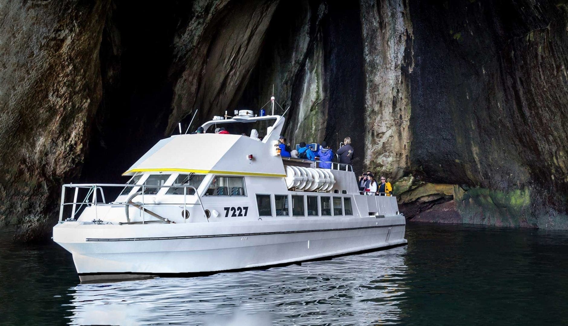
Klettshellir is about scale, sound, and the sudden change from open sea to a dark rock chamber. The famous acoustics matter because the cave is enclosed enough to turn a short stop into a memorable moment.
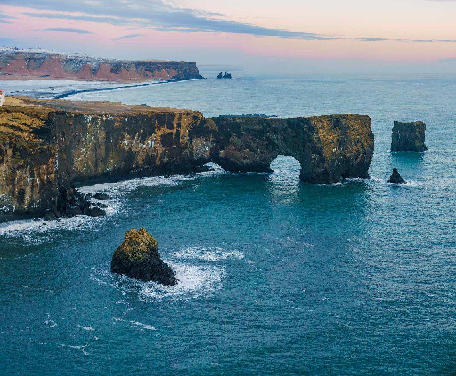
The cave sits under the Ystiklettur cliffs near Klettsvik, where the harbor-side landscape changes from green-topped rock to vertical sea walls. From the water, the opening reads less like a hiking destination and more like a place carved for boats, echoes, and careful maneuvering.
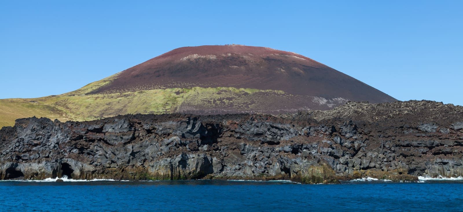
That is why Klettshellir pairs better with the volcanic island story than with a normal cave checklist. Eldfell gives you the land-based eruption context, while Surtsey viewpoints and the boat route explain why the Westman Islands feel so different from mainland South Iceland.
The exterior view shows why this is a water-access cave rather than a walk-in land stop.
How much time and effort does it need?
Treat Klettshellir as a half-day to full-day planning choice once the ferry, harbor, boat trip, weather buffer, and other island stops are included. The cave itself is only one part of the commitment.
For most travelers, the real effort is not walking; it is sequencing. You need to reach Landeyjahofn, cross to Vestmannaeyjar, join a suitable boat departure, and still leave room for whatever else made Heimaey worth the detour. If you are bringing a car, building the cave into a short itinerary, or returning to the mainland the same day, the margin matters.
A balanced version gives the boat trip its own block and keeps the rest of the island simple. A slower version adds Eldfell or harbor time before returning to the mainland. A tight version tries to combine the ferry, cave, and a full South Coast route; that is the version most likely to disappoint.
The cave belongs to a wider cliff-and-sea route around Heimaey, not an isolated checklist stop.
Where does it fit with the South Coast?
Klettshellir fits best as a deliberate island detour from a South Coast route. It is weaker when added after the mainland day is already full.
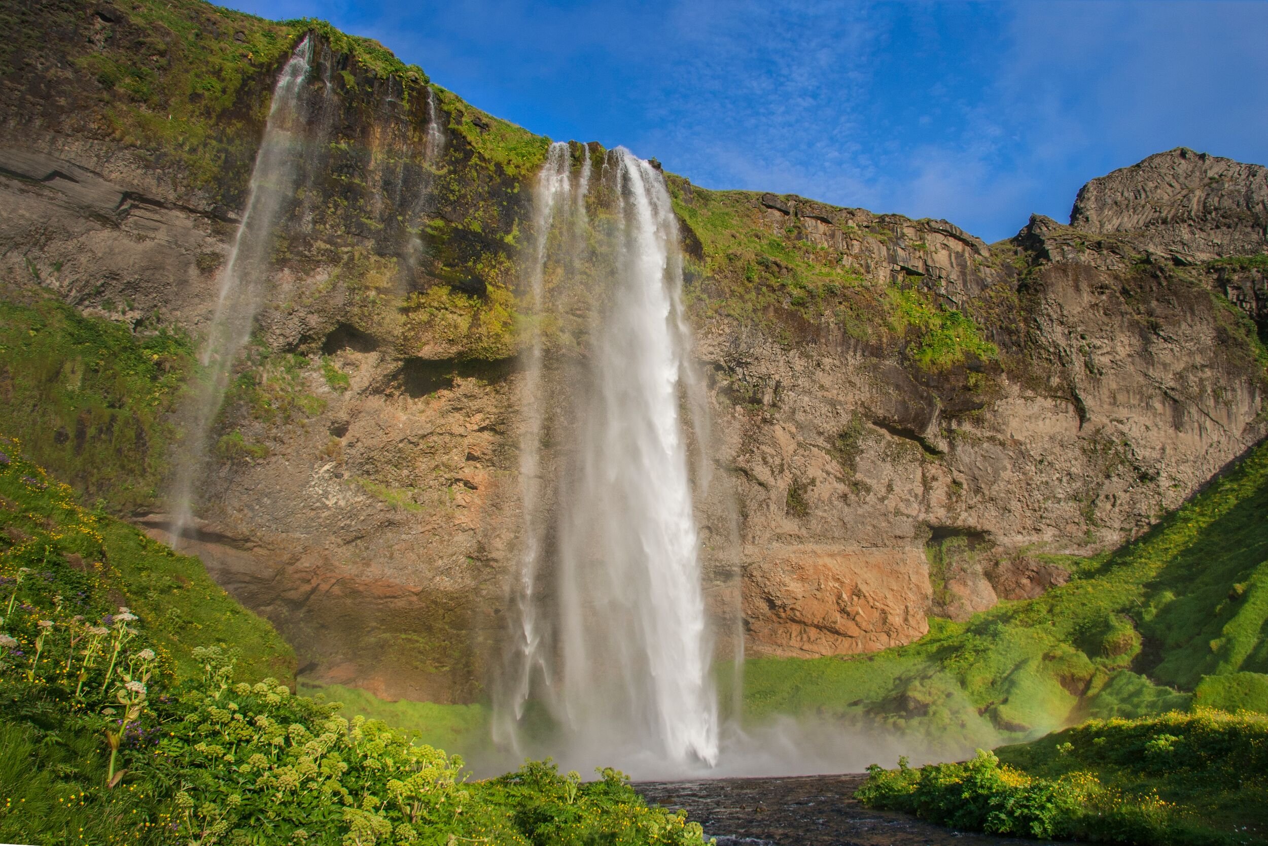
If your route is built around waterfalls and black-sand coast, keep the mainland sequence simple: Seljalandsfoss first, then Skogafoss, Dyrholaey, and Reynisfjara as the day moves east. Add the Westman Islands only if you are willing to make the ferry and boat trip the headline choice.
If your trip has more room, Klettshellir can add something the mainland stops cannot: a sea-level view into cliffs, caves, bird ledges, and volcanic coastline. The South Coast road trip guide is the better place to decide whether that detour strengthens the driving day or turns it into too much.
Choose Klettshellir over another mainland stop when you want the Westman Islands to feel like a separate chapter.
Choose Eldfell first when land-based volcanic context matters more than a boat trip.
Choose Seljalandsfoss, Skogafoss, Dyrholaey, and Reynisfjara first when this is your only South Coast day.
What should you check before committing?
Use official ferry, operator, road, weather, sea-condition, safety, and on-site guidance before making Klettshellir the fixed point of the day. This page is editorial planning guidance, not live operating confirmation.
The checks are straightforward: Herjolfur for ferry travel, the boat operator for suitability and tour details, SafeTravel for safety guidance, Umferdin for roads to the ferry, and the Icelandic Meteorological Office for weather and sea-weather context. Let those sources decide the day when wind, swell, visibility, road conditions, or ferry notices affect the plan.
Do not make the cave your only reason for crossing if the rest of the island would not interest you. If the water portion changes, a good Heimaey day should still have enough value through Eldfell, harbor views, volcanic history, and the island coastline.
Use this for weather, warnings, wind, and sea-weather context before boat-dependent plans.
Common Klettshellir planning questions
Most uncertainty comes from access, timing, and whether the cave deserves the ferry detour. Answer those before building the rest of the day around it.
Can you visit Klettshellir from land?
No, plan it as a water-access sea cave rather than a normal land-based cave walk. Boat operators and sea conditions decide how close the visit gets.
Is Klettshellir enough reason to visit the Westman Islands?
Usually not by itself. It is strongest when paired with a wider Heimaey day that also includes volcanic landscape, harbor time, cliffs, or other island stops.
How long should I allow for Klettshellir?
Allow a half day to full day once ferry travel, boat timing, weather buffer, and other Westman Islands plans are included. Do not judge it by cave time alone.
What if the boat portion does not work for my day?
Use land-based island stops or continue the South Coast instead. Eldfell, Seljalandsfoss, Skogafoss, Dyrholaey, and Reynisfjara are easier to keep flexible.
Map
See where this stop sits
Use nearby places and useful bases before opening directions.
Region
South Iceland
Works well with
South Coast
Useful base
Vík
Interactive planning map for Klettshellir
Klettshellir
Keep exploring
Compare Klettshellir with nearby South Coast and island stops
Use volcanic, coastal, and route-planning pages to decide whether a boat-based Westman Islands day improves the trip.