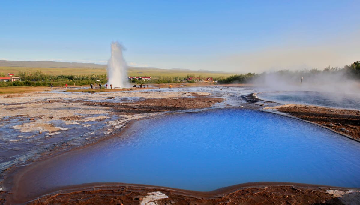
Geysir is a protected geothermal area in Haukadalur where the historic Great Geysir, active Strokkur, hot pools and mineral ground reveal different parts of the same volcanic system.
Geology snapshot
What it is
Protected geothermal area with geysers, hot springs and mineral deposits
Active geyser
Strokkur is the regular eruption most visitors see
Great Geysir
Historic geyser; the official record lists its most recent known eruption in 2016
Useful visit
About 45-75 minutes for Strokkur and the main marked paths
Protected
A 1.2-square-kilometer natural monument since 2020
In this guide
Geysir names both a famous spring and the wider area
Geysir is a protected hot-spring field in Haukadalur, not just one erupting pool.
Great Geysir is the historic feature that gave the area its name and helped give English the word “geyser.” Around it are Strokkur, Blesi, Konungshver and many other springs, along with steam, warm ground and pale deposits of silica-rich geyserite. Together they show how broad the geothermal system is beneath this part of Haukadalur.
The 1.2-square-kilometer Geysir area became a protected natural monument in 2020. Protection covers the springs and geological formations as well as microorganisms, vegetation and cultural remains. The main visitor paths cross only a compact part of that landscape.
Official boundary, protection date and natural-monument purpose.
Photo guide
Geysir Geothermal Area in photos
A Strokkur eruption immediately identifies the Geysir geothermal area.
Strokkur provides the regular eruption
Great Geysir and Strokkur are different geysers, and that distinction changes what visitors should expect.
Great Geysir has varied greatly in activity and is dormant at present. The official protected-area record gives 2016 as its last known eruption. Strokkur, nearby in the same field, is now the main active attraction and produces the recurring eruptions visitors usually photograph. Its water can rise as high as 30 meters, although the height and interval are not fixed promises.
Strokkur is the active geyser behind most eruption photographs from the Geysir area.
Wait at a safe distance and watch the surface of Strokkur's pool. The water often swells into a blue dome just before an eruption. Wind can carry spray toward one side of the viewing area, so protect cameras and avoid crowding the barrier for a closer angle.
Official activity records for Great Geysir and Strokkur, plus the wider spring field.
The smaller features make the field easier to understand
Steam and eruptions are the obvious sights, but pools, channels and mineral crusts show how heat and water reach the surface in different ways.
Geyserite forms where mineral-rich geothermal water reaches and cools at the surface.
Follow the marked path beyond the busiest viewing point. Blesi is known for contrasting pools, while other named springs and vents differ in color, temperature and activity. Conditions can change, so read current signs rather than assuming a pool behaves exactly as an older photograph shows.
Laugarfell rises 187 meters above the hot-spring area and gives a broader view when its path is suitable. Treat that climb as an optional extension, not part of the basic visit. Wind, ice and the abilities of your group matter more than completing every path.
The view from higher ground shows that the active springs belong to a wider geothermal field.
Marked paths are part of the safety system
Boiling water and thin or unstable ground can exist beside surfaces that look ordinary.
Never step over a rope, barrier or closure. The marked route protects visitors from heat and unstable crust while also protecting mineral formations and sensitive vegetation from trampling. Keep children close enough to control, especially near pools and steaming channels.
Allow 45-75 minutes for a useful first visit
That range gives most travelers time for at least one Strokkur eruption and a walk past the main neighboring springs.
A focused 45-minute visit works when you remain in the main field. Around 60-75 minutes is more comfortable if you want to wait through another eruption, read the interpretation and look closely at the quieter geothermal features. Laugarfell or slow winter walking can extend the visit.
The site is exposed year-round. In poor weather, check Umferðin for roads and the Icelandic Meteorological Office for wind, precipitation and warnings. Use current protected-area signs for any path work or closures rather than relying on a fixed route described online.
Gullfoss and Þingvellir are nearby, but they offer very different landscapes and reasons to stop.
Gullfoss is the nearest major contrast, replacing hot pools and eruptions with a glacial river dropping into a canyon. Þingvellir adds assembly history, rift geology and a longer walk through the landscape.