Lakagígar is a remote crater row in the south Highlands, worth planning only when highland-road access, weather, vehicle choice, and enough day space align, with enough flexibility for conditions and nearby route choices.
Quick guide
Type
Protected volcanic crater row and moss-covered lava landscape
Region
South Iceland Highlands, inside Vatnajökull National Park
Route context
Reached from the Kirkjubæjarklaustur area by F206 and F207 highland roads
Access
Four-wheel drive only, with unbridged river crossings and current road checks required
Time to allow
Usually a full-day commitment from the Ring Road area once driving, stops, and trails are included
Best experience
Clear summer weather, open F-roads, Laki viewpoint, Tjarnargígur, and careful marked-trail walking
Main caution
River levels, rough gravel, weather, and protected moss make current official checks essential
Nearby pairings
Fagrifoss, Eldgjá, Langisjór, Ófærufoss, Dverghamrar, Stjórnarfoss, and South Coast route anchors
Is Lakagígar worth the long F-road detour?
Yes, Lakagígar can be worth the effort if you have a suitable 4x4, stable summer access, enough time, and a real interest in volcanic landscapes. It is not worth forcing into a packed South Coast day or attempting when road, river, or weather conditions are uncertain.
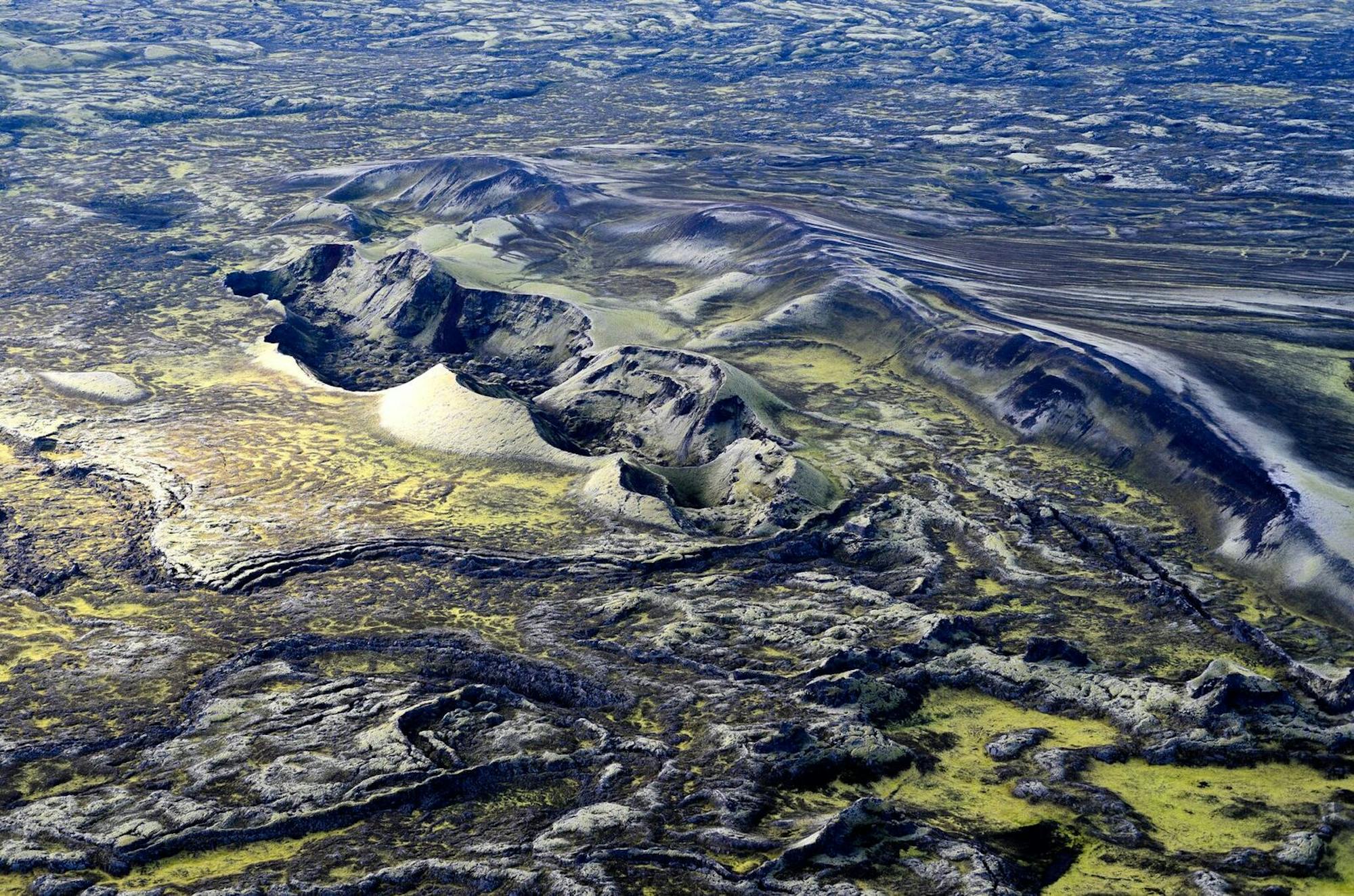
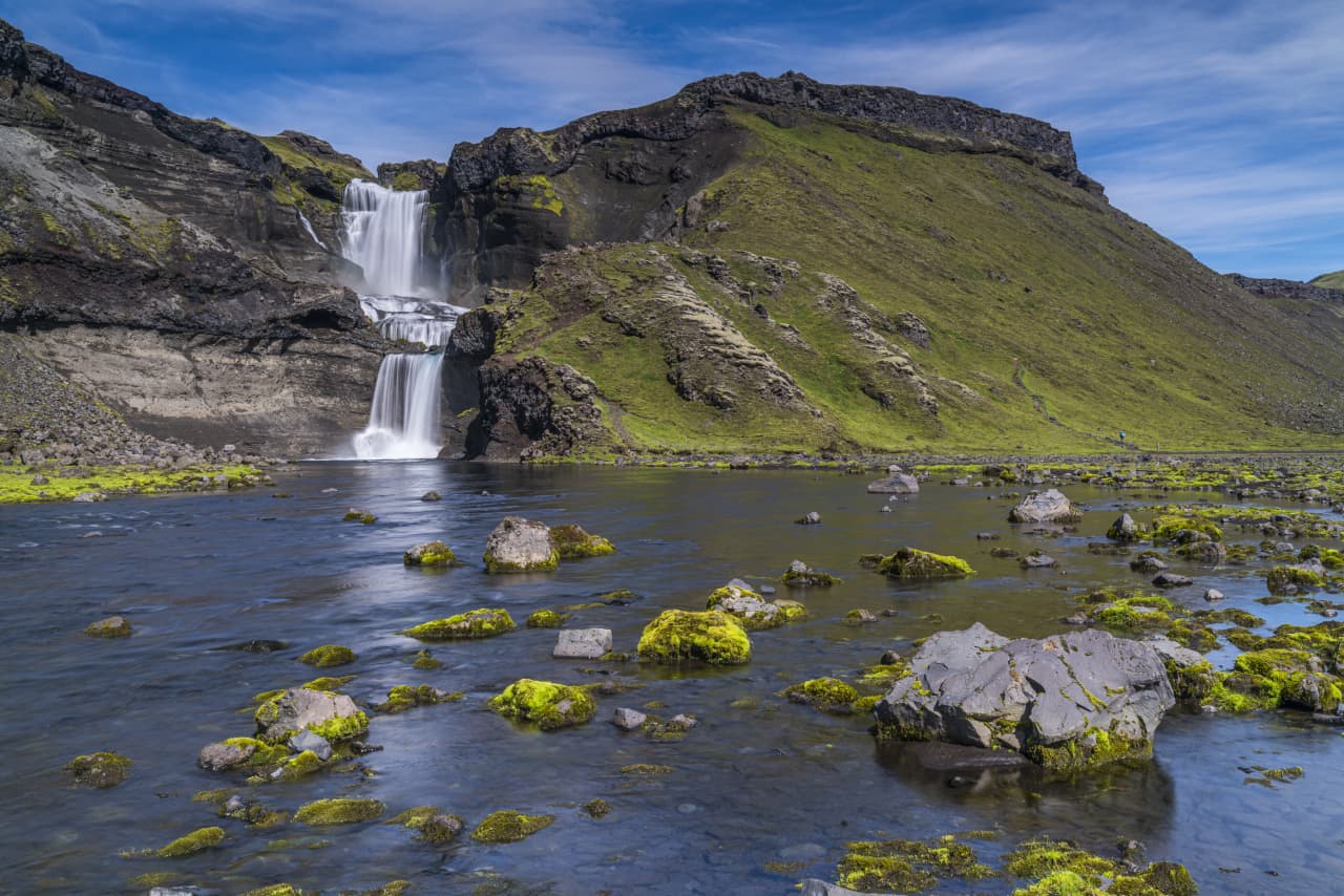
The reward is scale. Lakagígar is not one crater beside a car park; it is a long volcanic fissure where rows of moss-covered craters, black ash, rough lava, and the Laki viewpoint show how large the 1783-1784 Skaftáreldar eruption was.
The tradeoff is also real. Reaching Lakagígar means leaving the easy South Coast rhythm behind. If your trip is built around quick stops such as Skógafoss, Reynisfjara, or Jökulsárlón, this detour needs a separate day-level decision rather than a spare-hour slot.
Photo guide
Lakagígar in photos
1 / 2
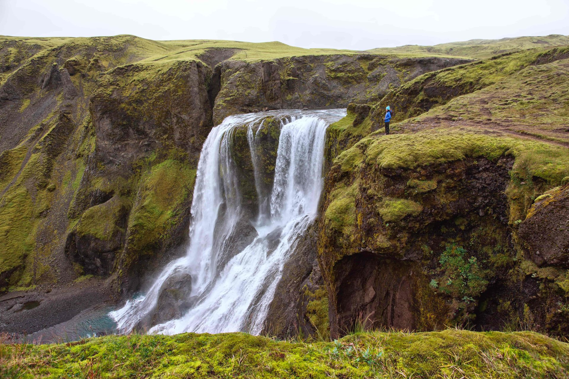
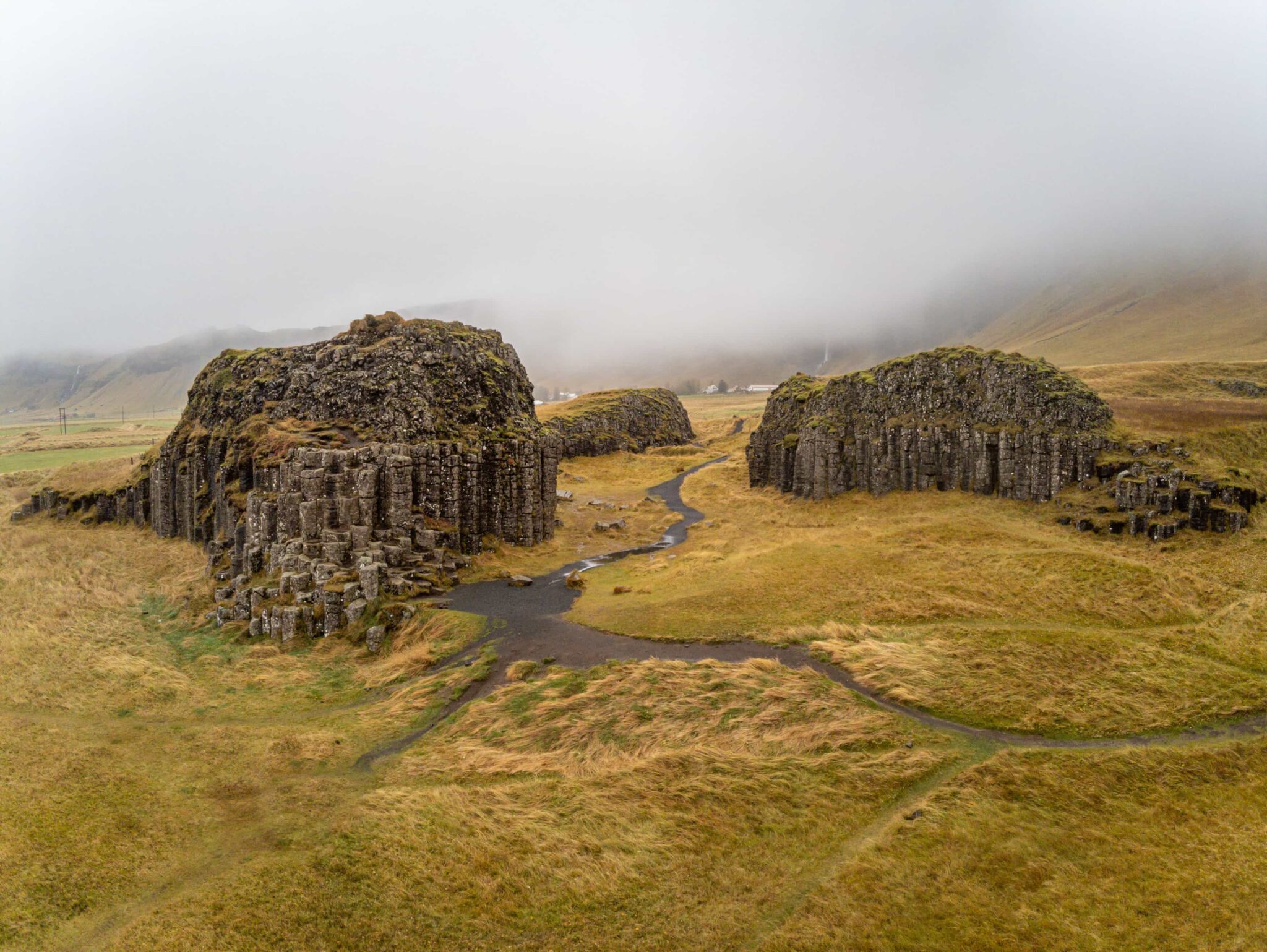
Moss and rough lava are part of the appeal and the reason marked paths matter.
Worth the stop?
When this stop makes sense
Good match for
summer self-drive travelers with a suitable 4x4
volcanic-landscape focused trips
photographers who want crater rows and mossy lava fields
travelers based near Kirkjubæjarklaustur with a full day to spare
Think twice if
travelers in small two-wheel-drive rental cars
winter or thaw-season trips without official access confirmation
Lakagígar is a protected row of volcanic craters in Vatnajökull National Park, formed during the Skaftáreldar eruptions of 1783-1784.
Official park information describes the crater row as more than 29 kilometres long, with over 130 craters. Regional sources often describe the visible fissure as about 25 kilometres, which is the scale most travelers are trying to understand from the ground.
The eruption sent lava into river valleys, reshaped nearby lowlands, damaged farms, and contributed to severe hardship in Iceland. For visitors, that history matters because the landscape still reads as both beautiful and damaged: green moss softens the craters, but the black gravel, lava channels, and exposed slopes keep the place from feeling gentle.
What does the visit feel like on the ground?
The visit is quiet, exposed, and spread out, with marked paths, crater views, rough tracks, and very little of the roadside convenience found at easier South Coast stops.
At Laki, the main appeal is getting above the landscape enough to see the crater row line up across the highlands. In clear weather, the view makes the fissure easier to read than it is from the road, where individual craters and mossy lava fields can blend into one broad volcanic scene.
On the ground, Lakagígar feels wide, quiet, and more remote than the classic roadside South Coast stops.
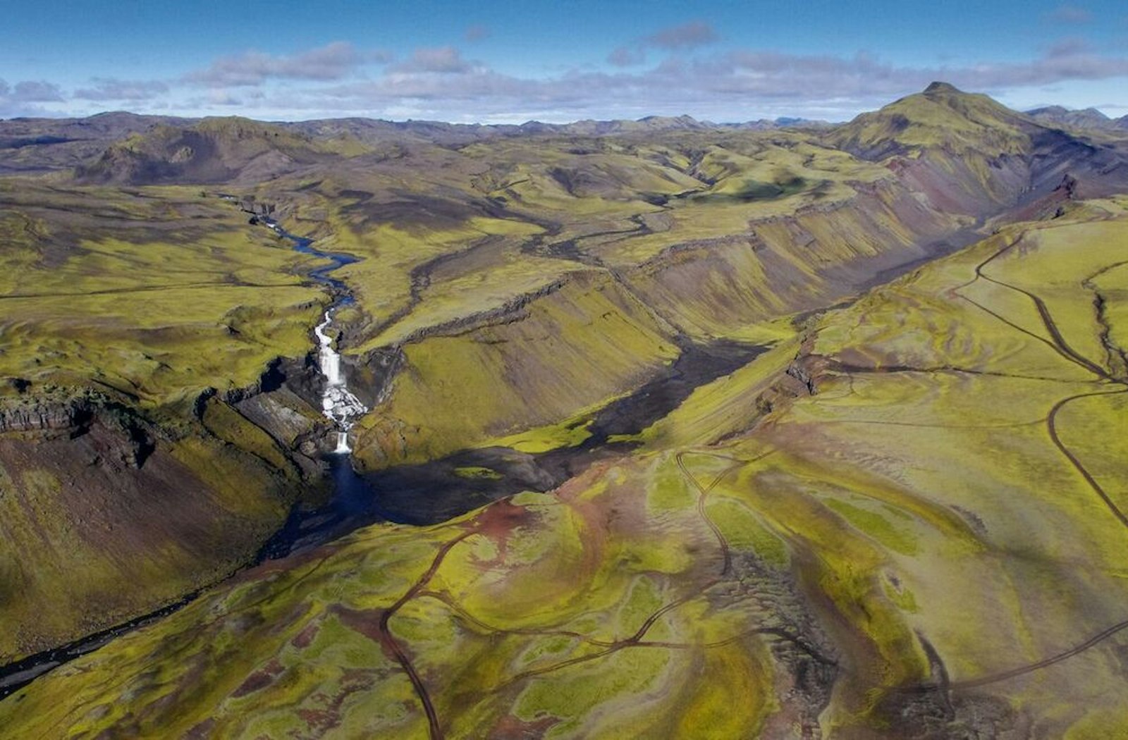
Tjarnargígur adds a different rhythm: a crater lake, a short rest stop, and a clearer sense of how water, moss, and dark volcanic material sit together. The national park also notes toilets and picnic tables at Laki and Tjarnargígur, but facilities should never be the reason to underestimate the remoteness of the drive.
Tjarnargígur is one of the clearer short stops inside the Lakagígar area.
How hard is the drive to Lakagígar?
The drive is the main planning filter: Lakagígar is reached by F206 and F207 highland roads, with rough gravel and unbridged river crossings.
Vatnajökull National Park states that the road to Lakagígar is only accessible by four-wheel drive and includes four unbridged river crossings that can swell in rainy conditions. Visit South Iceland also warns that western park roads are mountain tracks, with potholes, loose gravel, and possible fords.
The ranger station context is useful, but it does not make the F-road approach casual.
This is also protected terrain. Driving off-road is illegal in Iceland, and official sources ask visitors to use marked roads and marked paths. That is not just a rule for dramatic photos; moss and loose crater slopes can hold damage long after one careless visit.
How much time should you allow?
Plan Lakagígar as a full-day commitment from the Ring Road area, especially if you want the Laki viewpoint, Tjarnargígur, photos, and enough margin to drive cautiously.
Lakagígar time planning
Plan style
Best use
Time pressure
Out-and-back from near Kirkjubæjarklaustur
Most realistic self-drive version for careful travelers
Still a long day once F-road speed, checks, stops, and trails are included
Laki viewpoint plus Tjarnargígur
Good balance of crater-row scale and a distinct crater-lake stop
Needs stable weather and enough daylight
Trying to add it between major South Coast icons
Usually too ambitious for first-time itineraries
High risk of rushing or cutting important safety checks
If your day already includes a long drive toward Jökulsárlón or back toward Reykjavík, Lakagígar is usually the wrong add-on. It competes for the same daylight and energy that make major South Coast stops work well.
What nearby places pair with Lakagígar?
Lakagígar pairs best with places in the same highland and Kirkjubæjarklaustur orbit, while bigger South Coast icons work better as comparison points for a different day.
Fagrifoss is the most natural future attraction pairing on the F206 approach when conditions allow.
Eldgjá and Ófærufoss belong to the same volcanic-highland decision set, but they need their own access checks.
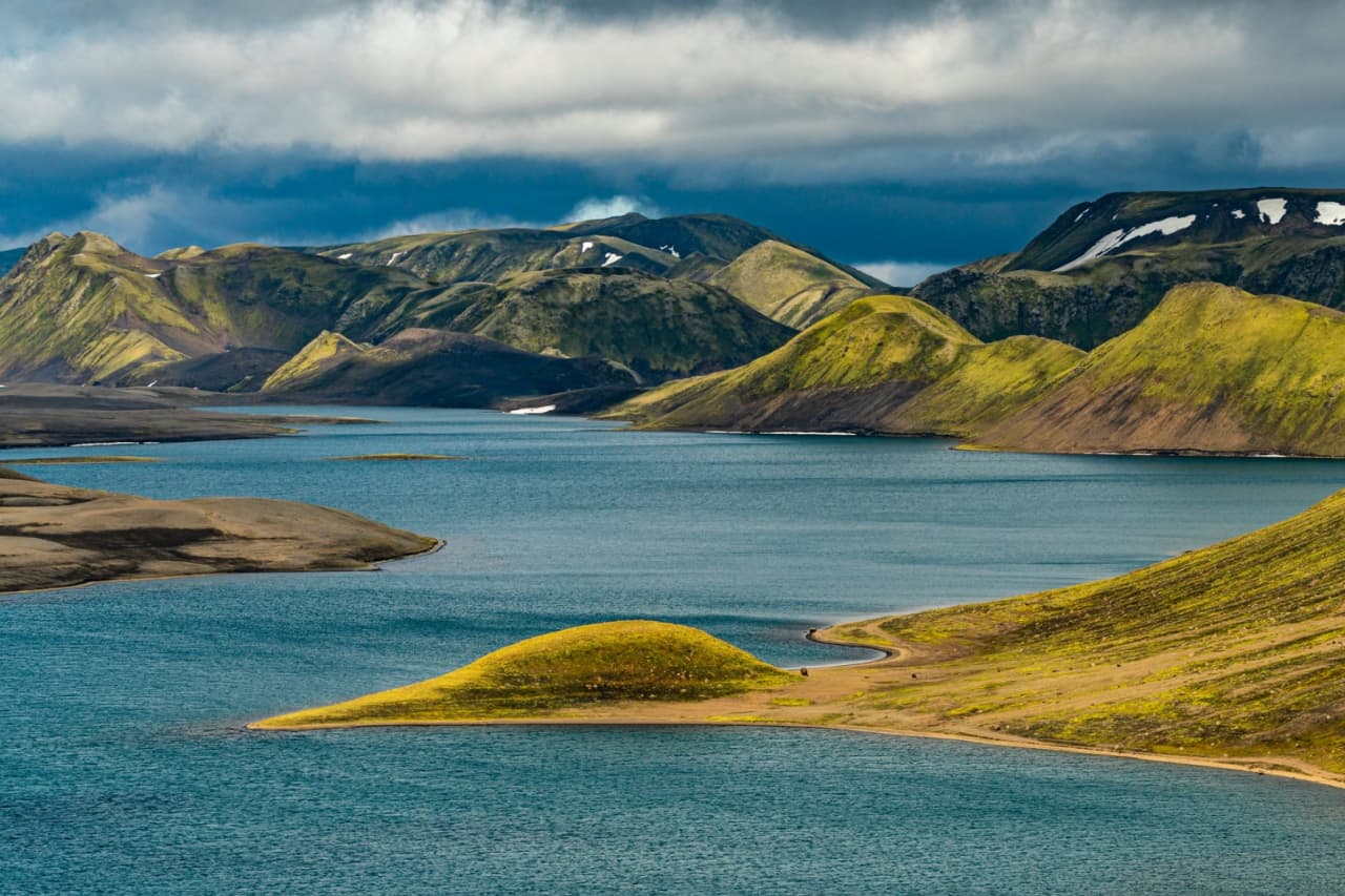
Langisjór and Veiðivötn are useful future comparison points for travelers building a deeper highlands route.
Dverghamrar and Stjórnarfoss are lower-friction Kirkjubæjarklaustur-area stops if Lakagígar is too much for the day.
Skógafoss, Reynisfjara, Dyrhólaey, Seljalandsfoss, and Jökulsárlón are stronger as broader South Coast anchors, not same-day filler around Lakagígar.
Use the South Iceland region guide if you are deciding whether a remote volcanic day belongs in the trip at all. If the answer is no, the classic South Coast still gives you waterfalls, black sand, glacier lagoons, and easier route structure without the same F-road exposure.
What should you check before going?
Do not rely on old blog posts or yesterday's conditions for Lakagígar. Current official checks are part of the visit.
Official weather source for wind, rain, visibility, and warnings.
Lakagígar questions that decide the plan
These are the questions that usually determine whether Lakagígar stays in the itinerary or becomes a future-trip idea.
Do you need a 4x4 for Lakagígar?
Yes, you should treat Lakagígar as a four-wheel-drive highland-road visit. Official park information says F206 and F207 access requires four-wheel drive and includes unbridged river crossings.
Can you visit Lakagígar in winter?
Do not plan a normal self-drive winter visit unless official sources confirm access. The road is affected by seasonal highland conditions, thaw, snow, river levels, and road authority closures.
How long do you need at Lakagígar?
Most travelers should allow a full day from the Kirkjubæjarklaustur or Ring Road area. The drive, road checks, cautious F-road speed, viewpoints, and marked trails make it much more than a short stop.
Is Lakagígar suitable for families?
Lakagígar can suit capable, patient families in good summer conditions, but it is not an easy family roadside stop. The limiting factors are the long rough drive, river crossings, exposed weather, and staying on marked paths.
Can you walk anywhere on the craters?
No, visitors should stay on marked paths and follow local signs. The protected moss, loose gravel, and crater slopes are sensitive, and off-road driving is banned.
Map
See where this stop sits
Use nearby places and useful bases before opening directions.
Region
South Iceland
Works well with
South Coast / Highlands routes
Useful base
Vík
Interactive planning map for Lakagígar
Lakagígar
Keep exploring
Put this place in route context
Use nearby places and planning pages to decide whether this stop strengthens the route or stays optional.