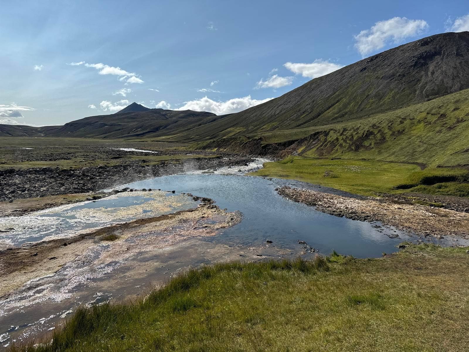
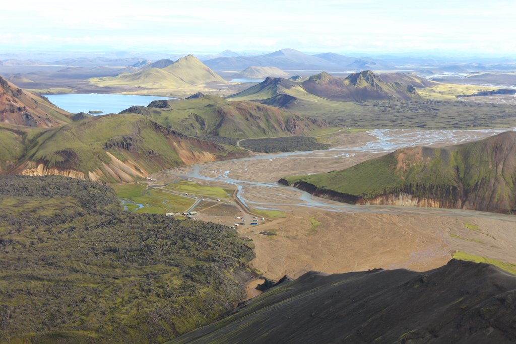
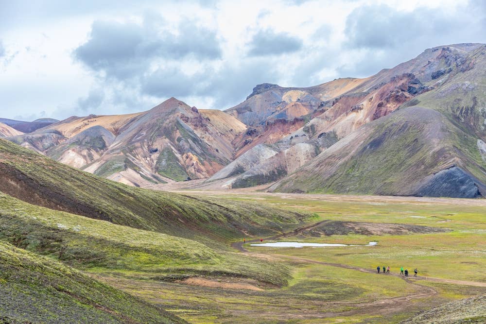
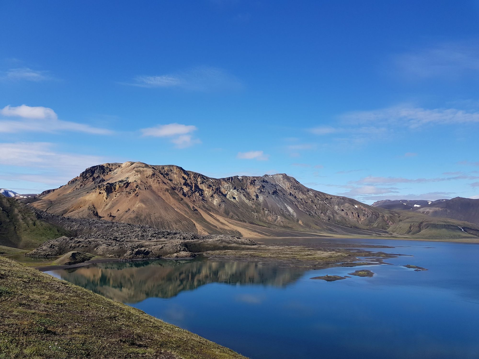
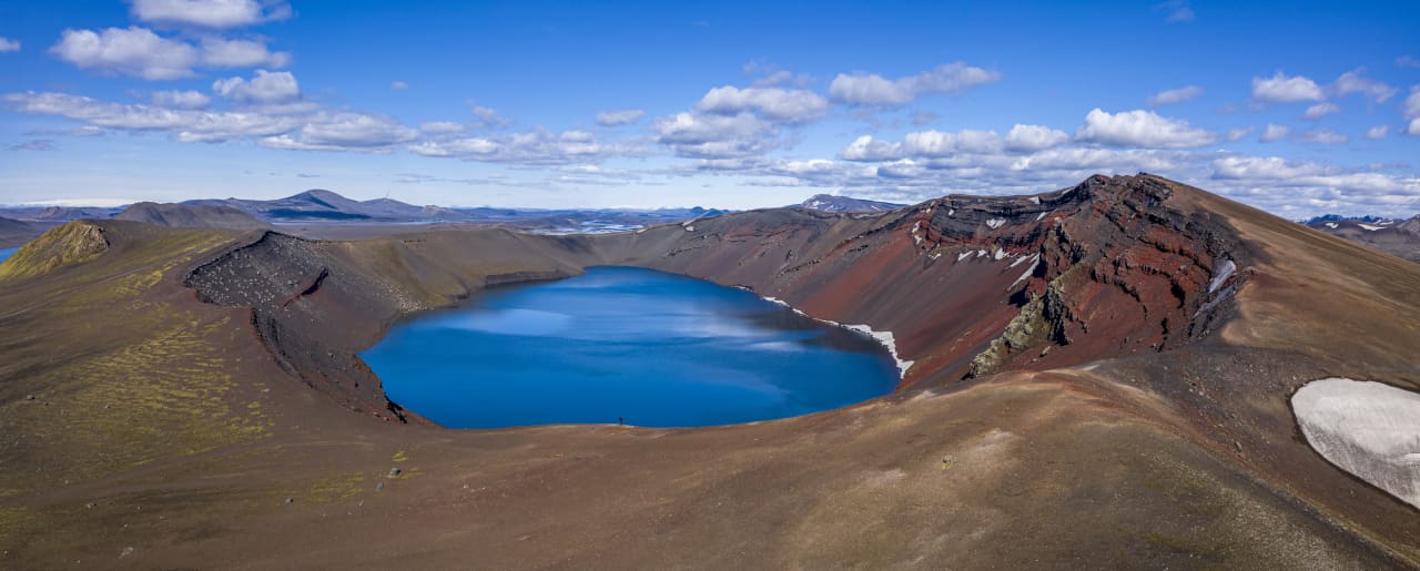
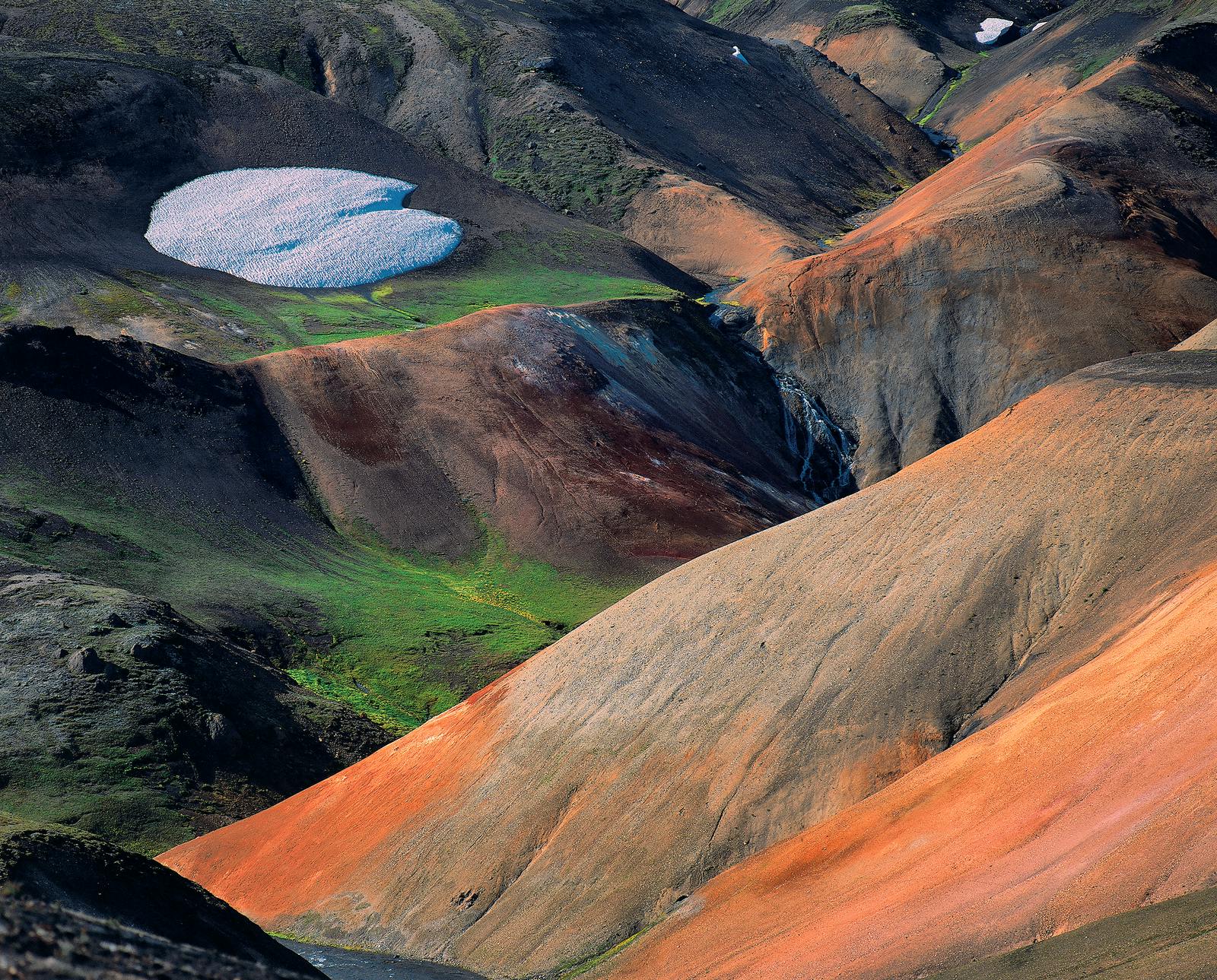
Is Torfajökull worth the Highlands detour?

Yes, Torfajökull is worth planning if you want the colorful, geothermal, rough-edged side of the South Iceland Highlands and you can give the day enough flexibility. It is a weak choice for a tight first-trip route focused on easy paved stops.

The value is not one single viewpoint. Torfajökull is a volcanic area where snow patches, orange and green rhyolite slopes, black ground, steam, and highland silence combine into a landscape that feels very different from the waterfall rhythm around Skógafoss and the lower South Coast.

Add it when the trip already has room for Fjallabak, Bláhnjúkur, Brennisteinsalda, or Strútslaug. Skip it when you would be borrowing time from safer anchors, because the approach, weather checks, and slow movement are part of the stop.

Worth the stop?

When this stop makes sense

Good match for

  • repeat visitors ready for a remote Highlands landscape
  • summer self-drive travelers with suitable F-road planning
  • hikers pairing Landmannalaugar-area mountains and geothermal ground
  • photographers who want rhyolite color, snow patches, and wide volcanic scale

Think twice if

  • first trips built around easy paved South Coast icons
  • travelers without a suitable Highlands vehicle or local transport plan

Pair it with

South IcelandStrútslaugBláhnjúkurBrennisteinsalda

What does the Torfajökull area look and feel like?

It feels open, mineral, and exposed: a broad volcanic system rather than a neat roadside sight. The most memorable views come from the contrast between pale glacier remnants, colored rhyolite hills, dark gullies, and geothermal ground.

On a clear day the area can look almost painted, with rust, gray, green, black, and snow sharing the same slope. In rough weather the same scene becomes harsher, with fewer visual cues and much less margin for casual exploring.

Snow patches and muted rhyolite slopes make Torfajökull feel more like a volcanic region than a single viewpoint.

This is where an Iceland editor would add the stop for a repeat visitor who has already seen the classic South Coast, wants a stronger Highlands day, and is prepared to cut the plan if the checks are not favorable.

How should you handle access and safety checks?

Access is the main decision. Torfajökull sits in remote Highlands country, so road status, vehicle suitability, river and track conditions, weather, and protected-area rules matter more than normal drive-time estimates.

Use Umferðin for road status, SafeTravel for Highland driving guidance, the Icelandic Met Office for weather and warnings, and Environment Agency guidance for protected-area behavior. Treat those checks as part of the attraction, not as admin after the route is fixed.

Stay on marked roads and paths. The appeal of Torfajökull depends on fragile volcanic slopes, moss, hot ground, and protected wilderness, so shortcuts and off-road movement damage the thing people came to see.

How much time should you give Torfajökull?

Give it at least a half day when conditions are good, and treat a fuller day as the better plan if you are pairing it with Landmannalaugar-area hiking or geothermal scenery.

Use the available time and conditions to decide how much of the area to attempt.
PlanBest useWatch for
Scenic Highlands lookA shorter visit when you already have access into FjallabakThe drive may feel too costly if you only stop for a few photos
Landmannalaugar-area hiking pairBláhnjúkur or Brennisteinsalda when the weather supports walkingExposed trails and changing visibility can reduce the safe plan
Slow volcanic landscape dayTorfajökull plus Ljotipollur, Dómadalur, or Strútslaug when route logic worksToo many rough-road stops can turn a strong day into a fragile one

The practical rule is simple: if you are counting minutes, Torfajökull is probably the wrong stop. If you can build the day around road checks, weather, slow driving, and one or two nearby goals, it becomes much more rewarding.

Which nearby places pair best with Torfajökull?

Pair Torfajökull with places that share the same Highlands logic instead of dragging it into a normal paved South Coast sequence. The strongest pairings are around Fjallabak and Landmannalaugar.

Bláhnjúkur is the sharper hiking contrast, with a clearer summit-style decision. Brennisteinsalda is the colorful geothermal mountain comparison. Ljotipollur and Frostastaðavatn help turn the area into a lake-and-crater day rather than a single volcanic stop.

Aerial views show why Torfajökull works best as part of a wider Fjallabak plan.

Strútslaug makes sense only for travelers already comfortable with more remote Highlands planning. Skógafoss and Seljalandsfoss belong to a different kind of day; use them as easier backups or as lower-route anchors, not as proof that Torfajökull is a quick add-on.

What should you check before building the day around it?

Check the official road, weather, safety, and protected-area sources before making Torfajökull a fixed part of the route. The public page should guide the decision, while those sources handle changing details.

Is Torfajökull a good first-time Iceland stop?

Usually no. It is better for repeat visitors or Highlands-focused travelers because access, vehicle choice, weather, and time buffers matter more than they do at paved South Coast attractions.

Can you visit Torfajökull without a Highlands plan?

No, not realistically. Treat it as a remote Highlands area that needs road-status checks, suitable transport, weather awareness, and a clear backup.

Is Torfajökull the same as Landmannalaugar?

No. Torfajökull is the broader volcanic and geothermal area, while Landmannalaugar is one of the best-known visitor bases and hiking areas on its northern side.

What is the main reason to go?

Go for the combination of rhyolite color, geothermal terrain, glacier remnants, and remote volcanic scale, especially when you can pair it with nearby Fjallabak stops.

Official visitor checks