Svartifoss is Skaftafell’s basalt-column waterfall, worth adding when you have time for a real walk rather than only quick southeast Iceland viewpoints, with enough flexibility for conditions and nearby route choices.
Quick guide
Type
Waterfall with black basalt columns inside Vatnajokull National Park
Area
Skaftafell, South Iceland, a short detour from Route 1
Time to allow
About 2 hours for the official S2 loop, more if you continue toward Sjonarnipa
Walk reality
Uphill from the Skaftafell visitor area, not a roadside waterfall
Best experience
Use it as the main walking stop of the day, not as a rushed photo pull-off
Season note
Possible year-round when conditions permit, but winter and shoulder seasons need road, weather, and trail checks
Nearby pairings
Skaftafell, Vatnajokull, Jokulsarlon, Diamond Beach, and other South Coast waterfall stops
Before you go
Check Vatnajokull National Park notices, SafeTravel, road conditions, and the Skaftafell weather forecast
Is Svartifoss worth the hike from Skaftafell?
Yes, Svartifoss is worth the hike if you want a South Coast stop that feels different from the drive-up waterfalls. It is less about height and more about the walk into a black-basalt amphitheatre inside Skaftafell.
The important tradeoff is time. Svartifoss asks for an uphill walk from the Skaftafell visitor area, so it works best when you can give the stop roughly two hours and still keep your drive realistic.
For many travelers, that makes it a better fit on a slower South Coast or Ring Road day than on a compressed run from Vik to Jokulsarlon and Diamond Beach. If your day is already crowded, Skogafoss or Seljalandsfoss gives you a lower-effort waterfall stop; Svartifoss gives you a more deliberate walking break.
Photo guide
Svartifoss in photos
1 / 2
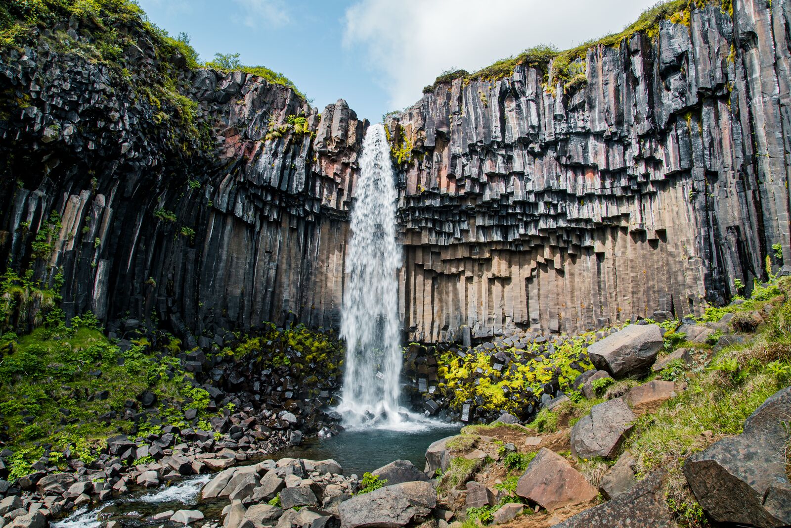
A higher official-park view shows how the waterfall sits inside the Skaftafell slope.
Worth the stop?
When this stop makes sense
Good match for
travelers who want a real walking stop at Skaftafell
waterfall and geology-focused visitors
South Coast self-drive trips with two spare hours
photographers who want basalt-column texture
Think twice if
travelers looking for a drive-up waterfall
very rushed South Coast days between Vik and Jokulsarlon
What makes Svartifoss different from other South Coast waterfalls?
Svartifoss feels enclosed and architectural. The water drops in front of dark, jointed basalt columns, with broken rock, birch slopes, and a small stream shaping the scene around it.
The official national park description explains that the columns formed from ancient lava that cooled and cracked into vertical shapes. That geology is the reason the waterfall looks so different from broad curtain waterfalls like Skogafoss or the walk-behind setting at Seljalandsfoss.
The waterfall is not the biggest sight in Vatnajokull National Park, but the setting is specific: a short mountain-side walk, smaller waterfalls on the way, a dark cliff bowl, and the sense that you have stepped away from the car for a real part of the day.
The final approach makes the basalt walls and stream part of the visit.
How hard is the walk to Svartifoss?
The official S2 route, Svartifoss - Sjonarsker - Sel, is listed by Vatnajokull National Park as a 5.8 km circle that takes about 2 hours and is rated easy. That is easy by park-trail standards, not the same as flat or effortless.
Expect an uphill start from Skaftafell, changing surfaces, and weather exposure. The Visit Vatnajokull regional page describes the walk to the waterfall as about 1.9 km or 45 minutes one way from the visitor centre, which is a useful minimum if you only care about reaching the waterfall and returning.
Allow about 2 hours for the standard loop if you want a calm visit.
Use proper walking shoes, especially after rain, frost, or snow.
Do not plan it as a quick stop between two long drives.
Check the visitor centre or park notices if conditions look uncertain.
Should you stop at the waterfall or continue toward Sjonarnipa?
Stop at Svartifoss if the waterfall is your main goal. Continue toward Sjonarnipa only when visibility, daylight, footing, and energy make the longer route worthwhile.
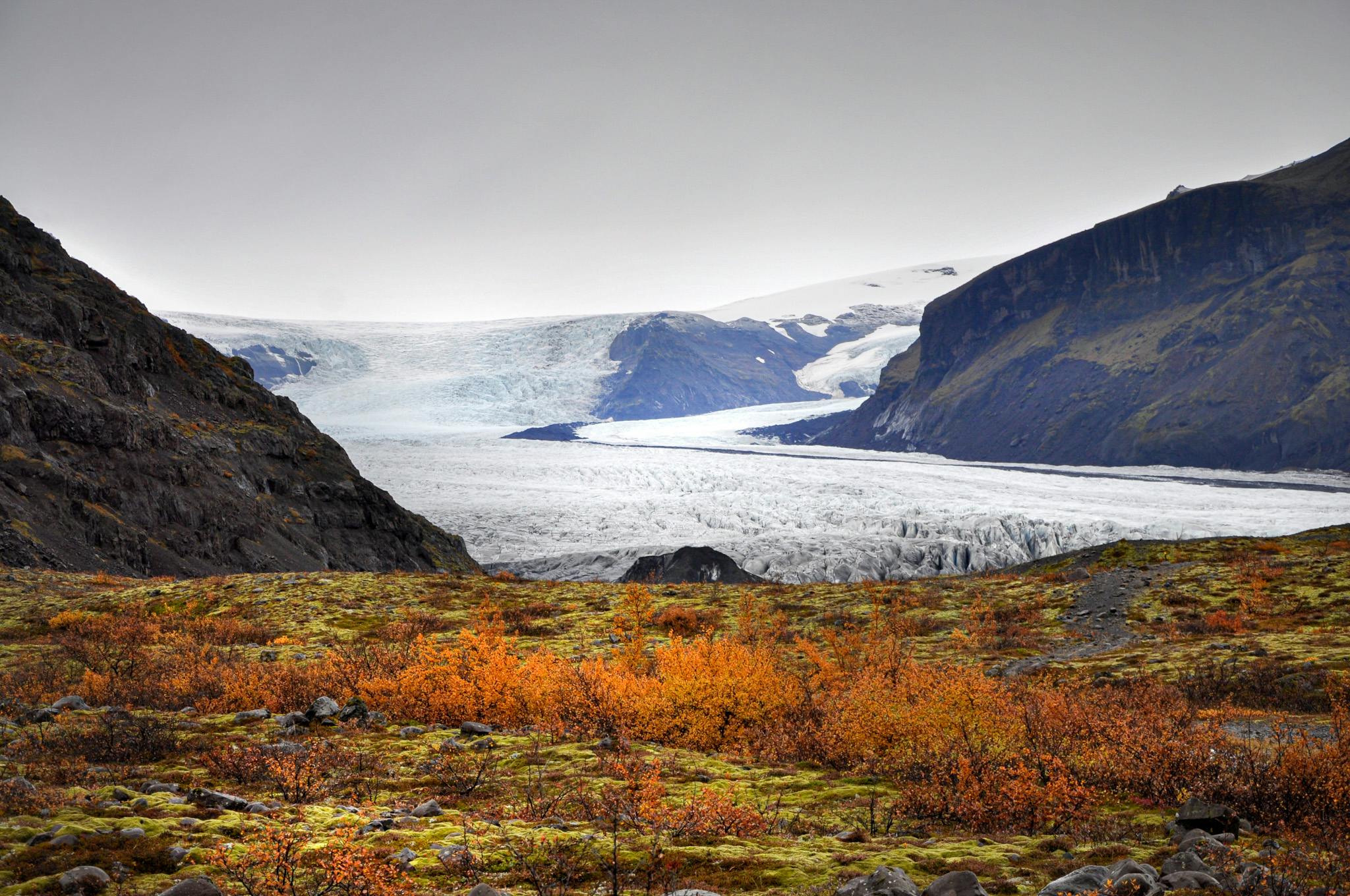
The park lists a longer S6 route, Svartifoss - Sjonarnipa, at 7.1 km and 2.5 to 3 hours, with a challenging rating. The payoff is the wider Skaftafell landscape: mountain views, Skaftafellsjokull, and the outwash plains in good visibility.
That extension changes the visit from a waterfall walk into a more serious Skaftafell hike. It can be excellent on a clear day, but it is not the version to force when cloud, wind, ice, or a late start are working against you.
Sjonarnipa turns the visit into a broader Skaftafell viewpoint hike.
Where does Svartifoss fit on the South Coast?
Svartifoss fits best as the walking anchor around Skaftafell, between the Vik-area sights to the west and the glacier-lagoon stops to the east.
If you are driving east, a realistic sequence is to use Reynisfjara, Dyrholaey, Skogafoss, or Seljalandsfoss on a separate western South Coast day, then give Skaftafell and Svartifoss their own space before continuing toward Jokulsarlon and Diamond Beach.
If you are driving west, the same logic works in reverse: start early near Jokulsarlon, keep Diamond Beach weather-dependent, then use Svartifoss as the stop that gets you out of the car before the long return toward Vik or Kirkjubaejarklaustur.
How to use Svartifoss in a route
Trip shape
Best use
Fast South Coast day
Usually skip unless Skaftafell is already a priority.
Ring Road segment
Use as a 2-hour walking break between Vik/Kirkjubaejarklaustur and Jokulsarlon.
Skaftafell base or slow day
Pair the waterfall with Sjonarnipa or another official Skaftafell trail.
Winter or shoulder season
Keep it flexible and check roads, weather, daylight, and park notices first.
What should you check before hiking?
Check official conditions before you treat Svartifoss as fixed. The attraction is straightforward in good conditions, but it still depends on trail footing, daylight, wind, road access, and park notices.
Start with Vatnajokull National Park for trail and visitor-area information. Then check SafeTravel for broader travel conditions, the Icelandic Road and Coastal Administration traffic map for the drive, and the Icelandic Meteorological Office forecast for Skaftafell.
Avoid hardcoding your plan around old parking, facility, or opening details. Skaftafell has a year-round visitor centre, but services, prices, weather, and trail conditions are the details most likely to change.
No. Svartifoss is reached on foot from the Skaftafell visitor area, so plan it as a hike rather than a roadside stop.
How long should I allow for Svartifoss?
Allow about 2 hours for the official S2 loop. Add more time if you want to continue toward Sjonarnipa or stop often for photos.
Is Svartifoss good in winter?
It can be good in winter when conditions are suitable, but you should check park notices, road conditions, weather, daylight, and trail footing before going.
Should I choose Svartifoss or Jokulsarlon if I am short on time?
Choose Jokulsarlon if you only have time for one southeast Iceland anchor. Choose Svartifoss when you specifically want a Skaftafell hike and basalt-column waterfall setting.
Map
See where this stop sits
Use nearby places and useful bases before opening directions.
Region
South Iceland
Works well with
South Coast
Useful base
Höfn
Interactive planning map for Svartifoss Waterfall
Svartifoss Waterfall
Keep exploring
Put this place in route context
Use nearby places and planning pages to decide whether this stop strengthens the route or stays optional.