Skeiðarársandur is the vast black-sand outwash plain between Vatnajökull and the Atlantic, best judged as a scenic Route 1 context stop rather than a destination that replaces Skaftafell or Jökulsárlón.
Quick guide
Place type
Glacial outwash sand plain, braided river landscape, and Route 1 context stop
Region
Southeast Iceland, on the South Coast between Kirkjubæjarklaustur and Skaftafell
Route context
Crossed by Route 1, useful on South Coast and Ring Road drives
Time to allow
10-20 minutes for a quick stop, or 30-45 minutes if you pause at the bridge monument and let the landscape register
Best experience
Clear visibility, safe wind, and enough route slack to stop without stealing time from Skaftafell
Access reality
Use marked pull-offs and road-safe stopping points; do not treat the sand plain as an off-road playground
Season note
The drive can be meaningful in any season, but wind, visibility, snow, ice, and sand movement can change the decision
Nearby pairings
Skaftafell, Svartifoss, Vatnajökull, Falljökull, Jökulsárlón, and Diamond Beach
Before you go
Check official road, weather, park, and safety guidance before making it a fixed stop
Is Skeiðarársandur worth stopping for?
Yes, but only if you treat it as a short context stop. Skeiðarársandur is strongest when it helps you understand the scale of the southeast drive before or after Skaftafell, not when it is forced in as a major attraction.
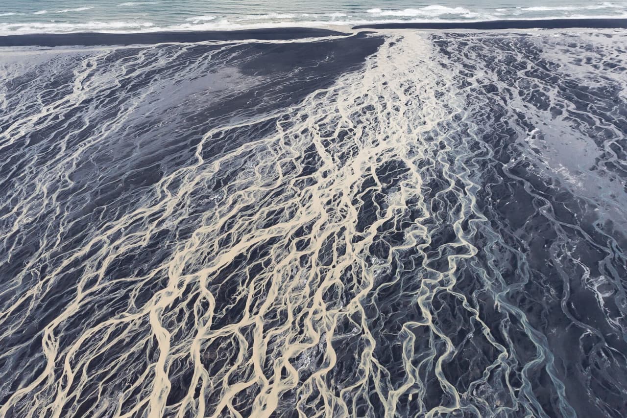
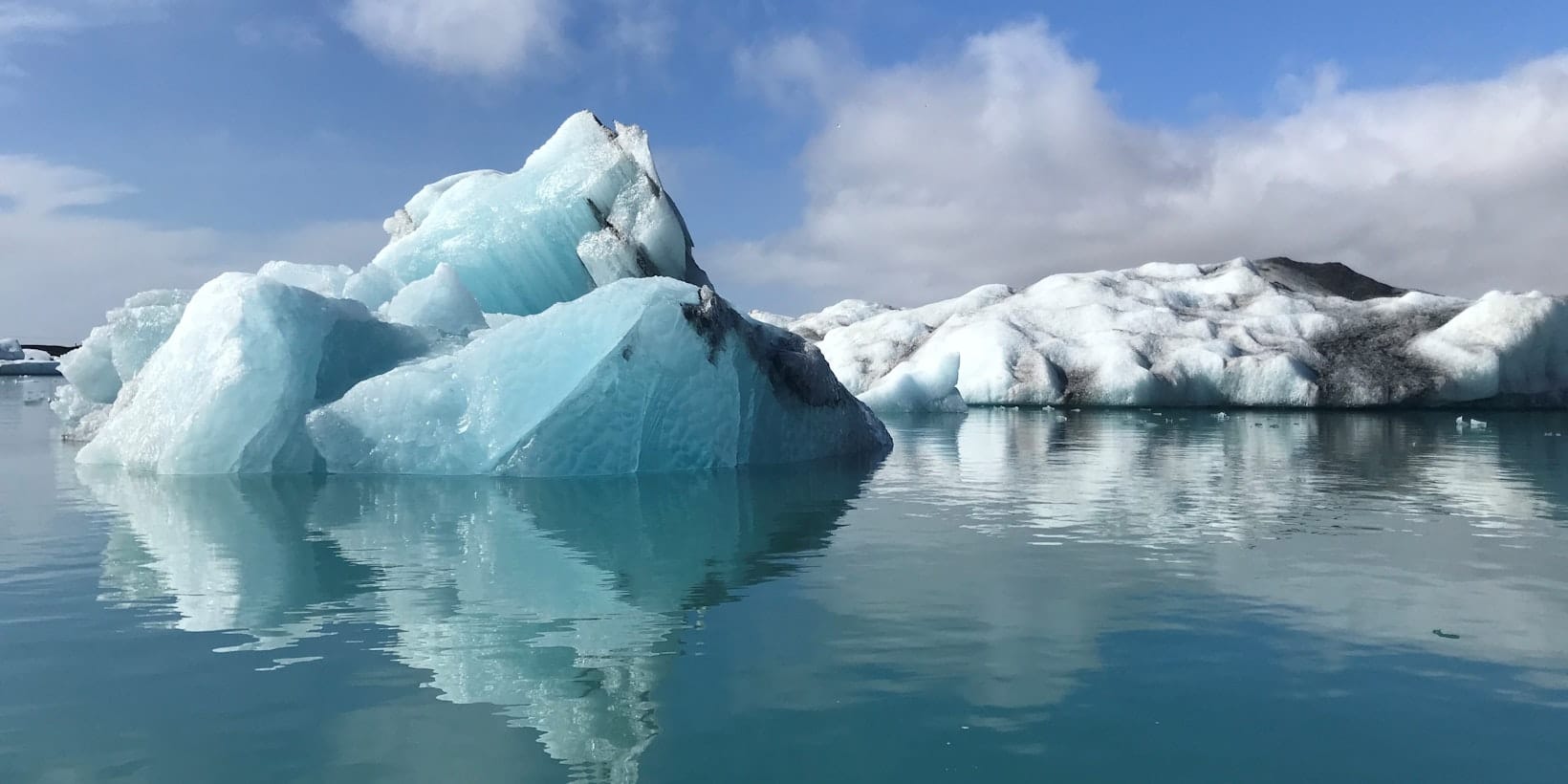
The plain spreads between Vatnajökull and the Atlantic, with black sediment, pale braided rivers, distant glacier edges, and long straight sections of Route 1. From the car it can feel empty; with a little context it becomes one of the clearest places to see how glacier water, volcanoes, sand, and road engineering shape travel in southeast Iceland.
A local Iceland travel editor would add Skeiðarársandur when the day needs a short pause or when the bridge monument gives meaning to the drive. They would skip it when daylight is tight, the weather makes stopping awkward, or the real choice is still between a Skaftafell walk and the glacier-lagoon area.
Photo guide
Skeiðarársandur in photos
Additional exact-place river-pattern candidate retained in metadata but not used in the article body.
Worth the stop?
When this stop makes sense
Good match for
South Coast self-drive travelers who like landscape context
photographers interested in braided rivers and black-sand scale
Ring Road travelers stopping briefly between Kirkjubæjarklaustur and Skaftafell
visitors who want the bridge-flood history behind Route 1
Think twice if
travelers expecting a signed viewpoint with a long activity list
rushed days that still need Skaftafell, Jökulsárlón, and Diamond Beach
Start by choosing the job of the stop. Skeiðarársandur works as a quick look, a balanced bridge-and-landscape stop, or a slower photography pause, but it rarely needs to become the main event of the day.
Skeiðarársandur visit choices by route pace
Visit style
Best use
Watch for
Quick look
Let the black plain and braided rivers register from a safe roadside stop.
Do not stop abruptly on Route 1 or use unmarked sand tracks.
Balanced stop
Pause at the bridge monument, read the landscape, and keep moving toward Skaftafell or Jökulsárlón.
Wind, visibility, other traffic, and how much time the bigger stops still need.
Slow version
Use low light, clear weather, and a calmer schedule for photography and quiet route context.
This only works when the southeast day has real slack.
The plain is most impressive when you read it as part of the Vatnajökull landscape rather than a single viewpoint.
What are you looking at from Route 1?
You are crossing a glacial outwash plain: sediment carried by glacier-fed rivers from Vatnajökull toward the sea. The result is a wide black surface cut by changing water channels, gravel, sand, and clay.
Near the glacier the ground can be rougher and more gravelly; closer to the coast the material becomes finer. That is why Skeiðarársandur does not feel like a normal beach, desert, or lava field. It is a moving edge between ice, rivers, volcanic material, and the ocean.
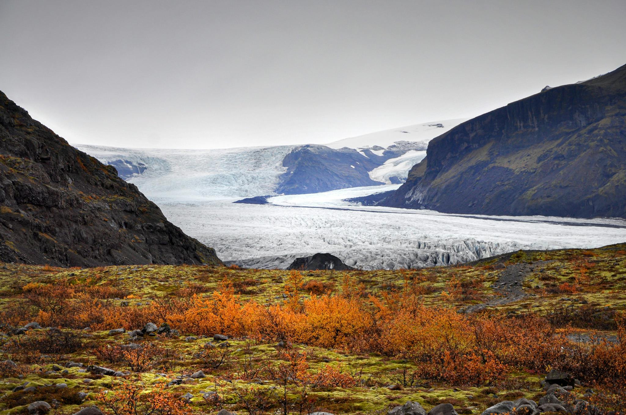
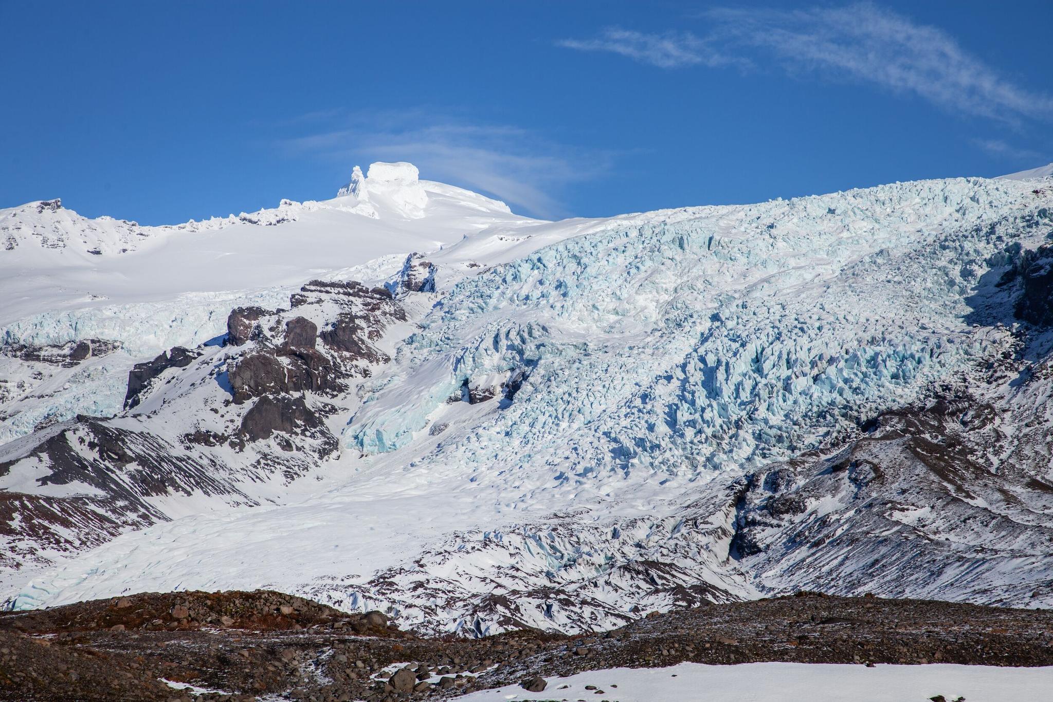
This is also why the plain can feel more powerful after you have visited Vatnajökull or Falljökull. The glacier views show the source; the sand plain shows where meltwater, ash, and sediment go.
The landscape is not empty from an ecological point of view either. Vatnajökull National Park identifies Skeiðarársandur and nearby Breiðamerkursandur as important nesting areas for birds including great skua, red phalarope, and barnacle goose. If you leave the car, keep distance and avoid treating the ground as open recreation space.
How much time should you allow?
Most travelers need 10-20 minutes if they are simply breaking the drive. Allow 30-45 minutes if you want the bridge monument, photos, and a calmer look across the plain.
The stop has a low walking requirement, but it can still cost more route time than expected if the weather is sharp, the light is good, or you start comparing safe stopping points. Do not let a small context stop quietly steal the time you planned for Svartifoss, Skaftafell, Jökulsárlón, or Diamond Beach.
Use 10-20 minutes when Skeiðarársandur is a drive break between bigger stops.
Use 30-45 minutes when the bridge monument and plain views are part of the day.
Skip the stop in poor visibility if it would not add anything beyond a windy roadside pause.
Save the slow version for a southeast overnight or a deliberately relaxed South Coast Road Trip.
Why does the old Skeiðará bridge matter?
The bridge story turns the plain from scenery into route history. Skeiðarárbrú is tied to the completion of Route 1 around Iceland, and the damaged bridge remains point back to the 1996 jökulhlaup.
Regional sources connect the 1974 opening of Skeiðarárbrú with the Ring Road becoming a complete loop. That matters for travelers because the road across the sand plain was not just another stretch of asphalt; it was a difficult engineering link across glacier-fed rivers and unstable ground.
The 1996 Grímsvötn/Gjálp event sent a major glacial outburst flood across Skeiðarársandur, damaging bridges and road sections. The twisted bridge girders left near the road make that history visible without needing a long museum-style stop.
The 1996 flood is the reason the bridge remains feel more than decorative.The bridge monument is the most concrete reason to make a short stop on the plain.
What should you check before committing?
Use this page as planning guidance, not live condition confirmation. Road, wind, visibility, alerts, and on-site signs should decide whether you stop, slow down, or keep driving.
Skeiðarársandur is easy to underestimate because it sits on the main road. The practical risks are not complicated, but they matter: wind across open sand, poor visibility, winter surface conditions, fast traffic, and the temptation to pull over where stopping is not sensible.
Check official road conditions, the Icelandic weather forecast, SafeTravel guidance, and any relevant Vatnajökull National Park information before building the stop into a tight day. If those checks make the drive feel fragile, let the sand plain be scenery through the windscreen.
Which nearby stops make the plain more worthwhile?
Skeiðarársandur is most useful when it sits between stronger southeast anchors. Pair it with Skaftafell for walking, Vatnajökull for scale, and Jökulsárlón or Diamond Beach for the glacier-and-coast finish.
West to east, the cleanest rhythm is to cross the sand plain, stop briefly if the conditions and timing make sense, then give proper time to Skaftafell or Svartifoss. If your day continues east, Jökulsárlón and Diamond Beach can carry the next part of the route.
If you are comparing the whole day, the South Coast Road Trip and Ring Road or South Coast? pages are more useful than adding random stops. They help decide whether this is a context pause inside a southeast day or a sign that your route is trying to do too much.
Skeiðarársandur works best as part of the drive between larger southeast stops.
Skeiðarársandur FAQ
The questions here are practical because Skeiðarársandur is more confusing than difficult: it looks huge on the map, but the visitor decision is usually simple.
Is Skeiðarársandur a beach?
Not in the usual visitor sense. It is a glacial outwash plain that reaches toward the sea, so plan it as a Route 1 landscape and bridge-history stop rather than a beach walk.
Can you drive onto the sand plain?
Do not treat Skeiðarársandur as an off-road driving area. Stay on permitted roads and use sensible, marked stopping places.
Is the bridge monument worth stopping for?
Yes, if you like route history or want a short, concrete reason to pause. Skip it if the day is already tight or conditions make roadside stopping feel poor.
How does Skeiðarársandur compare with Skaftafell?
Skaftafell is the stronger destination for walking and glacier viewpoints. Skeiðarársandur is the landscape context you cross before or after that bigger stop.
Map
See where this stop sits
Use nearby places and useful bases before opening directions.
Region
South Iceland
Works well with
South Coast / Ring Road
Useful base
Höfn
Interactive planning map for Skeidararsandur Sand Plain
Skeidararsandur Sand Plain
Keep exploring
Put this place in route context
Use nearby places and planning pages to decide whether this stop strengthens the route or stays optional.