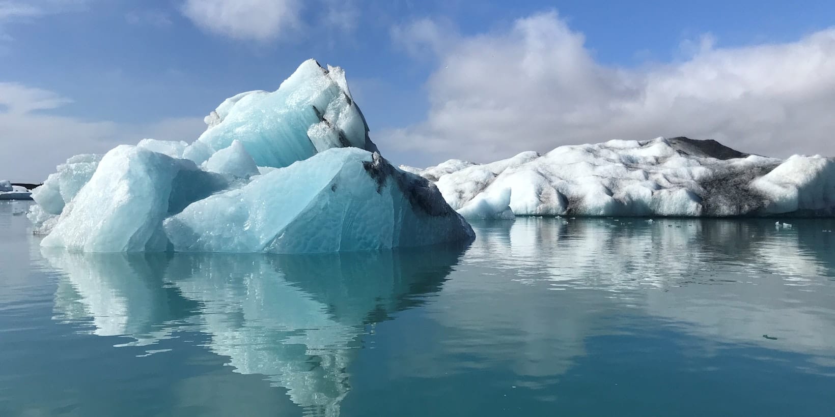
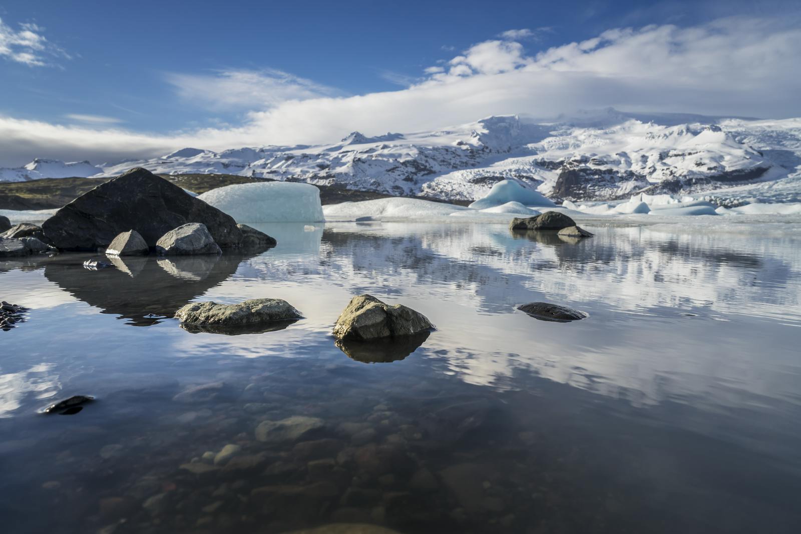
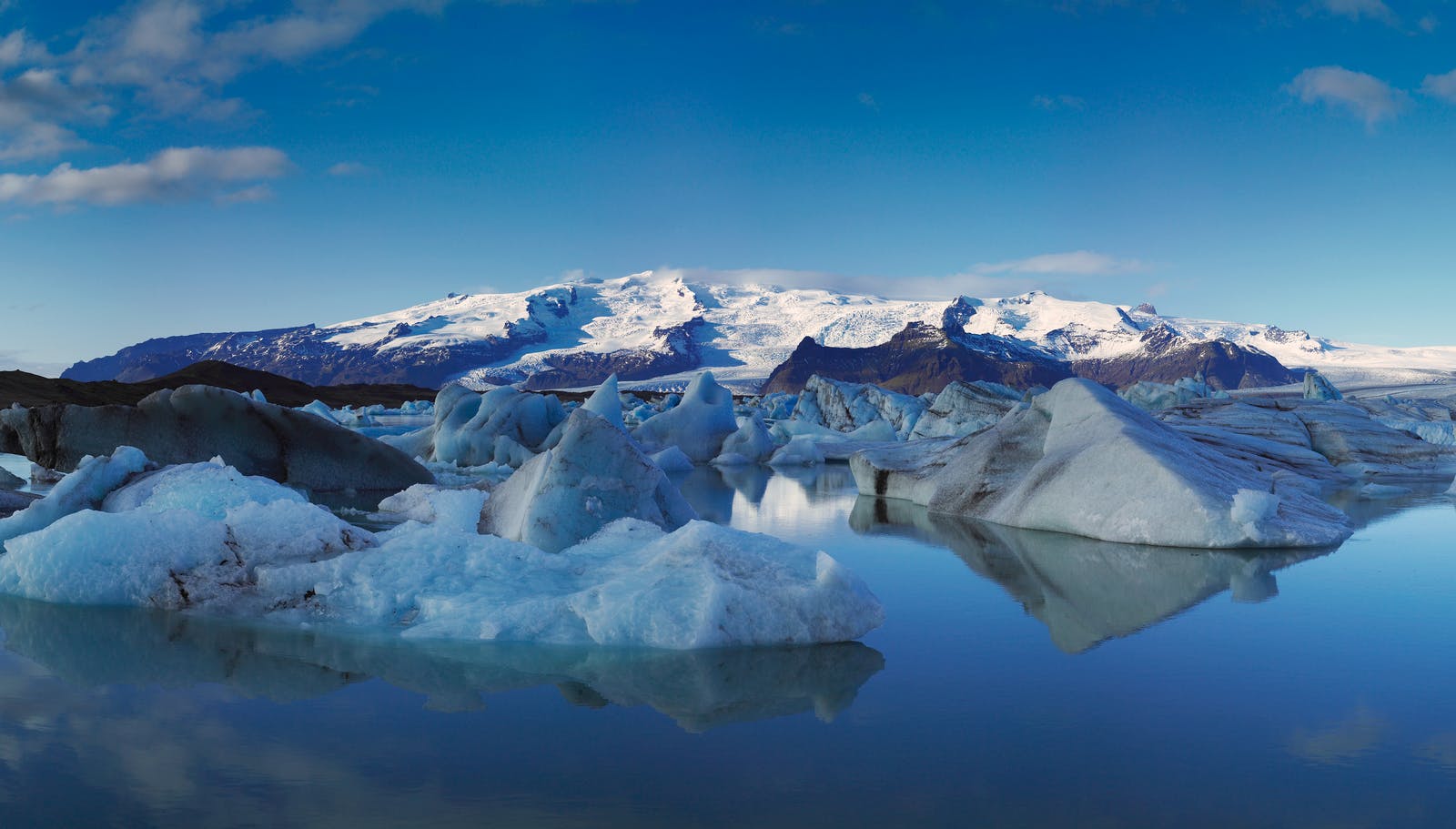
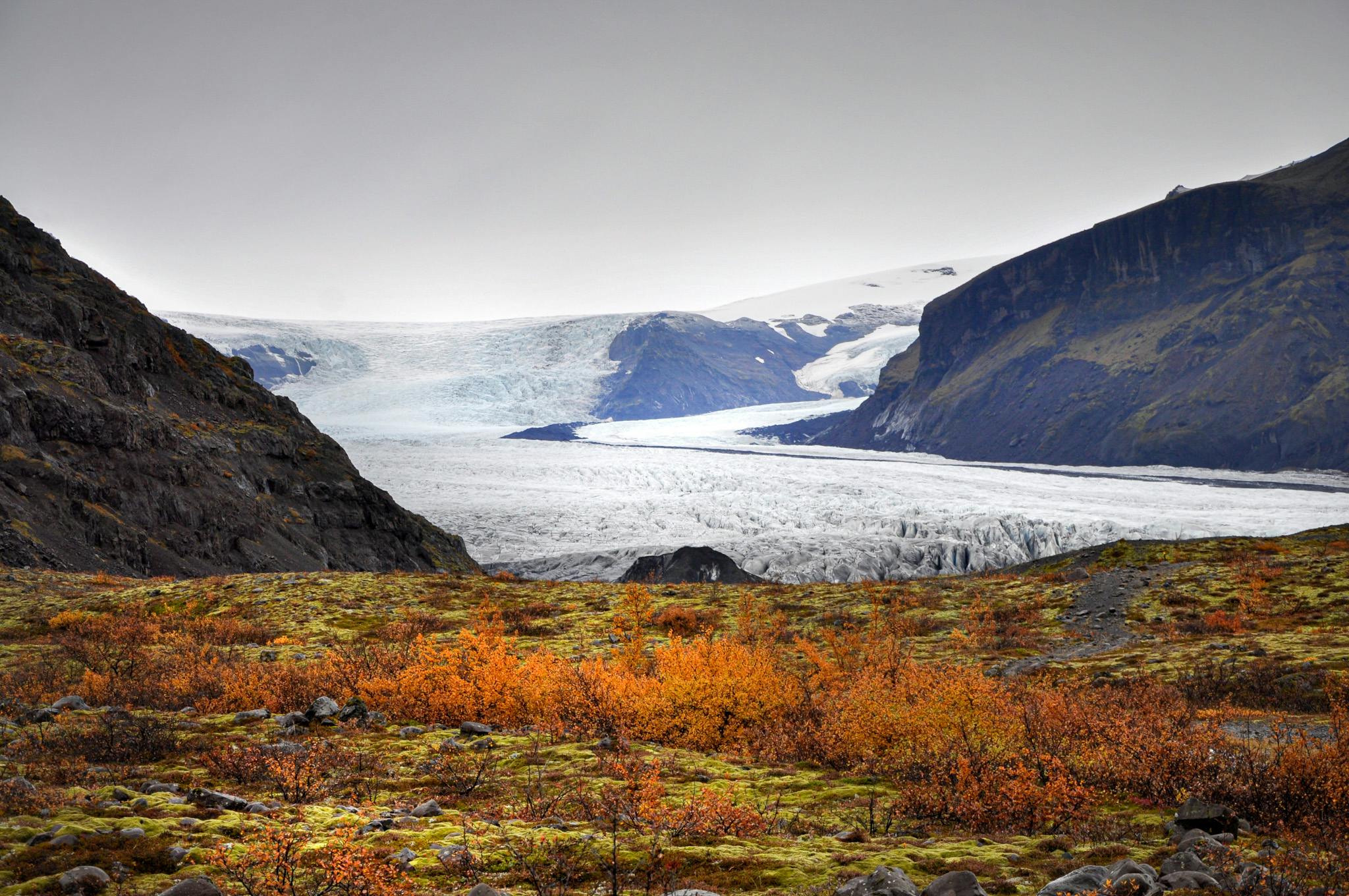
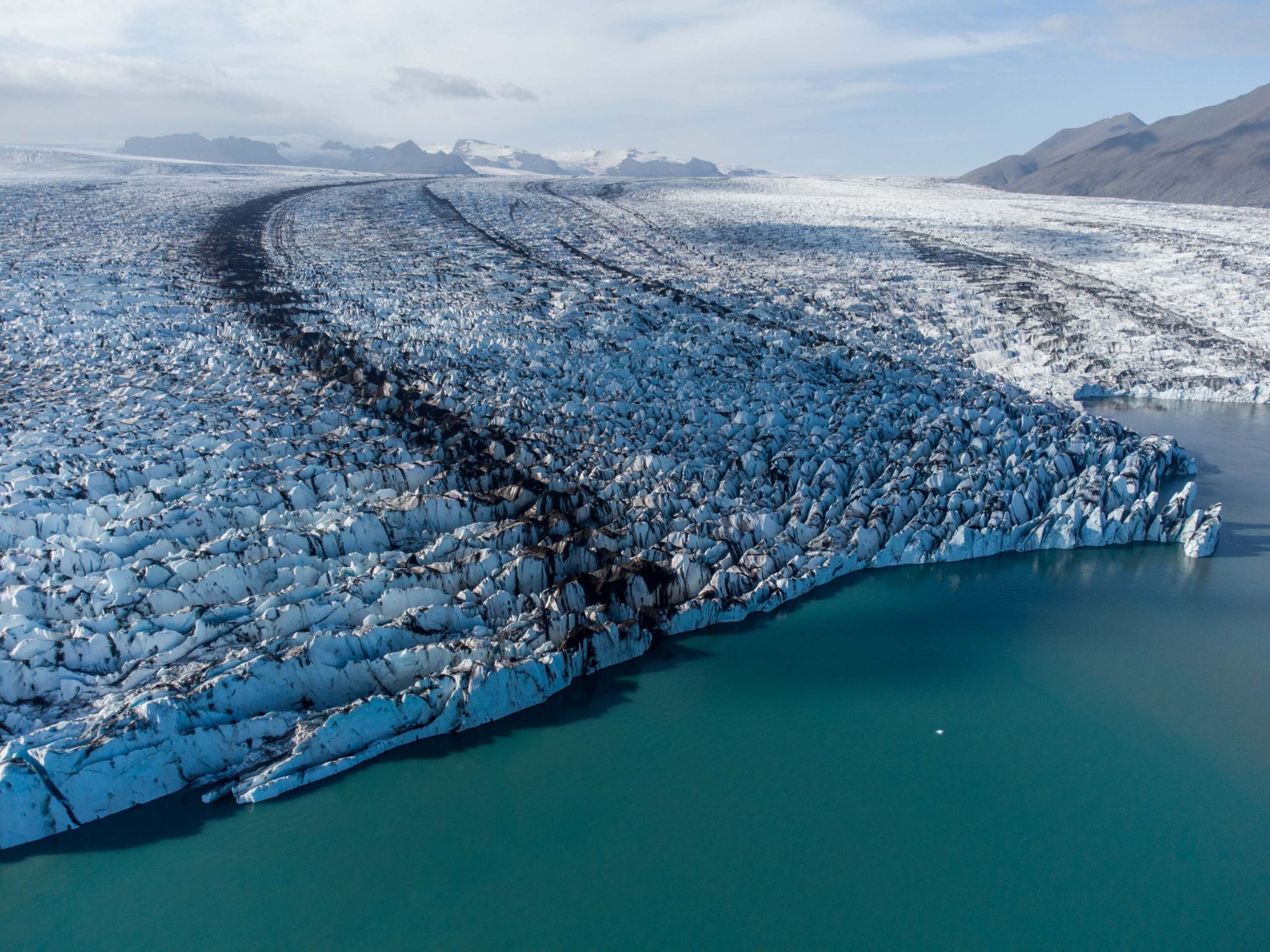
Is Breiðamerkurjökull worth planning around?

Yes, if you are already reaching Jökulsárlón and want to understand the glacier that gives the lagoon its ice. No, if you are trying to add a separate casual glacier stop to an overloaded South Coast day.

Breiðamerkurjökull is not a roadside attraction in the same simple way as a waterfall viewpoint. It is the outlet glacier behind the Jökulsárlón landscape: the broken ice, dark moraine bands, calving front, and icebergs that eventually make the whole area feel larger than a normal scenic stop.

The useful decision is whether the glacier changes your plan. For most travelers, Breiðamerkurjökull makes Jökulsárlón more meaningful rather than adding another separate stop. It becomes a bigger commitment only if you are considering a guided glacier, ice-cave, or close-ice experience.

A local Iceland travel editor would add Breiðamerkurjökull when the route already reaches Jökulsárlón, Diamond Beach, or Fjallsárlón and the traveler wants to understand the ice landscape. They would skip making it a standalone checklist item when daylight is tight, the drive is long, or the traveler might mistake a safe view for permission to walk onto glacier ice.

How Breiðamerkurjökull should work in a day
Visit styleUse it whenMain caution
Quick glacier contextYou are stopping at Jökulsárlón and want the glacier story behind the icebergsDo not add a new detour if the lagoon and beach already fill the stop
Photo-focused stopYou want glacier scale, moraine bands, and icebergs in the same visual clusterWind, spray, low cloud, and light can change the value of waiting
Guided close-ice experienceYou have verified guide, weather, safety, and road details before building the day around itDo not treat glacier terrain or floating ice as independent walking ground

Worth the stop?

When this stop makes sense

Good match for

  • South Coast and Ring Road travelers already reaching Jökulsárlón
  • visitors who want to understand where the lagoon ice comes from
  • photographers interested in glacier scale, moraine bands, and icebergs
  • travelers considering a guided glacier or ice-cave experience

Think twice if

  • rushed day trips trying to reach the glacier-lagoon area from Reykjavík
  • travelers looking for an independent walk onto glacier ice

Pair it with

South IcelandJökulsárlón Glacier LagoonDiamond BeachFjallsárlón Glacier Lagoon

What are you actually seeing from Jökulsárlón?

You are seeing an outlet glacier of Vatnajökull that calves into the Jökulsárlón system. The lagoon is the visitor setting; Breiðamerkurjökull is the moving ice source behind it.

That naming distinction matters. Jökulsárlón Glacier Lagoon is where most visitors stand, photograph icebergs, and decide whether to add a boat or beach stop. Breiðamerkurjökull is the glacier feeding the scene, while Vatnajökull Glacier and National Park is the wider ice-cap and protected-area context behind the southeast coast.

The glacier surface is full of dark moraine bands, broken ice, and texture that explain why the lagoon looks so dramatic.

Look past the floating ice and the glacier becomes easier to read. Dark bands mark debris carried through the ice. The broken front shows why icebergs appear in the lagoon. The mountains and broad white ice behind the water remind you that this is not a static backdrop; it is a changing glacier margin.

How should you pair it with nearby stops?

Pair Breiðamerkurjökull with places that make the glacier easier to understand, not with every nearby name on the map. The strongest cluster is 
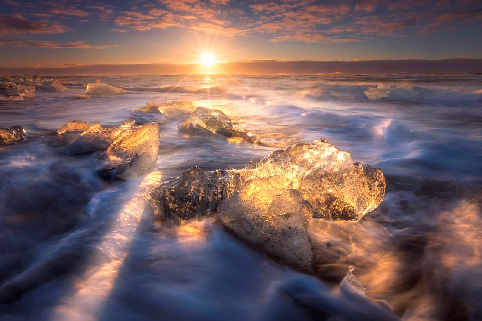
Jökulsárlón, Diamond Beach, Fjallsárlón, and the broader Vatnajökull area.

Start with Jökulsárlón if you want the classic lagoon view. Add Diamond Beach when the ocean, black sand, and stranded ice are part of the decision. Add Fjallsárlón if you want a quieter glacier-lagoon comparison close to Fjallsjökull.

Breiðamerkurjökull is easiest to understand when you connect the glacier to the lagoon and iceberg landscape below it.

Skaftafell changes the rhythm. It is not next door in the same parking-stop sense, but it works in the same southeast Iceland planning zone if you are building a slower South Coast Road Trip or choosing between the South Coast and a fuller Ring Road vs South Coast plan.

  • Best short pairing: Jökulsárlón plus Diamond Beach, with Breiðamerkurjökull as the glacier context.
  • Best quieter comparison: Jökulsárlón plus Fjallsárlón, especially if you want two different glacier-lagoon moods.
  • Best broader day: Jökulsárlón, Diamond Beach, and Skaftafell only when the drive plan has enough daylight and weather margin.
  • Best culture add-on: Þórbergssetur if the southeast coast needs an indoor, local-history counterpoint.

How much time and effort should you allow?

For most travelers, Breiðamerkurjökull does not need its own long slot. The time belongs to the lagoon cluster, the weather, and the decision about whether close glacier access is part of the day.

Allow a short stop if your goal is to understand the glacier while visiting Jökulsárlón. You can read the landscape, watch the ice, take photos, and still keep the day moving. This version is often the right choice on a South Coast drive with multiple major stops.

Allow more time only when the glacier is the main reason for being in the area. A guided ice activity, winter ice-cave plan, or deeper photography stop changes the day from sightseeing to conditions-dependent planning. That is where official visitor details, operator information, road conditions, and weather matter before the route is locked.

Practical time choices

Quick understanding
20-45 minutes around the Jökulsárlón-side viewpoint context.
Balanced glacier-lagoon cluster
A longer stop when Jökulsárlón, Diamond Beach, and photos all matter.
Guided close-ice plan
A flexible half-day-style commitment once official details and operator guidance support it.
Bad fit
A rushed return from Reykjavík with no buffer for weather, darkness, or slower winter travel.

What should you check before getting close to the ice?

Check the official sources that affect real decisions: safety alerts, weather, road conditions, protected-area guidance, on-site signs, and operator instructions. Glacier scenery is easy to admire, but close ice is not casual terrain.

The most important rule is not to turn a viewpoint stop into independent glacier travel. Crevasses, calving ice, cold water, unstable ice, and changing weather are exactly why close glacier access belongs with qualified guides and proper equipment.

Floating ice at Jökulsárlón and Diamond Beach is also part of the risk picture. Enjoy the shapes from stable ground, respect on-site guidance, and avoid stepping onto ice that can move, roll, break, or be carried by water.

For winter or shoulder-season travel, connect the glacier decision to the wider route. The winter driving guidance matters because the attraction sits far from Reykjavík, and a small delay near Vatnajökull can affect the rest of the day.

Official sources to check

Common questions about Breiðamerkurjökull

The common confusion is whether Breiðamerkurjökull is a separate stop from Jökulsárlón. For most trips, it is the glacier context behind the lagoon stop.

Is Breiðamerkurjökull the same as Jökulsárlón?

No. Breiðamerkurjökull is the glacier, while Jökulsárlón is the glacier lagoon where many travelers view icebergs and the glacier landscape.

Can you walk on Breiðamerkurjökull by yourself?

No, do not treat it as independent walking terrain. Close glacier travel should be handled with qualified guides, proper equipment, and official safety guidance.

Is Breiðamerkurjökull worth a separate stop?

Usually not as a separate checklist stop. It is most useful as the glacier context for Jökulsárlón, Diamond Beach, or a verified guided ice experience.

How does Breiðamerkurjökull fit with Fjallsárlón?

Use Breiðamerkurjökull for the Jökulsárlón glacier source and Fjallsárlón for a quieter nearby lagoon comparison tied closely to Fjallsjökull.