Langisjór is a remote highland lake near Vatnajökull, worth planning only when road access, weather, vehicle choice, and a full highland day all make sense, with enough flexibility for conditions and nearby route choices.
Quick guide
Type
Remote Highlands lake, mountain landscape, and viewpoint area
Region
Southern Highlands, southwest of Vatnajökull in the South Iceland planning area
Route context
Reached as a deliberate F-road detour, not as a normal paved South Coast stop
Time to allow
Plan most of a day once slow driving, lake time, photos, and weather margin are included
Best experience
Clear summer conditions, open F208/F235 access, and time for the lake shore or Sveinstindur
Access reality
Requires current road, river, vehicle, weather, and safety checks before departure
Season note
Summer-focused; do not assume access before official roads are open
Nearby pairings
Sveinstindur, Lakagígar, Eldgjá, Fagrifoss, and broader South Iceland plans
Is Langisjór worth the F-road detour?
Yes, Langisjór is worth the detour if you want a remote Highlands lake and you have the right vehicle, summer access, weather window, and time buffer. It is not worth forcing into a tight South Coast day just because it looks close on a map.
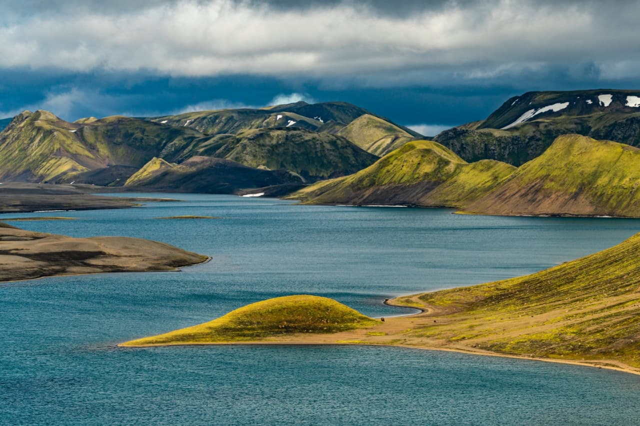
The reward is a long blue lake hidden between volcanic ridges, black sand, mossy slopes, and the mountain line around Sveinstindur and Fögrufjöll. It feels very different from the easy waterfall-and-beach rhythm of the South Coast because the approach is part of the commitment.
Choose Langisjór when your trip can handle a slow Highlands day. If you are still deciding between easier anchors such as Skógafoss, Jökulsárlón, or Lakagígar, compare the access risk first instead of adding all of them to the same route.
Photo guide
Langisjór in photos
1 / 2
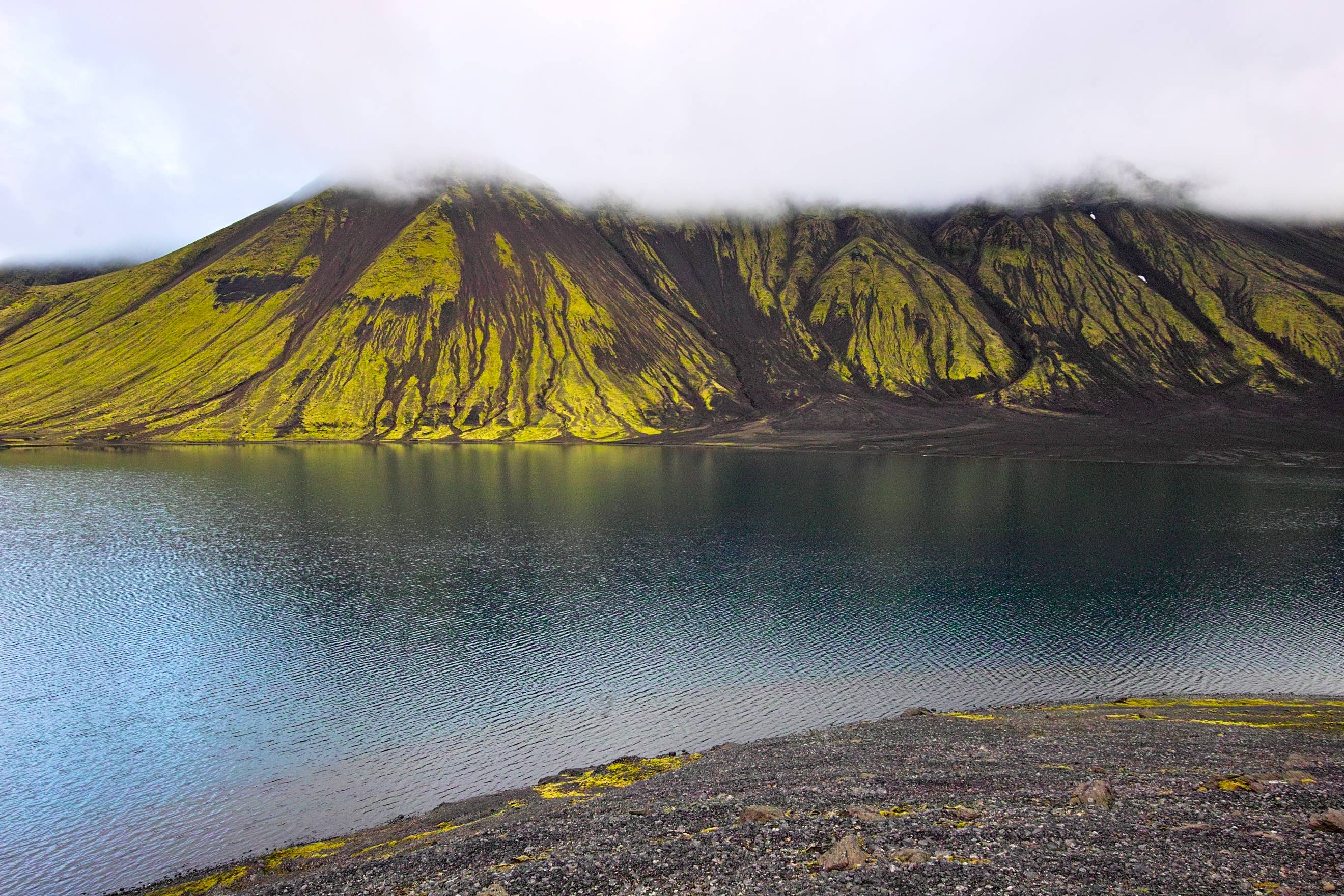
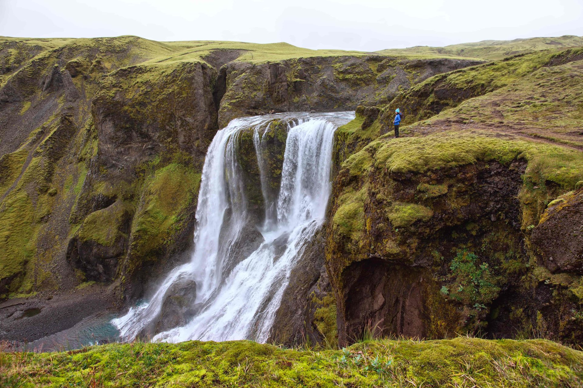
Shore-level views make the lake feel quieter and more exposed than the aerial panoramas.
Worth the stop?
When this stop makes sense
Good match for
summer Highlands self-drive travelers
photographers who want remote lake and ridge views
hikers considering Sveinstindur
repeat visitors with time beyond the easy South Coast icons
Think twice if
travelers without a suitable Highlands vehicle
winter or shoulder-season trips without confirmed access
What does the lake feel like when you finally see it?
Langisjór feels open, quiet, and slightly unreal because the lake does not announce itself from a busy road. The view arrives after rougher country, then stretches out between dark volcanic ground and green-brown ridges.
The lake is long enough that it reads more like a blue corridor through the Highlands than a small scenic pool. On calm days, the water can hold mountain reflections; in rougher weather, the same shore feels exposed and austere.
From above, the lake reads as a long blue corridor through volcanic ridges.
That exposed feeling is part of the appeal. There are no city services, no easy cafe stop, and no reason to rush from viewpoint to viewpoint. The place works when you slow down enough to notice the black sand, moss, islands, ridges, and silence.
How hard is the F208 and F235 access?
The access is the main planning barrier. Langisjór is reached by Highlands roads, commonly involving F208 and road F235, so road status, vehicle rules, river crossings, weather, and daylight matter more than normal drive time.
Visit South Iceland describes the western national-park roads as mountain tracks for four-wheel-drive vehicles, with rocky sections, potholes, loose gravel, and streams or rivers that can suddenly swell. SafeTravel adds the practical warning that Highland conditions change quickly and that not every 4WD is suitable for every F-road.
The access area makes the visit feel practical: rough road, open ground, and few services.
If river depth, rain, wind, vehicle clearance, rental rules, or daylight look uncertain, turn Langisjór into a future-plan item. A safer South Iceland day is better than treating a remote lake as a test of luck.
How much time should you allow at Langisjór?
Allow most of a day if Langisjór is the main goal. The actual lake stop can be shorter, but the slow drive, current checks, photo time, possible hike, and return route make it a full planning commitment.
Use the available time and conditions to decide how much of Langisjór to attempt.
Plan
Best use
Watch for
Lake-shore look
A shorter visit once you have already committed to the drive
The approach may feel too costly if you only stop for a few photos
Lake plus Sveinstindur viewpoint
The strongest choice in clear weather for travelers who want scale
The hike adds exposure, time, and weather dependence
Slower Highlands day
Langisjór plus careful comparison with Lakagígar, Eldgjá, or Fagrifoss
Too many rough-road stops can break the day
The practical question is not whether Langisjór deserves attention once you are there. It is whether your day can reach it safely, enjoy it without rushing, and still leave enough margin to drive out.
What should you do at the lake?
Most visitors should keep the plan simple: see the lake, walk carefully where paths allow, photograph the ridges, and consider Sveinstindur only when conditions and energy make it realistic.
Use the shore and marked paths for the easiest sense of the lake's scale.
Consider Sveinstindur if you want the classic high view over Langisjór and the surrounding Highlands.
Keep photography flexible because cloud, wind, and reflection conditions can change the whole mood.
Treat fishing, camping, kayaking, or boating as current-check activities, not default assumptions.
Protect the moss and fragile ground by staying on existing paths and legal roads.
Sveinstindur is the obvious viewpoint name to know, but the attraction page should not make every traveler hike it. In poor visibility, strong wind, low energy, or late-day timing, the lake shore and a controlled look may be the better visit.
Sveinstindur gives the clearest sense of Langisjór as a long lake set into the Highlands.
Which nearby Highlands stops pair best with Langisjór?
The best pairings are route-relevant Highlands and South Iceland places, but they only work if the roads and day still have enough margin. Langisjór is not a place to overload with optimistic map pins.
Sveinstindur is the closest planned comparison because it turns the lake into a viewpoint decision. Lakagígar is the strongest published nearby comparison for another remote volcanic landscape, while Eldgjá and Fagrifoss are natural future attraction links in the same rough-road planning area.
If your trip is still built around easier South Iceland highlights, use Skógafoss and Jökulsárlón as the contrast. Those stops are simpler for most first-time routes; Langisjór is for a day when the Highlands are the point.
What should you check before committing?
Check official sources close to departure because Langisjór is remote, seasonal, and condition-dependent. Old trip reports and fixed opening assumptions are not enough.
Start with Umferðin for road status, then use SafeTravel for Highland driving and river-crossing advice, the Icelandic Met Office for weather and warnings, and Vatnajökull National Park or local visitor information for current area guidance.
Official forecast and warning checks for wind, visibility, rain, and exposure.
Langisjór FAQ
These questions matter because Langisjór is beautiful, remote, and easy to underestimate from a map.
Can you visit Langisjór without a 4x4?
No, you should not plan Langisjór without a suitable Highlands vehicle. Access uses mountain-road conditions where current status, rental rules, river crossings, and weather all matter.
Is Langisjór open year-round?
No, Langisjór should be treated as a summer-focused Highlands attraction. Road opening depends on conditions, so check official road status before assuming access.
Is Sveinstindur necessary to enjoy Langisjór?
No, Sveinstindur is not necessary, but it gives the strongest high view of the lake in clear conditions. Skip the hike if visibility, wind, timing, or footing make it a poor choice.
How long should you spend at Langisjór?
Most travelers should plan most of a day for the full Langisjór commitment, even if the shore visit itself is shorter. The drive, checks, weather margin, photos, and possible hike create the real time cost.
What should you pair with Langisjór?
Pair Langisjór with Sveinstindur, Lakagígar, Eldgjá, or Fagrifoss only when the day has enough road and weather margin. Otherwise, keep it separate from easier South Iceland stops.
Map
See where this stop sits
Use nearby places and useful bases before opening directions.
Region
South Iceland
Works well with
South Coast / Highlands routes
Useful base
Vík
Interactive planning map for Langisjór Lake
Langisjór Lake
Keep exploring
Put this place in route context
Use nearby places and planning pages to decide whether this stop strengthens the route or stays optional.