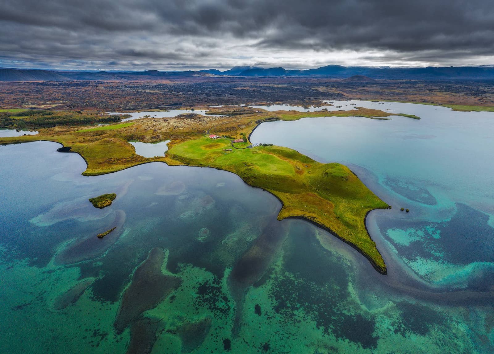
A shallow lake with an unusually broken shoreline

Mývatn covers about 37 square kilometers, yet its average depth is only 2.5 meters and its deepest water is about 4 meters.

The lake contains around 50 islands and islets, with bays, marshy edges and low lava forms dividing the water into smaller spaces. From ground level it rarely appears as one uninterrupted blue surface. The shore keeps changing between open water, reeds, lava and green humps, which is why moving between a few marked viewpoints reveals more than one distant overlook.

Mývatn and the Laxá river are protected under Icelandic law and form a wetland of international importance. The protection reflects the connection between the water, insects, fish, birds, lava and vegetation. This wetland is one of the defining landscapes of Northeast Iceland, not scenery that can be understood apart from the living system.

The name means midge lake. Small flying insects can be numerous in warm, calm weather, especially near the shore. Many are non-biting chironomid midges, while blackflies can bite. They are inconvenient for people but central to the food web that supports the lake's birds and fish.

Official lake facts

Lava and water created the pseudocraters

The rounded craters along parts of the shore are not volcanic vents. They formed when hot lava passed over wet ground and trapped water flashed into steam.

Steam explosions broke through the lava and built crater-shaped mounds from fragments. At Skútustaðagígar on the southern shore, marked paths cross a dense group formed roughly 2,300 years ago. Their low green forms make more sense when seen beside the shallow water that helped create them.

Hverfjall is a true volcanic crater, distinct from the smaller pseudocraters beside the lake.
Dark Hverfjall crater rising above the Lake Mývatn landscape

Hverfjall is a true volcanic crater, distinct from the smaller pseudocraters beside the lake.

Nearby Hverfjall is different: it is a large tephra crater with a marked ascent and rim. Keeping the two landforms separate makes the geology easier to understand. Do not climb unmarked crater slopes or lava formations; the protected ground is fragile and informal tracks spread quickly.

Pseudocrater geology

Birdlife changes with season and water conditions

Mývatn is one of Iceland's most important waterbird areas, with especially rich duck life supported by the productive shallow lake.

Barrow's goldeneye is one of the characteristic species, alongside many other ducks and wetland birds. Spring and early summer can bring intense nesting activity, while the number and location of birds shift later in the year. Binoculars are more useful than approaching the shore closely. Sigurgeir's Bird Museum provides indoor context for travelers who want to identify the area's birdlife.

The lake's birds depend on the same shallow water and insect life that visitors notice along the shore.
Waterbirds on Lake Mývatn among shallow wetland vegetation

The lake's birds depend on the same shallow water and insect life that visitors notice along the shore.

Stay on marked paths, keep dogs controlled where permitted and avoid stopping directly beside nesting birds. A bird moving away, calling repeatedly or trying to draw attention is a sign to increase the distance. Watch from far enough away that the birds continue feeding, resting or caring for their young normally.

Flora and fauna

Dimmuborgir, Hverfjall and Hverir are separate places

Lake Mývatn is the organizing landscape, while several nearby places focus on one volcanic or geothermal feature.

Dimmuborgir is for walking among lava pillars and caves formed when a lava lake drained; Lava Church Cave is one formation inside that area. Hverir is a bare geothermal field of steam vents and mud pots, while Bjarnarflag shows a smaller industrial geothermal landscape. Grjótagjá is a lava cave with geothermally heated water, and Krafla covers a larger volcanic system farther east.

The Stóragjá fissure, beside Reykjahlíð, offers another small-scale view into the lava. Regional walking guidance connects it with Grjótagjá, but geothermal water is not permission to bathe; follow current signs and local guidance.

These are not parts of one continuous footpath, and the lake should not become a checklist for collecting them all. A useful visit can be the shore and pseudocraters alone. With more time, add the one landform that answers your strongest interest: lava at Dimmuborgir, a crater at Hverfjall or active geothermal ground at Hverir.

Hvannfell is mainly a landmark associated with specialist Lofthellir cave access east of the lake. It is useful map context, not another standard lakeshore stop.

Hverir belongs to the wider Mývatn landscape, but it is a separate geothermal visit with its own hazards.
Gray bubbling mud and orange mineral ground at Hverir near Lake Mývatn

Hverir belongs to the wider Mývatn landscape, but it is a separate geothermal visit with its own hazards.

Half a day gives the lake room to register

Two to four hours is a realistic minimum for the lake and one nearby landform; a full day allows several distinct experiences without rushing.

A short stop can show water and pseudocraters, but it cannot represent the whole protected area. Allow time to walk slowly, notice birds and insects, and understand the difference between the shoreline and the volcanic features beyond it. Reykjahlíð is the main village base for services near the lake. An overnight stay adds flexibility when low cloud, wind or rain obscures a planned walk.

Mývatn Nature Baths is a separate paid bathing attraction, not the lake itself. Swimming in Lake Mývatn is not the purpose of the protected-area visit, and geothermal water elsewhere should never be assumed safe because it looks calm.

Weather changes visibility, insects and footing

Summer and winter reveal different parts of Mývatn, and neither season removes the need for current checks.

Warm, still summer weather can bring the heaviest midge activity, while wind often reduces it. A head net can be more useful than insect repellent around non-biting swarms. In winter, snow simplifies the landscape but can cover path edges, lava gaps and ice. Short daylight also makes several separate walks harder to complete safely.

Snow can make the lava landscape clearer visually while hiding uneven ground underfoot.
Snow-covered marked path through dark lava formations at Dimmuborgir near Mývatn

Snow can make the lava landscape clearer visually while hiding uneven ground underfoot.

Current condition checks