Ódáðahraun is a vast lava desert north of Vatnajökull, useful for travelers deciding whether a Highlands route should focus on Askja, Holuhraun, rough roads, or easier alternatives nearby.
Quick guide
Type
Vast highland lava field, volcanic desert, and route context around Askja and Holuhraun
Region
Central Highlands north of Vatnajökull
Route context
A Highlands F-road landscape, not a normal roadside attraction
Time to allow
Half day to full day if tied to Askja, Holuhraun, or Herðubreiðarlindir; longer for deep Highlands plans
Best experience
Use it as the setting for a deliberate Highlands day rather than as a standalone pin
Access reality
Roads, vehicle suitability, weather, and local guidance should decide whether the plan is sensible
Safety note
Stay on legal roads and marked routes; lava, sand, water scarcity, and poor visibility can make small mistakes serious
Nearby pairings
Askja, Víti by Askja, Holuhraun, Herðubreiðarlindir, Hveravellir, Kerlingarfjöll, Hofsjökull, and Þjórsárver
Before you go
Check official road, weather, safety, and national-park visitor information before making the stop fixed
Is Ódáðahraun worth planning around?
Yes, but only when you are already planning a real Highlands day. Ódáðahraun is not a neat viewpoint; it is the enormous lava desert that gives places like Askja and Holuhraun their remote setting.
The value is scale. Instead of one waterfall, beach, or crater, you get a sense of Iceland's interior as a dry volcanic world: rough lava, pale sand, distant table mountains, glacier-fed rivers, and long spaces where the road itself feels like part of the visit.
The catch is that a broad lava field is a weak goal by itself. Most travelers should use a concrete anchor such as Askja Caldera, Víti by Askja, Holuhraun, or Herðubreiðarlindir, then treat Ódáðahraun as the landscape that makes that day feel different from a normal Ring Road stop.
Ódáðahraun decision guide
Decision
Go if
Skip or save it if
Check before committing
Trip purpose
You want a serious Highlands volcanic landscape and have a clear anchor such as Askja.
You only need a quick scenic stop between easier lowland sights.
Confirm which anchor place gives the day a concrete reason.
Access
Your vehicle, route plan, daylight, and confidence fit remote highland roads.
The road choice feels like a stretch for the group or rental terms.
Use official road status, weather, and safety guidance before driving.
Time
You can keep most of the day flexible for rough roads, walking, photos, and a turnaround decision.
The same day already has a tight South Coast, Golden Circle, or Ring Road schedule.
Leave room for slower driving, poor visibility, and a backup plan.
Worth the stop?
When this stop makes sense
Good match for
experienced Highlands travelers who want the landscape context around Askja and Holuhraun
self-drivers with suitable highland access plans and enough time to adjust
photographers who value stark lava, volcanic desert, mountain scale, and empty interior scenery
travelers comparing one serious Highlands objective with easier lowland route days
Think twice if
short first trips built around the Golden Circle, South Coast, or Reykjavík
small-car travelers or rentals not suited to remote highland roads
Ódáðahraun is a huge volcanic desert north of Vatnajökull, shaped by lava, sand, sparse water, mountains, and routes that feel far removed from Iceland's coastal travel corridors.
The name is often translated as the lava field of outlaws or misdeeds, which fits the feeling: empty ground, hard edges, and a history of people imagining the interior as a place beyond normal settlement. For planning, though, the useful point is simpler: this is not one fenced attraction with a standard arrival pattern.
Ódáðahraun can look empty from a distance, but the ground itself is rough, broken, and slow to cross.
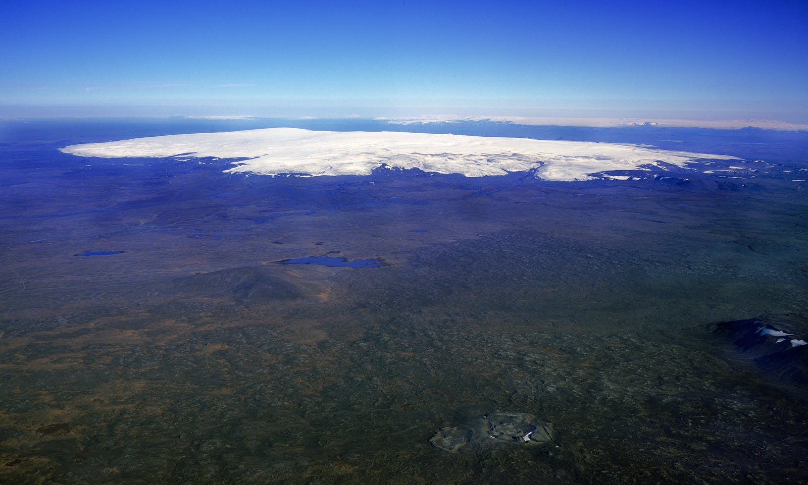
The landscape sits in the same broad highland world as Hofsjökull views, Þjórsárver wetlands farther west, and the interior routes that connect places like Hveravellir and Kerlingarfjöll. Ódáðahraun feels harsher than those geothermal and mountain stops because water and vegetation are much less obvious.
What access checks decide the visit?
Access should decide the visit before scenery does. Ódáðahraun belongs to the Highlands, so road status, vehicle suitability, weather, daylight, and group confidence matter more than a saved map pin.
Expect rough interior-road thinking: loose surfaces, slow progress, possible river-crossing decisions on some approaches, long gaps between help, and conditions that can change faster than a lowland itinerary allows. A plan that looks simple on a map can become tiring when visibility drops or the surface deteriorates.
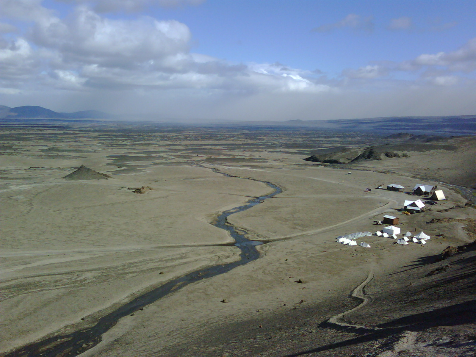
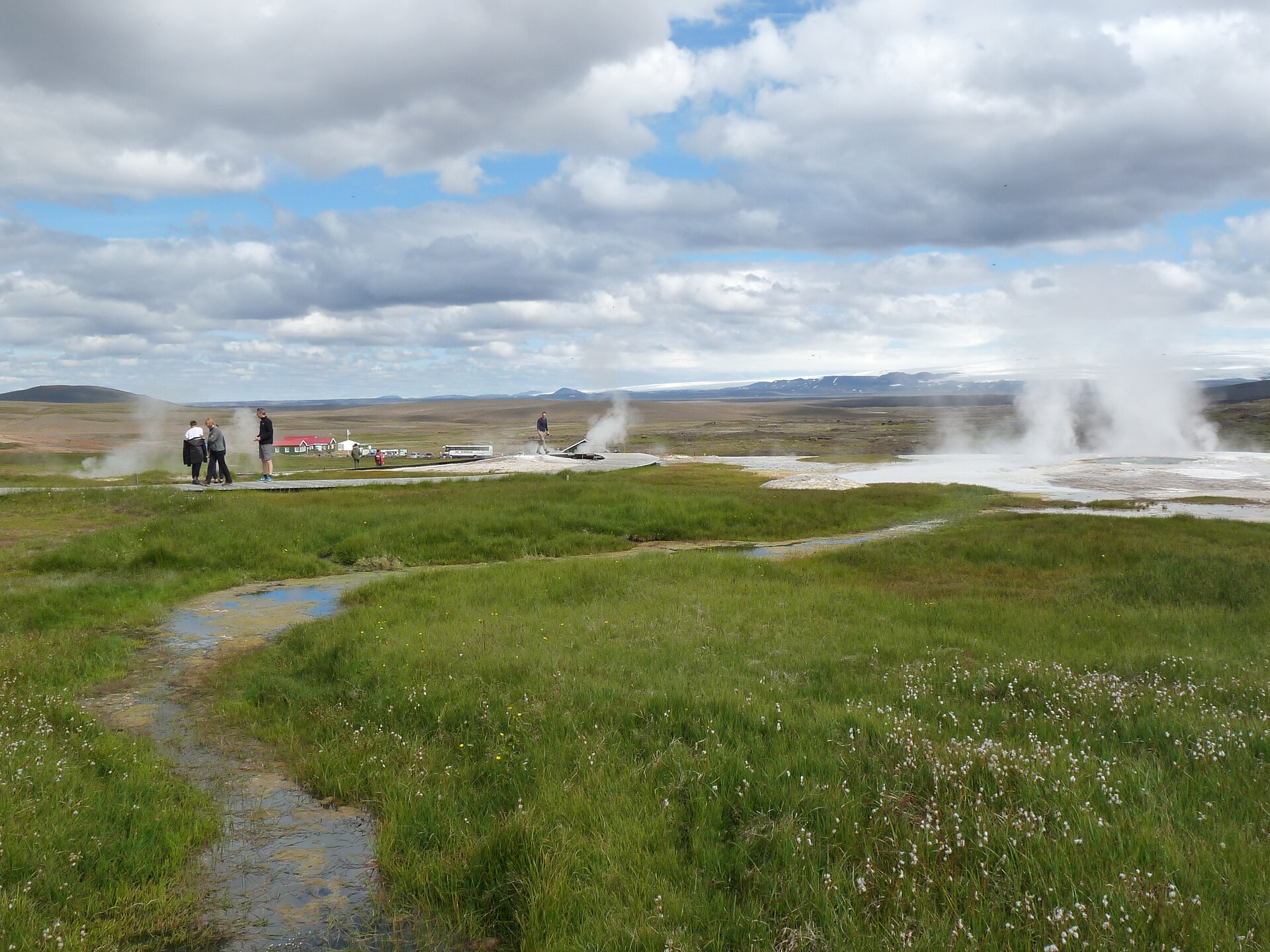
Herðubreiðarlindir shows why water, vegetation, and marked routes matter so much inside the lava desert.
If you are using the Iceland Highlands Road Trip Planning guide, treat Ódáðahraun as one of the places where the route plan needs a real exit strategy. If the road check, forecast, or group mood is weak, a lower-friction highland comparison such as Hveravellir or Kerlingarfjöll may be a better day.
What does the lava desert feel like?
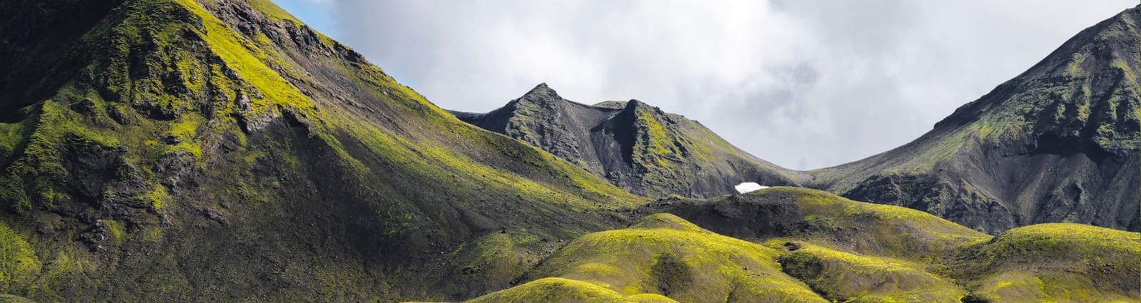
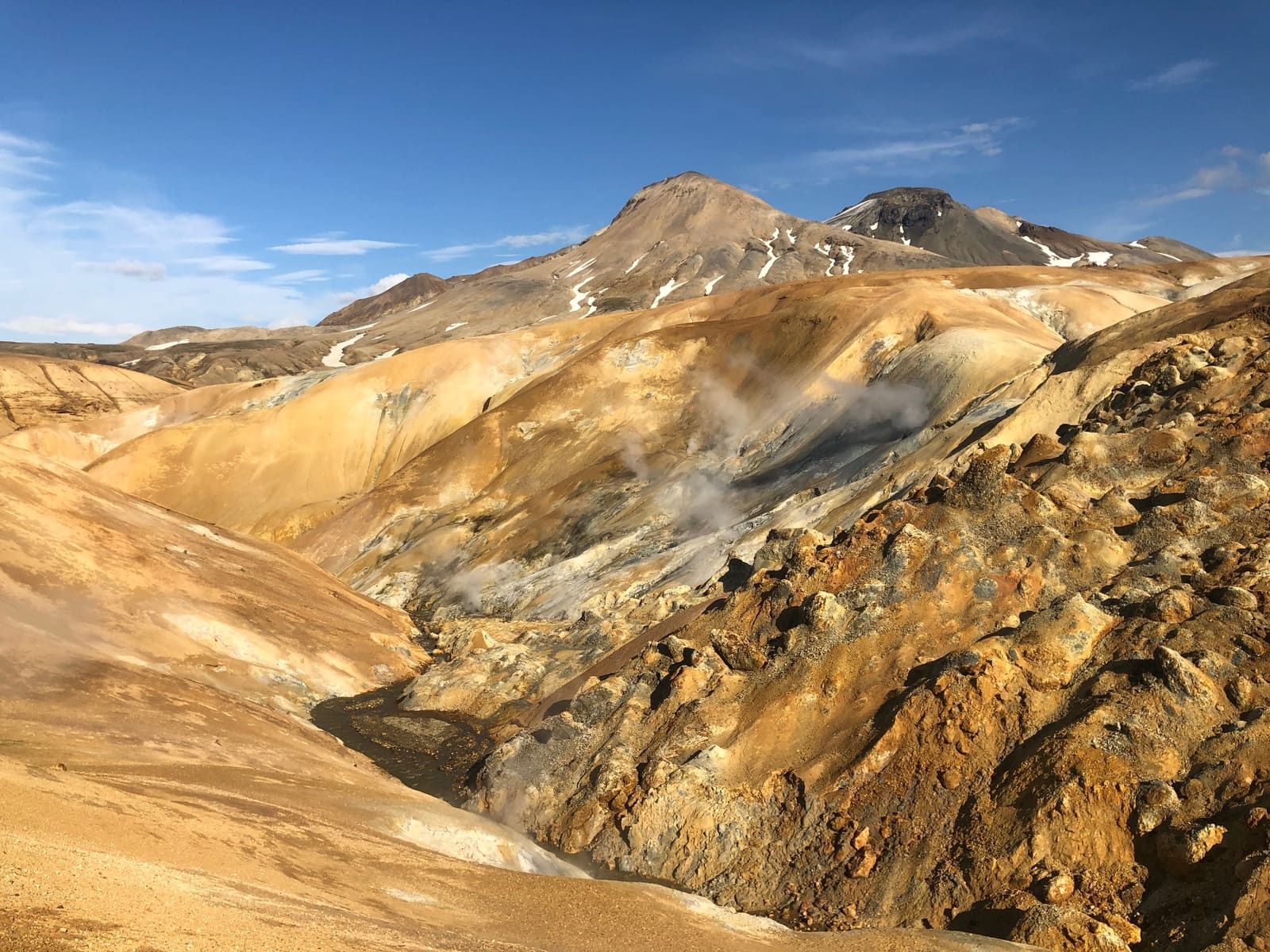
Ódáðahraun feels wide, dry, and exposed: a place where the dark lava, pale sand, distant mountains, and low vegetation make distance harder to judge than in Iceland's greener regions.
The most memorable part is not a single view. It is the slow change from one volcanic surface to another: rough lava slabs, gravelly stretches, black ridges, muted moss, occasional water, and mountains that seem close for a long time before you actually reach them.
The appeal is often the space itself: broad lava, low color, and weather moving across the interior.
That same emptiness is why the area can feel unforgiving. In poor visibility, wind, or dust, the landscape loses its drama and becomes a navigation and energy problem. Bring the mindset of a remote route, not a casual roadside photo stop.
Which nearby places make Ódáðahraun useful?
Ódáðahraun becomes useful when it helps you choose a concrete highland objective. Most travelers should compare nearby stops by effort, payoff, and how much uncertainty they add to the day.
Askja is the clearest reason many travelers enter the Ódáðahraun area.
Nearby highland choices
Place
Why pair it
Planning tradeoff
Askja Caldera
The strongest concrete volcanic objective in the area, with Öskjuvatn and Víti by Askja giving the day a clear destination.
Usually needs a serious road, weather, and time margin.
Holuhraun
Shows newer black lava and marked-trail terrain on the southern edge of the lava-field world.
Best when national-park guidance and access checks support the stop.
Good alternatives when your trip leans toward southern Highlands hiking and color rather than northern volcanic desert.
Do not stack them with Ódáðahraun unless the whole trip is built around the interior.
If you only have one Highlands day, choose the main objective first. Askja is the obvious match for Ódáðahraun; Hveravellir and Kerlingarfjöll suit a different central corridor; Landmannalaugar and Þórsmörk usually belong to a southern Highlands plan.
What should you check before committing?
Before committing, check the official sources that can change the day: road status, weather, safety guidance, national-park visitor information, rental or operator rules, and local advice.
Do not rely on a saved itinerary, an old trip report, or a single summer photo. Ódáðahraun is exactly the kind of place where the smarter decision is sometimes to use a backup day elsewhere in the Highlands or stay with lower-risk attractions.
Marked routes matter in young lava landscapes, where the surface can be fragile, sharp, and slow.
Check official road conditions before driving into the interior.
Check Highlands weather and warnings before treating visibility or wind as manageable.
Use SafeTravel and national-park guidance for remote-route preparation, legal-road behavior, and protected-area rules.
Verify visitor details with official or operator sources if services, hut access, guided transport, or facilities affect your plan.
Use for Herðubreiðarlindir, Askja-area routes, ranger information, and park guidance.
Common questions about Ódáðahraun
These questions matter because the place is broad, remote, and easy to misunderstand as a simple attraction pin.
Can you visit Ódáðahraun as a quick stop?
Usually no; it works better as the setting for a deliberate Highlands day than as a quick stop. If you need a short, predictable visit, choose an easier attraction or a more defined nearby objective.
Is Ódáðahraun the same as Askja?
No; Askja is a volcanic destination within the wider highland area, while Ódáðahraun is the vast lava-field landscape around and beyond it. For most travelers, Askja gives the area its clearest visitor purpose.
Do you need a special vehicle for Ódáðahraun?
You should treat the area as remote Highlands driving and verify road status, vehicle permission, and local guidance before relying on any approach. A map route is not enough for this part of Iceland.
Is Ódáðahraun safe for hiking?
Short marked routes near managed areas can be reasonable when conditions support them, but the wider lava desert should not be treated as casual wandering terrain. Bring water, stay on marked or legal routes, and use ranger or official guidance.
Map
See where this stop sits
Use nearby places and useful bases before opening directions.
Region
Highlands
Works well with
Highlands routes
Useful base
Akureyri
Interactive planning map for Odadahraun
Odadahraun
Keep exploring
Put this place in route context
Use nearby places and planning pages to decide whether this stop strengthens the route or stays optional.