Use this Highlands road-trip guide before you book a vehicle or lodging. It explains the route choices, F-road pressure, season limits, base logic, and official checks that decide whether a Highlands drive is realistic.
Best season
Summer only for normal self-drive planning; exact road openings must be checked on Umferdin before driving.
Vehicle rule
Use a Highland-approved 4x4 and confirm the exact F-roads with the rental company before booking.
Easiest taste
Compare one Landmannalaugar visit or the Kjölur corridor with a guided alternative; the chosen approach and vehicle must be suitable for that exact route.
Main risk
River crossings, rough surfaces, high wind, and remote recovery can turn an open route into a poor same-day decision.
Route essentials
Best season
Summer only for normal self-drive planning; exact road openings must be checked on Umferdin before driving.
Vehicle rule
Use a Highland-approved 4x4 and confirm the exact F-roads with the rental company before booking.
Easiest taste
Compare one Landmannalaugar visit or the Kjölur corridor with a guided alternative; the chosen approach and vehicle must be suitable for that exact route.
In this guide
Is a Highlands road trip realistic for your trip?
A Highlands road trip is realistic only when the season, vehicle, road status, driver confidence, and backup plan all work together.
The Highlands are not a normal scenic detour from the Ring Road. The routes are remote, services are sparse, and many access roads are F-roads with rough surfaces, steep sections, narrow tracks, or river crossings. The decision is not just whether the scenery is worth it; it is whether your specific trip can absorb the uncertainty.
For most travelers, the best Highlands plan is either one focused destination with a Highland-approved vehicle or a guided/highland-bus option that removes the hardest driving. A full interior crossing or deep Askja-style route belongs to experienced highland drivers with time, fuel, and a willingness to turn back.
Good to know
Is this right for you?
Best for
summer self-drive travelers with a Highland-approved 4x4
repeat visitors who want a route beyond the Ring Road and South Coast
travelers comparing Landmannalaugar, Kerlingarfjöll, Askja, and Þórsmörk
planners who are willing to change the route after road and weather checks
Think twice if
winter trips unless using specialist guided transport
travelers with a standard 2WD rental or unapproved campervan
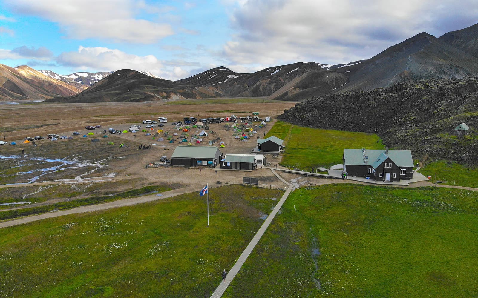
The pin marks the roadside P1 parking before the final rivers. Follow the parking signs and use the pedestrian bridge to the hut area. Include both walks in the visit allowance; choose a hike that fits and confirm the current reservation rules. The pin does not remove river crossings on other approach roads.
A two-day south-to-north plan through the Kerlingarfjöll base and Hveravellir, then Mælifellsdalur to Akureyri. Arrange an overnight and check every connecting road.
About 340 km out and back from Reykjahlíð via Route 901 and F905. Allow a very long summer day including the walk and breaks, or arrange an overnight; this is not a casual Ring Road detour.
Minimum time
16 hr
Driving
10 hr
Cut first: Optional detours outside the base route.
F-road opening, forecast, river state, vehicle approval and driver experience are separate checks. Check the official source.
River crossings are optional decision points
If depth, line or exit is uncertain, turn around or use specialist transport. Check the official source.
September needs an exit plan
Ordinary mountain-road access often ends around mid-September, with substantial variation. Check each road and the return before departure; a booking or map route does not override a closure. Check the official source.
Route totals are planning estimates
These figures do not predict progress on the day. Recheck the exact approach, road sequence and return; allow for slow surfaces and turn back when conditions or vehicle suitability fail. Check the official source.
Route overview
Locate the stops
Lines show the stop sequence, not the roads to drive. The ordered stops remain available without loading the map.
The map shows the named parking or transport arrivals. Follow the modeled approach and ranger or transport-operator guidance: navigation apps can choose different river crossings or valleys. Parking coordinates do not certify a drivable Highland route.
Interactive map loads only when requested
This keeps the route guide fast while the complete stop sequence stays visible.
Choose the easiest route that still gives you the Highlands
Start with the least difficult route that gives you the landscape you came for, then add difficulty only if your vehicle, time, and confidence justify it.
Travelers who want a southern Highlands taste with hiking, rhyolite mountains, and one clear destination
Check the exact approach and parking. P1 is before the final rivers, with a pedestrian bridge onward; this does not remove river crossings elsewhere on an approach.
A north-south interior taste with geothermal landscapes and easier route planning than deeper F-roads
Still remote, gravel-heavy, weather-exposed, and not a shortcut to treat casually.
Askja or north Highlands
Experienced drivers building a remote north or east Highlands route
Long distances, rough tracks, river risk, and limited services make this a poor first Highlands self-drive.
Sprengisandur crossing
Very experienced highland drivers with a suitable vehicle and a flexible multi-day plan
Remote, exposed, and not a scenic shortcut for normal visitors.
Þórsmörk
Travelers who want the valley and hikes more than the self-drive challenge
The river crossings are serious; guided super jeep or Highland bus transport is often the better planning move.
Choose the Highlands around the visit you want: a Landmannalaugar hiking day, a Kerlingarfjöll geothermal stop, a guided Þórsmörk visit, or a carefully planned interior crossing. Start with one main destination and leave room for the return journey.
An Askja route should be planned as one remote system. Hrossaborg, near the F88 junction, is an optional detour outside the listed stop allowances. The modeled Askja approach continues along Route 1 to Route 901 and F905; it does not use F88. Drekagil and Öskjuvatn belong to the deeper Askja commitment, with separate walking choices once you arrive. Keep the vehicle, fuel, road conditions and turnaround margin ahead of extra stops.
The southern Highlands need the same discipline. Uxatindar belongs to a Langisjór and Skælingar plan, while Einhyrningur belongs to a Þórsmörk-edge or hiking-led day. Both are destination-level choices, not extra pins to attach to an ordinary South Coast drive.
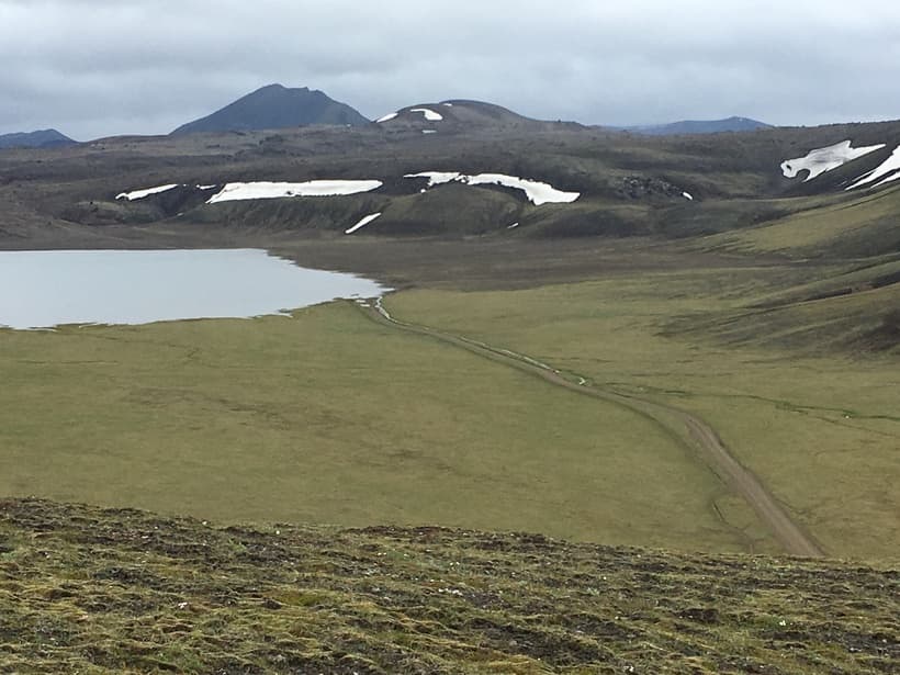
Landmannalaugar is often the first Highlands route to compare because the destination is clear and the access choices are visible.
For the northern Landmannalaugar approach, stay on Route 26 to Sigalda and then use Route 208 and F224. Landmannaleið, numbered F225, is the western approach and has its own river decisions. The day route on this page uses the northern approach in both directions; Bláhylur and other detours need extra driving and visit time.
How much driving pressure do F-roads create?
F-road pressure comes from slow progress, rough surfaces, river crossings, sparse services, and the possibility that conditions change after you start driving.
Drive-pressure checks
Road status
Check Umferdin before leaving and again before committing to the highland section.
Weather
Check the Icelandic Met Office for wind, precipitation, visibility, and warnings.
Vehicle
Confirm the rental is approved for the exact roads, not just marketed as 4x4.
River crossings
Treat crossings as optional. If unsure, turn around or wait for better information.
Recovery margin
Carry enough time, fuel, food, layers, and phone/navigation backup for a slower day.
SafeTravel is explicit that Highland driving is different from ordinary driving. Conditions can change quickly, not all 4WD vehicles suit all F-roads, and river damage risk stays with the driver. That should shape the route: fewer fixed stops, no late-day river decisions, and no plan that requires the road to behave exactly as hoped.
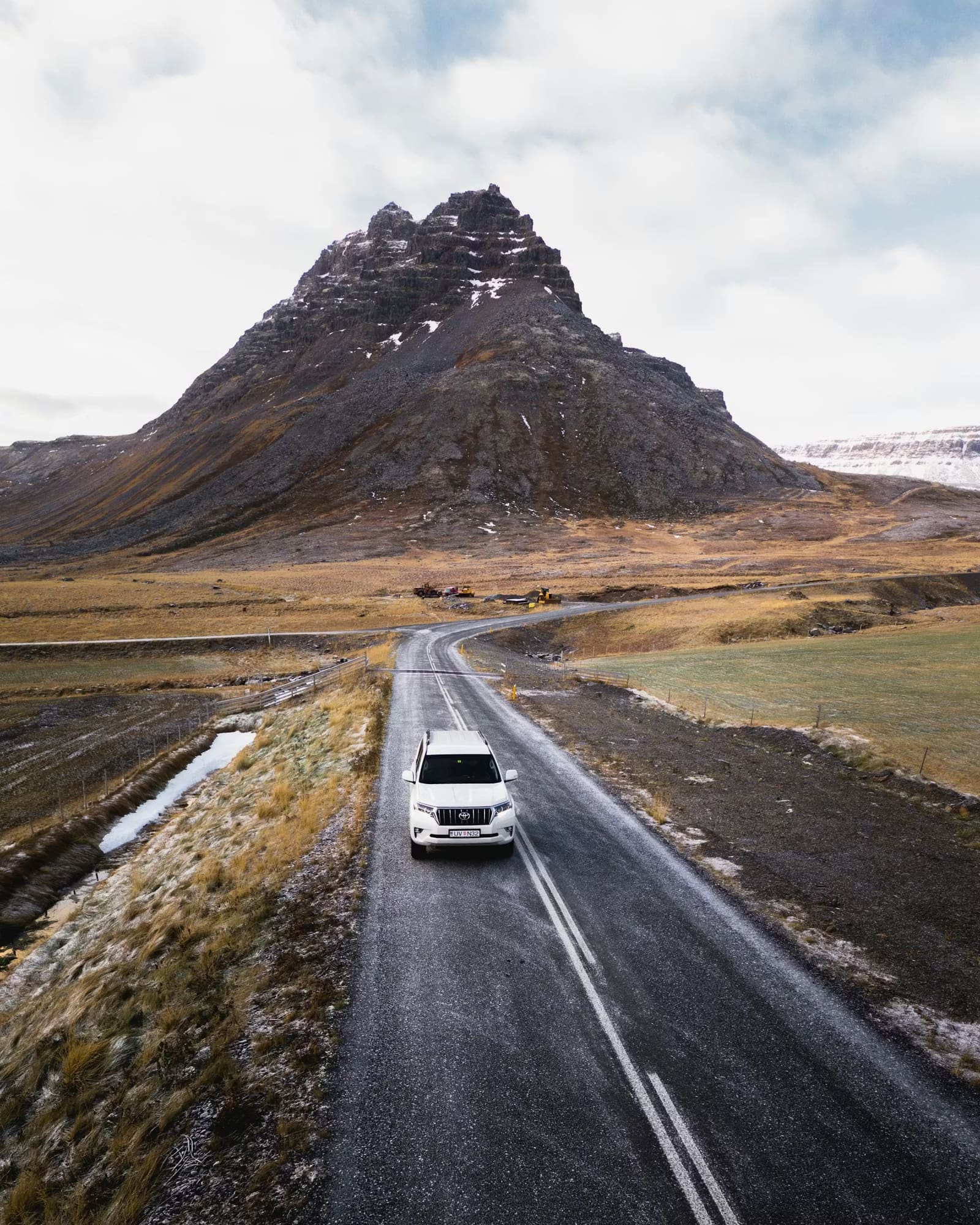
F-road pressure starts with the vehicle, road surface, and how much slower remote driving becomes.
Before leaving the lowlands, share the route and overdue check-in plan with someone who can act, carry offline navigation and backup power, and review the emergency-call preparation in our driving guide. A phone or app does not guarantee reception in a remote valley.
Distances are rounded planning figures checked against Vegagerðin’s named route alternatives. The selected Askja approach is roughly 170 km each way from Reykjahlíð via Route 901, F905, F910 and F894. Kerlingarfjöll base to Hveravellir is roughly 40 km; the onward Mælifellsdalur connection to Akureyri adds about 205 km. Driving and visit times are editorial allowances, not road-authority forecasts, bus schedules or a promise that a full day fits.
Separate the vehicle arrival from the walk you want to do.
Destination
Arrival and walking plan
Time outside the main drive
Landmannalaugar
P1 is before the final rivers. Walk over the pedestrian bridge to the hut area, then start your chosen trail. The map now marks the roadside P1 arrival.
The 150–300-minute visit allowance includes the walk from parking and back. A longer hike needs more time.
Kerlingarfjöll
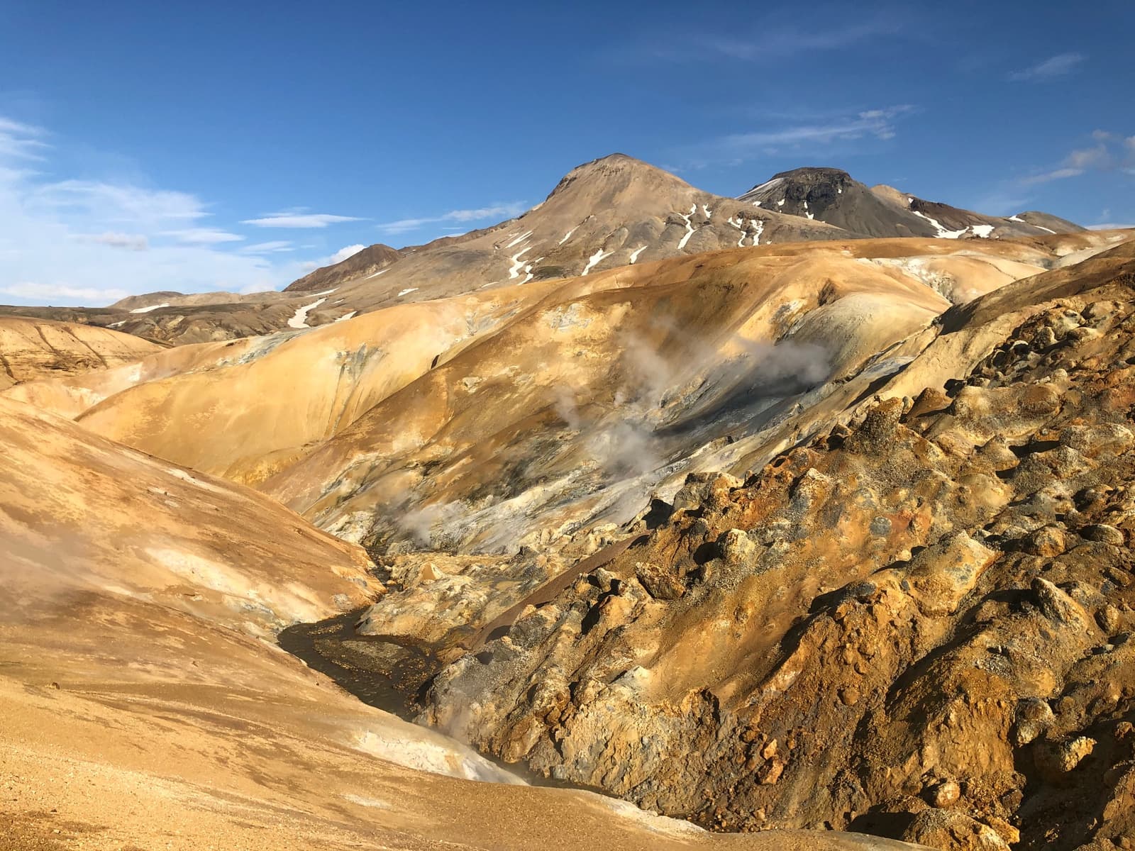
The map marks Ásgarður service centre. Hveradalir has a separate upper parking area. The protected-area guide describes a 4 km circuit there, taking roughly 1–2 hours; the operator also describes longer walks.
The 180–360-minute allowance assumes a permitted onward drive and a short geothermal walk with breaks. It includes that local driving, which is outside the main route totals. Walking from the base needs a separate hiking plan.
Askja
Drive to signed Vikraborgir parking, then walk to Öskjuvatn and back. The park lists about two hours for its A1 walk. Check the trail with rangers; a Víti descent is a separate decision because of slippery slopes and rock or mud slides.
Allow 180–300 minutes for the walk, viewing and breaks. Added to about ten hours of editorial driving allowance, this is a long day even before other stops.
Hveravellir
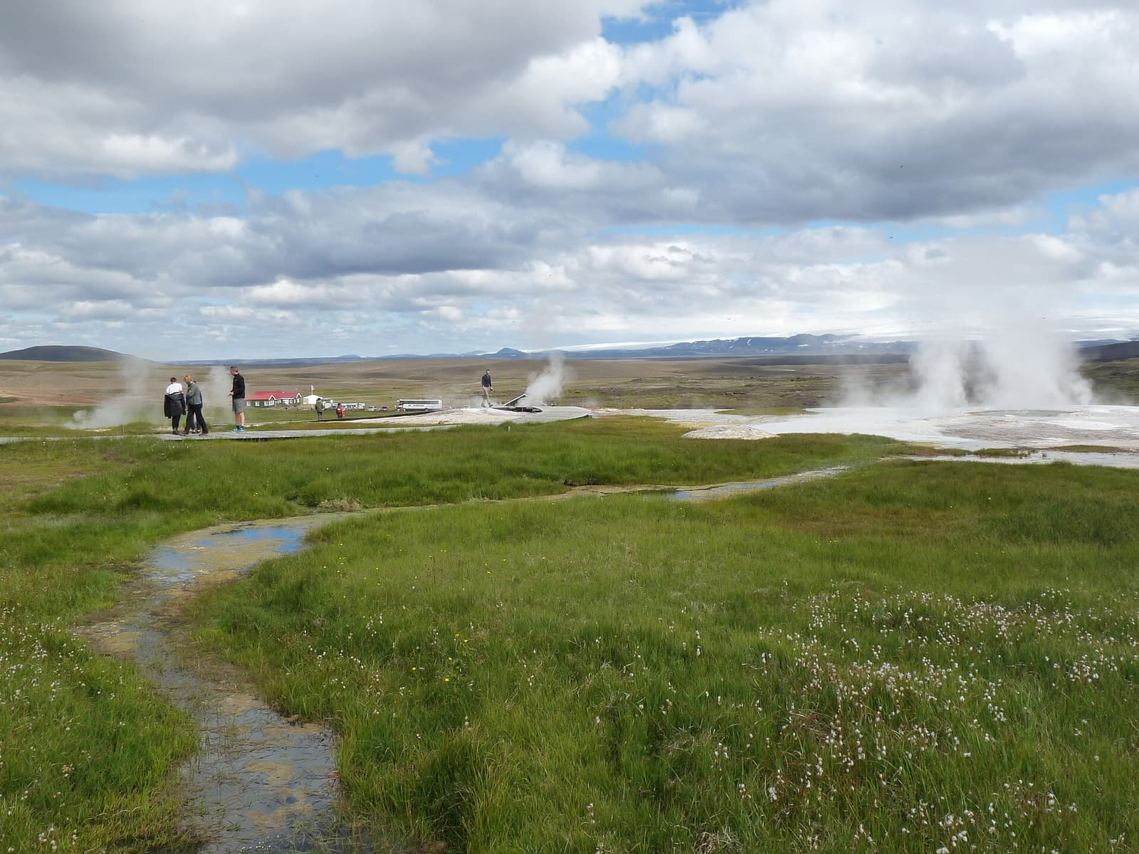
Follow the marked geothermal boardwalk from the hut area. The protected-area guide estimates 15–30 minutes for the hot springs; longer trails take hours.
The 60–120-minute allowance covers a short walk and a break. Add time for bathing or a longer hike.
Básar / Þórsmörk
Use the stop on your transport booking and return there for pickup. A walk to another valley may depend on movable Krossá footbridges; confirm their condition with wardens.
Choose a local hike within the booked gap. The 180–360-minute allowance is not a bus timetable or a promise that a particular trail fits.
Read the complete route budget before choosing a hike. All times here are editorial planning allowances.
Variant
Driving or transfer allowance
Visits and remaining decisions
Landmannalaugar from Hella
About 7 hours return driving via Route 26, Sigalda, Route 208 and F224.
Add 2½–5 hours for the parking walk, visit and chosen short hike. The 14-hour minimum window leaves room for breaks, but does not include crater-lake detours.
Kjölur and Mælifellsdalur
About 10 hours 45 minutes driving across the whole two-day route.
Add 4–8 hours across Kerlingarfjöll and Hveravellir. Arrange the overnight separately. The northern leg uses Mælifellsdalur, not a continuation on Route 35 all the way to the lowlands.
Askja from Reykjahlíð
About 10 hours return driving via Route 901, F905, F910 and F894.
Add 3–5 hours for walking and breaks. At the longer end, the 16-hour minimum window has little spare time; arrange an overnight or remove the drive if conditions need more margin.
Básar from Hvolsvöllur
About 5 hours allocated to the return transfer.
The operator's actual pickup, arrival and return times decide the hiking gap. The 3–6-hour visit allowance cannot be used as a bus timetable.
A short visit at one arrival does not include a hike to the next destination. Walking from Ásgarður to Hveradalir, crossing between Þórsmörk valleys or adding a long Hveravellir trail requires a separate route and return plan. The overview now identifies these arrivals; confirm the signed parking or booked pickup and the permitted approach before departure.
Where to base before and after a Highlands drive
The best base is usually on the edge of the Highlands, because it reduces the penalty if the road is slow or the weather changes.
Base choices that change the Highlands plan.
Base area
Best use
Watch for
Hella, Hvolsvöllur, or Selfoss
Southern Highlands approaches, Landmannalaugar planning, and South Coast pairings
Do not assume a Reykjavík return is easy after a slow F-road day.
Highland edge lodging or huts
Slower hiking-focused trips where the Highlands are the main purpose
Availability, facilities, access rules, and reservations need early verification.
Kjölur, Hveravellir, Kerlingarfjöll, or northbound route planning
Avoid stacking this after a tiring Ring Road transfer.
Reykjavík
Guided day tours or Highland bus plans where someone else handles the hard access
Weak base for a long self-drive Highlands day unless the route is deliberately simple.
If the Highlands are only one part of a larger trip, protect the night after the route. A flexible edge base is more useful than a cheaper room that forces you to drive rough roads, then make a long paved transfer in the dark or wind.
Interior stops such as Hveravellir make base choice a facilities, access, and route-sequence decision.
What changes by season and weather?
Season decides whether the route is even a self-drive candidate, while same-day weather decides whether an open road is still a good idea.
Season tradeoffs for Highlands road trips.
Timing
What works
Planning move
Early summer
Some edge routes may begin opening, but deeper roads can remain closed or fragile.
Keep the Highlands optional and choose a lower-risk route if opening dates are uncertain.
Mid-summer
The strongest window for normal Highlands self-drive planning.
Still check road status, river conditions, wind, and rental permissions before departure.
Late summer into early autumn
The normal access season can end quickly; September is a decision point, not a guaranteed extension of summer.
Avoid routes that depend on perfect conditions or late-day crossings.
Winter and spring
Normal self-drive Highlands planning should be off the table.
Consider a specialist operator only if it confirms a permitted route and suitable conditions; otherwise keep the trip in the lowlands.
Do not hard-code Highlands dates into the itinerary. The official road status is the deciding source, and the weather forecast can still change the plan after roads open.
When to choose a guided tour, Highland bus, or skip it
Choose a guided or bus-based Highlands plan when the destination matters but the driving risk is not worth owning yourself.
Use guided transport for Þórsmörk if river crossings are the main barrier.
Use a Highland bus or guided Landmannalaugar day if you want the hikes and hot spring without managing F-road decisions.
Choose Kerlingarfjöll or a Kjölur-based plan if you want an interior feel with simpler route planning than Askja or Sprengisandur.
Skip the Highlands on short first trips when South Iceland, Snaefellsnes, or the Golden Circle already fill the route well.
Move the Highlands to a future trip if every day is fixed and there is no backup window.
A guided route can reduce the driving responsibility, but the operator can still change or cancel it. Confirm the outward and return service for your date and retain a lowland day that works without the Highlands.
For places like Þórsmörk, the better plan may be transport that handles the hardest access for you.
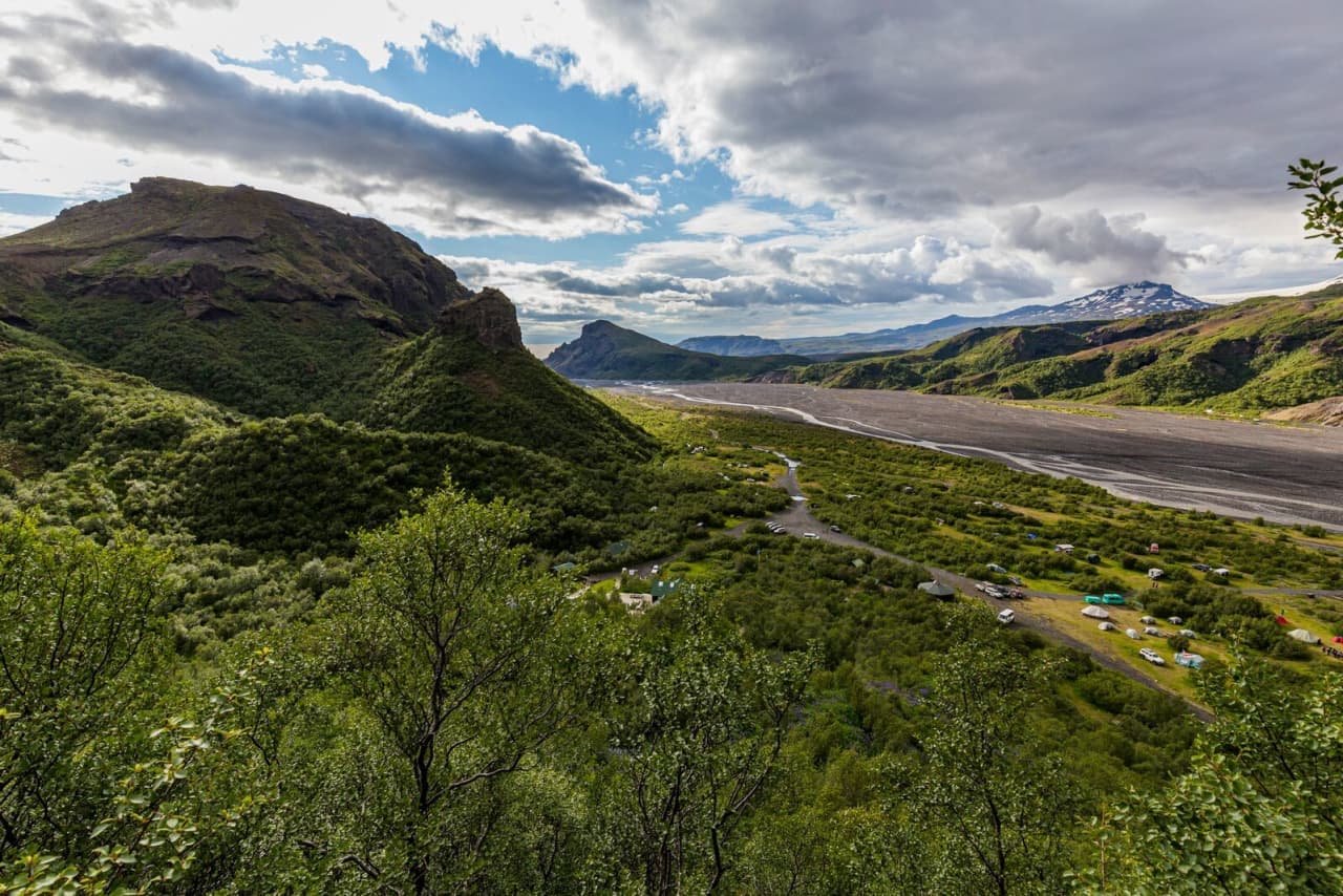
For Þórsmörk, confirm whether your ticket ends at Básar, Langidalur or Húsadalur. This route uses Básar and the Route 1–249–F249 approach from Hvolsvöllur. Route 261 follows a different side of the valley and is not an interchangeable approach. Match the return ticket and walking plan to the same stop.
Before you book the vehicle or lodging
Commit only after the route, vehicle, base, and backup plan all pass the same practical checks.
Confirm the exact roads you plan to drive and whether each is open or historically realistic for your travel window.
Ask the rental company whether your specific vehicle is permitted on those roads.
Check whether river crossings are part of the route and whether there is a safer parking, bridge, bus, or guided option.
Place lodging so you are not forced into a long transfer after rough road driving.
Carry a backup route outside the Highlands for bad weather or closed roads.
Use official sources on the day, not old screenshots, forum reports, or a fixed itinerary PDF.
Highlands road trip FAQ
These are the decisions most likely to change whether the Highlands belong in your itinerary.
Can I drive the Icelandic Highlands in a normal rental car?
No, a normal 2WD rental is not appropriate for Highlands F-road planning. Use a Highland-approved 4x4 and confirm the exact roads with the rental company.
When are Highland roads open?
Highland roads are generally a summer self-drive topic, but exact openings vary by road and conditions. Check Umferdin before planning and again before driving.
Which Highlands route is easiest for a first-timer?
A focused Landmannalaugar plan or the Kjölur/Kerlingarfjöll corridor is usually more realistic than Askja, Sprengisandur, or Þórsmörk self-drive. The exact choice still depends on road status, vehicle approval, and driver confidence.
Should I cross rivers myself in the Highlands?
Only cross if the vehicle, route, depth, current, and your experience all make it clearly safe. If you are unsure, do not cross; turn around, wait for better information, or use guided transport.
Can I add the Highlands to a short South Coast trip?
Usually not unless the Highlands are the main purpose of the trip. A short South Coast itinerary is often better without the extra F-road risk and backup-day requirement.
Official references to check before driving
Use these sources for the current details this page cannot safely freeze into permanent copy.
Road, weather, safety, and protected-area references
Short geothermal-boardwalk visit versus longer hikes.
For the alternative routes, use these parking arrivals:
Hveravellir: The pin marks visitor parking beside the Hveravellir facilities. The 60–120-minute allowance covers a short geothermal-boardwalk visit and a break. Longer hikes, bathing and an overnight need extra time. Follow facility signs and continue north only with enough fuel and a checked overnight plan.
Askja: The pin marks Vikraborgir car park at the F894 trailhead. Allow time to walk to Öskjuvatn and back; follow ranger advice and do not assume a descent into Víti is possible. The modeled F905 approach runs via Route 901; F88 has different river risks. Carry fuel and food for the return.