Landmannalaugar is a remote Highland valley where pale rhyolite mountains meet black lava, geothermal water and marked hiking trails. The landscape is the reason to visit; current road, parking and weather conditions decide whether the visit is practical.
Highland landscape
What it is
Rhyolite mountain and geothermal hiking area
Setting
Fjallabak Nature Reserve in Iceland's southern Highlands
Main season
Summer, after the Highland roads officially open
Visit length
At least several hours; often a full day including travel
Key checks
Road status, vehicle rules, weather and parking reservation
In this guide
Rhyolite and lava give Landmannalaugar its color
Landmannalaugar sits inside Fjallabak Nature Reserve, where mineral-rich rhyolite mountains rise around the dark Laugahraun lava field.
The first impression is contrast rather than one famous viewpoint. Black lava reaches the edge of the hut area, while nearby slopes carry bands of cream, rust, green, gray and yellow. Steam and warm water reveal the geothermal system below the surface. Low cloud can flatten those colors, but it also makes the lava and gullies feel more severe.
Landmannalaugar is the main visitor destination within the 446-square-kilometer Fjallabak reserve. The wider protected area also contains lakes, mossy ridges, geothermal ground and large stretches of quiet interior landscape. The protection is not abstract: soft ground and moss recover slowly, so marked paths and boardwalks matter.
Official landscape, protection, access and parking information for Fjallabak and Landmannalaugar.
Photo guide
Landmannalaugar in photos
Laugahraun lava and Bláhnúkur show the dark side of Landmannalaugar's colorful landscape.
Walking reveals more than the hut area
The hut, campsite and bathing brook form the visitor base, but even a short marked walk is needed to understand the scale of the surrounding mountains.
Laugahraun gives a first visit the clearest close view of rough black lava against lighter rhyolite. Longer options climb into more exposed terrain. Bláhnúkur is a dark peak with broad views, while Brennisteinsalda is associated with vivid mineral color and geothermal activity. Conditions, signs and ranger advice should decide the exact walk.
Higher ground reveals the layered rhyolite landscape that is only partly visible from the visitor base.
Landmannalaugar is also one end of the multi-day Laugavegur trail to Þórsmörk. That does not make every visitor a long-distance hiker. A shorter walk can be the better choice when the drive has taken longer than expected or when wind and visibility leave little margin. Ljótipollur is a separate crater-lake stop nearby, not part of the paths from the hut area.
Lakes and bare mountain ridges extend the landscape beyond Landmannalaugar's main walking area.
The natural bathing brook has simple facilities
Warm springs feed a natural brook near the hut, creating a simple outdoor bathing place beside lava and wet ground.
There are no tiled pools or controlled water temperatures. Visitors change near the hut facilities, follow the boardwalk across boggy ground and enter where the warm and cool water mix. The exact temperature varies by position and conditions. Soap and glass are not permitted, and everyone should keep to the built approach rather than widening paths through the vegetation.
The natural brook is one part of Landmannalaugar, with simple facilities and fragile ground around it.
Bring a swimsuit, towel and warm layers for afterward if bathing matters to you. It is still worth visiting without entering the water: the mountains, lava and walking are the defining experience, while the brook is an optional pause.
Current hut, camping, bathing, facilities, hiking and access information from the site operator.
Access is part of the decision
Landmannalaugar is normally a summer Highland destination, not a paved-road stop that can be added casually to a South Coast day.
The reserve is approached on Highland roads including F208 and F225. Opening dates depend on snow, thaw and road condition rather than a fixed calendar. A road appearing on a map does not prove that it is open, suitable for a particular vehicle or allowed under a rental agreement. Travelers who do not want that driving responsibility can consider a scheduled bus or guided transfer when services operate.
Different approaches involve different surfaces and river considerations, so no single approach is permanently the safest. Check the official road map, vehicle terms and current local advice on the day. Turn around if a crossing or surface is beyond the driver, even if another vehicle continues.
Summer daytime parking requires advance planning
During the summer daytime reservation window, private and rental vehicles need an advance parking booking and service-fee payment.
The reservation controls vehicle arrival, not access to the landscape itself. Check the official Fjallabak page before departure because the operating period and booking process can change. A parking booking does not replace the road, weather or vehicle checks.
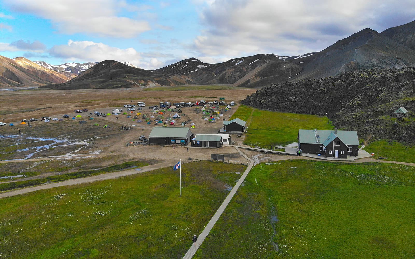
The parking and camping area is a compact visitor base in an otherwise remote landscape.
The hut area has toilets, showers, camping and staffed summer accommodation, but this remains a remote base. Hut beds and camping should be booked or checked separately where required. Bring food, drinking water, clothing and any medication you need rather than assuming a full-service visitor center.
For a day visit, allow several hours after arrival. One suitable walk, time to look closely at the lava and an optional soak usually gives a more satisfying experience than racing through multiple trails. Include the slow approach and return when deciding whether there is enough time for Landmannalaugar.
Wind and low cloud can change the visit
Wind, rain, cold and low cloud can change both the hiking experience and the journey out of Landmannalaugar.
Carry waterproof outer layers, insulation, food and a charged phone even on a short summer walk. Start with a turnaround time and choose a less exposed option when clouds hide higher ground. The colorful slopes are still visible from lower trails, so reaching a summit is not necessary for the visit to be worthwhile.
Before leaving, compare the road map with the weather forecast and SafeTravel notices. Recheck after prolonged rain or a rapid temperature change. If reports conflict or conditions look marginal, come another day rather than take extra risk on the road or trail.