Nesjavellir is a working geothermal landscape north of Hengill, where steam, pipelines and mountain slopes meet near Þingvallavatn. Visit for permitted outdoor viewpoints and marked trails. Plant operating areas are closed, and the scenic Road 435 approach is seasonal.
South Iceland, north of Hengill and near Lake Þingvallavatn
Route context
Best as a flexible Golden Circle extension or scenic Road 435 detour
Time to allow
Allow 30–60 minutes at viewpoints, plus driving; hiking time depends on the chosen marked route
Best experience
Steam, mountain scale, geothermal infrastructure, and the approach road rather than a single headline viewpoint
In this guide
Nesjavellir’s steam, mountains and working geothermal landscape
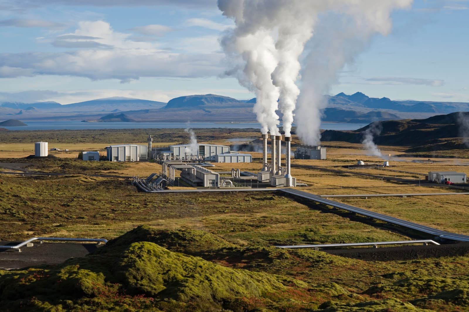
Nesjavellir lies north of Hengill near Lake Þingvallavatn. Steam rises above a power station that uses the area’s geothermal heat to produce hot water and electricity.
Pipelines, steam plumes and plant buildings sit beneath the Hengill slopes. They are part of the place’s identity, alongside the lava, ridges and open views that draw walkers and drivers to the area.
Allow room for the approach as well as the stop. Nesjavellir suits a flexible day around Hengill and Þingvallavatn; adding it to a full Þingvellir, Geysir and Gullfoss schedule can leave too little time for the drive or a walk.
Nesjavellir decision guide
Choice
Use it when
Better move
Go
You want a scenic geothermal drive and have flexible time near Hengill.
Keep it short unless conditions support a longer walk.
Skip
Your Golden Circle day already feels full or your group needs predictable low-effort stops.
Prioritize Þingvellir, Geysir, Gullfoss, or Kerið.
Keep optional
The weather, road surface, or trail plan is uncertain.
Decide after checking official sources and nearby alternatives.
Photo guide
Nesjavellir in photos
1 / 2
The official ON Power image is a clean compact view of the plant and surrounding landscape.
What will you see around the power station and geothermal slopes?
Expect a mix of natural steam, pipes, plant buildings, mossy lava, mountain ridges, and open views toward the Þingvallavatn side of the Golden Circle.
The power station is part of the scene, not something to edit out mentally. Nesjavellir is most interesting when you like seeing how Iceland's geothermal heat moves from the ground into visible infrastructure: steam columns, pipes, service roads, and buildings sitting below rough Hengill slopes.
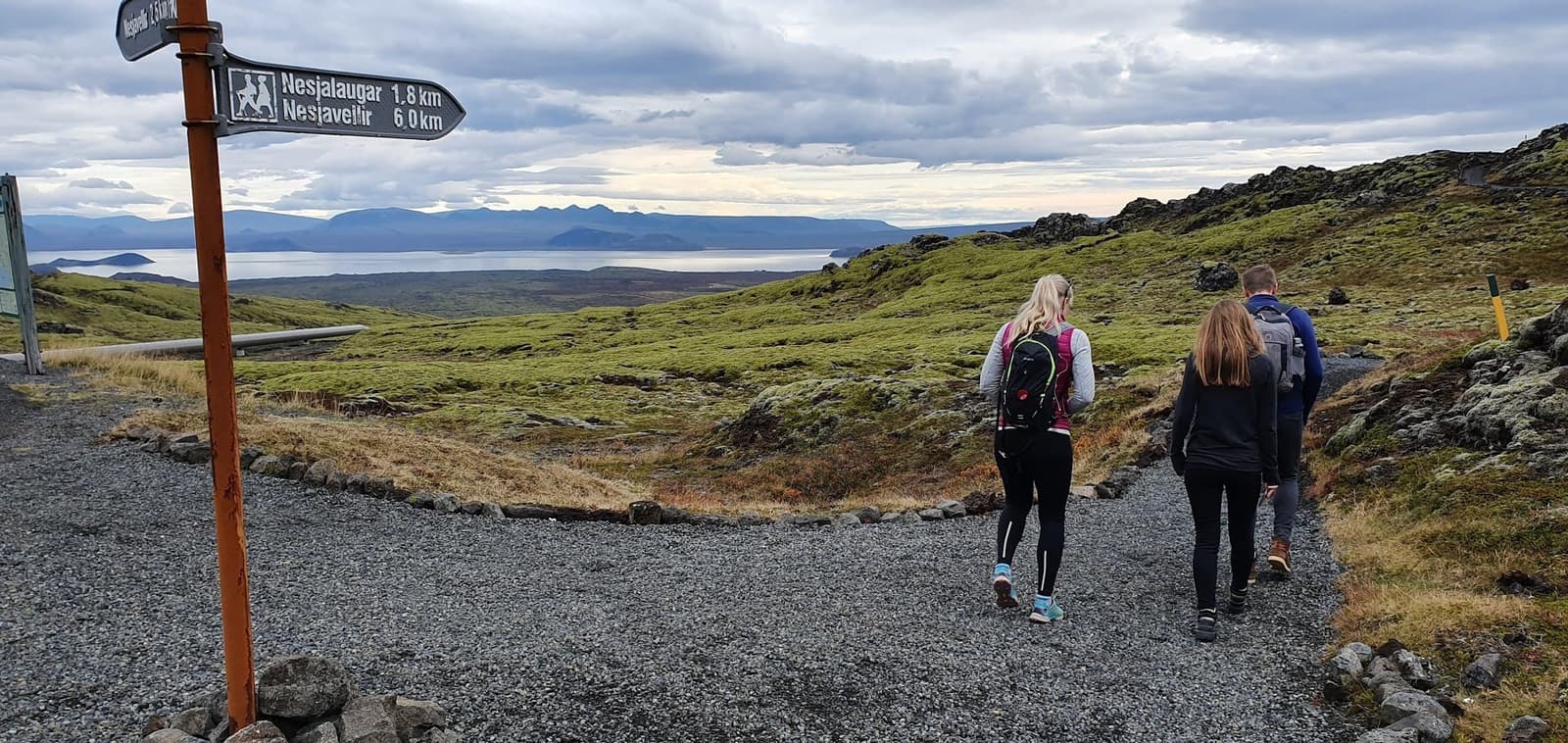
ON Power distinguishes the public Hengill recreation area from its closed plant operating areas. Enjoy permitted viewpoints and marked trails, and stay outside restricted roads, buildings and borehole compounds. The company’s public Geothermal Exhibition is at Hellisheiði, a separate power station.
The best Nesjavellir views combine geothermal color, steam, and the working power-station landscape.
Use the marked recreation routes and respect the closed operating areas.
How much time and effort does Nesjavellir need?
Allow about 30–60 minutes at permitted viewpoints for a short visit, with driving time added separately. A walk needs its own route, distance and return-time plan.
For a short visit, use permitted stopping areas for the plant, steam and mountain views. Do not stop on a narrow road shoulder or enter a service road to reach an angle seen in a photograph. The drive through the area can take longer in poor weather.
For a longer outing, choose a named marked route from ON Power’s Hengill trail information. Check its distance, ascent and return point before estimating time. The wider trail network does not make every walk near Nesjavellir a short or easy one. Compare Hengladalsá if you are building a walking day around the geothermal valleys near Hveragerði.
Planning allowances at Nesjavellir; add driving time separately.
Version
Time
Best for
Viewpoint stop
About 30–60 minutes
Permitted viewpoints and photos, without an extended hike.
Balanced stop
1-1.5 hours
A slower look at the approach road, landscape scale, and permitted stopping areas.
Marked Hengill walk
Depends on the selected route
Check distance, ascent, footing and return logistics before setting a time allowance.
A longer visit should be treated as a Hengill-area walk, not as an accidental add-on.
Which nearby stops make the detour worthwhile?
Nesjavellir is strongest when it helps a real cluster. It is weakest when added as one more name after the main Golden Circle stops are already enough.
Pair it with Hengill if you want the wider volcanic and geothermal story. Pair it with Reykjadalur only if you have enough time for an active valley stop. Pair it with Kerið when you want a shorter, easier volcanic contrast.
If your day is about classic first-trip Iceland, Þingvellir, Geysir, Gullfoss, and Brúarfoss usually deserve priority before a Nesjavellir detour. If your day is about quieter South Iceland geothermal scenery, Nesjavellir can make the route feel more distinctive.
Best short pairing: Kerið plus Nesjavellir when you want two compact volcanic/geothermal stops.
Best active pairing: Hengill or Reykjadalur when walking time matters more than ticking off landmarks.
Best classic-day pairing: Þingvellir first, then decide whether Nesjavellir still fits before driving onward.
Best wider planning link: use South Iceland or the South Coast road trip if this detour affects the next travel day.
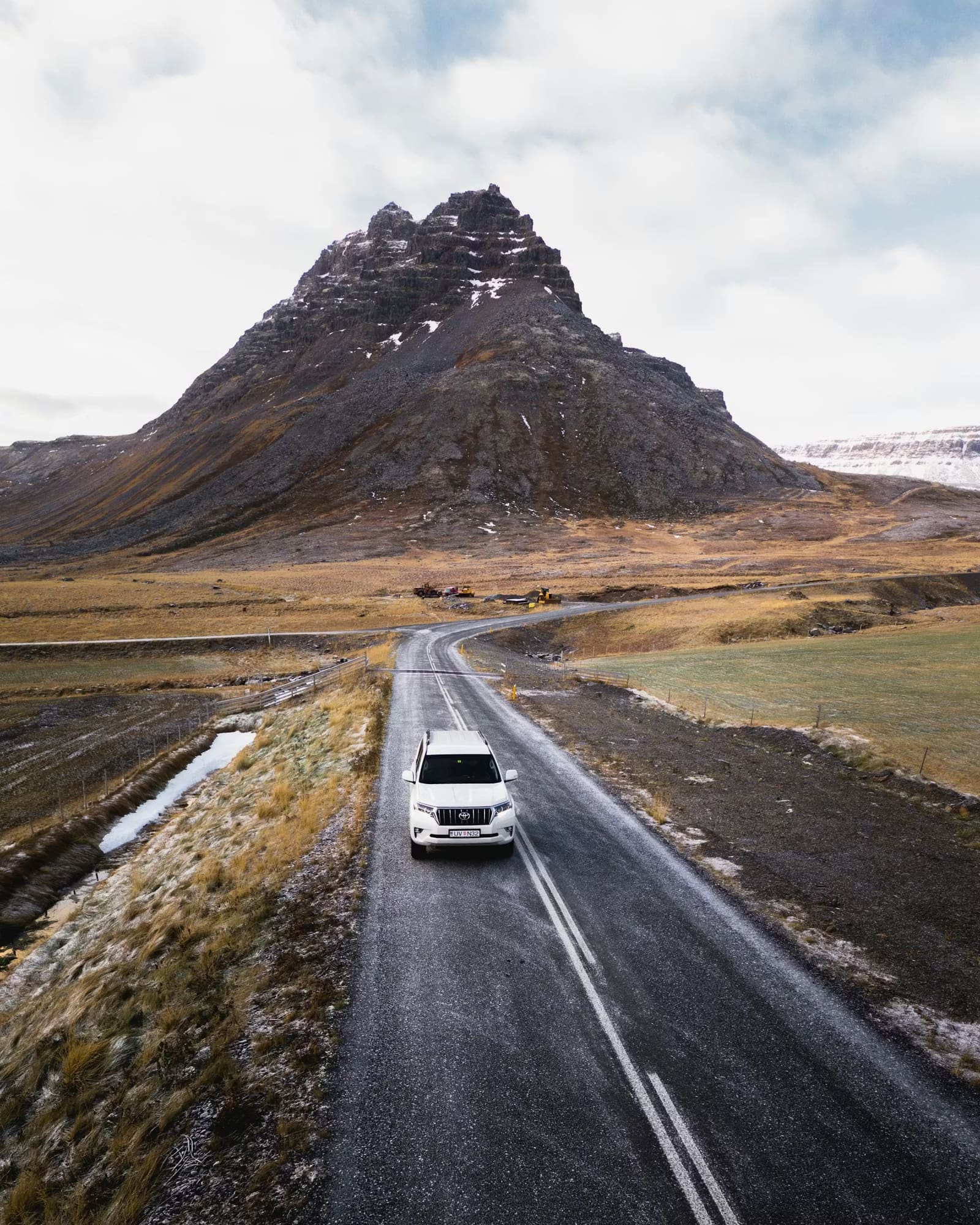
Nesjavellir makes more sense when the wider Hengill landscape is part of the plan.The approach road is a major part of the stop, so road and weather checks belong in the plan.
Road 435 closures and geothermal safety at Nesjavellir
The scenic Road 435 approach is seasonal. Check Umferðin for the whole route before leaving, especially in winter or when a navigation app suggests the mountain road.
Local arrival advice warns that Road 435 closes in winter even when GPS still suggests it. From Reykjavík, Road 36 toward Þingvellir and then Road 360 is the alternative described for reaching Nesjavellir. Check those roads too: a suggested alternative is not confirmation that it is open or suitable today.
Stay on marked or clearly permitted recreation routes. ON Power warns about hot steam and gas around springs, hot streams and boreholes. Keep away from hot ground, pipes and closed plant operating areas, and follow signs and barriers even if they prevent the view or walk you planned.
The local property’s arrival note warns about Road 435 winter closures and describes the Road 36/360 approach. Confirm current conditions with Umferðin.
Use for travel alerts and outdoor-safety decisions.
Common questions about Nesjavellir
These are the questions that most often decide whether Nesjavellir stays in a realistic plan or drops behind stronger nearby stops.
Is Nesjavellir worth visiting?
Yes, if you want geothermal scenery, power-station views, and a quieter Hengill-area detour. Skip it if you only have time for the classic Golden Circle anchors.
Can you walk around Nesjavellir?
The public Hengill recreation area has marked trails, while the plant operating areas are closed. Choose a specific route and check its distance, ascent and conditions. Follow signs rather than informal tracks around hot ground or industrial equipment.
Is Nesjavellir a good winter stop?
Keep it conditional. Road 435 closes in winter, and navigation apps may still suggest it. Check the Road 36/360 alternative, current Umferðin information, weather and daylight before deciding whether to visit.
Does Nesjavellir replace Reykjadalur or Hengill?
No. Nesjavellir is better for a power-station and scenic-road detour, while Reykjadalur and Hengill are stronger when you want the walking experience itself.
Should I expect visitor services at Nesjavellir?
Plan around permitted outdoor viewpoints and marked trails. The power station’s operating areas are closed. ON Power’s public Geothermal Exhibition is at the separate Hellisheiði plant; do not treat the Nesjavellir pin as its entrance.
The pin marks the Nesjavellir area, not verified visitor parking or a public plant entrance. Choose a permitted stopping area or marked trailhead, respect closed operating areas, and check Road 435 or the Road 36/360 approach before driving.
Region
South Iceland
Works well with
Golden Circle
Useful base
Selfoss
Interactive planning map for Nesjavellir
Interactive map
Load the map when you need it
Place context and external map links remain available without loading it.
Routes and itineraries
Place it in a realistic trip
Compare road trips and itineraries that give this place a sensible position in the wider journey.