Fjallabak is a protected Highland nature reserve behind South Iceland, where colorful rhyolite valleys, lakes, lava, and F-roads reward prepared travelers who can choose between a focused Landmannalaugar visit and a slower interior day.
Quick guide
Type
Protected Highland nature reserve with rhyolite mountains, lava, geothermal areas, lakes, and rough roads
Region
Southern Highlands, behind the South Coast and north of Myrdalsjokull
Route role
A deliberate Highlands objective or route area, not a quick Ring Road pullout
Time to allow
A long day for Landmannalaugar; more time for a slower reserve route with lake and crater stops
Access reality
F208, F225, and nearby Highland roads require official road checks, suitable transport, and conservative weather judgement
Best experience
Clear summer visibility, a flexible plan, marked trails, and enough time to turn around without pressure
Nearby pairings
Landmannalaugar, Eldgja, Strutslaug, Thorsmork, and easier South Coast anchors for backup planning
Main caution
Fragile protected ground, fast weather changes, road closures, river crossings, and vehicle limits should decide the day
Should Fjallabak be your Highlands day?
Yes, if you want a real South Highlands landscape day and can handle the access decisions. No, if your trip needs easy roadside stops, fixed timing, or a small-car route.
Fjallabak is not one neat viewpoint. It is a protected reserve of rhyolite mountains, lava, lakes, geothermal ground, braided sand, and rough interior roads behind South Iceland. The reward is scale and color; the cost is that the drive, weather, vehicle, and route choice become part of the attraction.
The simplest useful version is a focused Landmannalaugar day. The slower version links wider reserve scenery such as Frostastadavatn, Ljotipollur, Domadalur, or the approach toward Eldgja when the route and conditions support it.
Worth the stop?
When this stop makes sense
Good match for
prepared summer Highlands travelers with a suitable 4x4, bus, or guided plan
hikers and photographers choosing between Landmannalaugar, crater lakes, lava, and rhyolite valleys
self-drivers who can treat road status, weather, river crossings, and protected-area rules as part of the decision
travelers who want a wider Fjallabak day rather than only one famous stop
Think twice if
small-car trips or rental agreements that exclude F-roads
tight South Coast itineraries with fixed arrival times and no weather backup
Choose the visit style before choosing extra stops. Fjallabak works best when the day has one clear goal and enough room for slower roads, photos, walking, and a clean exit.
You want the clearest first Fjallabak experience with trails, lava, colored mountains, and visitor infrastructure checks.
It can still take most of a day once access, parking, hiking, and the return drive are included.
Reserve route day
You already understand Highland driving and want to compare lakes, craters, valleys, and wider interior scenery.
The day becomes more weather- and road-sensitive, with fewer simple bailout points.
Scenic approach only
You are nearby, conditions are strong, and you want a conservative look without forcing a long walk.
It may not justify the friction if you are giving up easier South Coast anchors.
Skip or postpone
Vehicle rules, road status, wind, visibility, river crossings, or group confidence make the plan feel marginal.
You lose the Highland color but protect the rest of the route.
A local Iceland travel editor would add Fjallabak to a summer route when the trip already has a Highlands slot, suitable transport, and enough flexibility to turn around. They would skip it on a first South Coast sprint if it replaces Skogafoss, Dyrholaey, or Reynisfjara with a rushed F-road gamble.
What does Fjallabak feel like on the ground?
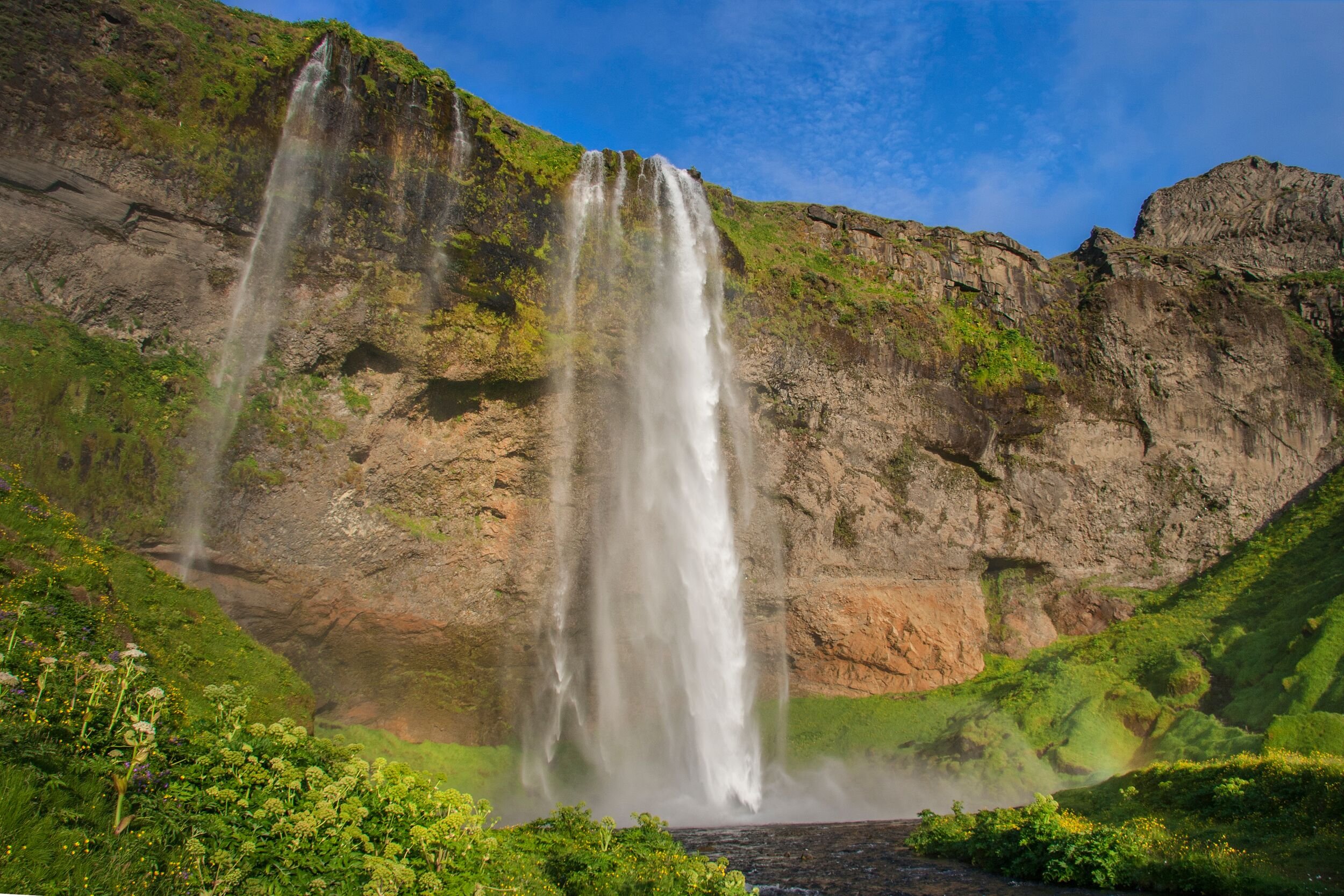
The reserve feels wide, exposed, and more varied than a single famous stop suggests: black lava beside pale sand, colored mountains, lakes, steam, and rough tracks crossing fragile ground.
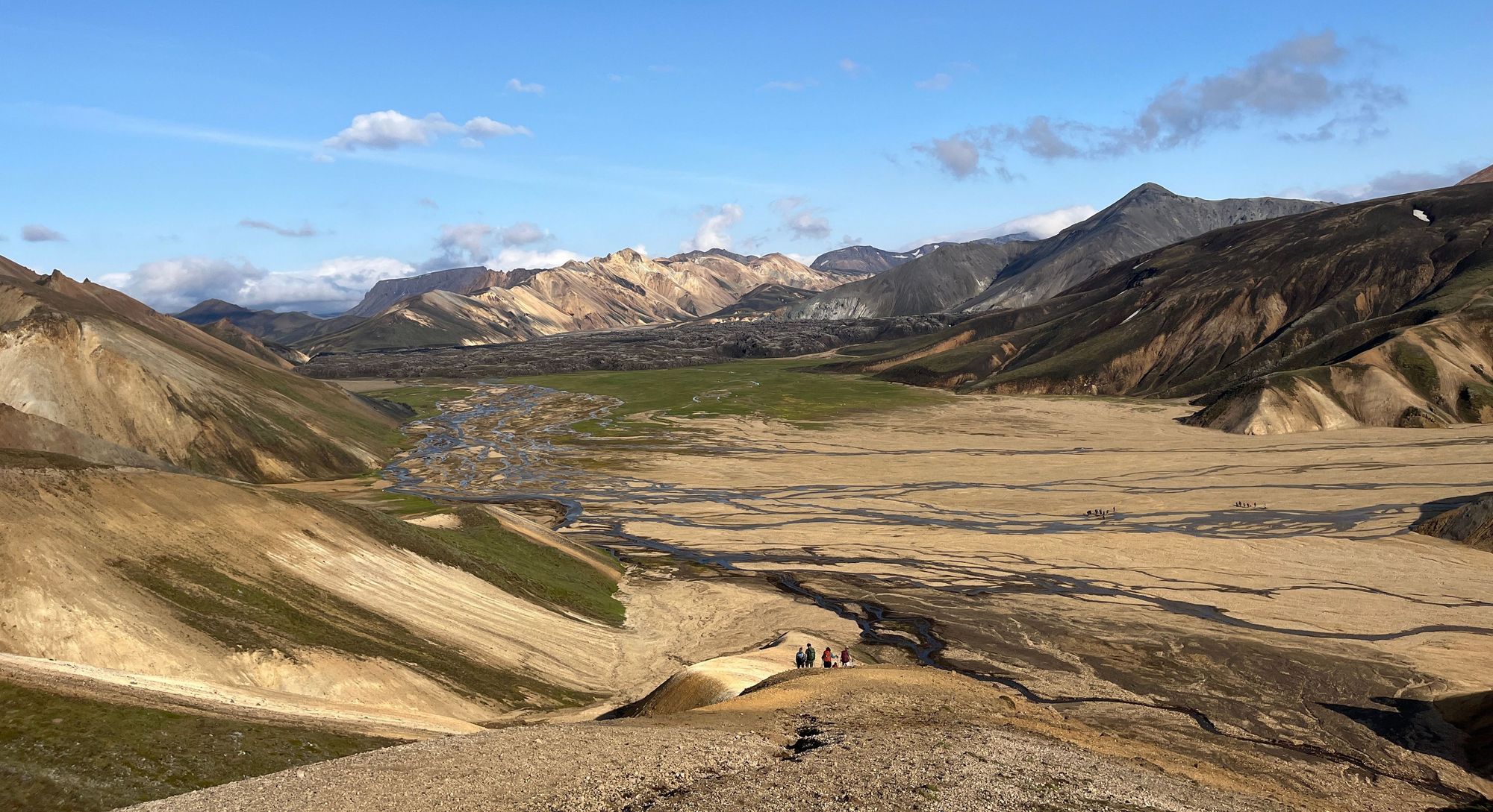
At Vondugiljaaurar and Jokulgil, the landscape opens into braided sand and steep rhyolite slopes. Human scale disappears quickly, which is why even short walks need more respect than an easy roadside photo stop.
Jokulgil shows why Fjallabak is better planned as a landscape area than as a single viewpoint.
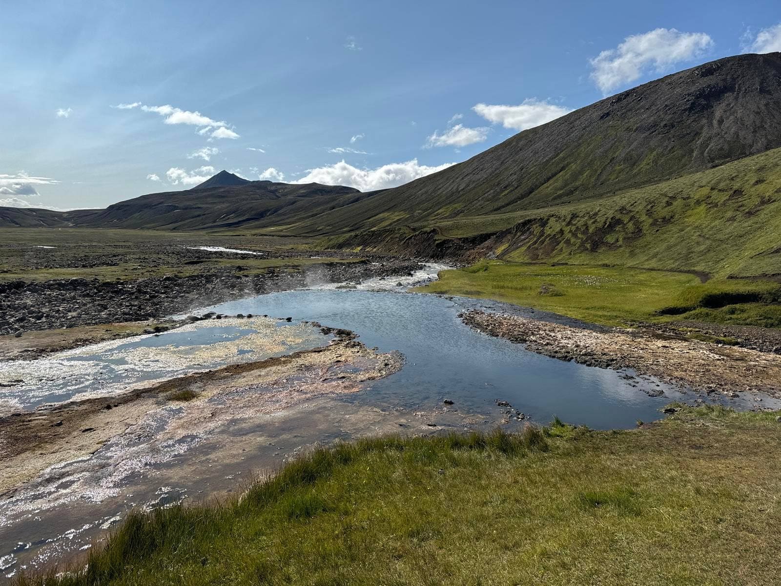
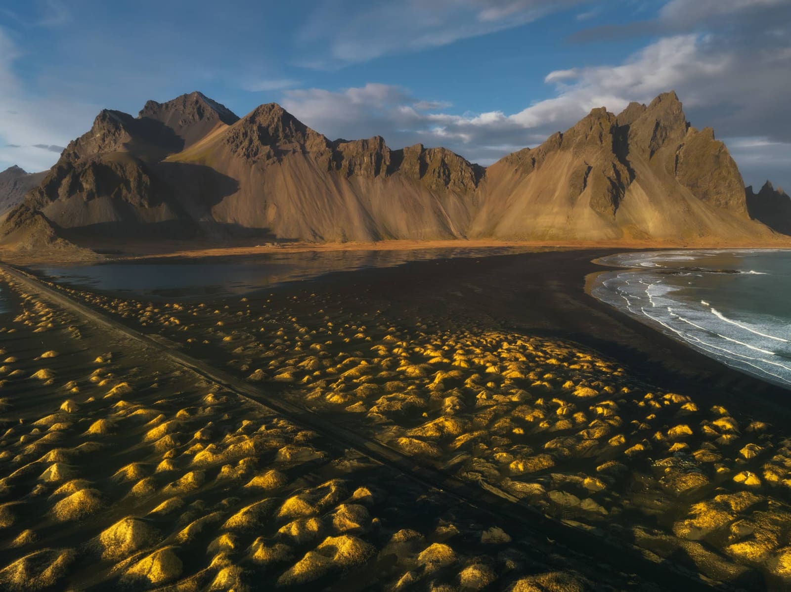
The color is not only in the mountains. Frostastadavatn, Laugahraun, geothermal ground, and crater lakes give the reserve a shifting rhythm: water, lava, sand, steam, and mineral slopes repeat in different combinations.
Frostastadavatn is one of the lake-and-lava scenes that can make a slower Fjallabak day worthwhile.
How hard are the roads into Fjallabak?
The roads are the main filter. Plan around official road status, F-road rules, river-crossing judgement, vehicle permission, fuel, daylight, weather, and the route you can safely leave by.
Official and regional sources point to routes such as 208, F208, and F225 around Fjallabak and Landmannalaugar. The important planning point is not memorizing a single road number; it is matching the approach to official conditions, your vehicle, rental rules, and your experience.
Do not treat Fjallabak like a normal South Coast detour. The road can become the whole day, and a beautiful map line is weak evidence if visibility, wind, river levels, or road status are unfavorable.
Go if official road status, weather, vehicle permission, driver confidence, and return timing all line up.
Skip if the plan depends on optimistic river crossings, late exits, or a route your rental agreement does not allow.
Check before committing: road status, weather warnings, SafeTravel alerts, protected-area rules, parking information, and local operator advice where relevant.
Which nearby places should shape the decision?
Landmannalaugar is the obvious anchor, but Fjallabak becomes more useful when you compare it with both nearby Highland goals and easier South Iceland backups.
If this is your first time in the reserve, Landmannalaugar is usually the strongest focus because it concentrates trails, lava, hot-spring scenery, and protected-area visitor checks in one place. Eldgja and Strutslaug are different kinds of remote Highland decisions and should not be casually stacked into the same day.
Ljótipollur is the kind of nearby sub-stop that makes Fjallabak a choose-your-day area.
If the Highlands plan weakens, compare the day against South Iceland instead of forcing it. Skogafoss, Dyrholaey, Reynisfjara, and Seljalandsfoss can give a stronger trip day when weather, vehicle rules, or road status make Fjallabak too uncertain.
Thorsmork is the useful comparison for travelers who want a serious Highland hiking objective behind the South Coast. It has different access problems, but the same basic planning lesson applies: transport and conditions decide whether the scenery belongs in the route.
How much time should you give the reserve?
Give Fjallabak most of a day at minimum, and more if you are doing anything beyond a focused Landmannalaugar visit. The reserve punishes tight timing more than it rewards extra checklist stops.
A focused visit still needs time for the approach, parking or bus logistics, a short walk, weather delays, photos, and the return drive. A wider reserve day adds slower roads, more decision points, and fewer easy shortcuts.
For most trips, Fjallabak should replace something rather than sit on top of an already full South Coast plan. It is better to have one clean Highland objective and leave with margin than to collect names and drive out tired.
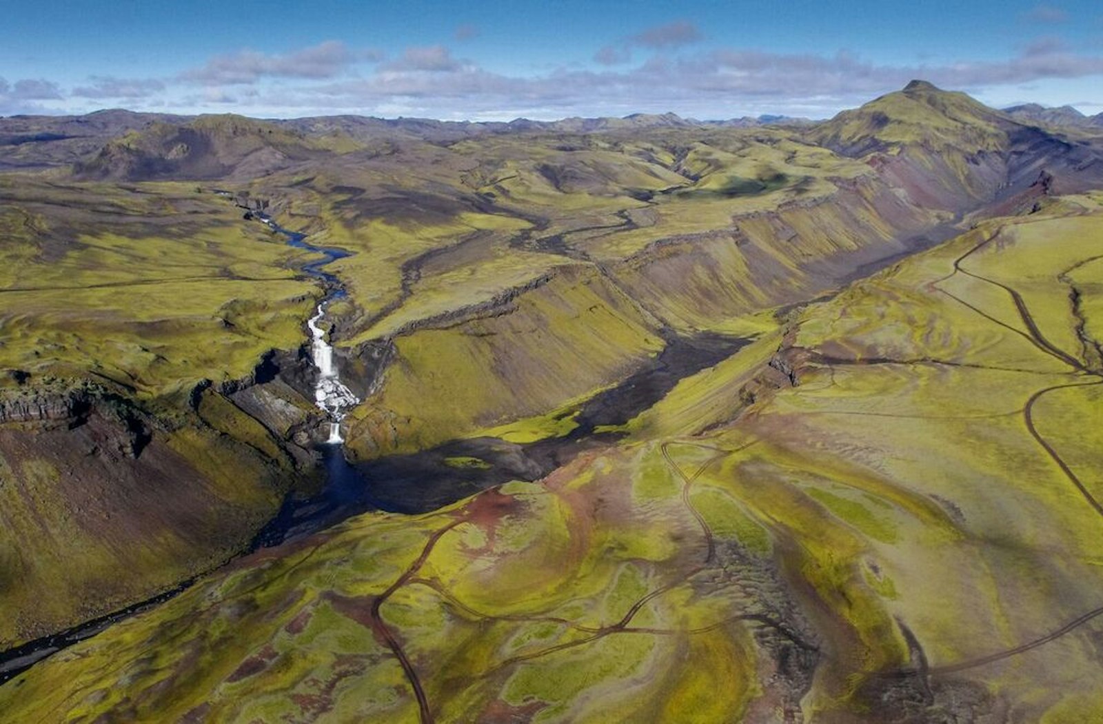
The aerial view makes the reserve feel like a route area, not a quick roadside stop.
What protected-area rules matter most?
Stay on allowed roads and marked routes, avoid driving off-road, respect geothermal and vegetated ground, and use official protected-area guidance before assuming what is permitted.
Fjallabak was protected because its landscape, geology, wilderness, and living systems are sensitive. The travel decision is therefore not only about whether you can reach the reserve, but whether your plan avoids damaging the place you came to see.
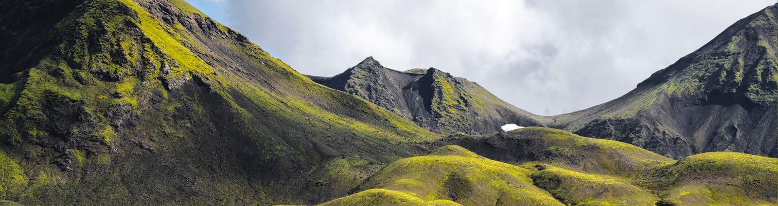
Small geothermal and vegetation details are part of why staying on marked ground matters in Fjallabak.
Use for wind, visibility, precipitation, and wider trip-condition decisions.
Fjallabak planning questions travelers ask
The common questions are really access questions: whether the vehicle, route, weather, and time make the reserve a sensible choice.
Is Fjallabak the same as Landmannalaugar?
No, Landmannalaugar is the main visitor focus inside Fjallabak Nature Reserve. Many travelers use Landmannalaugar as their Fjallabak day, while a slower plan can include other reserve landscapes.
Do you need a 4x4 for Fjallabak?
Self-drivers should treat Fjallabak as a Highland F-road plan that needs suitable transport, rental permission, and official road checks. A bus or guided plan can remove some driving decisions, but conditions still matter.
Can Fjallabak fit into a normal South Coast day?
Usually not if the South Coast day is already full. Fjallabak works better as a deliberate Highland objective, with easier South Iceland places kept as backups when access or weather weakens.
What should I verify before relying on Fjallabak?
Verify official road conditions, weather, SafeTravel alerts, protected-area rules, vehicle permissions, parking or bus details, and local advice if your plan depends on a specific route.
Map
See where this stop sits
Use nearby places and useful bases before opening directions.
Region
Highlands
Works well with
Highlands routes / South Coast
Useful base
Vík
Interactive planning map for Fjallabak
Fjallabak
Keep exploring
Put this place in route context
Use nearby places and planning pages to decide whether this stop strengthens the route or stays optional.