Trékyllisvík is a remote cove and small community in Strandir, best for Westfjords travelers who want raw coastal scenery, witch-trial history, birdlife, and a slow route north toward Norðurfjörður.
Quick guide
Type
Remote cove, small community, and coastal landscape
Region
Strandir in the Westfjords
Route context
Westfjords Way side of the Strandir coast, south of Norðurfjörður
Typical visit
30 minutes to 2 hours, longer if you add beach walking, photography, or nearby stops
Best experience
A clear, unrushed Strandir day with enough time for the cove, church area, birdlife, and coastal views
Access reality
Remote Westfjords driving; check official road, weather, and local visitor details before committing
Nearby pairings
Norðurfjörður, Krossneslaug, Djúpavík, Hrolleifsborg, Drangajökull, and Hornstrandir planning
Is Trékyllisvík worth the Strandir detour?
Yes, if your trip already gives Strandir real time. Trékyllisvík is not a classic first-trip icon; it is a remote cove that rewards travelers who want the Westfjords to feel sparse, coastal, and historically strange.
The value is the combination: a broad cove, steep green mountains, scattered settlement, old churchyard atmosphere, birdlife, and a direct connection to Iceland's 17th-century witch-trial history. It feels less like arriving at a built attraction and more like reaching one of the country roads where landscape and local memory sit together.
A local Iceland travel editor would add Trékyllisvík to a route that already includes Hólmavík, Djúpavík, Norðurfjörður, or the northern Strandir coast. They would skip it for a tight Ring Road trip, a South Coast-first holiday, or any plan where remote driving would crowd out stronger anchors like Dynjandi or Látrabjarg.
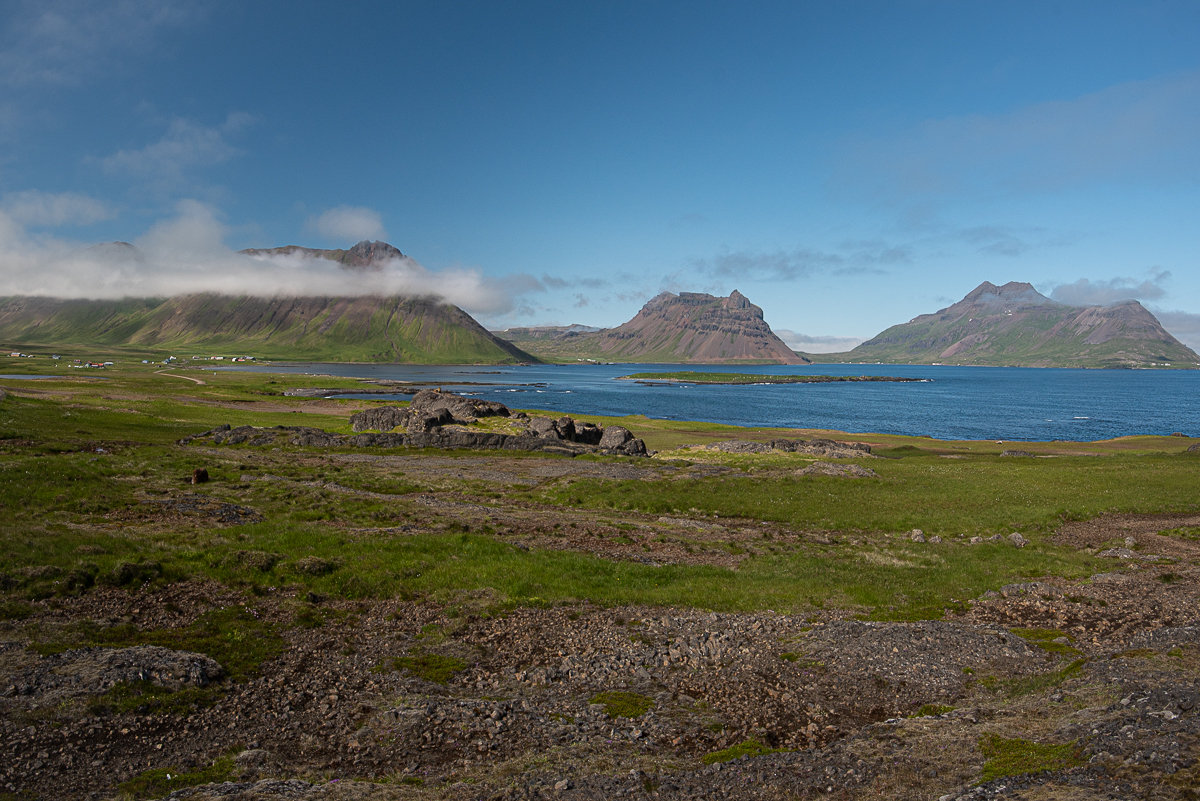
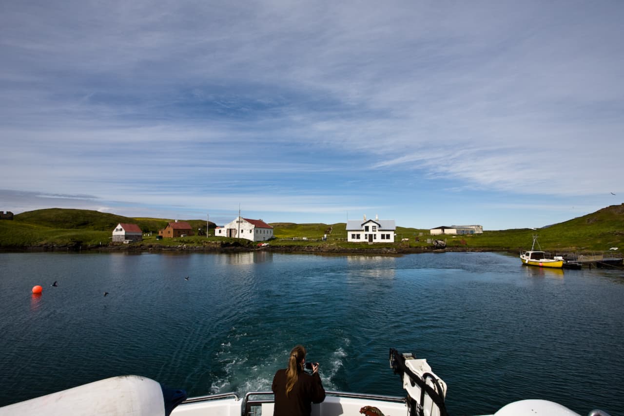
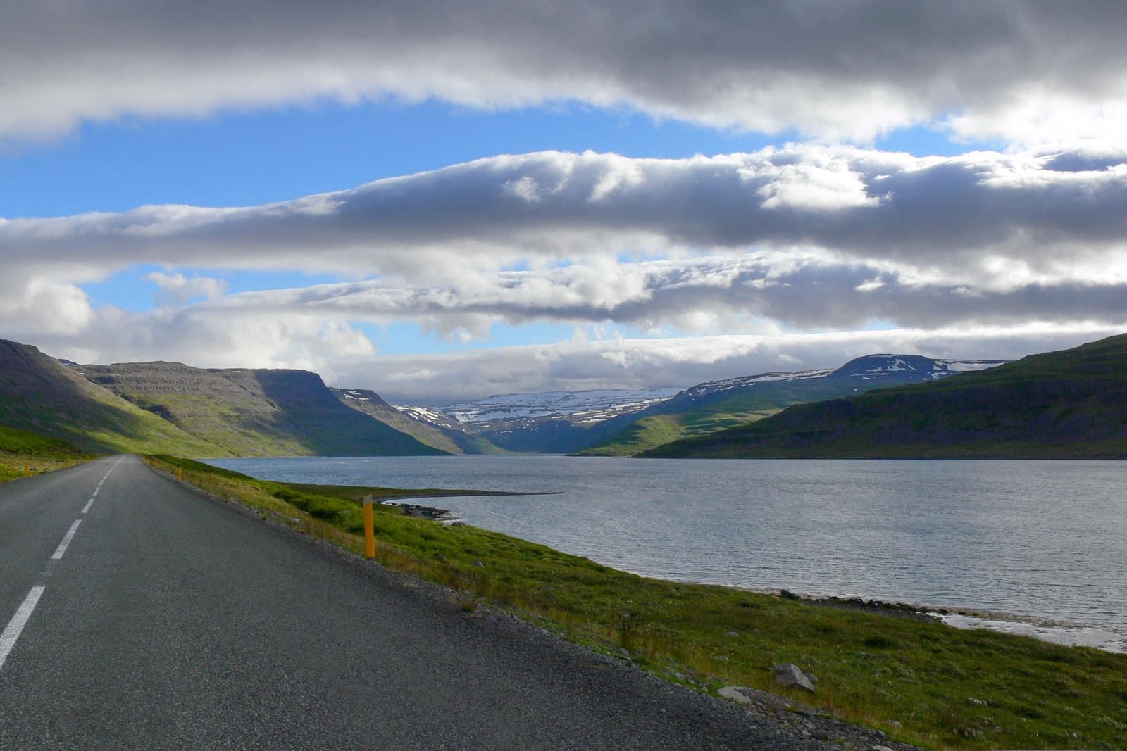
Trékyllisvík opens as a wide coastal pocket between mountains and sea. The scene is not a single viewpoint; it is a slow sweep of farms, water, rock, grass, birds, and weather.
On a clear day the mountains around the cove are the first thing you notice. Low cloud can hang across the ridges, while small buildings and shoreline details make the place feel inhabited but still exposed. The appeal is realistic rather than polished: working land, rough shore, and a sense of distance from the main travel corridors.
The stop is strongest when you have time to pull over safely, look across the cove, and let the weather decide the mood. In wind or low cloud it can feel harsh and quiet; in good light it becomes one of the more memorable coastal scenes on the Westfjords Way.
Why does Trékyllisvík matter beyond the view?
The cove matters because Strandir's landscape is tied to folklore, isolation, and witchcraft history. Visit Westfjords connects the region's witch-trial story with Trékyllisvík, and Hit Iceland places the 17th-century episode directly in the cove's local history.
That history should not turn the visit into a gimmick. The better way to read Trékyllisvík is as a place where a beautiful coast also carries hard local memory. The nearby Museum of Icelandic Sorcery and Witchcraft in Hólmavík gives the wider context, while the cove itself gives the geography: isolated communities, church life, weather, and long distances.
If culture is part of your trip, pair Trékyllisvík with Hólmavík before pushing farther north. If the day is mostly scenic, keep the history in the background and use the cove as a quiet pause between Djúpavík, Hrolleifsborg, and the Norðurfjörður area.
How should you fit it into a Westfjords day?
Build the day around Strandir, not around map distance. The cleanest rhythm is Hólmavík as the practical base, then Djúpavík and the northern coast, with Trékyllisvík as one of the remote scenic and cultural pauses before Norðurfjörður.
Route evidence puts Trékyllisvík in the Westfjords Way cluster with Drangajökull, Hornstrandir, Hrolleifsborg, Vigur, Hestfjörður, Dynjandi, and Patreksfjörður. In practice, the nearby Strandir names matter most for the actual day; the bigger attractions help you decide whether the whole Westfjords segment deserves more nights.
Trékyllisvík route choices
Choice
Use it when
What to check
Short cove pause
You are already driving the Strandir coast and want a scenic stop with history attached
Weather, safe stopping, and whether the day still leaves room for the return drive
Slow Strandir day
You want Djúpavík, Trékyllisvík, Norðurfjörður, and nearby coast to be the point of the day
Road conditions, daylight, food and fuel planning, and local visitor details
Wider Westfjords link
You are deciding between remote Strandir scenery and bigger Westfjords anchors
Whether Drangajökull, Hornstrandir, Dynjandi, or Patreksfjörður better matches the trip
Do not force Trékyllisvík into the same mental category as an easy waterfall stop. It is a place to include when the journey north is already worthwhile, not a box to tick from far away.
How much time and effort should you allow?
Allow 30 minutes to 2 hours for Trékyllisvík itself, then add generous margin for the Strandir drive. The stop can be simple; the remote context is what makes planning important.
If you only want the cove view, a short pause may be enough. If you want to notice the birdlife, church area, shoreline, and mountain backdrop, slow down and treat it as part of the day rather than a photo stop between longer drives.
Birdlife and weather are part of the cove's character, so a slower stop works better than a quick pass-through.
The practical mistake is stacking too many remote names into one day because they look close on a map. Strandir roads, weather, safe stopping, and limited backup options make a lighter plan stronger.
Which nearby places pair best with Trékyllisvík?
The best pairings depend on whether you want culture, coast, wilderness, or a bigger Westfjords anchor. Trékyllisvík is strongest with Strandir neighbors first, then broader Westfjords decisions second.
Use Hrolleifsborg when you want another remote coastal and folklore-leaning stop in the same northern Strandir rhythm.
Use Drangajökull when the trip should lean toward remote glacier and fjord scenery rather than only cove stops.
Use Hornstrandir when you are comparing Strandir's road-accessible coast with true north-coast wilderness planning.
Use Dynjandi, Látrabjarg, and Patreksfjörður as broader Westfjords anchors, not as casual extras after Trékyllisvík.
The cove works best as part of a remote Strandir day, where settlement, mountain, and sea stay close together.
If you are short on time, choose one rhythm. Culture and folklore point back toward Hólmavík; remote coast points north through Trékyllisvík; big-name Westfjords sightseeing points toward Dynjandi, Látrabjarg, and Patreksfjörður.
What official checks matter before going?
Use official checks for road conditions, weather, and general driving safety, then verify any local visitor details with regional or operator sources before building a tight day around the stop.
SafeTravel's Iceland driving guidance is especially relevant here: drive for conditions, slow down before gravel, stop only where it is safe, and do not rely only on map apps for closures or passability. Umferðin and the Icelandic Met Office should decide whether the drive still makes sense.
Official weather forecast for wind, precipitation, visibility, and travel timing.
Common planning questions about Trékyllisvík
These are the questions that usually decide whether the cove belongs in a real itinerary.
Is Trékyllisvík a good first-trip stop?
No, not for most first trips. Trékyllisvík is best when the route already commits to Strandir or a slower Westfjords segment.
Can Trékyllisvík be a quick photo stop?
Yes, but that is the weakest version of the visit. The cove works better when you have time for the mountain setting, birdlife, history, and nearby Strandir context.
What should I check before driving to Trékyllisvík?
Check official road conditions, the Westfjords weather forecast, SafeTravel driving guidance, daylight, and local visitor details before making the stop fixed.
What should I pair with Trékyllisvík?
Pair it with Djúpavík, Norðurfjörður, Hrolleifsborg, Krossneslaug, or a broader Westfjords plan that also compares Drangajökull and Hornstrandir.
Map
See where this stop sits
Use nearby places and useful bases before opening directions.
Region
Westfjords
Works well with
Westfjords Way
Useful base
Ísafjörður
Interactive planning map for Trékyllisvík
Trékyllisvík
Keep exploring
Put this place in route context
Use nearby places and planning pages to decide whether this stop strengthens the route or stays optional.