Látrabjarg is a 14-kilometre line of protected sea cliffs at Iceland's western edge, rising as high as 441 metres. Summer seabirds are the draw, but fragile ground, exposed drops, weather, and remote Road 612 make careful behavior essential.
Cliff and wildlife facts
What it is
One of Europe's largest seabird-cliff areas and a protected nature reserve
Scale
About 14 kilometres long and up to 441 metres high
Main danger
Loose, burrowed ground near very high and exposed cliff edges
Best bird window
Best puffin odds are usually April through July, with some later sightings
Road
Road 612, a narrow gravel approach that needs current-condition checks
In this guide
Látrabjarg is a wall of cliffs, not one viewpoint
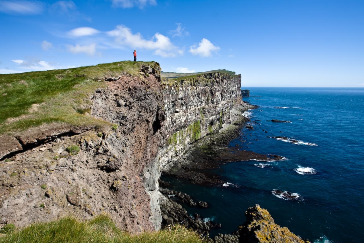
The scale only becomes clear when you look along the coast rather than straight down.
Látrabjarg is a connected line of sea cliffs about 14 kilometres long, reaching 441 metres at its highest point. The grassy top, dark rock faces, and open Atlantic make it feel much larger than the arrival area near Bjargtangar lighthouse suggests. It is also Iceland's westernmost mainland point.
The area became a nature reserve in March 2021 to protect its ecosystem, bird habitat, landscape, and cultural history. That status matters on the ground: this is not an open cliff edge where visitors can invent their own paths or drone angles.
Regional overview of cliff scale, birdlife, Road 612, and fragile-edge safety.
Photo guide
Látrabjarg in photos
The lighthouse marks the approach to the high sea cliffs at Látrabjarg.
Puffins and the larger Látrabjarg bird colony
Puffins are the most famous residents, but the cliffs support a much broader seabird community.
Puffins use burrows in the soft ground near the cliff top, which is one reason the edge can be fragile.
Puffins nest in grassy upper sections, while razorbills, guillemots, Brünnich's guillemots, and kittiwakes occupy other parts of the cliffs. The sound and movement of the colony can be as striking as a close puffin view, so bring binoculars and look across the whole rock face.
Regional guidance says the best puffin odds are usually from April through July, although sightings may continue into August or September. Dates vary with conditions and no page can promise birds at a particular hour, so visit for the cliff landscape as well as the wildlife.
Regional context for puffin breeding behavior and the usual viewing season.
The safe distance protects people and birds
Soft ground and hidden burrows make the edge less stable than it looks.
A long lens gives useful detail without forcing a closer position at the cliff edge.
Stay behind barriers, follow marked paths, and keep well back from any crumbling or undercut edge. Do not crawl toward puffins for a photograph. Their burrows weaken the turf, and approaching too closely can disturb nesting behavior as well as put you over hidden holes.
Nature-reserve guidance prohibits drone flights without permission, off-road driving, and overnight stays or camping in the protected area. Pets are not allowed during the stated nesting period from 15 May to 15 September. Treat posted signs and any local closure as the final instruction.
Reserve history, protected-area rules, nesting restrictions, and approach guidance.
Road 612 makes Látrabjarg a deliberate visit
The walk is simple compared with the remote approach.
The top is walkable in good conditions, but the exposed setting and long approach set the pace.
Látrabjarg is reached by Road 612, a narrow gravel road in the southern Westfjords. Surface condition, visibility, wind, traffic, and your rental terms all matter more than a fixed drive-time estimate. Parking and services are limited, so arrive with fuel, food, layers, and enough time to leave before fatigue or darkness becomes the next problem.
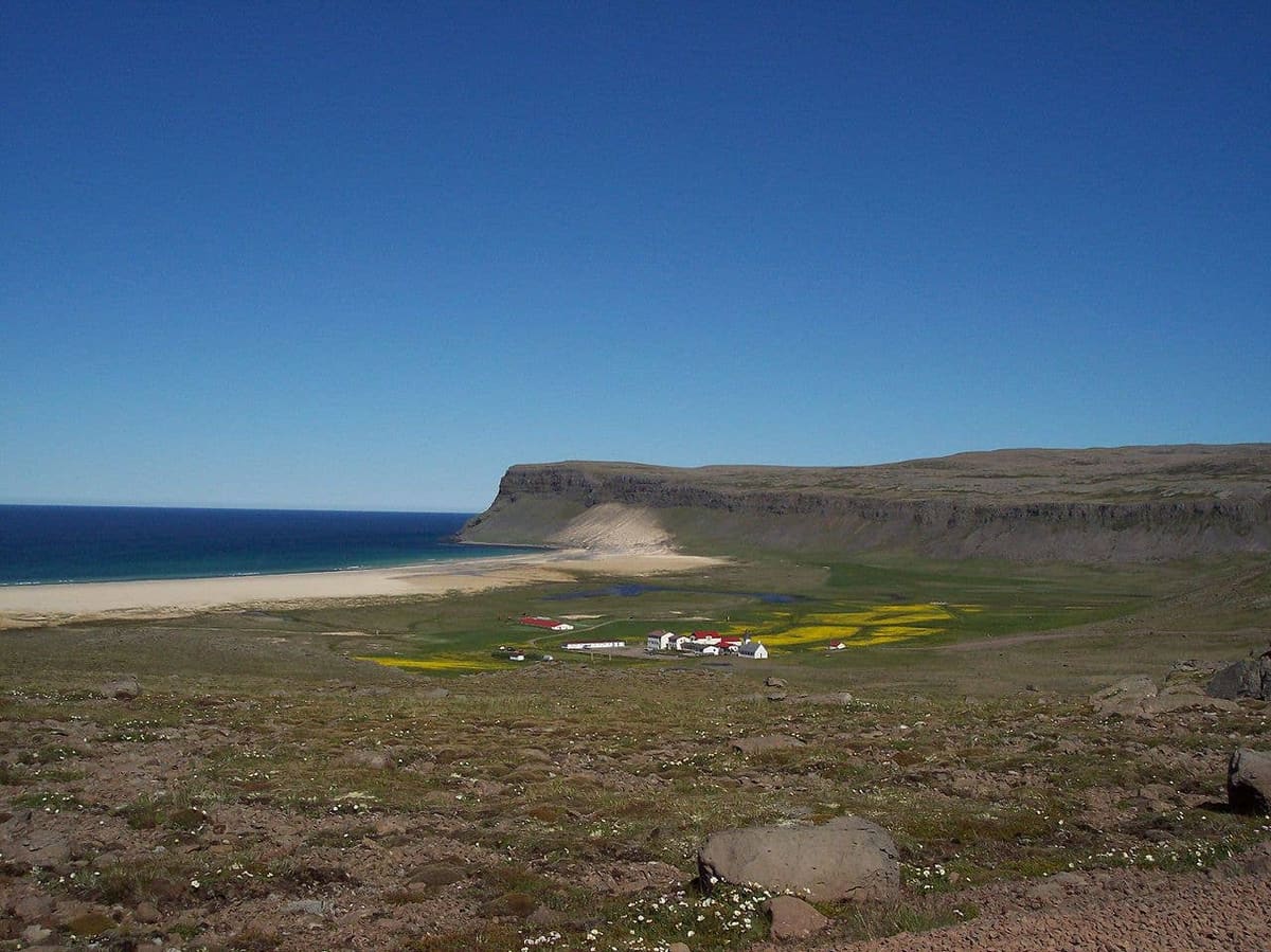
Breiðavík is the closest useful stop for local context, while Patreksfjörður is the practical town base. Check official road and weather sources before leaving either area rather than assuming a map's arrival estimate is a condition report.
Use for gravel-road behavior and condition-aware driving advice.
Southern Westfjords context beyond the cliffs
Látrabjarg pairs naturally with nearby history and coast, but remote roads keep the list short.
Rauðasandur gives a red-and-gold beach contrast, and Garðar BA 64 adds a short piece of maritime history. Hnjótur Museum is the best cultural link if you want to understand local rescue stories and rural life. Save Dynjandi for the wider Westfjords route rather than squeezing every major sight into the same day.