
Quick guide
- Type
- Remote mountain
- Region
- Northern Westfjords
- Route fit
- Specialist Westfjords stop
- Effort
- Serious mountain terrain
- Check first
- Weather and route details
Hrolleifsborg is a remote Westfjords mountain near Drangajökull, best for experienced planners who want wild hiking context and broad fjord views, not a casual stop on a tight Iceland route.
Quick guide
Yes, if your trip already belongs in the remote Westfjords and you want a serious mountain objective. No, if you are collecting quick sightseeing stops.
Hrolleifsborg is not a practical add-on for most first Iceland trips. It sits in the kind of northern Westfjords country where the drive, the weather, and the decision to turn back are part of the visit.
Build Hrolleifsborg into the plan only when the route already includes Drangajökull or Hornstrandir-style wilderness thinking and has enough spare time for a mountain day. For a tight Ring Road plan, a South Coast-focused trip, or any day that needs predictable roadside sightseeing, choose a simpler Westfjords stop.
Worth the stop?
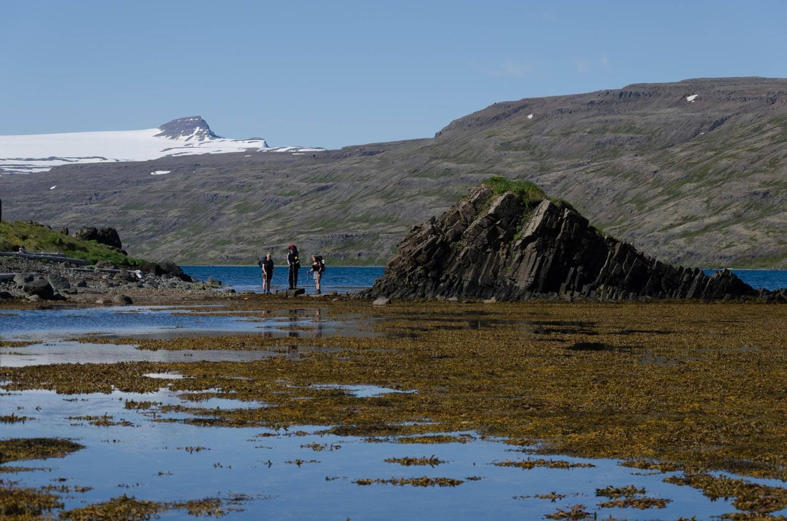
Hrolleifsborg is a high Westfjords peak near Drangajökull, with the feel of a wild mountain edge rather than a developed attraction.
The appeal is the scale around it: dark rock, snow patches, water, wide slopes, and the sense that the Westfjords are still doing most of the work. Hrolleifsborg is the opposite of a polished stop with a short path and a neat photo angle.
If you like quiet fjord country, rougher landscape texture, and mountain views that feel earned, Hrolleifsborg can be memorable. If your ideal Westfjords day is easier services and classic highlights, Vigur, Dynjandi, or Látrabjarg will usually be a better use of time.
Only treat the hike as realistic if you have the right conditions, navigation ability, clothing, and time margin. This is not a casual waymarked stroll.
Older hiking logs show why Hrolleifsborg needs respect: long distances, fog, snow-soft ground, and route-finding all appear in user reports. Those reports are useful warnings, not instructions to follow blindly.
For most travelers, the better decision is to admire the mountain as part of a broader northern Westfjords landscape unless the day is built around hiking. If the plan depends on snowfields, poor visibility, exposed terrain, or uncertain access, choose the conservative option.
Hrolleifsborg pairs best with northern Westfjords and wilderness planning, not with a rushed loop of every famous Westfjords name.
Drangajökull is the most natural comparison because it shares the remote glacier-and-mountain context. Hornstrandir is the broader wilderness decision nearby, especially for travelers already thinking about boat access, hiking, and self-sufficiency.
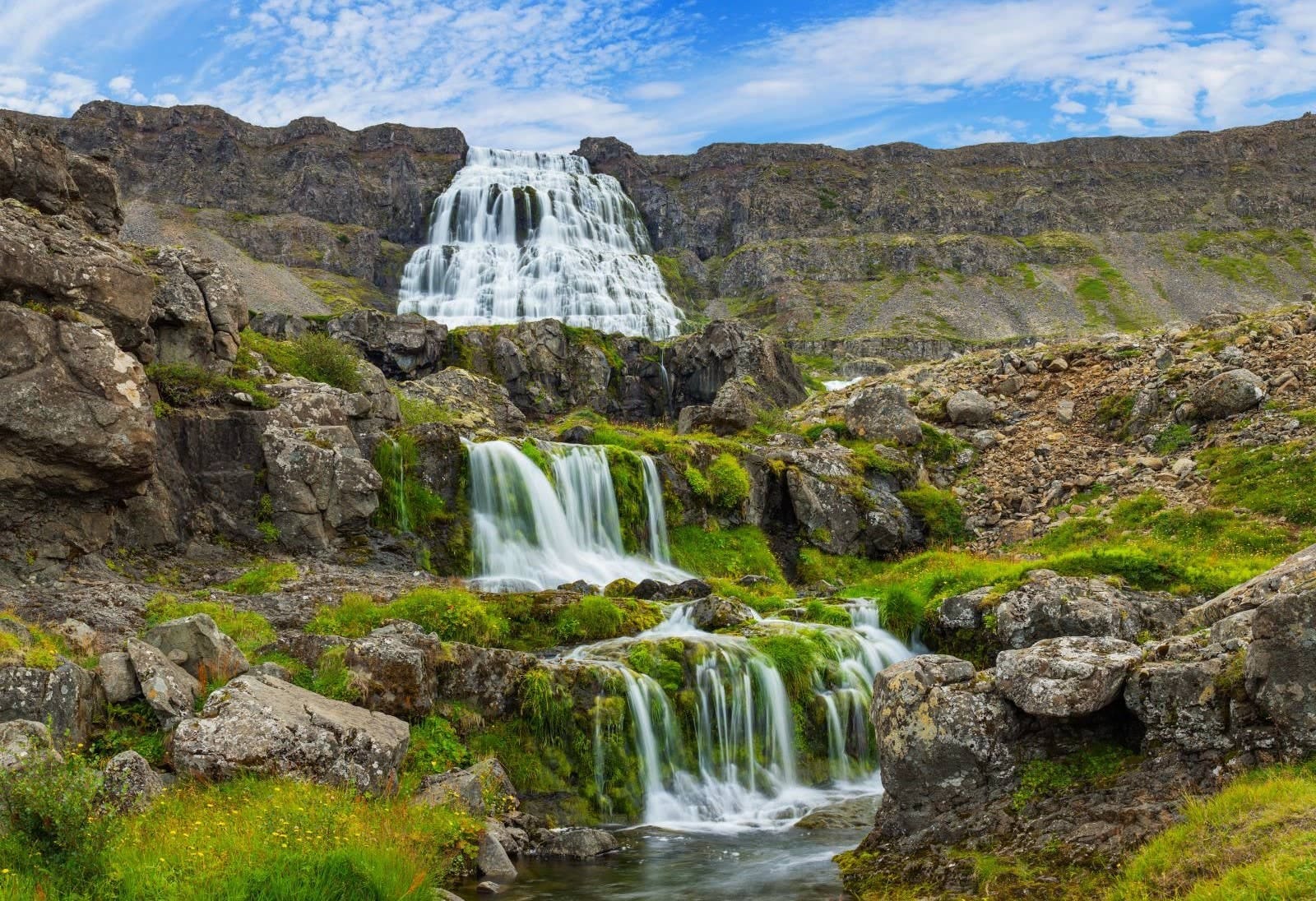
Dynjandi and Látrabjarg are stronger public landmarks, but they sit in a different Westfjords rhythm. Combining them with Hrolleifsborg can make sense only in a longer regional plan with overnight time and flexible pacing.
Vigur and Hestfjörður help if your Westfjords plan is more about fjord scenery and coastal texture than summit ambition. Patreksfjörður belongs to a southern Westfjords base decision, while the Westfjords region guide is the better starting point if you are still choosing the shape of the trip.
Think in route margin, not a fixed stop length. Hrolleifsborg can be a distant landscape context, a serious hike, or a stop you skip after checking conditions.
| Choice | Use it when | What to check |
|---|---|---|
| Landscape context | You are already in the northern Westfjords and want to understand the mountain setting without committing to a hike | Visibility, road conditions, and whether the detour still leaves enough daylight |
| Mountain hiking objective | Hrolleifsborg is the main point of the day and everyone is prepared for remote terrain | Weather, navigation plan, local access information, wind, snow patches, and turn-back timing |
| Skip or save it | The trip is short, the weather is poor, or the day already has long Westfjords driving | A simpler alternative such as Drangajökull context, Hornstrandir planning, or a southern Westfjords highlight |
The key mistake is adding Hrolleifsborg because it looks close to something on a map. Westfjords distances are often less important than road shape, visibility, and whether the day still has a practical exit.
Use official sources for the parts that can change: roads, weather, alerts, and visitor safety. Keep the page decision flexible until those checks support it.
Before building Hrolleifsborg into a fixed day, check Umferðin for roads, the Icelandic Meteorological Office for the Westfjords forecast, and SafeTravel for travel-condition and outdoor guidance. If local signs or local advice are more conservative, follow them.
Use Visit Westfjords to understand the surrounding Árneshreppur and northern Westfjords context.
Use SafeTravel before remote driving, hiking, or weather-sensitive plans.
Use Umferðin before relying on exposed or remote Westfjords roads.
Use the Westfjords forecast for wind, visibility, precipitation, and timing decisions.
These answers are intentionally conservative because the useful decision is whether the mountain fits your actual day.
Usually no. First trips normally get more value from easier Westfjords highlights or from staying on the main South Coast, Golden Circle, or Ring Road structure.
Only treat it that way if you are already nearby and the road, weather, and daylight checks support a low-commitment stop. Do not make it the reason for a long detour unless you want the remote mountain context.
Yes, for travelers who want the full experience. Others can use it as landscape context while focusing their day on Drangajökull, Hornstrandir planning, or more accessible Westfjords places.
Pair it first with Drangajökull and northern Westfjords wilderness planning. Add Dynjandi or Látrabjarg only when your route has enough days for both northern and southern Westfjords pacing.
Map
Use nearby places and useful bases before opening directions.
Interactive planning map for Hrolleifsborg
Keep exploring
Use nearby places and planning pages to decide whether this stop strengthens the route or stays optional.
A remote, slower region best suited to travelers with multi-day flexibility and tolerance for longer, weather-sensitive driving.
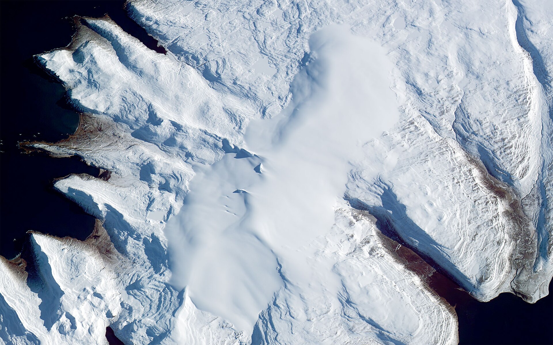
Drangajökull is the only glacier in the Westfjords, best planned as a remote landscape stop where Kaldalón access, road conditions, weather, and wider Westfjords time decide whether the detour is worthwhile.
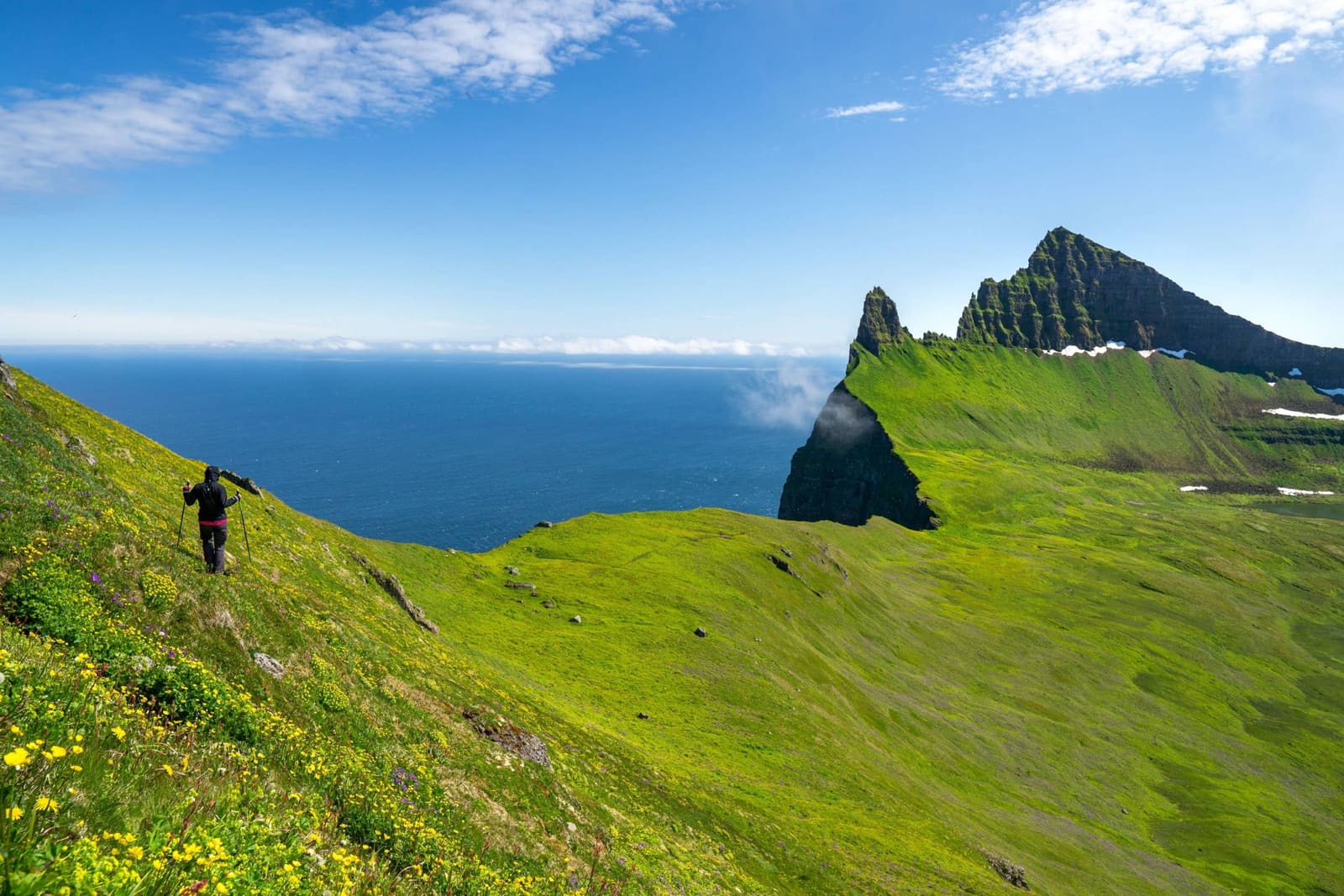
Hornstrandir is a remote Westfjords nature reserve reached mainly by boat, best for travelers who want wild cliffs, foxes, and hiking enough to accept weather, camping, and access planning.
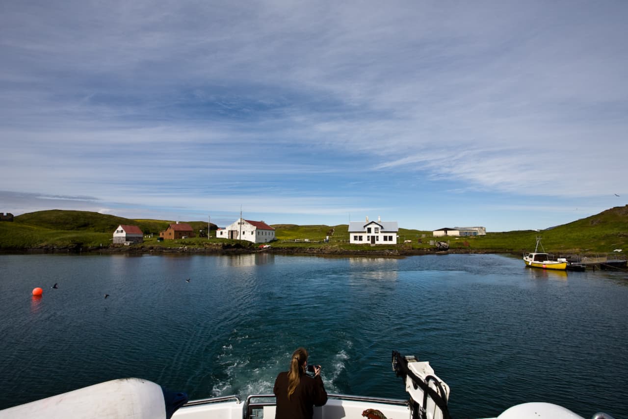
Vigur is a small bird-rich island in Ísafjarðardjúp, best for Westfjords travelers who want a guided boat-access visit with puffins, eiderdown heritage, historic buildings, and conservation-sensitive access near Ísafjörður.
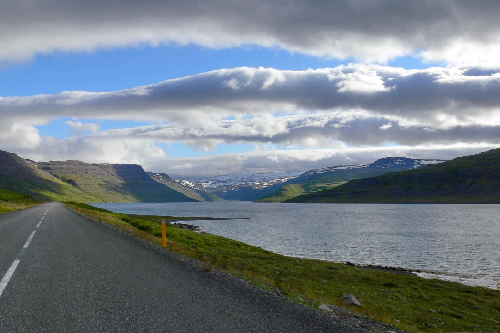
Hestfjörður is a quiet side fjord of Ísafjarðardjúp on the Westfjords Way, best for travelers who want a slower road-edge view rather than a formal planned attraction stop.
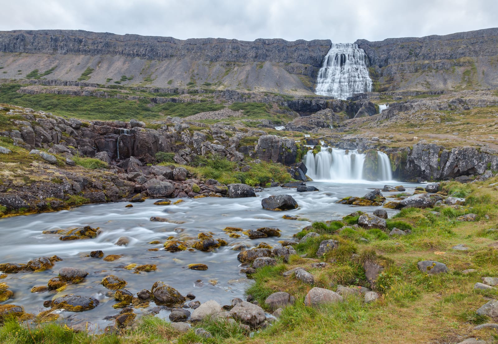
Dynjandi is the Westfjords waterfall many travelers build around, worth planning as a main regional stop with enough time for the fjord drive and lower cascades, with enough flexibility for conditions and nearby route choices.