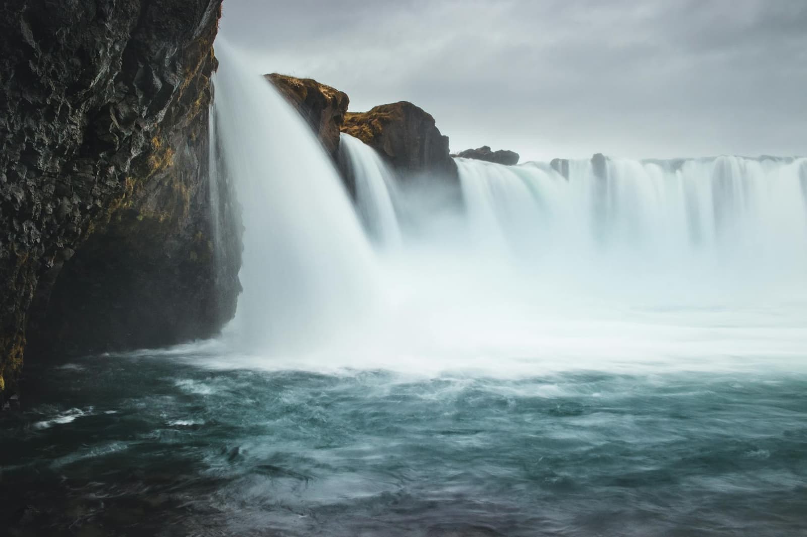
Goðafoss spreads across a broad curve in the Skjálfandafljót river, breaking into two main falls and several smaller channels. Short paths reach viewpoints on both banks, so the visit is easy to understand without a long hike.
Waterfall facts
What it is
Protected waterfall on the Skjálfandafljót river
Height and width
9-17 meters high and roughly 30 meters wide
Useful visit
About 30-60 minutes for the main viewpoints
Access
Parking and paved viewpoint paths on both banks near Route 1
Main conditions
Waterfall spray, wind and possible ice on the short paths
In this guide
Water spreads across a broad curve of rock
Goðafoss is divided into two main falls and several smaller channels, giving it a wide, broken shape that changes with river flow and season.
The protected waterfall is 9-17 meters high and roughly 30 meters wide. Water from the Skjálfandafljót spreads around rock outcrops before dropping into the basin, so the whole form is easier to read from a little distance than from the closest edge.
Its appearance is not fixed. High flow can soften the gaps between the channels, while lower water exposes more of the dark rock. Snow, low winter light and spray can make the same waterfall look much more severe.
On the western bank, the land called Hrútey is bounded by Hrúteyjarkvísl, a branch that leaves the main river above Goðafoss and rejoins it below. This divided watercourse helps explain why the waterfall reads as several connected falls rather than a single straight curtain. The river here is Skjálfandafljót; Svarta is a separate river name used elsewhere in North Iceland, not another channel at Goðafoss.
Official dimensions, protection status and cultural context.
Photo guide
Goðafoss Waterfall in photos
1 / 4
Warm low light outlines the broad curve of Goðafoss.
The two banks give different views
Marked paths reach viewpoints on both sides of the river. One bank is enough for a short stop, while seeing both gives a clearer sense of the waterfall's full curve.
The broader viewpoints show how the river divides before the drop. Closer positions emphasize sound and spray, but they reveal less of the full shape. Parking is available on both sides, and a pedestrian bridge lets visitors cross without moving the car when conditions are suitable.
A wider view makes the separate channels and curved waterfall lip easier to see.
Allow about 30 minutes for one side at an unhurried pace. Around 45-60 minutes gives time for both banks, photos and slower footing. A short lower riverside extension can also reach Geitafoss, a smaller downstream fall. This is still a viewpoint visit, not a hiking destination.
If time or mobility is limited, choose the most convenient bank and do not treat the crossing as essential. The useful decision is whether another angle adds something for you, not whether every path has been completed. Snow, maintenance or surface conditions may also make one side the sensible limit.
The name belongs to a conversion story
Goðafoss means waterfall of the gods, and its name is traditionally connected with Iceland's adoption of Christianity around the year 1000.
According to the familiar account, lawspeaker Þorgeir Ljósvetningagoði threw images of the Norse gods into the falls after deciding that Iceland should accept Christianity. The Nature Conservation Agency presents this as folklore, which is the most careful way to understand it rather than treating every detail as documented fact.
Goðafoss and its immediate surroundings have been protected as a natural monument since 2020. The designation covers more than the main view: the river channels, rocky banks and the setting around the falls form one protected landscape. Marked paths keep the visit clear while reducing damage to that ground.
Season and light can transform the scene without changing the waterfall's broad outline.
Spray and ice can change a simple walk
The paths are short, but the waterfall creates its own wet and cold conditions near the viewpoints.
Wear a waterproof outer layer and protect a camera or phone from spray. Around freezing, wet surfaces can turn icy even when the parking area looks manageable. Stay on marked paths and behind closures; an exposed rock is not a safer viewpoint just because other visitors have stood there.
Wind direction matters as much as rainfall. A dry approach can become wet near the basin when spray blows across the path, and a cold wind can make a short stop uncomfortable quickly. Turning back from a closer position usually costs little because the wider viewpoints still show the waterfall well.
Official wind, precipitation and visibility forecast.
Mývatn is the nearest major change of landscape
Goðafoss sits close to Route 1 between Akureyri and the Mývatn area, so it fits naturally between larger North Iceland stops.
Continue east to Lake Mývatn for shallow water, pseudocraters and volcanic landforms. Dettifoss is a larger commitment and a much rougher waterfall experience, while Húsavík shifts the day toward the coast and harbor.