Where did the eclipse cross Iceland?
The August 12, 2026 eclipse path crossed western Iceland. Reykjavík was inside totality; places farther west had a longer total phase.
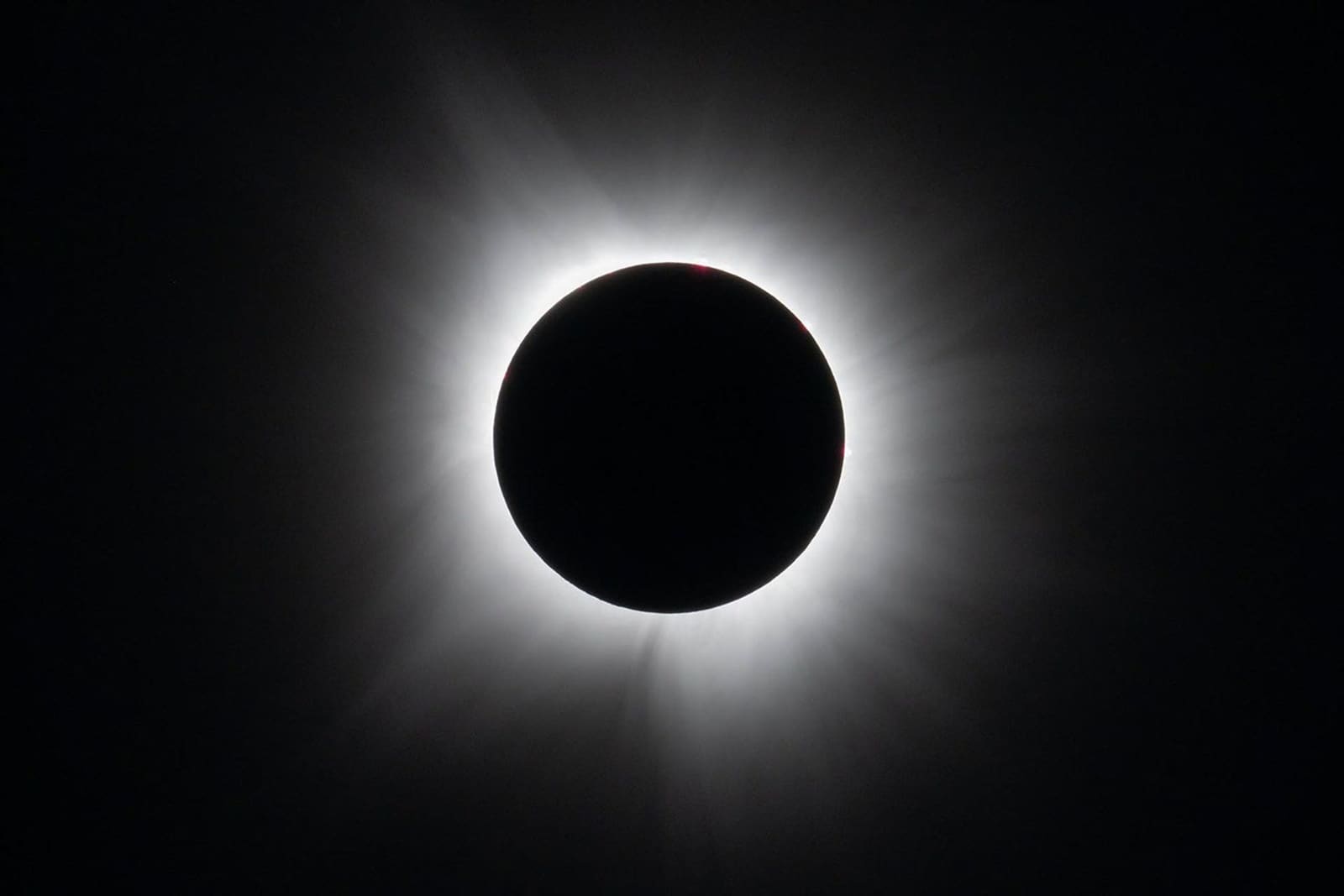
Illustrative lead photograph: totality in Dallas, Texas, on April 8, 2024. Photo: NASA / Keegan Barber.
Reykjavík’s published timing put totality at about 17:48 local time for just over a minute. Western Westfjords locations had up to about 2 minutes 13 seconds. Those are astronomical durations, not a guarantee that clouds allowed a clear view.
Authorities directed Reykjavík visitors toward designated capital-region gathering areas and encouraged walking, cycling, or public transport where possible. Visitors choosing Reykjanes, Snæfellsnes, or the Westfjords were advised to make that region part of the trip at least the day before rather than treat a remote western viewpoint as a same-day add-on.
Confirm the event and the path
Eclipse date, path and phase definitions; regional contact times are supplied by the linked Iceland visitor sources.
Archived evidence for nationwide preparation, designated-site, parking, and crowd guidance.
Good to know
Is this right for you?
Archive useful for
- readers comparing Iceland’s eclipse timing and path
- travel planners learning from the event's traffic and access controls
- people comparing totality duration with road and cloud risk
- future eclipse viewers who need clear eye-safety guidance
Think twice if
- live cloud, traffic, viewing-site, or event-status decisions
- astronomical photography equipment reviews
Related context
What time was the eclipse?
The table preserves published regional timings in local time (UTC). Exact contact times depend on the viewing coordinates.
| Area | Partial phase | Totality / maximum | Approximate totality |
|---|---|---|---|
| Reykjavík | 16:47-18:47 | 17:48-17:49 | Just over 1 minute |
| Reykjanes | About 16:46-18:47 | Maximum about 17:48–17:49 by site | About 1 minute to roughly 1 minute 48 seconds by site |
| Snæfellsnes / West Iceland | About 16:45-18:46 | Maximum about 17:46–17:47 by site | Approaches 2 minutes at western sites |
| Western Westfjords | About 16:43-18:45 | Maximum about 17:45 | Up to about 2 minutes 13 seconds |
Regional times were planning references rather than a last-minute arrival cue. Exact contact times varied by location, so the event plan paired an official gathering site with location-specific coordinates and timing.
Location-specific eclipse maps
- officialEclipse2026.is maps of Iceland
Archived Iceland maps show which locations were inside totality and compare exact duration.
- map creditIceland at Night eclipse project
Co-publisher of the Iceland eclipse map shown below.
Reykjavík vs Reykjanes vs Snæfellsnes vs the Westfjords
The longest totality was not automatically the strongest event plan. Access, services, and the surrounding overnights changed the risk substantially.
| Base | Best for | Main advantage | Main risk | Recommendation |
|---|---|---|---|---|
| Reykjavík | Most visitors, families, no-car trips | Several official areas, services, public transport | Large crowds and local road closures | Official low-risk default for visitors based in the capital |
| Reykjanes | Visitors already based near Keflavík or on the peninsula | Longer totality at western sites with several designated areas | Controlled coastal roads and limited parking | Required an early local arrival and a regional overnight |
| Snæfellsnes | Travelers with peninsula accommodation | Near-two-minute totality and strong western horizon options | One-way traffic, road closure, and a difficult mass departure | Official advice called for arriving at least a day before and staying after |
| Westfjords | Travelers already committed to a multi-night western trip | Iceland's longest totality at the far west | Remote roads, restricted access, small services, and crowd pressure | Unsuitable as a Reykjavík day trip |
The weather forecast could change the local choice, but it did not remove transport constraints. The official compromise was a primary and backup site within one region, not an eclipse-day driving race across several regions.
What did Reykjavík plan for viewers?
Visit Reykjavík listed several designated viewing areas, including these coastal and town sites, with basic facilities planned.
- Suðurströnd in Seltjarnarnes
- Ægisíða in Reykjavík
- The shoreline west of the Álftanes sports area
- Hamarinn and Ástjörn in Hafnarfjörður
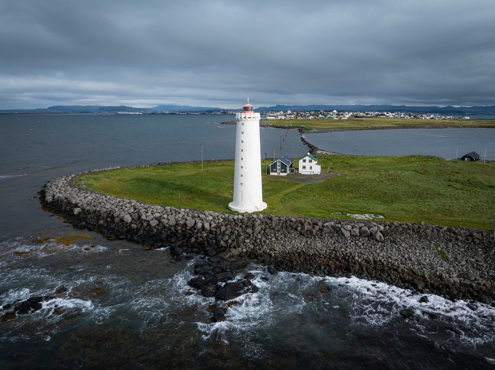
The published plan barred access to Grótta on August 12 because the causeway was expected to be submerged during totality. It also announced afternoon vehicle restrictions near designated viewing areas.
Reykjavík viewing and closure details
Archived evidence for designated areas, capital-region times, access, and street closures.
What was the Reykjanes visitor plan?
Reykjanes was the practical western option for visitors already sleeping on the peninsula or able to make it their overnight region before the event.
Visit Reykjanes listed gathering sites at coastal landmarks and in towns. Its site guide described the planned facilities and access arrangements; these varied by location.
The regional guide gave some western sites about 1 minute 45 to 48 seconds of totality. Accommodation nearby and an early arrival were central to the visitor advice. Use the Reykjanes road-trip guide for current route planning.
Designated Reykjanes sites
Archived evidence for site-by-site totality, parking, facilities, accessibility, and local event updates.
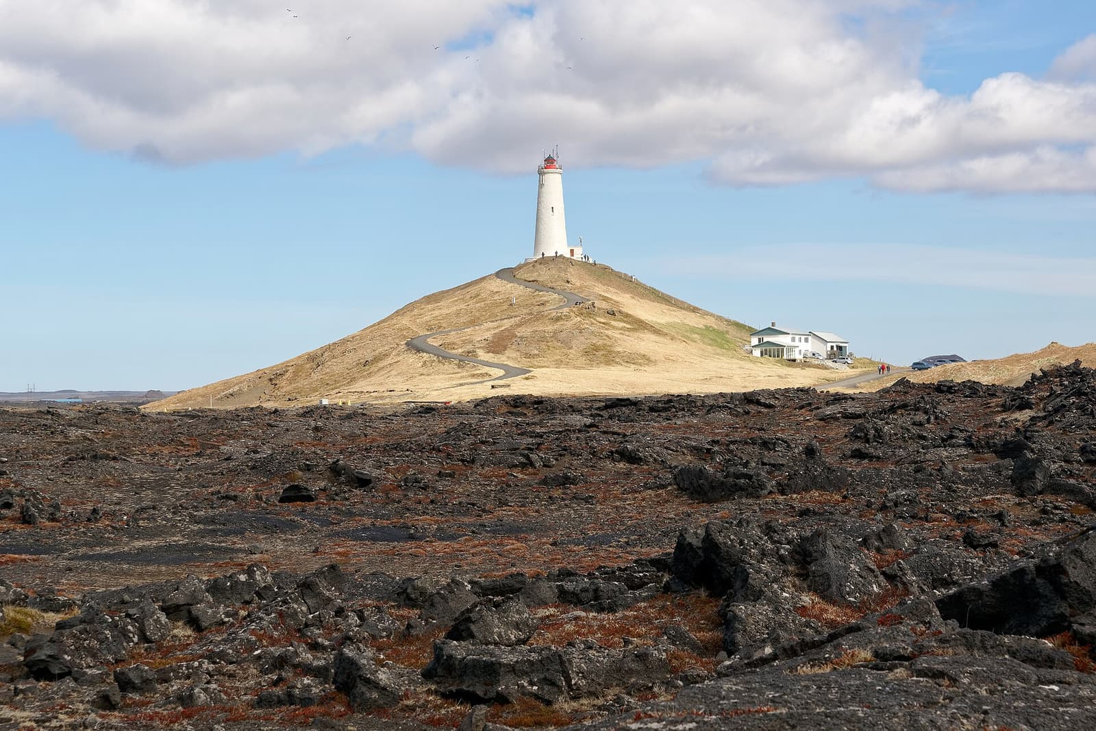
Lighthouse photograph credit
- referenceReykjanes Lighthouse by Jakub Hałun
Photographed April 30, 2023; resized and cropped for display.
The lighthouse photograph is used under CC BY-SA 4.0; adaptations remain subject to the same license.
What access changes were planned on Snæfellsnes?
Snæfellsnes offered longer totality, but the peninsula's limited road system made the overnight and departure plan essential.
West Iceland listed community viewing sites across the peninsula and nearby towns. The advice favored established parking and services and an overnight stay before eclipse day.
The road authority announced one-way travel on Road 574 westward from Búðir and closure of Road 579 to general traffic, with a national-park shuttle planned. Its detailed notice and summary differ on the Road 574 endpoint and start time, so this archive does not present one precise schedule as a verified account of what happened.
For Snæfellsnes viewers, accommodation came before the exact viewpoint, and the arrival and departure were part of a multi-day peninsula plan. Use the Snæfellsnes Peninsula road trip for current route guidance.
Snæfellsnes viewing and access
Archived evidence for community viewing sites, arrival advice, parking, and regional restrictions.
Archived evidence for the event's one-way systems, road closures, and traffic-control times.
How did the Westfjords fit the event?
The Westfjords made sense only when the region was already the trip, not simply because its duration was the largest in the table.
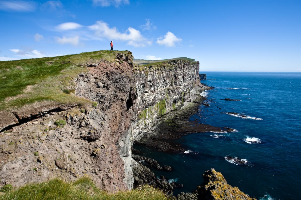
The western Westfjords had Iceland’s longest totality, up to about 2 minutes 13 seconds. Remote access to places such as Látrabjarg and Rauðisandur made advance planning necessary. The road authority announced one-way restrictions on Roads 612 and 614 and an early checkpoint.
The lower-risk Westfjords choice was a designated community site where parking, toilets, food, and emergency access were easier to manage. Authorities told visitors to arrive prepared for several hours outside and not to park on a road or shoulder. Reykjavík or Reykjanes was the more defensible base for travelers without a multi-night Westfjords route.
Westfjords sites and controls
Archived evidence for official gathering places, facilities, regional timing, and arrival guidance.
What was the cloud backup strategy?
Pre-event forecasts could help viewers compare nearby options. This archive does not contain a verified site-by-site weather or visibility report.
- Compare broad cloud forecasts for the region where you are staying.
- Choose a primary site and a nearby backup with confirmed access.
- Check notices before moving; a clearer forecast is of little use if the route is closed or parking is full.
- Cloud can hide the Sun and corona even though the sky darkens.
- Cloud is not an eye filter. Use safe solar viewers throughout every partial phase.
Use Iceland's official cloud forecast
Current forecast service, not a historical record of cloud on August 12.
What did the transport advice ask visitors to do?
Authorities prepared for heavy traffic across western Iceland. Their advice addressed arrivals, parking and the risk of a concentrated departure after totality.
- Reach a remote viewing region before eclipse day.
- Use designated parking and keep roads, shoulders and emergency access clear.
- Carry food, water, medication, warm layers and a charged phone.
- Allow time after totality before starting a long onward drive.
The notices announced different start times for different roads. They are records of August 12 plans, not current restrictions or a confirmed log of implementation. Use the driving in Iceland guide and current road information for a trip now.
Event road-control sources
Current road-condition owner; the event-specific advice recorded here is historical.
Archived evidence for the planned one-way systems, closures, and eclipse-specific traffic management.
How do you watch a future solar eclipse safely?
Eye safety changes only during the brief total phase. Before and after totality, even a thin bright crescent of Sun needs proper protection.
- Use eclipse glasses or a handheld solar viewer that complies with ISO 12312-2 and comes from a supplier vetted by the American Astronomical Society for every partial phase.
- Regular sunglasses are not safe, no matter how dark they appear.
- Do not use damaged, scratched, or loose viewers.
- Do not look through a camera, binoculars, or a telescope while wearing eclipse glasses; the optical device needs its own correctly fitted solar filter on the front.
- Only inside the path of totality, remove eye protection once the bright solar surface is completely covered. Put the viewers back on before the bright Sun reappears. Outside that path, keep them on throughout.
- Supervise children and practice using the viewers before any future eclipse.
Solar-viewing safety
Use for safe direct viewing, indirect methods, and camera, binocular, and telescope warnings.
Use to choose viewers from a supplier vetted for solar-viewing products.
What did the event plan ask viewers to bring?
The packing plan accounted for a long wait in exposed Icelandic weather, not only the minute of totality.
| Bring | Why it matters |
|---|---|
| Safe eclipse viewers plus a spare pair | Every person needs reliable protection for the partial phases |
| Waterproof shell, warm layer, hat, and gloves | Coastal wind and waiting can feel cold even in August |
| Food, water, medication, and a charged power bank | Queues and post-event traffic may keep you outside for hours |
| A seated or accessible setup where needed | Standing on rough exposed ground is not a good default for every traveler |
| Camera filter and tested settings, if photographing | Do not spend totality troubleshooting unfamiliar equipment |
For a future eclipse, test equipment beforehand and leave time to watch rather than troubleshoot. A simple photograph of the surrounding scene can record changing light without pointing an unfiltered optical device at the Sun.
Iceland solar eclipse 2026 FAQ
These answers preserve the verified event timing and the main planning lessons.
What time was the 2026 solar eclipse in Reykjavík?
Visit Reykjavík published a partial phase of about 16:47–18:47 local time and totality at about 17:48–17:49. The exact seconds depend on the observer’s location within the capital region.
Was Reykjavík inside the path of totality?
Yes. The capital was inside the total-eclipse path. Whether someone saw the Sun and corona clearly still depended on local cloud.
Was it worth driving to Snæfellsnes or the Westfjords?
The longer totality was a reason to include those regions in a longer trip. Published advice warned about remote roads, limited capacity and temporary traffic controls, so a same-day drive from Reykjavík was a poor plan.
What happened if it was cloudy?
Viewers could still experience sudden darkness and the atmosphere of totality, but cloud could hide the corona and the Sun. The event plan favored a short local backup instead of a long late drive across regions.
Do I need eclipse glasses if it is cloudy?
Yes whenever any part of the bright Sun is visible outside totality. Cloud is not a safe solar filter. Use proper viewers for all partial phases.
Could visitors drive to a viewpoint on the afternoon of August 12?
Published guidance told visitors to arrive early and use designated sites. Temporary restrictions were planned on several western roads; this archive does not verify how each control operated on the day.
By ThorPublished Updated