Glacier facts
- Type
- Remote table mountain context
- Region
- Central Highlands near Vatnajokull
- Nearby
- Dyngjujokull, Bardarbunga, Askja, Holuhraun
- Best for
- Highland and geology orientation
- Access
- Rough tracks need live checks
Kistufell helps highland travelers decode a remote Vatnajökull mountain name, then decide whether it is useful route context, a specialist objective, or a place to leave off a normal Iceland itinerary.
Glacier facts
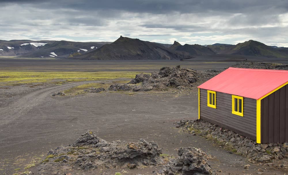
Kistufell is a remote mountain and volcanic table-mountain context near Dyngjujokull on the northern side of Vatnajokull. For most travelers, it is a map label to understand before choosing easier highland or volcanic stops.
The honest decision is simple: Kistufell belongs in plans for prepared highland travelers, glacier researchers, route completists, and geology-focused readers. It does not belong in a first Iceland trip just because the name appears near Bárðarbunga, Askja, or Holuhraun.
Sources place Kistufell near the margin of Dyngjujokull, with rough route context around Gaesavatn and the northern Vatnajokull interior. That setting makes it interesting, but it also means road, weather, meltwater, vehicle, and safety checks matter more than a scenic checklist.
Kistufell is useful because it helps explain a hard-to-reach part of Vatnajokull where glacier margins, volcanic terrain, and old highland routes meet.
The Smithsonian Global Volcanism Program describes Kistufell as a Pleistocene table mountain northeast of Bardarbunga at the margin of Dyngjujokull. That is the key identity: not a polished viewpoint, but a volcanic landform tied to the ice, lava, and interior geography around northwestern Vatnajokull.
Glacier-change research around Dyngjujokull adds the practical warning. The area near Kistufell hut is reached by rough mountain track through lava and sand, and meltwater can change apparently flat terrain quickly. Treat any glacier-edge idea as specialist terrain, not a casual walk from a pin.
Kistufell usually makes sense as supporting context for bigger highland decisions. Askja is the clearer visitor objective; Bardarbunga and Holuhraun explain the volcanic story; Kistufell helps locate the glacier-edge wilderness between them.
| Trip situation | Best use | Better next step |
|---|---|---|
| First Iceland trip | Treat it as background | Choose Askja or easier regional stops |
| Highland self-drive research | Check route difficulty and live conditions | Plan around current road and safety sources |
| Volcano and glacier interest | Use it to connect Dyngjujokull and Bardarbunga | Read Bardarbunga and Vatnajokull context |
| Remote hiking or hut idea | Confirm guidance, access, and backup plans | Do not rely on old route notes |
If you want a highland destination with a clearer traveler payoff, start with Askja, Víti by Askja, Dyngjufjöll, or Herðubreiðarlindir. If the goal is understanding ice-covered volcanoes, compare Bárðarbunga, Grímsvötn, and Vatnajökull.
The access check is the attraction filter. If current information is unclear, Kistufell should stay as a highland-map reference rather than become a route target.
Check official road notifications, weather forecasts, warnings, SafeTravel conditions, and national-park maps before relying on any route near the northern Vatnajokull interior. Old descriptions can be useful for orientation, but they cannot tell you what a track, ford, hut, sand plain, or glacier margin is like now.
For a normal Iceland itinerary, there is no penalty for leaving Kistufell out. You can still build a strong highland-aware trip through Askja, Holuhraun context, Jokulheimar, Landmannalaugar, or other places where visitor access and current information are easier to verify.
Official national-park map information supports using park maps for roads, hikes, and protected-area orientation.
Scientific volcano data supports Kistufell as a Pleistocene table mountain near Bardarbunga and Dyngjujokull.
Official road information supports checking current road notifications before highland driving.
Official safety information supports current travel-condition and alert checks before remote highland plans.
By ThorPublished Updated
Map
Use nearby places and useful bases before opening directions.
Interactive planning map for Kistufell
Interactive map
Place context and external map links remain available without loading it.
Planning context
Open the region or practical guide that resolves the next planning decision.
Wider route
Use broader place relationships for route comparison; they are not presented as immediate nearby stops.
Next step
Use the next page that helps turn this stop into a practical route decision.