Access reality
- Type
- Laugavegur lake and hut area
- Region
- Southern Highlands, near Fjallabak
- Best for
- Hikers and serious Highlands planners
- Route role
- Stage point between Hrafntinnusker and Hvanngil
- Access
- Trail or suitable highland vehicle conditions
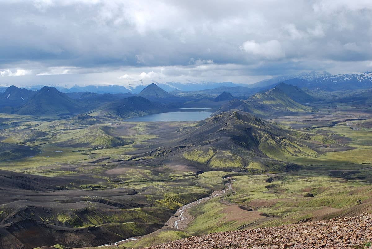
Álftavatn Oasis helps Laugavegur hikers and Highlands planners understand the lake, hut, campsite, road-access reality, and why this is a specialist outdoor stop rather than a casual attraction.
Access reality
Álftavatn is best understood as a specialist outdoor stop: a lake, hut, and campsite area on the Laugavegur Trail in the southern Highlands.
The word oasis works only if you keep the scale honest. Álftavatn can feel like a welcome rest point after exposed highland walking, but it is not a simple roadside lake, picnic stop, or easy attraction for a casual South Coast day.
Most travelers should care about Álftavatn when they are planning Laugavegur stages, hut or campsite nights, highland transport, or the route between Hrafntinnusker and the Hvanngil and Emstrur side of the trail. If that is not your trip shape, the page is still useful context, but it probably should not pull you away from easier stops.
The useful visitor identity is practical: lake setting, huts, campsite, toilets, route decisions, and a place to recover before the next highland section.
FÍ identifies Álftavatn as a hut area on the popular Laugavegur trail between Landmannalaugar and Þórsmörk. That matters more than any postcard label. Hikers use the area to break up the route, rest by the lake, sort food and gear, and decide how the next section should feel.
Facilities are part of the attraction, but they should not be treated as fixed background. Check the current FÍ page before relying on hut beds, camping, bathrooms, showers, wardens, fees, drinking water, booking rules, or seasonal operation.
Álftavatn sits in the planning middle of Laugavegur, where colorful Landmannalaugar terrain gives way toward broader valleys, river crossings, black sands, and the Þórsmörk direction.
From the north, many hikers think about Álftavatn after the higher and more exposed Hrafntinnusker stage. From the south, it belongs to the approach toward Hvanngil and the wider landscape that also explains Stórasúla, Mælifell, and the remote feel of Fjallabak.
This is why Álftavatn is stronger as route structure than as a sightseeing checklist item. It helps you understand how the trek breathes: hard exposed ground, a lake-and-hut pause, then more highland distance before the route eventually drops toward greener Þórsmörk.
| Traveler type | Álftavatn can help when | It is weak when |
|---|---|---|
| Laugavegur hiker | You need a logical hut or campsite stage | Bookings, weather, or group pace do not support it |
| Highlands self-driver | Road, vehicle, river, and weather checks all support access | You are treating F210 like a normal detour |
| First-time South Coast visitor | You have specialist Highlands time and flexibility | You mainly want easy waterfall and beach stops |
Álftavatn is not hard because the name is obscure. It is hard because the surrounding Highlands make access, timing, and backup plans matter.
Official hut information links summer vehicle access with Fjallabaksleið syðri, better known as F210, and warns about unbridged rivers. That does not make the drive a casual recommendation. Use Umferðin, Vegagerðin, your rental rules, and SafeTravel guidance before deciding that driving is realistic.
Trail access needs the same caution. Weather can change quickly in the highlands, visibility can drop, river crossings can change character, and snow or wet ground can affect the walking experience. Confirm the forecast, travel conditions, trail advice, and your group's ability before making Álftavatn the fixed anchor of a day.
The best nearby links are not random attractions. They are the places that explain why Álftavatn appears in serious Highlands planning.
Use Landmannalaugar, Brennisteinsalda, and Bláhnjúkur for the colorful northern-start context. Use Hrafntinnusker for the exposed stage before the lake, and Þórsmörk for the greener end of the classic route.
For remote-driving context, compare Álftavatn with Fjallabak, Mælifell, and the Highlands road-trip planning guide. Those pages help decide whether the highland commitment is genuinely the point of the trip or just a tempting map pin.
Check hut, campsite, facility, booking, and access details before relying on Álftavatn.
Use for route-stage context and current trail-planning guidance.
Check road and driving conditions before considering highland access.
Check Central Highlands weather before exposed hiking or driving.
Check alerts and conditions before remote highland travel.
By ThorPublished Updated
Map
Use nearby places and useful bases before opening directions.
Interactive planning map for Álftavatn Oasis
Interactive map
Place context and external map links remain available without loading it.
Planning context
Open the region or practical guide that resolves the next planning decision.
Wider route
Use broader place relationships for route comparison; they are not presented as immediate nearby stops.