Mælifell is a moss-covered cone volcano in Iceland’s southern Highlands, worth the effort when you want a truly remote black-sand landscape and your vehicle, weather, river, and route checks all support a deliberate F-road day.
Access reality
Type
Moss-covered cone volcano and remote mountain in a black-sand Highland plain
Region
Southern Highlands near Mýrdalsjökull and the Fjallabak area
Route context
A Highlands F-road objective, usually folded into a southern Highlands day rather than a normal Ring Road stop
Time to allow
Most of a day once the approach, river-sensitive route choices, photo stops, and return buffers are included
Access reality
Rough F-roads, changing weather, and river decisions matter more than the map distance
In this guide
Mælifell: but only when the trip is actually built for it
Yes, but only when the trip is actually built for it. Mælifell stands out because the approach, the black sand plain, and the clean green cone all feel far removed from the easier lowland Iceland most first trips revolve around.
If you want one of Iceland’s most distinctive mountain profiles and you are ready to treat the day as a real Highlands objective, Mælifell earns the effort. If you are mainly trying to squeeze in one more photo stop after Skógafoss or Mýrdalsjökull viewpoints, it usually asks too much from the route.
The mountain works best when the detour itself is part of the attraction: long black flats, rough tracks, braided water, and a sense that you have left the usual South Coast rhythm behind.
Go if you want a deliberate southern Highlands day and can keep the timing flexible.
Skip if your trip needs low-stress paved-route anchors more than a difficult detour.
Check before committing: official road conditions, Central Highlands weather, SafeTravel guidance, and local hazard advice.
Photo guide
Mælifell in photos
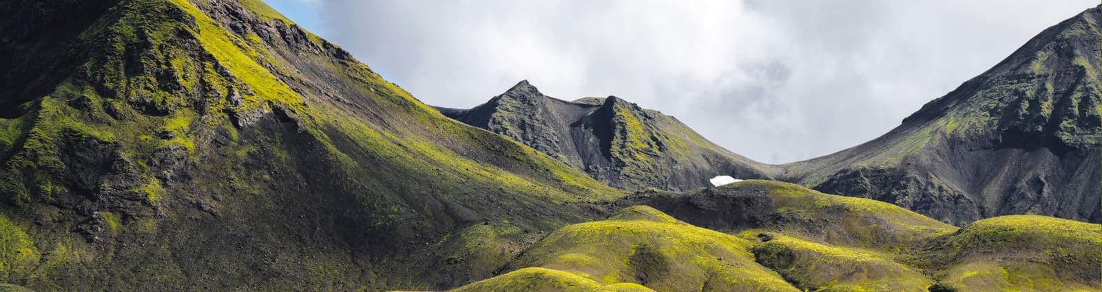
A closer profile works well at card size because the cone shape stays legible.
What makes Mælifell feel so distinctive?
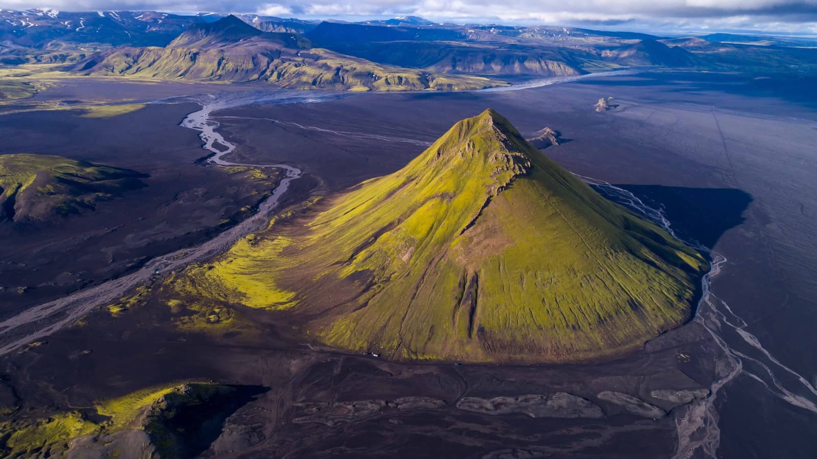
The place looks almost too clean to be real: one steep moss-covered cone rising from dark floodplain, with glacier ice and broken volcanic ridges sitting behind it.
What makes Mælifell memorable is not just the mountain shape. It is the contrast between the green cone, the black Mælifellssandur plain, thin water channels, and the cold white edge of the wider Mýrdalsjökull world beyond.
Mælifell is most striking when the green slopes, black desert, and water channels all read in one frame.
That visual isolation is why the stop keeps showing up on Highlands shortlists. It is not a built attraction with a walkway and a quick loop; it feels exposed, quiet, and farther away than the map alone suggests.
Which approach changes the plan the most?
Access is the real decision. Most travelers are not choosing whether the mountain is beautiful; they are choosing whether the route to it is sensible on the day.
The main difference is not mileage. It is how much rough driving, river uncertainty, and route commitment you are taking on. Specialist sources often treat F232 as the easier approach, while the F210 options can become much more serious once the day includes wider Highland driving or harder river choices.
The drive is part of the Mælifell decision, not just a transfer between sightseeing stops.
Mælifell approach styles
Approach
Best fit
Main caution
F232 from the south
Often the more conservative self-drive choice when you want the mountain more than a technical river day.
Still rough enough that vehicle choice, weather, and changing water matter.
F210 from the west
Experienced Highlands drivers who want a bigger scenic day and already know this is not a casual approach.
Can be slower, rougher, and easier to underestimate than the map suggests.
F210 or F233 from the east
Only when the route, vehicle, and river confidence are already strong.
Eastern approaches can raise the consequence of river and route decisions.
Guided super-jeep day
Travelers who want Mælifell itself without making every river and rental decision independently.
Less freedom, but often the simpler way to keep the day focused on the place rather than the vehicle stress.
How much time should you allow once the roads are favorable?
Even on a good day, Mælifell is not a quick detour. The approach, photo stops, and return buffer take far more of the day than the mountain’s compact footprint suggests.
Mælifell visit styles
Plan
What it means
Best for
Quick scenic objective
Drive in, take the mountain seriously as the single payoff, and leave margin for the return.
Travelers already confident that the road day itself is worth doing.
Balanced Highlands day
Pair Mælifell with one or two nearby southern Highlands decisions instead of forcing a long checklist.
Most self-drive visitors.
Photography-led day
Give the mountain room for changing light, cloud breaks, and repeated stops on the plain.
Travelers who care more about the landscape than ticking nearby names.
Wrong fit day
Trying to bolt Mælifell onto a full South Coast loop or a rigid transfer day.
Usually a sign to cut the stop.
The wider aerial view shows why a Mælifell day needs time for distance, weather, and repeated stops rather than a quick pull-in.
The practical rule is simple: if you need the stop to be efficient, it is probably the wrong stop for that day. If you can let the approach and weather decide the rhythm, Mælifell becomes far more satisfying.
Mælifell belongs in a southern Highlands cluster, but that does not mean every remote stop belongs in the same day
Mælifell belongs in a southern Highlands cluster, but that does not mean every remote stop belongs in the same day.
If your route already points toward Strútslaug or Torfajökull, Mælifell can make sense as the visual anchor of a broader Highlands decision. Eldgjá is another useful comparison when you are deciding whether the day should lean more toward canyon walking than toward an exposed black-sand mountain plain.
Landmannalaugar, Bláhnjúkur, and Brennisteinsalda belong to the same wider traveler mindset, but they usually deserve their own pace. Treat them as alternatives or as part of a slower Highlands plan rather than as a single rushed checklist.
Isolation is part of the attraction, which is why a cleaner cluster often works better than an overloaded route.
If that all sounds too ambitious, step back and compare the easier logic of a South Coast Road Trip or the wider South Iceland region instead. Many travelers are happier keeping the Highlands as a future return-trip goal than weakening an otherwise strong lowland route.
Use this page to decide whether Mælifell fits your trip, then let official sources decide whether it fits the actual day
Use this page to decide whether Mælifell fits your trip, then let official sources decide whether it fits the actual day.
Official road conditions for the relevant F-roads and connecting approaches.
Official Central Highlands weather and wider warning picture.
Official SafeTravel highland-driving guidance for rough roads and unbridged rivers.
Katla Geopark hazard guidance, especially for off-road prohibition and highland travel-plan habits.
Your rental rules and vehicle reality before you treat any approach as guaranteed.
This is also the point to be strict about fragile ground. Mælifell is a place to photograph and move around carefully, not a reason to improvise off-road lines or turn the mountain into a proof-of-skill drive.
Useful if your day is remote enough to need a stronger safety habit.
Mælifell FAQ
Most hesitation around Mælifell is sensible. The place is clear; the route judgment is the harder part.
Can you visit Mælifell on a normal Iceland road trip?
Not as a normal paved-road stop. Mælifell works best as a dedicated southern Highlands day rather than as a standard lowland add-on.
Is F232 the best way to reach Mælifell?
It is often treated as the easier self-drive option, but road openings, water, weather, and your vehicle matter more than a fixed route rule.
Can you climb Mælifell?
It is better treated as a mountain to circle and photograph carefully. The slopes and moss are fragile, and the stop does not need a summit objective to feel worthwhile.
Do you need a guided super-jeep trip to see Mælifell?
Not always, but it is often the simpler choice if you want the place without taking on every river and route decision yourself. Self-drive only makes sense when the vehicle, conditions, and confidence are all strong.