Access reality
- Type
- Remote mountain and hut area
- Region
- Fjallabak Highlands, near Laugavegur
- Best for
- Prepared hikers and highland planners
- Time
- Usually part of a trekking day
- Access
- Trail, weather, and hut logistics matter
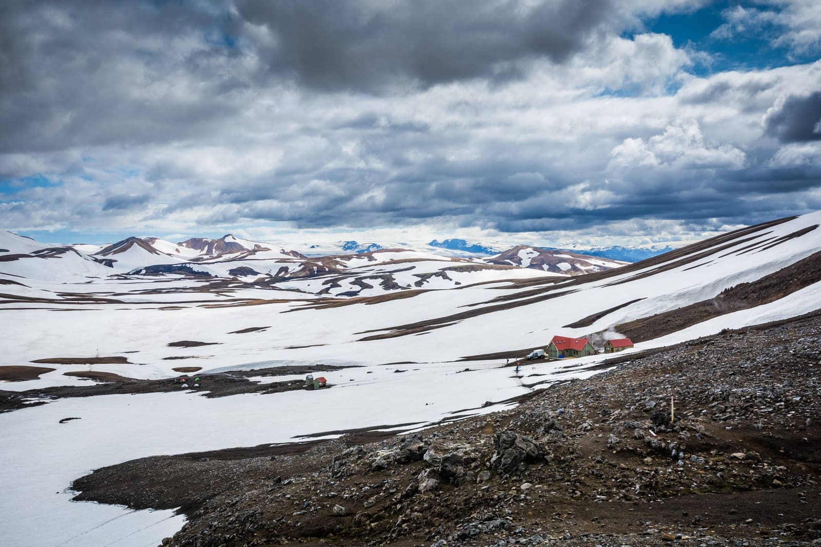
Hrafntinnusker is a remote Laugavegur Trail mountain and hut area for experienced hikers who want obsidian slopes, geothermal steam, snow patches, and a realistic sense of where it fits between Landmannalaugar and Álftavatn.
Access reality
Hrafntinnusker belongs in plans built around the Laugavegur Trail, not in casual sightseeing routes that only touch the Highlands from the edge.
The place is most useful to travelers who are already thinking beyond a simple Landmannalaugar stop. Hrafntinnusker is the mountain and hut area that gives the first stage of the Laugavegur a harsher, higher, more weather-exposed character.
Build it into the trip when the group wants a real highland trekking objective and has room for hut logistics, weather checks, and slower terrain. Leave it out when the plan is mainly a South Coast drive with one ambitious Highlands idea added late.
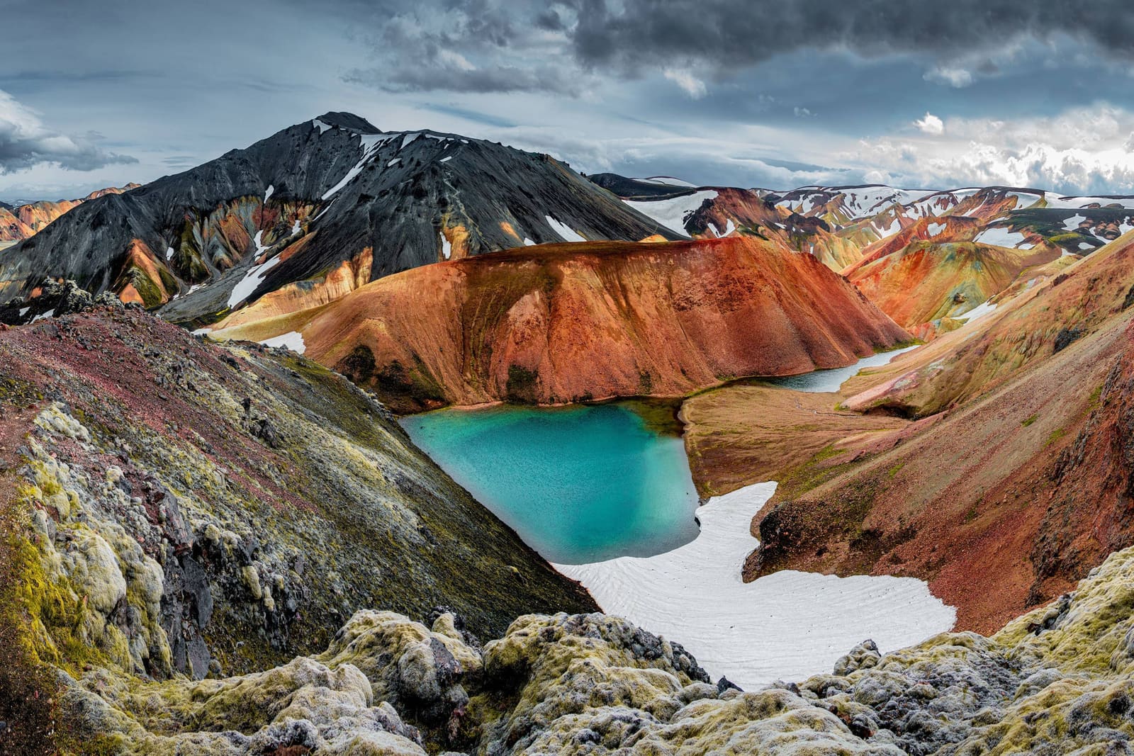
The appeal is sharp, austere, and very different from the warm colors near Landmannalaugar: black obsidian, pale snow, steam, and open wind.
Hrafntinnusker is named for obsidian, and that matters visually. The ground can feel dark and glassy in places, with geothermal steam and snow patches making the landscape look unfinished, raw, and less forgiving than the lower valley.
This is not a tidy mountain viewpoint. The visit feels like moving through a high, active volcanic area where weather, visibility, footing, and route confidence shape the memory as much as the scenery.
Use Hrafntinnusker when you want the remote Laugavegur character; use nearby Landmannalaugar hikes when you want a shorter mountain day.
Brennisteinsalda and Bláhnjúkur are easier comparison points for many travelers because they sit close to Landmannalaugar and offer strong color, steam, and views without turning the day into a hut-to-hut route.
Hrafntinnusker adds a different kind of value. It makes sense when the route itself is the attraction: the climb away from Landmannalaugar, the exposed plateau feeling, and the sense that the Laugavegur has moved beyond a day-hike sampler.
The map distance is less important than the full highland context: trail conditions, hut plans, weather, road access, daylight, and group capability.
Most visitors should think of Hrafntinnusker as part of a trekking day rather than a timed attraction stop. The practical question is not how long to stand there; it is whether the route, hut plan, vehicle access, and weather window make the day responsible.
The best pairings are close, highland-specific, and honest about effort. This is not a place to stack with every famous South Coast stop.
Start with Landmannalaugar, then compare Fjallabak, Frostastaðavatn, and Torfajökull if your plan is already focused on the central Highlands. These links keep the decision inside the same landscape system.
For classic first-trip sightseeing, Hrafntinnusker is usually the wrong level of commitment. It belongs in a hiking-led Highlands plan, not as a scenic bonus after waterfalls, beaches, and long driving.
Use official and specialist sources before making Hrafntinnusker a fixed part of the trip.
Confirm hut and trail details with FÍ, then check protected-area guidance, road conditions, weather warnings, and SafeTravel advice. Facilities, access, and route comfort can vary with season, staffing, maintenance, snow, and storms.
Use for hut and route-planning context.
Use for protected-area visitor guidance.
Use before relying on highland access.
Use with SafeTravel for exposed-route checks.
By ThorPublished Updated
Map
Use nearby places and useful bases before opening directions.
Interactive planning map for Hrafntinnusker Mountain Peak
Interactive map
Place context and external map links remain available without loading it.
Access context
Use nearby places only after road, season, vehicle, and safety realities make the route sensible.
Planning context
Open the region or practical guide that resolves the next planning decision.
Next step
Use the next page that helps turn this stop into a practical route decision.