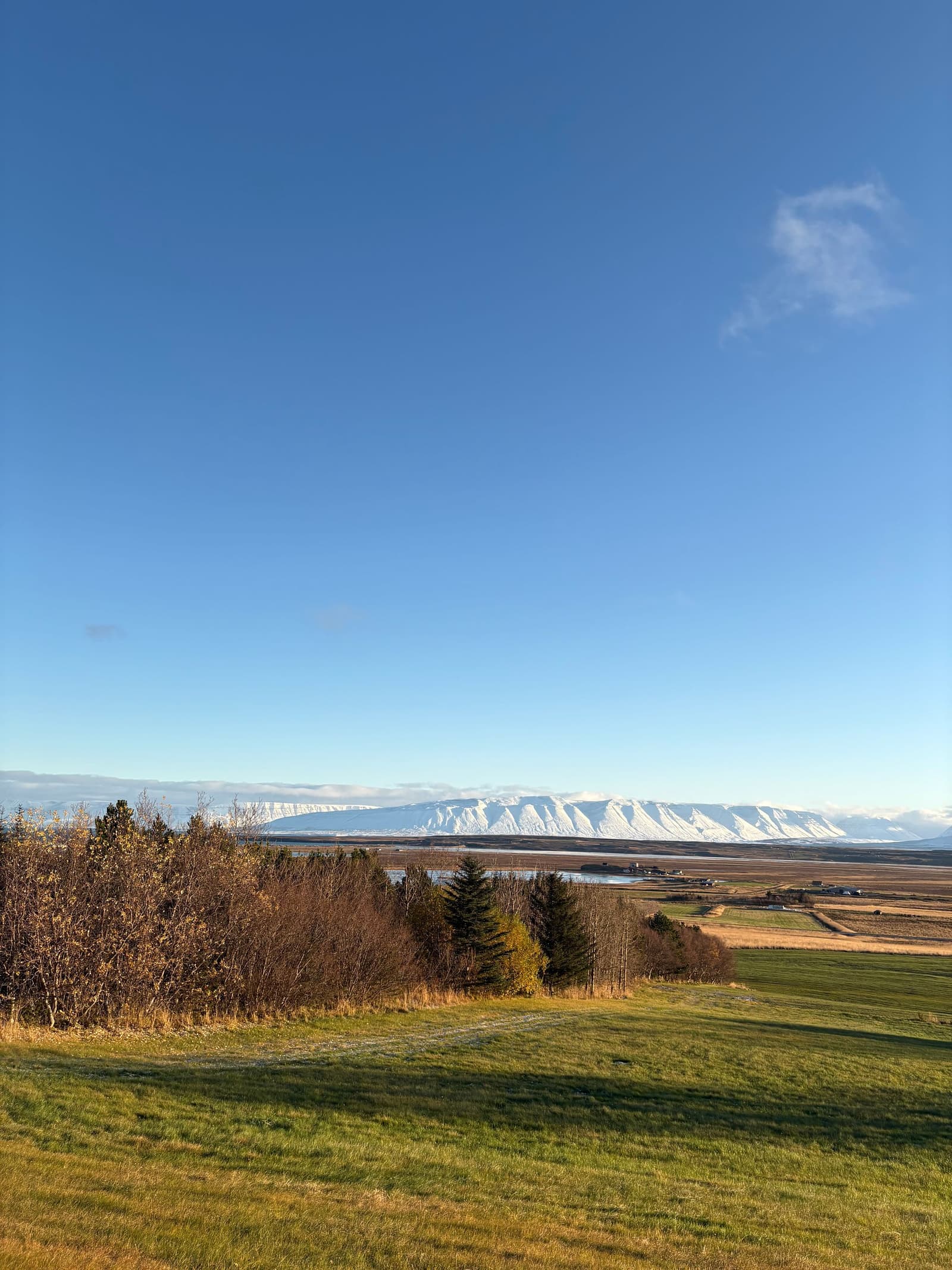
Tröllaskagi is a mountainous North Iceland peninsula for slower self-drive routes, fjord towns, and Arctic Coast Way texture, best when you have weather margin and time beyond the main Ring Road highlights.
Short stop snapshot
Type
Mountain and fjord peninsula
Region
North Iceland
Route context
Arctic Coast Way side loop between Eyjafjörður and Skagafjörður
Typical time
Half day to a full day for a meaningful scenic loop
Is Tröllaskagi worth adding to a North Iceland route?
Yes, if your North Iceland plan has room for a slower fjord-and-mountain loop. Tröllaskagi is less useful when the trip only has time for the obvious Ring Road anchors.
The peninsula is the kind of place that rewards margin. It gives North Iceland a rougher coastal mood: narrow fjords, steep mountain walls, fishing towns, winter-shadowed valleys, and long views across the Arctic-facing water.
Add Tröllaskagi for a repeat visitor, a photographer, or a self-driver who already has a real North Iceland base. Cut it from a compressed first trip where Goðafoss, Lake Mývatn, Dettifoss, and a practical overnight already fill the available time.
Photo guide
Tröllaskagi Peninsula in photos
1 / 2
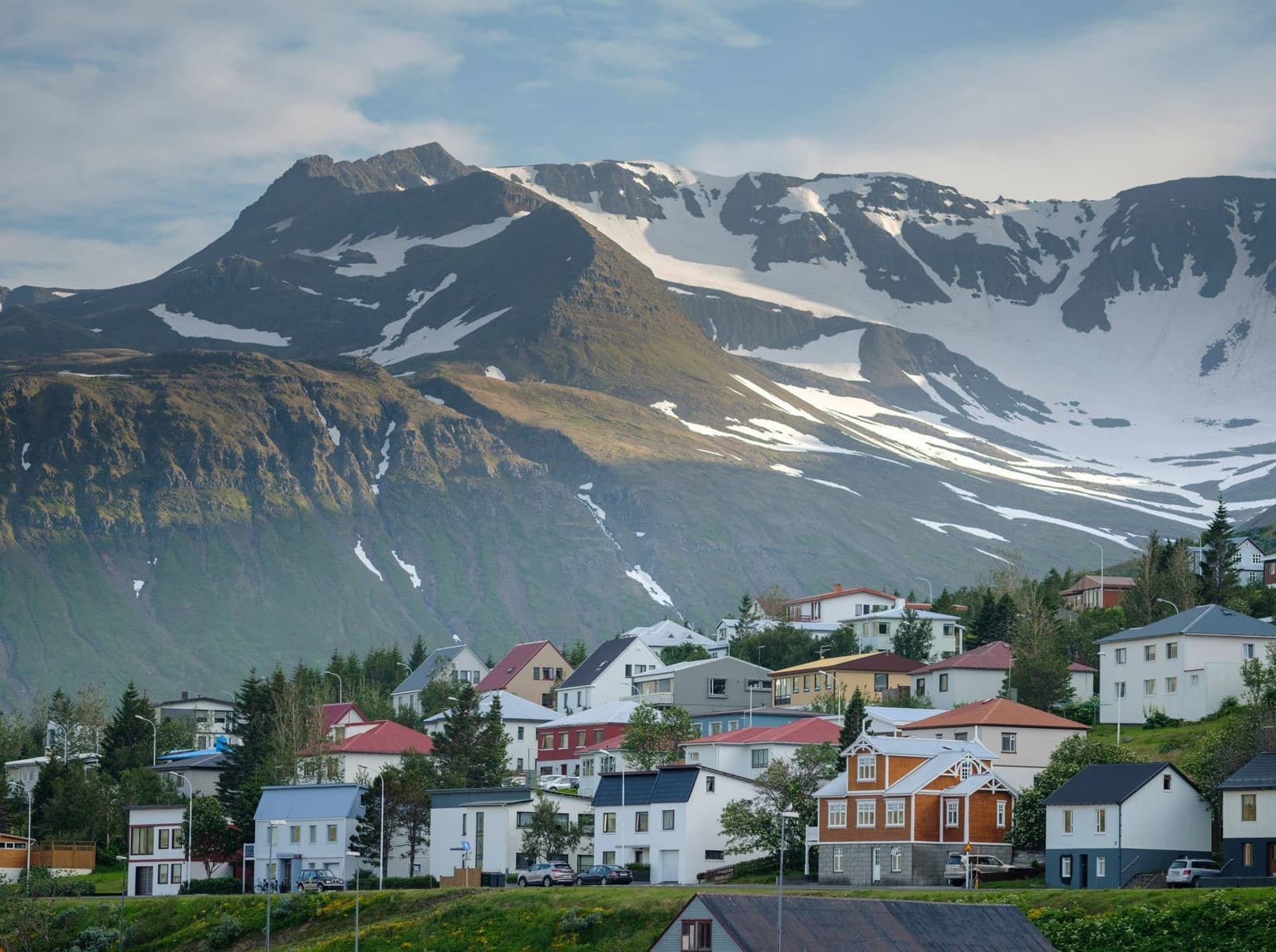
Dalvík and its mountain backdrop make the route practical at card size.
What does the peninsula feel like on the road?
Tröllaskagi feels more like a sequence of fjord scenes than one viewpoint. The reward is the changing drive: mountain shoulders, water, harbor towns, tunnels, and sudden pockets of quiet.
The eastern side connects naturally with Dalvík and Eyjafjörður, where the road feels close to farms, harbor life, and steep hillsides. Farther around the peninsula, the mood becomes more exposed and northern, especially near Siglufjörður and the coast toward Skagafjörður.
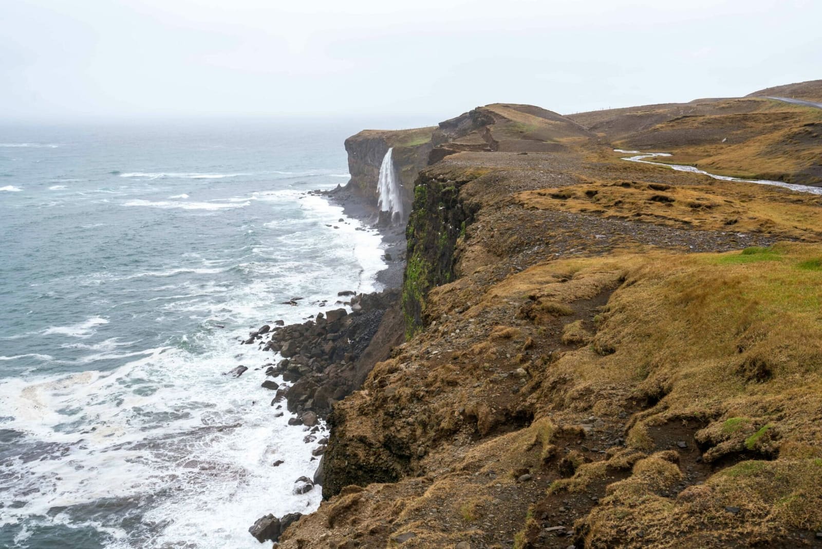
The north-coast edge gives Tröllaskagi its exposed, Arctic Coast Way character.
Do not expect a polished attraction sequence where every pause is a formal viewpoint. Much of the appeal is the road texture itself: stopping only where it is safe, slowing for weather, and letting the towns carry part of the visit.
How much time should Tröllaskagi get?
A rushed pass can feel underwhelming, because the peninsula works through accumulation. A half day gives you a taste; a full day lets the route breathe.
Tröllaskagi timing guide
Visit style
Time to allow
Best use
Taste of the peninsula
Half day
Dalvík, one or two scenic pauses, and a limited loop section.
Normal scenic loop
Most of a day
A slower sequence with Dalvík, Siglufjörður or Hofsós-side context, and room for weather.
Photography or repeat visit
Full day or more
Waiting for light, exploring towns, and choosing side stops without rushing.
Winter or marginal weather
Flexible
Let road, wind, visibility, and daylight set the limit.
If the drive is just a way to get somewhere else, Tröllaskagi may not pay back the time. If the peninsula is the point of the day, it can become one of the strongest North Iceland memories precisely because it is slower.
How to pair Tröllaskagi with Dalvík, Hofsós, and Skagafjörður
The easiest way to make Tröllaskagi useful is to anchor it with real places. Dalvík gives the eastern side a practical harbor stop, while Hofsós and Skagafjörður help the route continue west.
Use Dalvík when you want the peninsula to feel grounded rather than abstract. It gives you a town, harbor, mountain backdrop, and a natural pause before deciding whether to continue around the loop.
Dalvík makes the peninsula more practical because it turns the scenery into a usable stop.
Hofsós and Skagafjörður work better when you are moving west or building a broader north-coast day. They shift the route from fjord-wall drama into a more open coastal and farming landscape.
Shorter loop: pair Tröllaskagi with Dalvík and one scenic town or coastal pause.
Westbound day: let Hofsós and Skagafjörður become the handoff after the peninsula.
Longer North Iceland plan: use Tröllaskagi as the quiet contrast to Goðafoss, Mývatn, and Dettifoss.
When to choose Tröllaskagi over Mývatn or the Diamond Circle
Choose Tröllaskagi when your trip needs fjords, coastal towns, and mountain-road atmosphere. Choose Mývatn or the Diamond Circle when the priority is geothermal landscapes, waterfalls, and headline natural sights.
For many first-time visitors, Lake Mývatn, Goðafoss, Dettifoss, and the Húsavík side of North Iceland are easier to justify. They deliver clear stop-by-stop rewards and fit better into a standard Ring Road structure.
Tröllaskagi is stronger when you have already accepted a slower north. It is not trying to out-muscle Dettifoss or replace Mývatn. Its value is the feeling of moving through a less hurried coast where the scenery, towns, and weather all shape the day.
Good reasons to choose the peninsula
You want
Fjords, mountain roads, coastal towns, and a quieter North Iceland rhythm.
You can spare
A half day or more without weakening the rest of the route.
You should skip
When the day already depends on perfect timing around Mývatn, Dettifoss, or a long drive south.
What weather and road checks matter before the loop?
Road and weather checks matter more here than on a simple town stop. Tröllaskagi roads can feel exposed, and winter or shoulder-season plans need enough flexibility to turn around or simplify the day.
Use Umferðin for road conditions, the Icelandic Meteorological Office for weather and warnings, and SafeTravel for safety guidance before treating the loop as fixed. This is especially important if you are linking the peninsula with Hofsós, Skagafjörður, Akureyri, Mývatn, or a long onward drive.
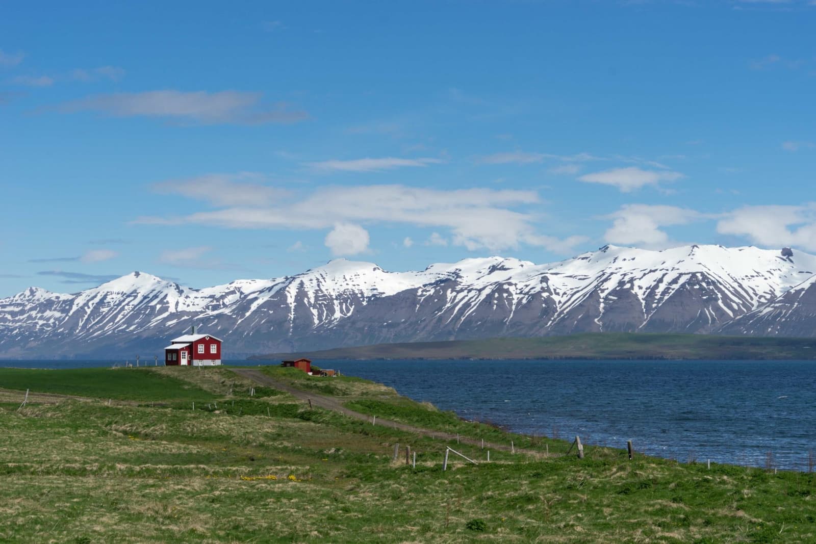
Winter scenery can be beautiful, but road comfort and visibility should decide the plan.
Travel conditions, safety guidance, alerts, and travel-plan tools.
Tröllaskagi FAQ
These are the questions that usually decide whether the peninsula belongs in a real route.
Is Tröllaskagi a must-see on a first Iceland trip?
No, not for most compressed first trips. It is best for travelers who have enough North Iceland time to slow down beyond the main Ring Road highlights.
Can Tröllaskagi work as a day trip from Akureyri?
Yes, it can work when roads, weather, daylight, and your pace line up. Keep the route flexible and avoid stacking too many distant stops into the same day.
What is the best part of Tröllaskagi for a short visit?
For many travelers, the Dalvík and fjord-side approach gives the clearest short taste. Continue farther only if the day has room for slower coastal driving.
Should I choose Tröllaskagi or Lake Mývatn?
Choose Lake Mývatn for geothermal sights and classic North Iceland stop value. Choose Tröllaskagi when fjord roads, towns, and quieter coastal scenery are the priority.
Map
See where this stop sits
Use nearby places and useful bases before opening directions.
Region
North Iceland
Works well with
Arctic Coast Way / Ring Road
Useful base
Sauðárkrókur
Interactive planning map for Tröllaskagi Peninsula
Interactive map
Load the map when you need it
Place context and external map links remain available without loading it.
Nearby places
Decide what else is close enough
Use nearby places to keep a short stop useful without inflating it into the center of the day.
Use Tröllaskagi only when it improves the shape of your North Iceland day. The next step is choosing a concrete town, fjord, or regional plan around it.