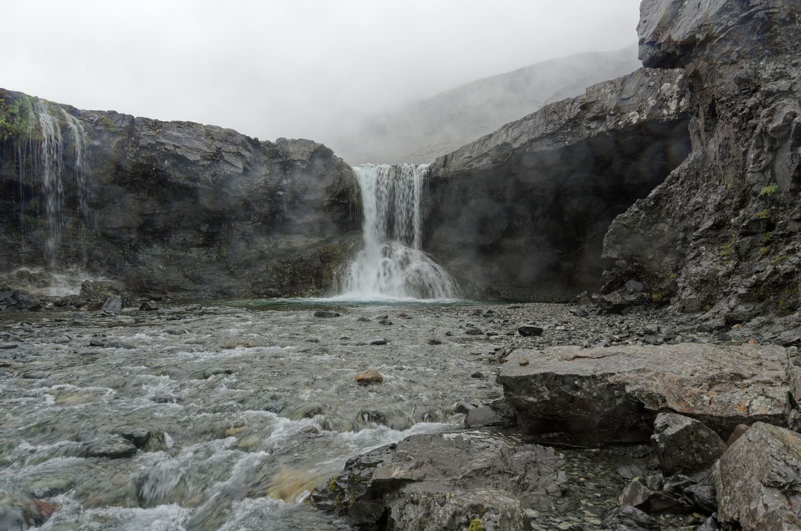
Skútafoss is a small waterfall on the Þorgeirsstaðaá river east of Höfn, with a shallow cave beside the falls. Its rough approach and slippery, exposed viewpoints make it a short walk to keep flexible within a Vestrahorn or Eastfjords driving day.
Waterfall facts
Type
Small cave-framed waterfall
Region
East Iceland, Hornafjörður area near Höfn
Route context
Short side stop near the Vestrahorn and Eystrahorn stretch of the Ring Road
Time to allow
Allow about 30–60 minutes; rough access can take longer
Best experience
A flexible stop when visibility, daylight, and ground conditions make the cave view worth the effort
In this guide
Skútafoss and the cave beside Þorgeirsstaðaá
Skútafoss drops beside a shallow rock cave in Þorgeirsstaðadalur, east of Höfn. The cave and smaller nearby falls give this quiet river valley its distinctive close-up views.
The main fall is about six meters high. A bend in the river partly hides it on the approach, while the rock overhang frames the water at close range. It is a small landscape detail within the Hornafjörður stretch between glacier-lagoon country and the Eastfjords.
Local information on the river, waterfall scale, short walk and exposed ground. Check conditions independently before visiting.
What makes the cave-framed waterfall memorable?
The waterfall is small, but the setting does the work: water, rock, cave-like framing, and a tucked-away valley feel.
Skútafoss is a small fall with neighboring cascades, rather than a thundering landmark. Its shallow cave and overhang create contrasting views of the water. Choose a stable viewpoint with firm footing; the cave roof and waterfall edge are exposed.
That makes it especially appealing for photographers and slower self-drivers. It is not about ticking off one more famous Iceland sight; it is about getting a quiet, textured scene where the rock, river, and waterfall sit close together.
In cold conditions the same cave-like framing becomes more dramatic, but winter images should not be treated as access promises.
How Skútafoss fits between Vestrahorn and Eystrahorn
Use Skútafoss as a small stop in the Hornafjörður corridor, especially when Vestrahorn, Stokksnes, Höfn, or Eystrahorn already shape the day.
The cleanest planning frame is the stretch around Hornafjörður. Westbound, Skútafoss can sit after Eystrahorn or Hvalnes Lighthouse before you settle around Höfn. Eastbound, it can work after Höfn and before the more open fjord-road rhythm begins.
If you only have one extra scenic stop near Höfn, choose the stronger anchor first. Vestrahorn and Stokksnes usually carry more route value because they define the mountain-and-black-sand landscape. Skútafoss is the add-on when you still want a quieter waterfall detail nearby.
A wider winter view shows why Skútafoss belongs to the same scenic corridor as the nearby mountain stops.
How much time and effort should you allow?
Allow roughly 30–60 minutes for a short visit once you have found suitable parking. This is a planning allowance, with extra time needed if you park farther back, take photos, or turn around on the approach track.
Local accounts describe roughly half a kilometer of walking to Skútafoss, but the distance depends on where you can safely leave the car. The unpaved approach can be coarse and bumpy. A small waterfall pin on a map does not establish a drivable route or a parking space.
Follow local access signs and use a permitted parking place clear of the road and track. Do not force a low-clearance car or camper farther along a rough section. If there is no suitable place to leave the vehicle, keep driving rather than stop on the Route 1 shoulder.
Skútafoss planning decision
Situation
Best decision
Why
You are based in Höfn or already stopping at Vestrahorn
Add Skútafoss as a flexible short stop
The small detour fits the same local route corridor.
You are driving a long glacier-lagoon to Eastfjords transfer
Keep Skútafoss optional
A small stop can still disrupt daylight and arrival timing.
The track is rough, icy, muddy, or visibility is poor
Skip or turn around early
The waterfall is not worth forcing a marginal access decision.
The small scale and nearby falls explain why the visit works best as a careful short stop, not a major hike.
Access, weather, and footing checks before you go
The main risk is over-treating a small waterfall as effortless. Check the driving context, then stay conservative around wet rock, slopes, and the upper views.
Wear grippy footwear and keep to the existing walking approach. Wet rock, soft ground and the exposed upper edge deserve more caution than the waterfall’s small size suggests. Stay back from drops and keep children close.
Winter photographs show the setting, not a safe route. Stay away from hanging icicles, frozen overhangs and ice at the water’s edge. Turn back when snow or ice hides the footing; a cave view is not worth entering an unstable or slippery area.
Winter and wet-ground context should push Skútafoss into the optional column until road, weather, and footing checks make sense.
What to pair with Skútafoss around Hornafjörður
Pair it with nearby route anchors, not with a long list of small extras. The best day still has a clear main reason to pause in this part of southeast Iceland.
For most travelers, that main reason is Vestrahorn, Stokksnes, Höfn, or the broader Hornafjörður base decision. Skútafoss then becomes the quieter waterfall detail that fills a gap between bigger landscapes.
If you are continuing east, compare the stop with Eystrahorn and Hvalnes Lighthouse before adding everything. If you are still deciding how far your itinerary should push beyond the South Coast, use Ring Road or South Coast? before turning a short stop into route pressure.
Best scenic anchor nearby: Vestrahorn and Stokksnes.
Best practical base nearby: Höfn.
Best eastbound continuation: Eystrahorn and Hvalnes Lighthouse.
Best broader handoff: the Eastfjords when you have time for the fjord-road rhythm.
Check visitor safety alerts and travel-condition guidance before leaving the main plan.
Map
See where this stop sits
The pin marks Skútafoss waterfall, not a verified parking area. The final approach is on foot; check the local track and permitted parking before leaving Route 1.
Region
East Iceland
Works well with
Ring Road
Useful base
Höfn
Interactive planning map for Skútafoss Waterfall
Interactive map
Load the map when you need it
Place context and external map links remain available without loading it.
Planning context
Use the wider destination guides
Open the region or practical guide that resolves the next planning decision.