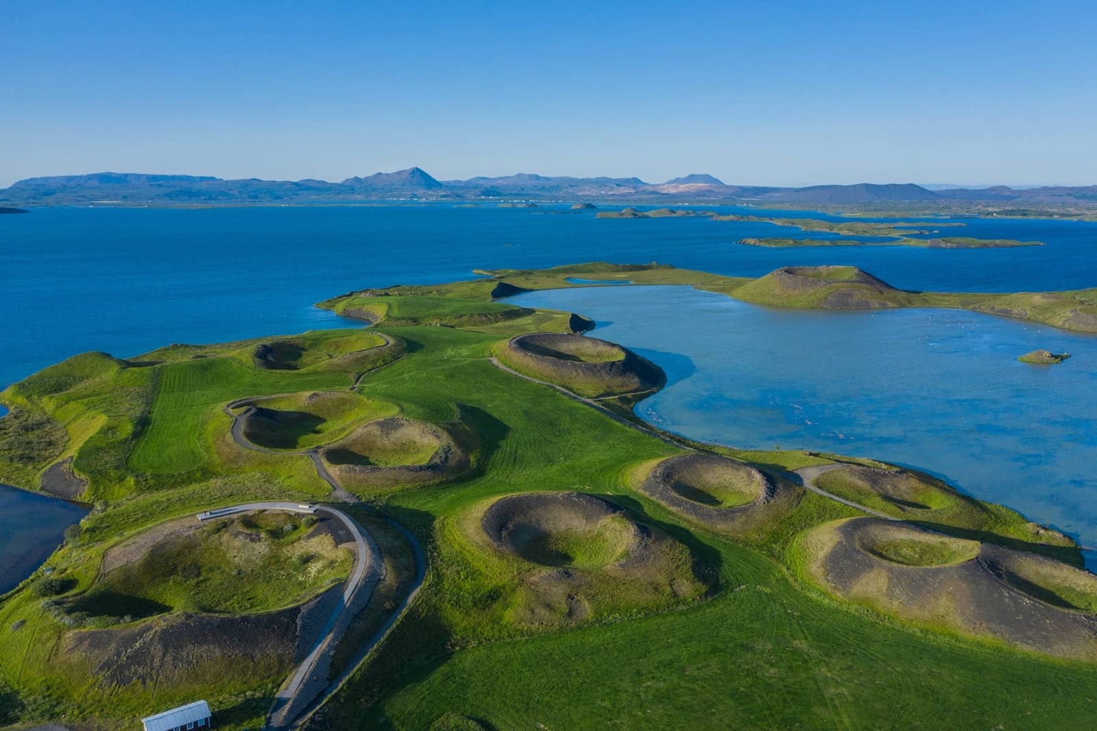
Geology snapshot
- Type
- Geothermal name and place guide
- Region
- Mývatn area, North Iceland
- Main stop
- Hverir below Námafjall
- Best for
- Short geothermal route context
- Nearby
- Námaskarð, Mývatn, Krafla
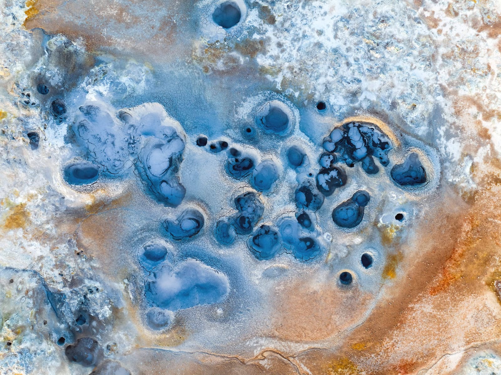
Námafjall Geothermal Area helps Mývatn travelers decode the names around Hverir, Námaskarð, and the geothermal field, then decide whether a short, safety-aware stop fits the route without duplicating nearby pages.
Geology snapshot
Námafjall Geothermal Area is useful as a traveler name, but the place most visitors walk through is Hverir or Hverarönd below the Námafjall ridge, near Námaskarð and Lake Mývatn.
That name clarity matters before you navigate. If your map, tour note, or image caption says Námafjall, it usually points you toward the same geothermal field covered by Hverir Geothermal Area. Námaskarð is the nearby pass and road setting, while Námafjall gives the mountain backdrop.
The honest judgement: stop here if you are already in the Mývatn area and want a vivid, compact look at steam, mud pools, sulfur colors, and active ground. Do not treat it as a separate half-day attraction if Hverir is already in your plan.
The attraction is raw geothermal ground rather than a polished viewpoint: steam plumes, bubbling mud, sulfur-stained slopes, sparse vegetation, and marked visitor routes across an exposed field.
Visit North Iceland describes hot springs, fumaroles, mud pools, mud pots, solfataras, colorful minerals, and acidic ground around Námaskarð and Námafjall. That is the visual reason the stop works even when you only have a short amount of time.
The scene can also feel harsh. Sulfur fumes, wind, steam, mud, and bare ground are part of the experience. Travelers sensitive to fumes, families with children who cannot stay close, or anyone expecting a calm spa-like stop should plan conservatively.
This is high-temperature geothermal terrain. The safest and most useful visit is the one that respects the marked paths, ropes, signs, and current conditions.
Visit Mývatn tells visitors to stay on the track and not cross trail lines at Hverir east of Námafjall, noting that people have sustained serious burns near boiling soil. Treat those lines as the route, not as an obstacle between you and a better photo.
Námafjall works best as one geothermal decision inside the Mývatn cluster, not as a second checklist item beside Hverir.
For a compact day, pair the stop with Lake Mývatn, Dimmuborgir, Grjótagjá, and Hverfjall. For a stronger volcanic day, add Krafla or Leirhnjúkur only when roads, weather, and timing allow.
| Plan shape | Use it for | Keep flexible |
|---|---|---|
| Quick Ring Road stop | Steam, mud, and name clarity | Road, wind, and visibility |
| Mývatn cluster | Hverir plus lake, lava, and crater stops | Do not repeat the same geothermal stop twice |
| Volcanic focus | Námafjall with Krafla or Leirhnjúkur | Trail conditions and daylight |
A larger North Iceland day can continue toward Dettifoss, but that only makes sense when the driving plan still has space for road checks, weather, and unhurried stops. Cut the smaller repeat stop before cutting the anchor sight.
In traveler planning, it usually points to the same compact area. Námafjall is the mountain setting, while Hverir or Hverarönd is the geothermal field most visitors walk around.
No. This is a geothermal viewing area with hot, unstable ground. Use managed bathing facilities elsewhere if you want a soak, and confirm operator details before going.
Not as a separate attraction. Use this page to understand the name overlap, then give your time to the actual Hverir field and nearby Mývatn route choices.
By ThorPublished Updated
Map
Use nearby places and useful bases before opening directions.
Interactive planning map for Námafjall Geothermal Area
Interactive map
Place context and external map links remain available without loading it.
Planning context
Open the region or practical guide that resolves the next planning decision.
Next step
Use the next page that helps turn this stop into a practical route decision.