
Geology snapshot
- Feature
- Circular tephra crater
- Age
- Formed about 2,500 years ago
- Diameter
- About 1,000 m across at the rim
- Northwest climb
- 600 m; official estimate 10–25 minutes
- Rim circuit
- 3.2 km; about 1 hour
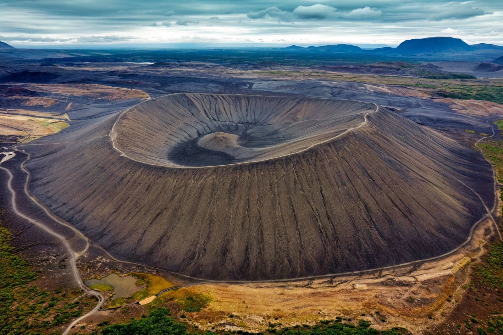
Hverfjall, also called Hverfell, is a broad black tephra crater beside Lake Mývatn. Two marked paths reach its exposed rim, where a 3.2-kilometer circuit looks across the crater and the surrounding volcanic landscape.
Geology snapshot
Hverfjall and Hverfell are two names for the same crater east of Lake Mývatn. Its dark ring is one of the clearest volcanic shapes in the area.
The crater formed in an explosive eruption about 2,500 years ago. Layers of volcanic ash and rock fragments built a steep circular rim around a wide central bowl. The top is roughly 1,000 meters across, so its scale is easier to understand from the air or after you reach the rim than from the road below.
Hverfjall has been protected since 2011. Foot traffic can quickly damage the loose tephra and leave marks that remain visible for years, which is why visitors must use the two marked ascent paths and the marked rim route.
Official geology, protection, access and walking-route information.
The northwest path is the shorter and easier approach. The southern path is the same length but steeper and more difficult.
From the northwest, the marked climb is about 600 meters long and the official estimate is 10–25 minutes. The southern path is also about 600 meters, but its steeper terrain has an official estimate of 30–45 minutes. These are ascent times in suitable conditions, not the length of the full visit.
Both climbs are exposed, with little shelter from wind. Volcanic gravel can feel loose underfoot, while snow and ice make the slope more demanding. Return by a marked path rather than cutting across the crater wall, even if an unofficial line looks shorter.
The marked circuit around the rim is 3.2 kilometers and takes about one hour in good conditions, according to the protected-area guidance.
You do not need to complete the whole circuit to see into the crater. Reaching the rim already reveals the broad bowl and opens views across the Mývatn landscape. Continue only while the wind, visibility and footing remain comfortable, and leave enough time to descend by one of the marked paths.
From the top, Lake Mývatn and the surrounding lava fields give the crater its wider setting. Dimmuborgir, southwest of Hverfjall, shows another side of the region's volcanic history: irregular lava formations rather than a symmetrical tephra ring.
The official protected-area page describes the gravel access road as rough but generally passable for passenger cars in summer. In winter it can become impassable.
Do not assume that proximity to the Ring Road makes the final approach dependable in every season. Check current road conditions before turning toward the crater, and be prepared to leave Hverfjall out if snow, ice or the access road makes the visit uncertain.
Weather matters on the walk as well as the drive. Strong wind can make the rim uncomfortable, while cloud or blowing snow can hide the view and make the route harder to read. Use the Icelandic Meteorological Office for forecasts and warnings and SafeTravel for current alerts.
Current road conditions for the Mývatn area and the journey to the crater.
Forecasts and warnings for the exposed climb and rim.
Current travel alerts and condition information in Iceland.
By ThorPublished Updated