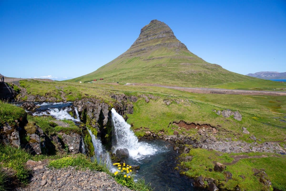
Kirkjufell is the steep, isolated mountain beside Grundarfjörður that forms one of Snæfellsnes's clearest landmarks. Most visitors come for the view, not to climb it, and stay only as long as visibility rewards them.
Short stop snapshot
Landscape
Steep coastal mountain beside Grundarfjörður
Classic view
Kirkjufell behind Kirkjufellsfoss
Allow
About 30 to 60 minutes
Normal visit
Viewpoint paths and photographs, not a mountain ascent
Main variable
Cloud, wind and winter ice can change the experience quickly
In this guide
A mountain whose shape changes as you move
Kirkjufell rises alone beside Grundarfjörður, with steep green or snow-covered slopes narrowing towards a layered summit. Its isolated position makes it easy to recognize, but not visually fixed.
From one angle it forms a near-symmetrical cone; from another it looks broader and more sharply ridged. The town, bay and neighbouring slopes provide scale. This changing profile is a better reason to pause than the idea of recreating one exact photograph.
Glaciers shaped the mountain during the Ice Age, cutting around its harder rock and leaving the isolated form seen today. The local municipality treats it as the landmark of Grundarfjörður, where ordinary streets and the harbour give a less staged view than the famous waterfall foreground.
Local context for Kirkjufell, its glacial shaping and its position beside the town.
Kirkjufellsfoss creates the classic foreground
The familiar composition looks across the small waterfall towards Kirkjufell. It is compact, easy to understand and often shared with other photographers.
Allow about 30 to 60 minutes to use the established paths, see how the mountain aligns with the falls and move without crowding other visitors. Extra time is useful only when you are deliberately waiting for cloud or light to shift.
Cloud can cover the summit quickly, while views from town reveal the mountain in a wider coastal setting.
Stay on the visitor paths, respect barriers and do not enter fragile or slippery ground to separate yourself from the crowd. Parking and pedestrian arrangements can change, so current signs should override older photographs and directions.
Local information about the mountain, waterfall and viewpoint area.
The viewpoint and the mountain are separate decisions
For an ordinary sightseeing visit, Kirkjufell is a mountain to look at. Its steep slopes and exposed upper ground belong to a different level of decision-making from the paths around Kirkjufellsfoss.
From Grundarfjörður, Kirkjufell is part of the everyday town and harbour landscape.Winter ice changes even the lower viewpoint paths; it is not an invitation to move onto the mountain.
Cloud, strong wind and ice can also make the lower visit less useful. Check weather and Road 54 conditions before setting out, then shorten the visit if the summit is hidden or footing is poor. A famous viewpoint is optional when the conditions are wrong.
Kirkjufell does not need a long list of additions. Its useful context is the contrast between the settled north coast and the wilder outer peninsula.
Lóndrangar provides that contrast with sea cliffs and rock pinnacles farther west. Stykkishólmur offers a town-and-harbour alternative when exposed viewpoints are less appealing. Choose according to visibility and the experience you want, rather than trying to collect every well-known name.
Still water and low light can transform the mountain, but neither can be scheduled or guaranteed.