Hvannfell helps travelers decode a North Iceland mountain name that appears around Lofthellir cave access, then decide whether it matters as route context, a photo landmark, or a specialist outdoor target.
Geology snapshot
Type
Mountain landmark and cave-route context
Region
Mývatn area, North Iceland
Best for
Lofthellir orientation and specialist route planning
Role
Access landmark, not a classic attraction
Nearby
Lofthellir, Mývatn, Hverfjall, Dimmuborgir
In this guide
Hvannfell is a Lofthellir landmark, not a normal stop
Hvannfell is a mountain name travelers may meet while researching Lofthellir cave east of Lake Mývatn. For most visitors, it is useful route context rather than a separate must-see attraction.
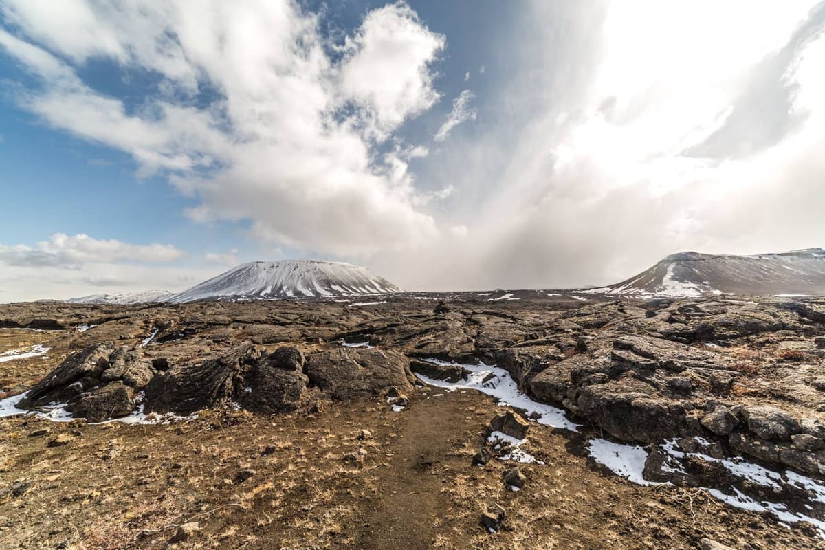
This matters because the name can look like another attraction to add to a Mývatn day. In practice, Hvannfell is most useful for understanding where the rough lava-field approach to Lofthellir begins and why guided cave tours describe the mountain.
If you are not going to Lofthellir, Hvannfell rarely deserves priority over clearer nearby stops. Lake Mývatn, Hverfjall, Dimmuborgir, Grjótagjá, Hverir, and Krafla usually give first-time travelers more accessible volcanic context.
The cave matters more than the summit for most travelers
Lofthellir is the practical reason Hvannfell appears in travel planning: tours describe reaching the roots of the mountain, then walking across lava toward the cave.
Operator information for Lofthellir describes a rugged route from the Lake Mývatn area, passing Hverfjall and the Lúdentarborgir crater row before reaching the Hvannfell area. The cave visit itself is guided, cold, dark, physically awkward in places, and not suitable for every traveler.
That makes Hvannfell a decision filter. If your group is uncomfortable with crawling, tight spaces, uneven lava, ice, cold conditions, or access that depends on current road and operator judgement, use the mountain name as a warning to choose a simpler Mývatn day.
Lofthellir is the reason many travelers encounter Hvannfell; cave access should be handled through current guided information.
Confirm the current operator details before relying on cave access.
Treat the lava-field approach as part of the effort, not just a transfer.
Keep weather, road status, and group fitness in the same decision.
When Hvannfell belongs in a Mývatn day
Hvannfell belongs in a real itinerary when the day is already shaped around Lofthellir or specialist volcanic terrain. Otherwise, it works best as background while you choose stronger Mývatn stops.
Remote tracks and exposed lava terrain can lose value quickly
Geology-focused repeat visit
Use it as a specialist landscape clue
It connects the cave, crater rows, and volcanic setting
For a normal self-drive day, the best sequence is to decide the Mývatn anchor first. If the anchor is the guided cave, Hvannfell has a clear role. If the anchor is scenery, walking, steam, or bathing, the mountain can stay as context while the better-known stops carry the day.
For non-cavers, the nearby Mývatn and Hverfjall area usually offers clearer, easier sightseeing value than Hvannfell itself.
What to check before treating the area as accessible
Do not treat Hvannfell, Lofthellir, or the nearby rough tracks as fixed-access attractions. Conditions, operator decisions, roads, and weather can change the plan.
Check the cave operator for current access, equipment, age or fitness guidance, cancellation risk, and meeting arrangements. Check official road information before driving away from the main Mývatn roads, and use the Icelandic Met Office plus SafeTravel for weather warnings and travel-condition context.
This is especially important outside settled summer conditions, but it is not only a winter issue. North Iceland weather, visibility, wet lava, soft tracks, and tour logistics can all change whether the stop is useful.
Official checks and useful references
Use these sources to verify the practical details that should not be frozen into a travel page.
[Geo Travel Lofthellir tour information](https://geotravel.is/tour/ice-cave-tour/) for guided access, fit, equipment, and cancellation context.
[Guide to Iceland Lofthellir information](https://guidetoiceland.is/travel-iceland/drive/lofthellir) for nearby place context around Hvannfell and Mývatn.
[Umferðin road conditions](https://umferdin.is/en) before relying on local driving conditions.
[Icelandic Met Office forecasts](https://en.vedur.is/) and [SafeTravel](https://safetravel.is/) before exposed or remote travel.