Eiríksjökull is a glacier-capped table mountain between West Iceland and the Highlands, worth adding only when rougher inland access, weather, and extra time support a scenic detour rather than a simple roadside stop.
Quick guide
Type
Glacier-capped table mountain and volcanic landscape
Region
Highlands edge, inland from West Iceland and Borgarfjörður
Route context
Best as a flexible inland detour or landscape anchor, not a quick paved-road attraction
Time to allow
Allow a half day or more if you are driving inland, stopping for views, and keeping backup options
Best experience
Clear-weather views across lava, gravel tracks, cliffs, and the broad white ice cap
Access reality
Road, weather, daylight, and vehicle suitability should decide the plan before the scenery does
Nearby pairings
Surtshellir, Hraunfossar, Barnafoss, Kerlingarfjoll, and wider Highlands planning
Current checks
Use official road, weather, and safety sources before relying on any inland approach
Is Eiríksjökull worth the detour?
Yes, Eiríksjökull can be worth the detour if you want a remote glacier-and-volcano landscape and your route already has space for inland driving. It is weak as a casual add-on because the reward depends heavily on visibility, access, and patience.
Go if you are already shaping a West Iceland or Highlands day around big landscapes, rougher roads, and flexible timing. Skip it if you need a quick, reliable stop between easier places, because Hraunfossar, Barnafoss, or Surtshellir usually give a clearer payoff with less uncertainty.
A local Iceland travel editor would add Eiríksjökull for a summer self-drive route with extra time around Borgarfjörður, Hallmundarhraun, or the Highlands edge. They would skip it for a first-trip sightseeing loop, poor visibility, tight daylight, or any group that expects services and marked paths.
Use Eiríksjökull only when the conditions support the kind of visit you want.
Choice
Good fit
Weak fit
Quick look
Clear weather and a route already passing inland
A long out-and-back drive just to collect another stop
Balanced detour
Half-day flexibility with Surtshellir or Borgarfjörður as backup
A packed day where one delay breaks the plan
Mountain objective
Specialist planning, equipment, and conservative conditions
Casual glacier curiosity or unplanned off-road exploring
Worth the stop?
When this stop makes sense
Good match for
flexible self-drivers already exploring Borgarfjörður or Highlands-edge roads
travelers who want a distant glacier and table-mountain landscape rather than a built attraction
photographers and geology-minded travelers with weather patience
summer trips with enough time to check roads, daylight, and backup stops
Think twice if
first-time visitors trying to keep a simple South Coast or Golden Circle pace
travelers expecting a marked viewpoint with visitor services
What does the landscape feel like around Eiríksjökull?
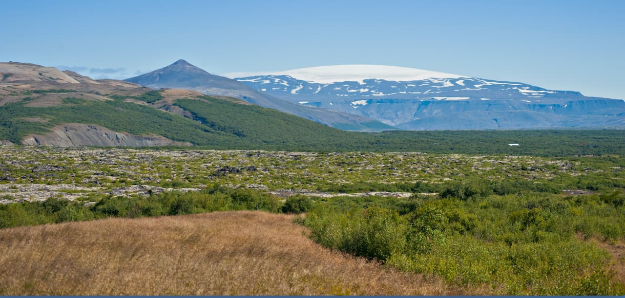
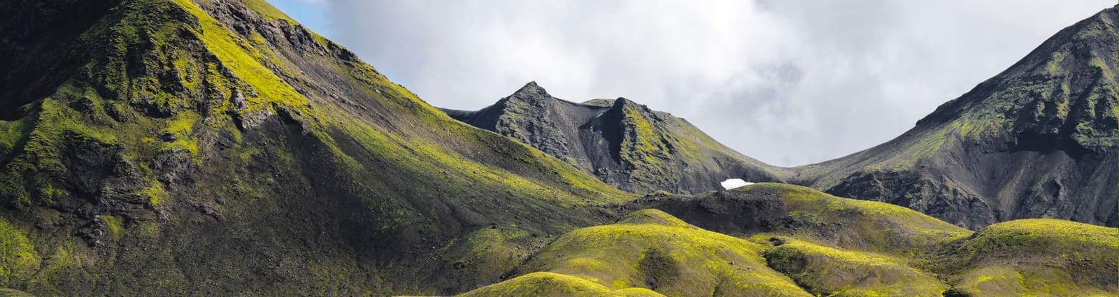
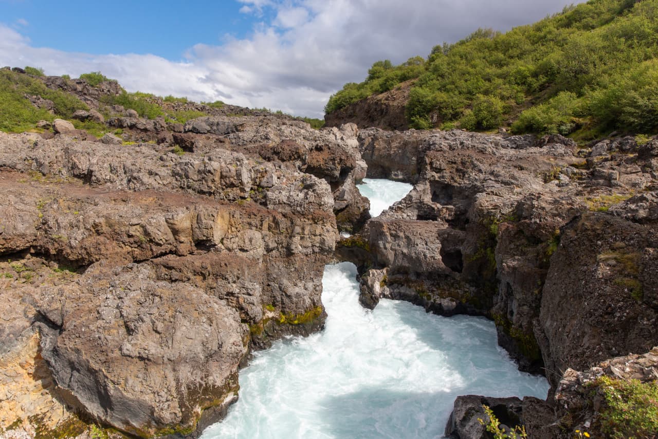
The draw is scale: a flat-topped volcanic mountain with a broad white ice cap, rising beyond lava fields, gravel tracks, cliffs, and open inland space.
Eiríksjökull does not feel like a built viewpoint. It feels like a landmark you read across the horizon. In clear weather the ice cap sits above dark volcanic slopes, and the surrounding lava and highland-edge roads make the mountain feel larger than a simple map distance suggests.
The most useful view of Eiríksjökull is often from the approach: road, weather, distance, and glacier scale all in one scene.
That is why the stop works best for travelers who enjoy the drive as part of the attraction. If your group wants a signed overlook, a short path, and a predictable visit, this landscape may feel too indirect.
How do roads, weather, and daylight change the plan?
Road and weather checks should come before the scenic ambition. Inland approaches around Eiríksjökull can turn a promising detour into a poor use of the day if visibility, surface conditions, wind, or daylight are against you.
Use official road, weather, and safety sources before committing to an inland approach. This page is editorial planning guidance, not live access confirmation. If clouds hide the ice cap or road conditions look marginal, make the day work with lower-friction West Iceland stops instead.
The cliffs and open lava foreground show why Eiríksjökull is better treated as a serious landscape than a casual roadside stop.
Keep a lower-friction backup such as Hraunfossar or Barnafoss if the inland plan loses value.
Avoid turning a visibility gamble into a long detour when the rest of the day already has strong stops.
Use winter driving in Iceland guidance if snow, ice, wind, or shorter daylight could affect the approach.
Treat vehicle suitability and rental restrictions as part of the route decision, not an afterthought.
What should you pair with Eiríksjökull?
The best pairings protect the day if the mountain view is partly hidden. Surtshellir, Borgarfjörður waterfalls, and wider Highlands planning all give the detour a second reason to exist.
Surtshellir is the most natural nearby attraction link because it shares the Hallmundarhraun lava-field context and the same need for careful judgement. It is not an easy substitute, but it gives geology-focused travelers another reason to be in the area.
For a simpler West Iceland day, compare Eiríksjökull with Hraunfossar and Barnafoss. Those waterfall stops are more predictable and easier to explain to mixed groups. For a more ambitious inland trip, Kerlingarfjöll gives a stronger Highlands anchor, but it also raises the access and weather stakes.
Pairing logic
Best nearby geology pairing
Surtshellir, if your group is prepared for a rough lava-cave decision
Best easier fallback
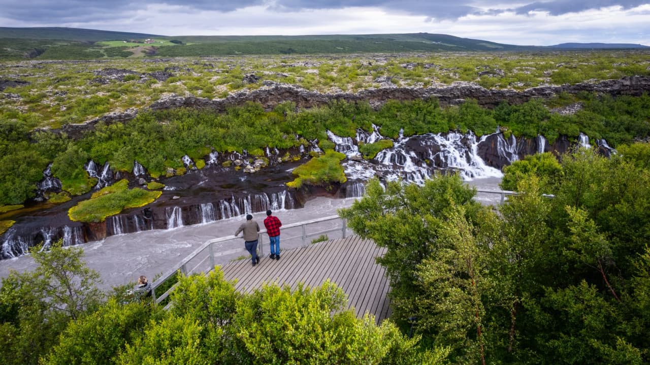
Hraunfossar and Barnafoss, if weather makes the glacier view less rewarding
Best bigger Highlands comparison
Kerlingarfjöll, if the trip can handle a more committed inland objective
Best planning frame
Highlands, if you are deciding whether remote roads belong in the itinerary at all
Should you hike or step onto the glacier?
Most travelers should treat Eiríksjökull as a view and route-context attraction, not as an improvised glacier objective. Mountain and glacier terrain need specialist judgement, equipment, and conservative conditions.
The mountain can interest hikers and mountaineers, but that does not make it a normal attraction walk. Steep scree, cliff bands, glacier margins, weather changes, and navigation all change the risk. If you are not already planning this as a specialist objective, keep the visit to safe viewpoints and approach roads.
Close glacier terrain around Eiríksjökull is specialist ground, not a casual extension of a scenic drive.
If glacier travel is the real goal, build that decision around qualified guidance and current safety information instead of treating an attraction page as permission to continue beyond ordinary visitor judgement.
What should you check before committing?
Check official visitor, safety, road, and weather information before relying on Eiríksjökull for a specific driving day. The useful planning question is not just whether the place exists on the map, but whether the day still works if conditions reduce the view.
If roads, vehicle rules, wind, cloud, or daylight make the inland plan questionable, choose a safer and more reliable West Iceland route. Eiríksjökull is strongest when the detour feels earned, not when it steals time from better-fitting stops.
Use for wind, precipitation, visibility, warnings, and daylight-sensitive planning.
Eiríksjökull FAQ
These questions matter because Eiríksjökull is easy to underestimate from a map.
Is Eiríksjökull a quick stop?
No, it is better treated as a flexible inland landscape detour. If your day needs quick, predictable stops, choose easier Borgarfjörður attractions instead.
Can you see Eiríksjökull without hiking?
Yes, the main value for most travelers is the distant view of the glacier-capped mountain from surrounding roads and open landscapes. Visibility and safe access still decide whether the detour is worthwhile.
Is Eiríksjökull good for families?
It can work for families who enjoy scenic driving and have flexible timing, but it is not ideal for groups expecting facilities, short paths, or predictable access. Verify current visitor details and road conditions before relying on it.
Should I climb Eiríksjökull?
Only consider it as a specialist mountain or glacier objective with proper equipment, conditions, and judgement. Casual visitors should keep the experience to safe viewpoints and route context.
Map
See where this stop sits
Use nearby places and useful bases before opening directions.
Region
Highlands
Works well with
Highlands routes / Silver Circle
Useful base
Borgarnes
Interactive planning map for Eiriksjökull
Eiriksjökull
Keep exploring
Put this place in route context
Use nearby places and planning pages to decide whether this stop strengthens the route or stays optional.