Drekagil is the volcanic gorge beside Dreki where a challenging 0.6 km walk can take about an hour; it is distinct from the 6 km Dreki–Nautagil loop and only fits a prepared, verified Askja Highlands plan.
Access reality
Type
Remote volcanic gorge with a short, challenging waterfall trail
Region
North Highlands near Askja
Base
Dreki huts and campsite
Access
Highland roads need live checks
Gorge trail
A3: 0.6 km, about 1 hour, challenging; starts at Dreki
In this guide
Drekagil is a highland decision, not a quick pullout
Drekagil is a rugged volcanic gorge at the Dreki area near Askja in the north Highlands. It suits prepared travelers already planning highland roads, hut logistics, and weather checks more than casual sightseeing.
Drekagil can be memorable if your trip is built around Askja, stark volcanic terrain, and a slower interior day. It is easy to skip if you are protecting a normal Ring Road schedule or driving a vehicle that does not belong on highland routes.
Travelers usually meet the name beside Dreki. Drekagil is the gorge and immediate landscape; Dreki is the hut, campsite, and practical base; Askja is the larger caldera destination that draws most people into the area.
Dreki is the base; Drekagil is the gorge beside it
The distinction matters on the ground: Dreki is the hut-and-campsite base at the gorge mouth, while Drekagil is the narrow volcanic landscape immediately beside it.
Visit North Iceland places Dreki at the mouth of Drekagil below the east side of Dyngjufjöll and describes it as a base for exploring Askja. Vatnajökull National Park also points travelers to Ferðafélag Akureyrar for hut and campsite details, so current operator information matters.
If you depend on the hut, book it with the operator and prepare for sleeping-bag accommodation rather than hotel service. Verify the operator's equipment and food requirements before departure, then recheck access and facilities; staffing, campground services, road access, and seasonal availability can change.
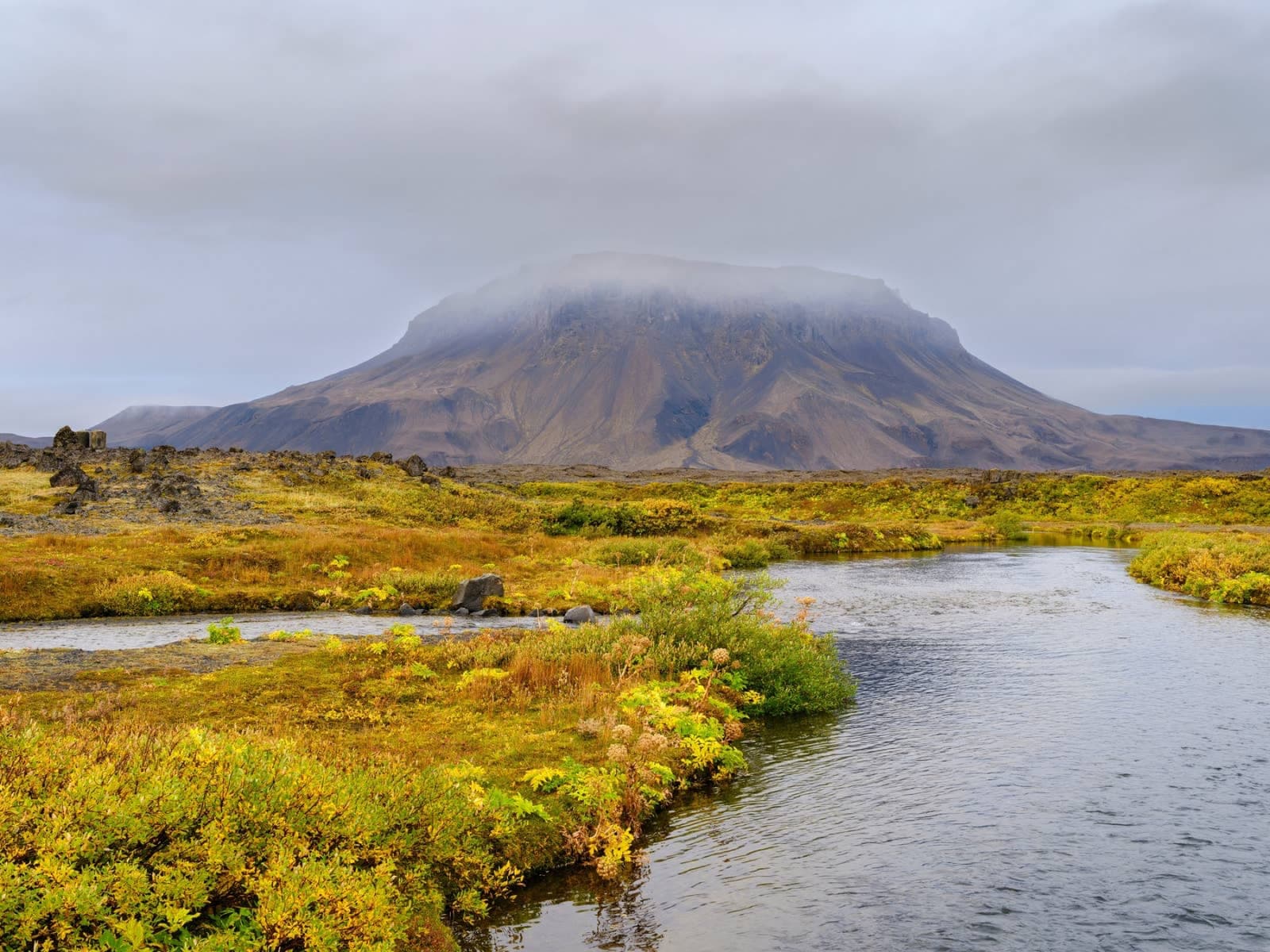
Dreki is the practical hut-and-campsite base at the gorge mouth, not a staffed urban-style visitor centre.Mist isolates the eroded volcanic formations that give the gorge its distinctive enclosed character.
Choose the 0.6 km gorge trail or the 6 km Nautagil loop deliberately
The short distance on the A3 Drekagil route is misleading: the official 0.6 km walk is rated challenging and takes about an hour, while A4 is a separate 6 km challenging loop toward Nautagil.
A3 starts at Dreki and goes up into Drekagil through hyaloclastite formations, lava, hardy highland plants, and waterfall terrain. Its 0.6 km distance does not make it an easy stroll: the national park rates it challenging and warns of rock and mud slides during snow thaw. If thawing snow, unstable debris, or current local advice makes the gorge unsafe, do not use the short distance as a reason to continue.
A4 Dreki–Nautagil is a different commitment: a challenging 6 km loop from Dreki through a broader volcanic landscape. Choose A3 when the gorge itself is the decision and current conditions support it; choose A4 only when the group wants a longer hike and has the time, navigation confidence, weather margin, and current trail information for it.
Do not confuse the two official walks from Dreki
Option
What it gives you
Decision point
A3 Up into Drekagil
0.6 km gorge walk with volcanic formations and a waterfall
Challenging despite the distance; avoid rock- and mudslide conditions
A4 Dreki–Nautagil
6 km loop through a wider volcanic landscape
Needs a larger hiking, weather, and return-time margin
Dreki base only
Orientation, hut or campsite context, and a pause before Askja
Do not assume services or access without operator and road checks
Normal Ring Road day
No sensible quick add-on
Use Mývatn or Dettifoss instead of consuming the day on a remote detour
If the highland plan feels too uncertain, compare easier North Iceland anchors such as Mývatn or Dettifoss. If you are committed to the interior, Drekagil pairs naturally with Víti by Askja, Dyngjufjöll, and the wider Askja area.
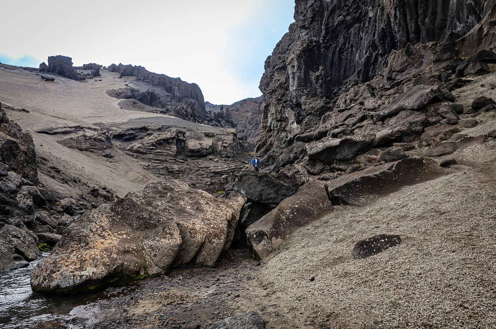
Loose wet ground and runoff show why trail conditions—not the 0.6 km number—should decide whether the gorge walk goes ahead.The stream, boulders, and broken rock layers make the official challenging rating easier to understand before arrival.
Read the gorge terrain before choosing how far to walk
Drekagil's walls, stream bed, loose debris, and lingering snow explain the official difficulty rating better than distance alone.
A narrow volcanic corridor can concentrate runoff and leave little margin around unstable slopes. Look for the conditions the official warning is describing: wet loose material, fresh debris, snow still feeding the channel, or advice from rangers and the park that the gorge is not suitable. A dramatic waterfall view is not a reason to override those signals.
The longer Nautagil loop needs a different decision. Its broader terrain adds time and weather exposure, while the short A3 route concentrates risk inside the gorge. Decide which landscape the group is prepared for before leaving Dreki, and keep both walks optional when the evidence is mixed.
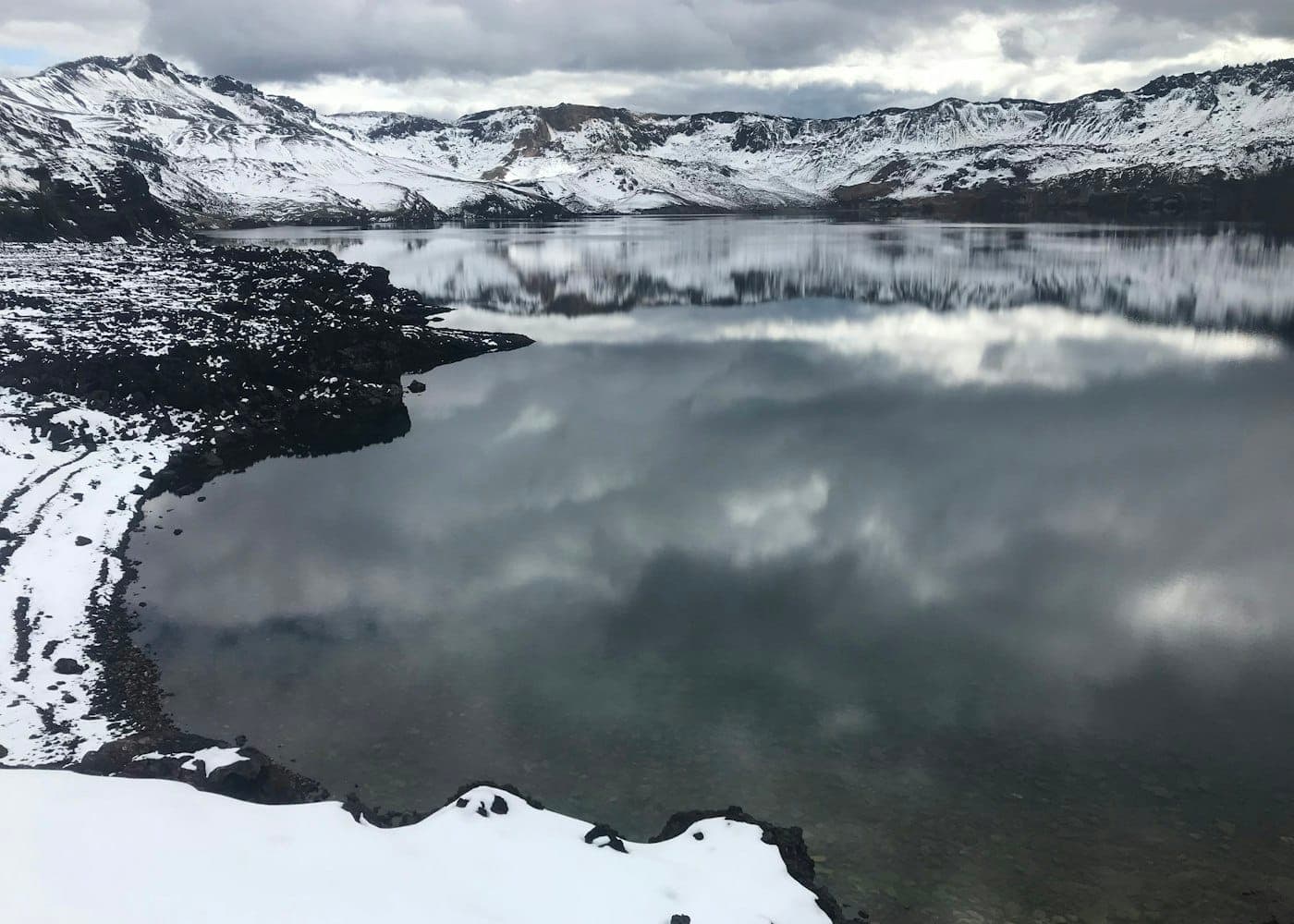
The walls close in quickly inside Drekagil, reinforcing the need to respect current trail and thaw conditions.Snow can linger inside the gorge, so thaw and runoff conditions deserve a specific check even in the normal Highlands travel season.
The waterfall is the reward, not a reason to override conditions
The A3 route reaches a waterfall inside Drekagil, but the enclosing walls and loose volcanic ground are also the source of its most important warning.
The waterfall gives the short gorge walk a clear destination and makes Drekagil more than an access base for Askja. It should not dominate the decision, though: the same narrow walls that frame the view can shed rock and mud during thaw. Treat the image as place evidence, not as proof that the route is safe on the day you arrive.
The waterfall is one reward on the A3 gorge route; the enclosing walls also explain why thaw-related rock and mud slides matter.
Road, weather, and hut evidence must agree before you drive
The access check is part of the attraction. Treat Drekagil as a conditions-dependent highland stop where live information beats old route descriptions.
Check Umferðin for current highland-road status before choosing an approach.
Check the Icelandic Meteorological Office for wind, visibility, precipitation, and warnings.
Check SafeTravel for travel conditions and remote-route guidance.
Confirm rental rules and vehicle suitability before driving on F-roads.
Confirm Dreki hut, campsite, and service details with the operator if you may depend on them.