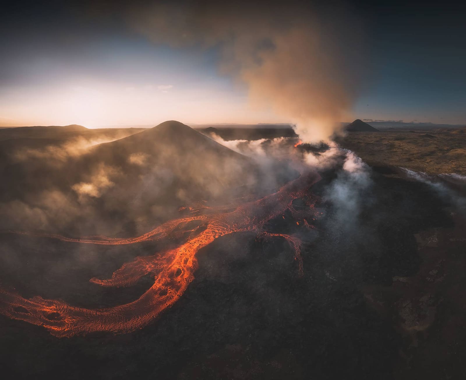
Litli-Hrútur is a recent Reykjanes eruption site for hikers who want fresh lava-field context, exposed volcanic terrain, and enough flexibility to check safety, gas, weather, and access before committing.
Geology snapshot
Type
Recent eruption site, volcano hike, and lava-field landscape
Region
Reykjanes Peninsula, near the Fagradalsfjall eruption area
Route context
Best as the main effort stop in a Reykjanes volcano-focused day
Time to allow
A longer half day when the Litli-Hrútur route is the goal
Effort
Long, exposed walking over gravel, uneven lava-area terrain, and steeper sections
In this guide
Is Litli-Hrútur worth adding to a Reykjanes day?
Yes, when you want recent volcanic terrain and can give the hike real time. Litli-Hrútur is not a casual roadside volcano stop; it is a condition-sensitive Reykjanes walk shaped by the 2023 eruption.
The strongest reason to visit is the chance to understand how fresh lava changed the Fagradalsfjall area. The reward is not guaranteed active lava, but the scale of new black ground, the open Reykjanes horizon, and the feeling that this landscape is still being rewritten.
Add Litli-Hrútur for hikers with flexible weather, proper footwear, and a whole Reykjanes day to shape around official guidance. Skip it on arrival or departure days, with tired children, or when the group only wants easy stops like Kleifarvatn, Gunnuhver, or Reykjanesviti.
Photo guide
Litli-Hrútur in photos
1 / 2
The 2023 eruption gave the mountain its visitor appeal, but the visit still depends on access and safety checks.
What will you actually see after the 2023 eruption?
Expect cooled lava fields, rough volcanic ground, distant crater context, and wide views across the Reykjanes Peninsula. The visit is about reading a new landscape rather than watching a live show.
The 2023 Litli-Hrútur eruption sits within the broader Fagradalsfjall eruption area. Even after active lava is gone, the terrain still feels unusually fresh: dark flows, torn moss edges, gas-aware signage, and paths that make distance feel longer than it looks on a map.
The page should help travelers judge whether the long walk is worth the lava-field context.
That makes Litli-Hrútur different from an older crater or a geothermal boardwalk. You are visiting a place where the main attraction is recent change: fresh lava, fragile crust, scarred ground, and a walking route that asks for attention instead of passive sightseeing.
How hard is the Litli-Hrútur hike?
Plan for a long, exposed volcanic walk rather than a quick viewpoint. Official trail descriptions put the Litli-Hrútur route in the demanding half-day range, with gravel, lava, uneven ground, and steep sections.
The practical challenge is the combination of distance, exposure, and slow terrain. Wind, low cloud, loose gravel, mossy lava rock, and changing route guidance can make the hike feel harder than the raw kilometers suggest.
Official destination imagery helps ground the eruption views in the wider Fagradalsfjall walking area.
Allow a longer half day when the Litli-Hrútur route is the real goal.
Use easier Fagradalsfjall-area viewpoints if the group is not ready for the full walk.
Keep the day flexible enough to turn around if wind, visibility, footing, gas guidance, or closures weaken the plan.
Where does Litli-Hrútur fit on the Reykjanes Peninsula?
Litli-Hrútur belongs in a Reykjanes volcano-focused day, especially with Fagradalsfjall, Keilir views, Kleifarvatn, Gunnuhver, Reykjanesviti, or the Blue Lagoon. It should not be treated as a Reykjavík city stop.
the best approach is to decide first whether the volcano hike owns the day. If it does, add only one or two simpler stops. If it does not, keep the hike conditional and build the day around easier peninsula places such as Kleifarvatn, Gunnuhver, Reykjanesviti Lighthouse, or Blue Lagoon.
Cooled lava fields are the durable reason to consider the stop after the eruption itself.
For route planning, compare it with the Reykjanes Peninsula road trip. Litli-Hrútur is strongest when it explains the peninsula’s volcanic character; it is weaker when it forces you to rush past coastal cliffs, geothermal fields, or recovery time after a flight.
What safety checks matter before you go?
Check official access, safety, weather, road, gas, and air-quality guidance before committing. This is a volcanic area where route advice and safe viewing choices can change faster than ordinary attraction pages.
Never walk on lava, even when it looks cooled. Fresh crust can hide heat, break under weight, or cut badly. Stay on marked routes, respect closures, and avoid turning social-media images of active lava into a promise for your own visit.
Gas, wind, lava crust, and closures matter more here than a fixed sightseeing checklist.
When should you choose an easier Reykjanes alternative?
Choose an easier stop when your day is short, the weather is poor, or the group is not ready for a long exposed walk. Reykjanes has excellent lower-effort volcanic and coastal options.
Fagradalsfjall is the closest comparison if you still want a volcano hike. Keilir works better for a mountain-profile goal. Bridge Between Continents, Gunnuhver, and Reykjanesviti make more sense when you need short stops with clear payoffs.
The best visual moments came from the active eruption, but public planning should stay durable.
The honest skip advice is simple: do not add Litli-Hrútur just because it sounds famous. Add it when recent-lava hiking is one of the things your Reykjanes day is built to do well.
What official details should you verify?
Verify the details that change: marked trail choice, parking arrangement, volcanic gas and air quality, wind and visibility, road conditions, and any local closure or rescue-team guidance.
Stable planning guidance can tell you why Litli-Hrútur matters and how it compares with nearby stops. It cannot replace official day-of information for a volcanic hiking area.
Road notifications and driving condition checks before heading onto Reykjanes roads.
How should you continue planning after Litli-Hrútur?
Place the hike inside a Reykjanes plan before deciding. The next useful step is not another eruption photo; it is choosing whether this hike, an easier volcano stop, or a wider peninsula drive fits your actual day.