
Waterfall facts
- Type
- Stepped Þjórsá waterfall
- Region
- South Highlands near Búðarháls
- Best for
- Remote waterfall detours
- Time
- Allow a slow half day
- Access
- Rough signed highland track
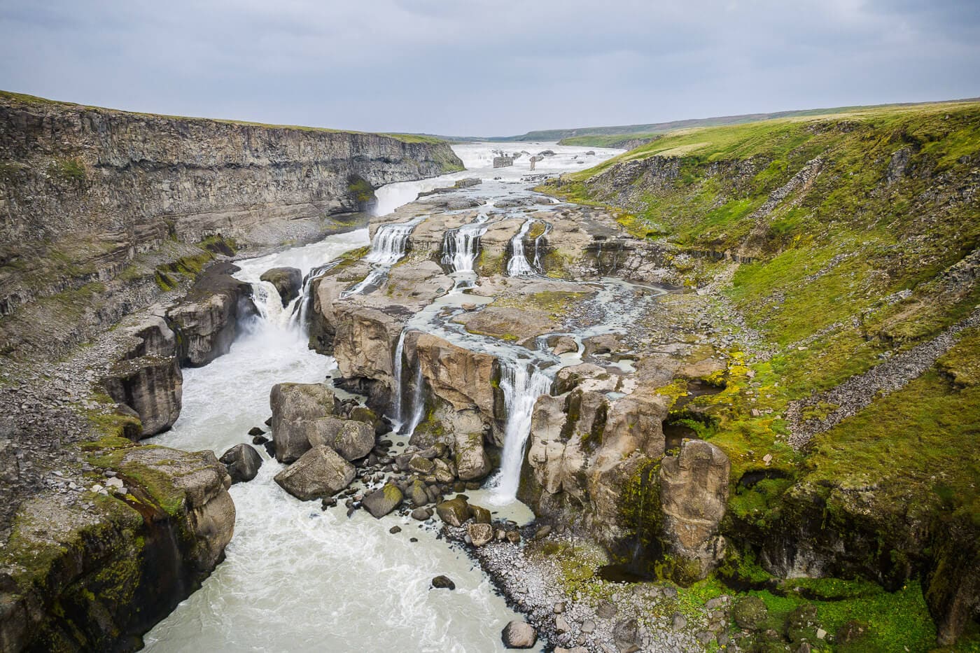
Búðarhálsfoss, also called Dynkur, is a remote stepped waterfall on Þjórsá for travelers with a capable vehicle, flexible timing, and interest in quieter South Highlands scenery beyond the usual Golden Circle stops.
Waterfall facts
Yes, if you are already comfortable with remote South Highlands driving and want a quieter Þjórsá waterfall. No, if your day depends on easy roads, tight timing, or a normal Golden Circle rhythm.
Búðarhálsfoss, also called Dynkur, is not the kind of waterfall you add because it is close to the main road. Its value is the opposite: a broad, stepped river waterfall that feels far from the busier circuits around Gullfoss and the standard South Coast.
Plan it only when the route already points toward the upper Þjórsá area, Þjórsárdalur, or a deliberate South Highlands day. For most travelers, Dynkur should be the main remote choice in that window rather than one more stop added to an overloaded route.
Dynkur is visually wider and more complex than a simple single-drop waterfall, with water splitting across ledges and channels in the Þjórsá river.
Regional visitor information describes Dynkur as a waterfall system on Þjórsá, with many smaller falls and pedestals forming the broader drop. That matters for expectations: the scene is about a whole river stepping down through rock, not one narrow plume with a paved viewing platform.
You may see both names used in travel material. For planning, treat Búðarhálsfoss and Dynkur as the same waterfall area, then focus on which side and approach make sense for the day.
The reward is scale, silence, and shape. The water spreads, folds, and drops across dark rock shelves, so the best visit gives you enough time to stand back and read the whole system rather than chasing one close-up angle.
The access question is the core decision. Dynkur can be signed and still demand highland judgment, suitable vehicle choice, and a willingness to turn around.
The Búðarháls side is the clearest practical approach in regional visitor guidance, but the same guidance warns that the road is suited to jeeps and off-road vehicles. Do not treat the waterfall like a normal rental-car stop, even when the map makes the distance look modest.
Dynkur belongs with a slow South Highlands plan, not with a fast Golden Circle checklist.
A practical route usually starts by deciding whether the day is built around the Þjórsá valley. Easier nearby planning anchors include Hjálparfoss, Þjórsárdalur, and Háifoss, while Sigöldufoss belongs to a more committed highland-style route.
The Búðarháls name also sits inside a working Þjórsá hydropower landscape. That context helps explain why the approach can feel more like a remote energy-and-river corridor than a polished scenic viewpoint.
That is part of the appeal for the right traveler. Dynkur is best when you want to understand the quieter upper Þjórsá landscape, not just collect another waterfall name.
Keep the cluster selective. Dynkur becomes less rewarding when it forces too many other stops into a marginal driving day.
| Day shape | Better pairing |
|---|---|
| Easier Þjórsá day | Hjálparfoss and Þjórsárdalur |
| Waterfall-heavy highland day | Háifoss plus Dynkur if road and weather margins are strong |
| Longer highland route | Sigöldufoss with careful route planning |
| Conservative fallback | Stay with easier South Iceland or Golden Circle stops |
If Dynkur is part of a broader self-drive plan, use the highlands road-trip planning guide before committing the whole day to rougher roads.
The final call should be based on official road, weather, and safety information, plus your vehicle permissions and daylight margin.
Check road conditions, weather, alerts, and vehicle terms before leaving easier routes. Dynkur is the kind of stop where a small change in wind, rain, visibility, or track condition can matter more than the distance shown on a map.
Regional place page for identity, access notes, and coordinates.
Road-condition information before rough highland approaches.
Weather and alert information for wind, visibility, and precipitation decisions.
Travel-safety information for remote driving and hiking judgment.
For travel planning, treat them as the same Þjórsá waterfall area. You may see either name in maps, specialist guides, and regional visitor material.
Do not plan Dynkur like a normal rental-car stop. Regional visitor guidance describes the road as suitable for jeeps and off-road vehicles, so vehicle permission and same-day conditions matter.
By ThorPublished Updated
Map
Use nearby places and useful bases before opening directions.
Interactive planning map for Búðarhálsfoss / Dynkur
Interactive map
Place context and external map links remain available without loading it.
Planning context
Open the region or practical guide that resolves the next planning decision.
Wider route
Use broader place relationships for route comparison; they are not presented as immediate nearby stops.
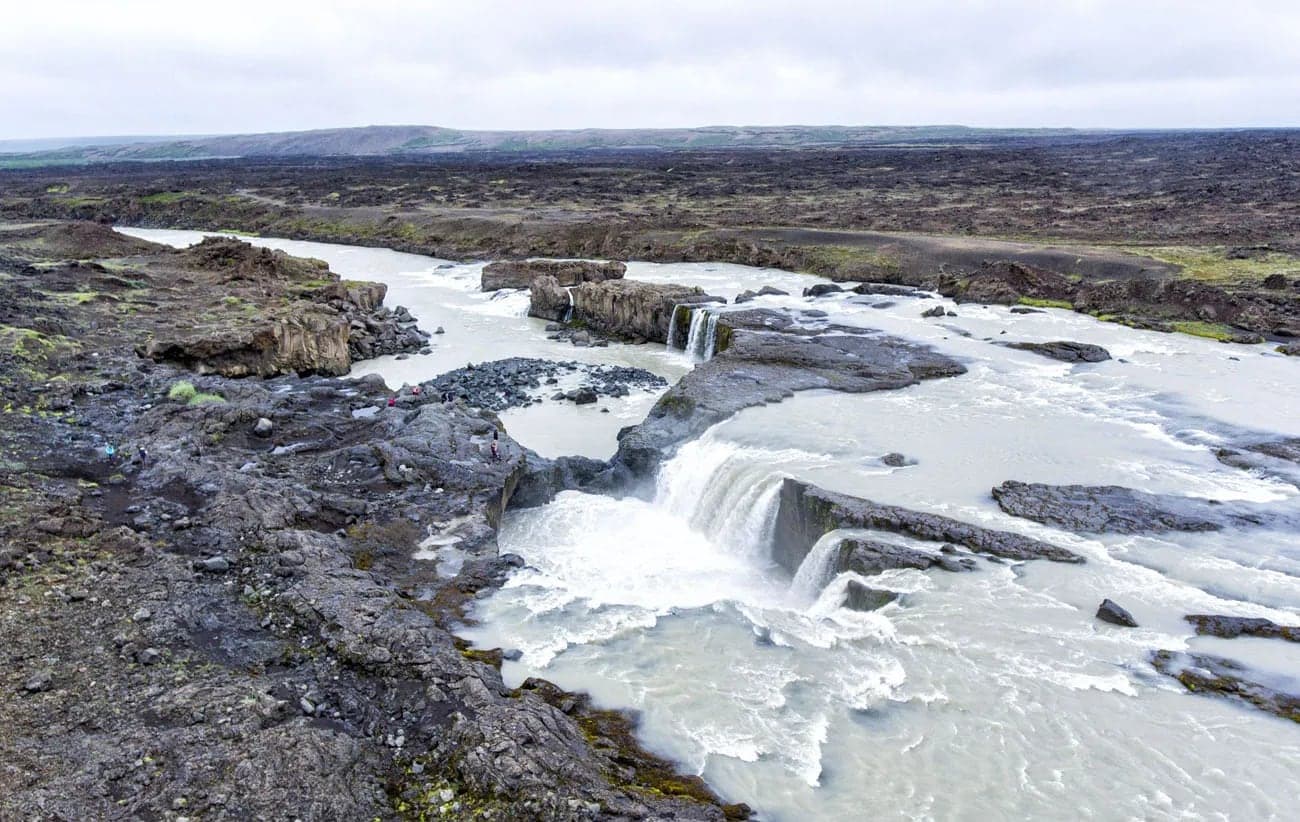
Hrafnabjargafoss is a remote Skjálfandafljót waterfall above Aldeyjarfoss in North Iceland, worth adding only when road conditions, vehicle choice, daylight, and walking time support a rougher valley detour.
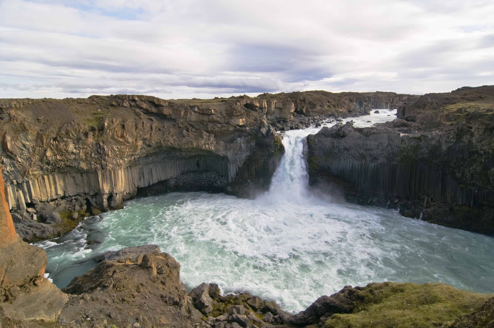
Aldeyjarfoss is a basalt-framed waterfall near the northern edge of Sprengisandur in North Iceland, worth the detour when F26 access, vehicle rules, daylight, and route time all line up.
