
Waterfall facts
- Drop
- About 10 meters, based on a published estimate
- River
- Tungnaá
- Current access
- Old approach restricted through 2029
- Setting
- Managed hydropower landscape near F208
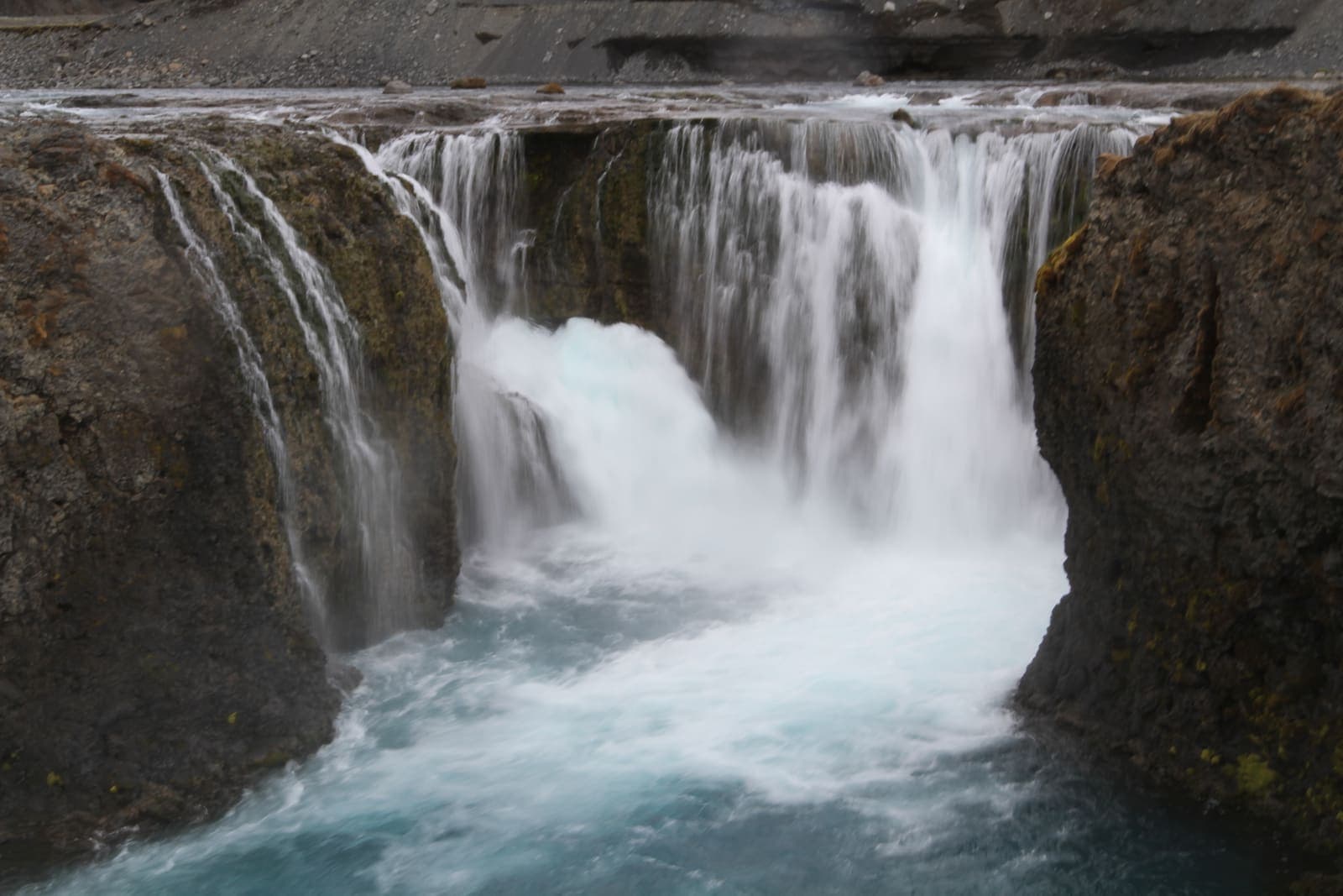
Sigöldufoss is a roughly 10-meter waterfall on the Tungnaá, shaped by the Sigalda hydropower system. The old approach and surrounding area are restricted during construction through 2029, so follow current signs rather than old online directions.
Waterfall facts
Sigöldufoss is a segmented fall on the Tungnaá, commonly described as about 10 meters high.
The water drops over dark rock into a pale blue pool. Its scale is smaller than Iceland's major roadside waterfalls, but the close rock walls and changing flow give it a distinct shape. This is also a managed river landscape: Tungnaá is dammed upstream to form Krókslón, and much of its water is directed through Sigöldustöð.
Sigöldustöð entered service on December 13, 1978. The power system reduced the normal flow over Sigöldufoss, so older photographs can show more or less water than you encounter. The waterfall and the station are parts of one connected water system.
Official history of the station, Krókslón and the Tungnaá water system.
Published estimate of the waterfall's height and river identity.
Construction at Sigöldustöð has changed how visitors can approach the waterfall.
Ásahreppur says the former route to Sigöldufoss and the area around it are closed for safety during the expansion, with restrictions expected to remain through 2029. Do not follow an old map pin, track or trip report into the work area. Obey barriers and signs even if the ground looks passable.
The municipality announced a signed viewpoint north of Tungnaá, reached from Fjallabaksleið nyrðri, with a view toward the construction area and part of the waterfall. Because work changes over time, use that viewpoint only when current signs direct you there. There is no reliable fixed visit time while access remains restricted.
River flow, traffic and noise may differ from the quiet blue-water scene shown in older photographs.
The station expansion runs from 2026 to 2029. During planned shutdowns, water may be directed back through the former river channel, changing both the color and volume at Sigöldufoss and nearby Sigöldugljúfur. Contractor traffic and construction noise are also expected around Sigöldustöð.
For the next few years, expect an active work setting and a variable river rather than a consistent, quiet waterfall scene.
The construction project does not close F208 or nearby Sigöldugljúfur, but normal Highlands conditions still apply.
Check Umferðin on the day you travel. A road that is shown on a map may be closed, rough or unsuitable for your rental vehicle. Then check the Icelandic Meteorological Office for wind, rain and warnings. The site's construction status does not make the surrounding roads safer.
Sigöldugljúfur remains a separate canyon stop and should not be confused with the restricted waterfall approach. If you are deciding whether to enter Fjallabak at all, use the Highlands road-planning guide before leaving paved roads.
Current closure, viewpoint and construction-traffic information.
Live conditions and closures for F208 and connecting roads.
Official forecasts and warnings for Highlands travel.
By ThorPublished Updated