
Hike snapshot
- Height
- 296 m above sea level
- Official route
- 4.34 km with about 209 m of ascent
- Walking time
- Usually 1-2 hours for the marked circuit
- Trail
- Cairn-marked, mixed soil, stone, and grass; no lighting or services
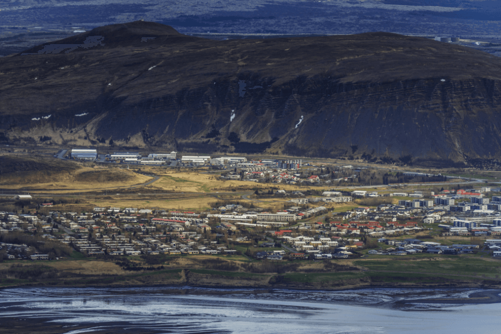
Úlfarsfell is a 296-metre mountain on the Reykjavík-Mosfellsbær boundary. Its marked summit route is a compact local hike with open views over the capital area, Mount Esja, Faxaflói Bay, and nearby lakes.
Hike snapshot
Úlfarsfell rises only 296 metres, but it feels like a proper hill once the streets and planted lower slopes fall away.
The mountain stands on the boundary between Reykjavík and Mosfellsbær. From Stórihnúkur, its main summit, the view reaches across the city, Faxaflói Bay, the Reykjanes Peninsula, and north toward Mount Esja. It is a local exercise hill rather than a remote wilderness destination, which is exactly why it works for travelers who want trail time without giving up a whole day.
Its slopes also tell a longer story than the modest height suggests. The Icelandic Tourist Board describes a foundation roughly two million years old, built from lava flows laid down in warmer periods and layers of tuff and glacial material from colder ones. Heath covers much of the open ground, while decades of planting have created wooded sections lower down.
Official height, geology, landscape, summit, and route information.
Capital-area setting, marked trails, and principal views.
Photo guide
1 / 4
The summit feels small, rocky, and local rather than like a major mountain objective.
The useful official circuit is 4.34 kilometres and normally takes one to two hours.
The described route starts at the Leirtjörn parking area above Úlfarsárdalur, climbs to Stórihnúkur, and returns on an old vehicle track. It gains about 209 metres. Cairns mark the way, but the surface changes between soil, stones, and grass, and one step or low ledge is noted on the official profile. Several other paths cross the fell, so follow the route you chose rather than assuming every branch returns to the same place.
The official difficulty is easy, but that means easy for a hiking trail, not a smooth city walk. There is no lighting and no service on the route. A comfortable pace, stops at the summit, and attention on the descent all belong inside the one-to-two-hour estimate.
Úlfarsfell is open all year, but an exposed, unlit hill can change character quickly in wind, cloud, snow, or ice.
Check the Icelandic Met Office for wind, precipitation, visibility, and warnings before setting out. In darker months, allow enough daylight for the return and expect winter footing to be more important than the short distance. SafeTravel provides general outdoor preparation and alerts, while signs at the trailhead remain the best source for a local change.
If the summit conditions are poor, Hafravatn offers a lower lake setting nearby. Perlan is the easier Reykjavík viewpoint when a trail is not suitable. The Reykjavík region guide gives the wider city context, but Úlfarsfell itself needs no itinerary machinery: come for the hike and the view.
Current forecasts and weather warnings for the capital area.
Current alerts and general preparation for outdoor travel in Iceland.
By ThorPublished Updated