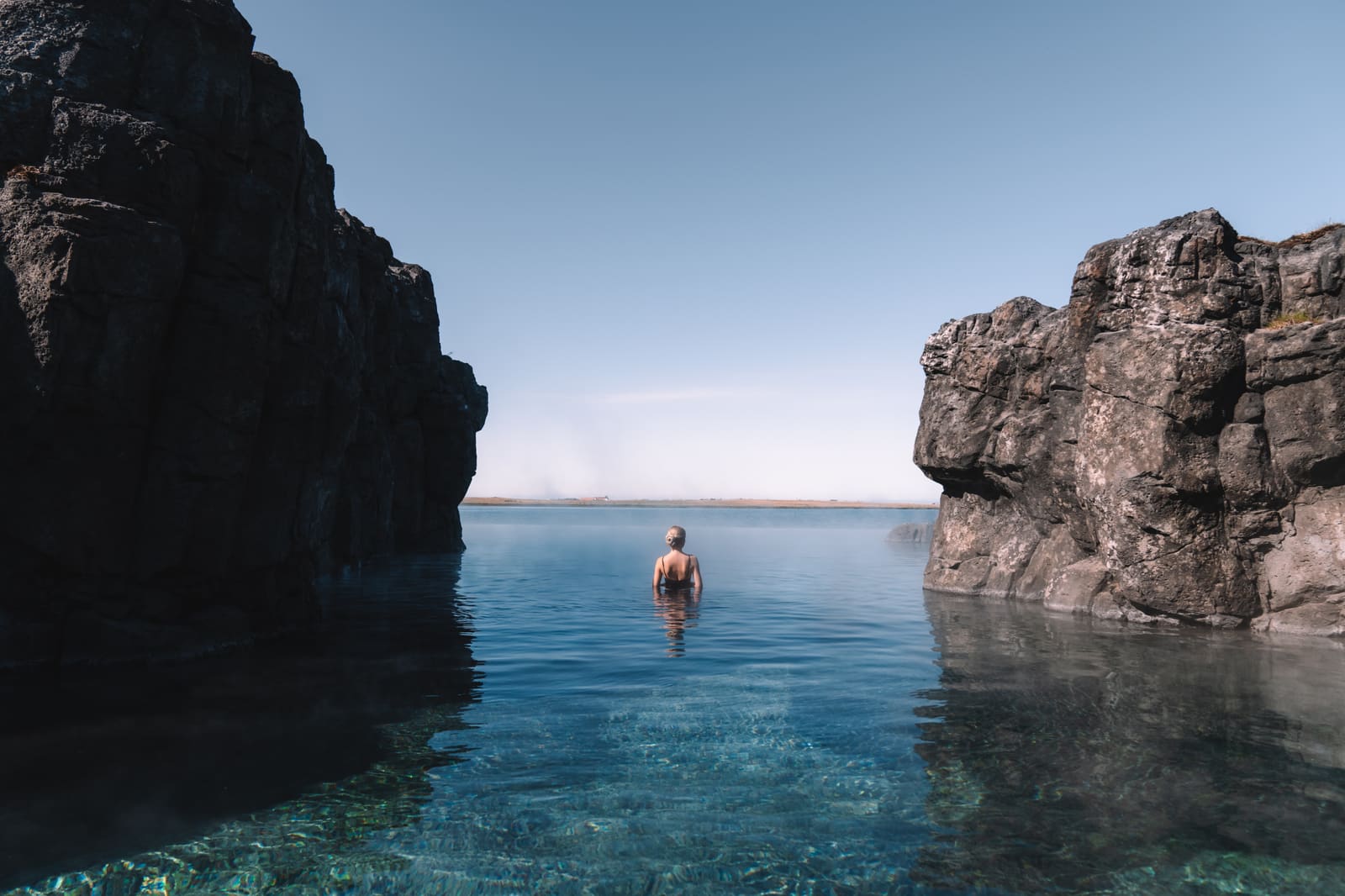
Bathing details
- Pools
- Two stone-built geothermal pools
- Setting
- Eastern Highlands, north of Snæfell
- Hike
- 8 km Waterfall Circle from Laugarfell
- Summer approach
- Route 910, then about 2 km unpaved
- Normal season
- June–September; winter by arrangement
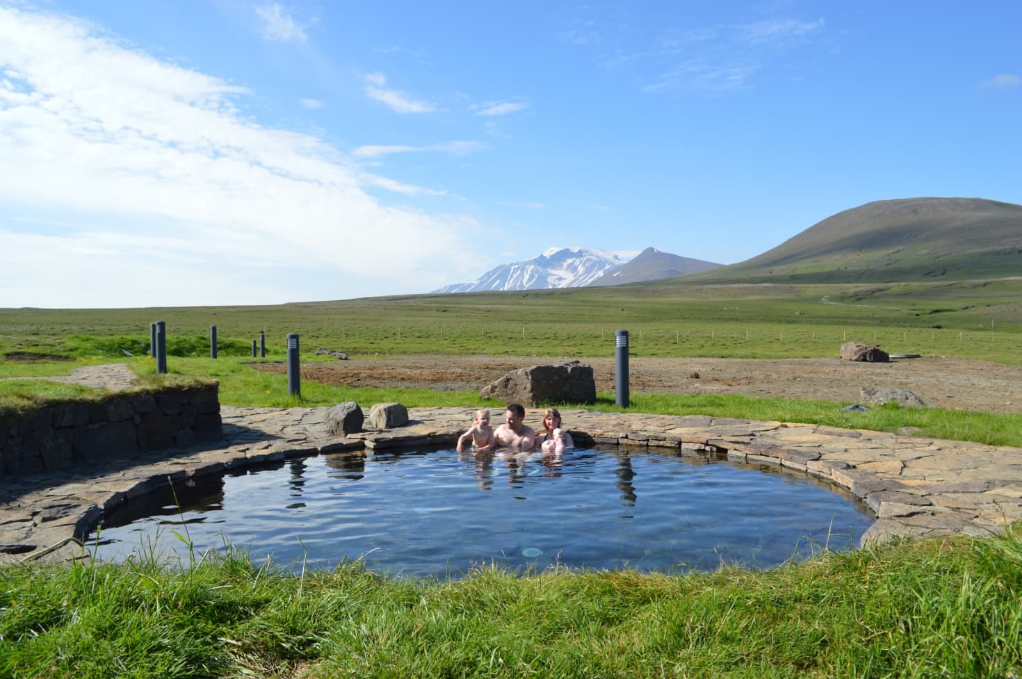
Two stone-built hot-spring pools sit beside Laugarfell’s mountain accommodation in the Eastern Highlands, north of Snæfell. Visit for a paid day soak or combine the pools with the eight-kilometer Waterfall Circle. The usual summer approach branches from paved Route 910; winter visits require separate arrangements.
Bathing details
Two stone-built pools, open highland views and a waterfall hike make Laugarfell a distinct stop north of Snæfell in East Iceland.
The pools sit beside mountain accommodation on Fljótsdalsheiði, with Snæfell visible in the distance. You can visit for a soak without staying overnight. A longer visit can combine bathing with the Waterfall Circle, which leaves from the same base.
The name belongs to the East Iceland place on Fljótsdalsheiði, north of Mount Snæfell. Do not confuse it with Laugafell in North Iceland. They are different places, and a one-letter mistake can send a route plan in the wrong direction.
Photo guide
The pool and stone paths at Laugarfell seen from above.
Laugarfell combines bathing with mountain accommodation and seasonal visitor services.
Laugarfell has two stone-built hot-spring pools with views toward Mount Snæfell. You can visit for a paid day soak without staying overnight; the operator lists separate access hours for day visitors and overnight guests, whose pool admission is included. Check the linked operator page for hours and admission before setting off.
Choose a paid day visit for the pools alone, or book accommodation if you want time to explore the trails. Vök Baths, near Egilsstaðir, is a different option when you want a managed bathing visit without the highland drive.
Visit Austurland describes the Waterfall Circle as an eight-kilometer hiking loop that starts and ends at Laugarfell, which gives the place a clear outdoor role.
The loop passes five waterfalls and a canyon, including Kirkjufoss and Faxi. Follow the Waterfall Circle signs back to Laugarfell. The longer Waterfall Trail from the Wilderness Center is a different outing, so confirm the route at the hut before starting.
Still, the hike should not be treated as automatic. Trail conditions, footwear, wind, visibility, daylight, and your group pace matter. If the hiking part is the reason for the detour, check regional guidance and weather before leaving the lower valley.
| Trip shape | Use Laugarfell for | Check first |
|---|---|---|
| Slow Egilsstaðir base day | Hot springs, simple services, and inland contrast | Operator details, roads, weather |
| Fljótsdalur and Hengifoss day | A higher-effort extension beyond the valley | Time, visibility, route fatigue |
| Highland Circle plan | A useful pause before or after Kárahnjúkar context | Road openings, vehicle suitability |
| Quick Ring Road transfer | Usually not the best use of time | Whether an easier bath fits better |
Laugarfell's normal visitor season is June through September. The usual summer approach differs from a winter visit or a longer journey across Highland F-roads.
From the Egilsstaðir area, follow the appropriate lakeside approach toward Hengifoss, then Route 933 and paved Route 910 toward Kárahnjúkar. The signed Laugarfell branch is about two kilometers of unpaved road. Visit Austurland describes this summer approach as suitable for ordinary cars; that does not apply to the whole Highland Circle beyond the dam.
The normal season is June 1–September 30. The operator describes winter use as a prearranged private hut rental, with specialist super-jeep access and self-service accommodation. A winter booking does not establish that ordinary vehicles may use a closed road. Arrange permitted transport and confirm the operating conditions directly.
Vegagerðin lists roughly 74–75 km from Egilsstaðir on the summer lakeside approaches, including the final unpaved branch. Add the return journey, bathing time and any hiking before deciding what else fits. The Snæfell mountain road and the F910 route beyond Kárahnjúkar have different vehicle and seasonal requirements.
Before building the day around Laugarfell, check Umferðin for current road status, the Icelandic Meteorological Office for forecasts and warnings, and SafeTravel for highland-driving guidance. If the plan depends on bathing, food, lodging, camping, or equipment, check the operator too.
The best pairings keep the day coherent: valley first, then one inland extension if the conditions and your pace support it.
A practical route usually starts with Egilsstaðir, Fljótsdalur Valley, or Hengifoss, then decides whether the inland branch earns its place. Kárahnjúkar and Snæfell add highland scale, but they also increase the need for careful road and weather judgment.
For bathing closer to town, compare Vök Baths. For a longer mountain day, use the official route descriptions and the Highlands driving guide to separate the paved approach to Laugarfell from rougher roads beyond it.
Day admission, overnight-guest access, hours and current bathing details.
Published normal season, winter-by-agreement visits and the summer approach.
Use before committing to the inland drive.
Use for highland-road and route-risk guidance.
Operator directions and the separate winter rental and transport arrangements.
Compare the lakeside approaches and final unpaved branch.
The eight-kilometer loop and its distinction from the longer Wilderness Center trail.
These questions help decide whether Laugarfell belongs in an East Iceland inland route.
They are natural hot springs with stone-built pools at a serviced accommodation stop. Paid day visits are available without an overnight stay; pool admission is included for overnight guests. Confirm the operator's hours and admission for your date.
It can be worth it when your East Iceland route already points toward Fljótsdalur, Kárahnjúkar, Snæfell, or the Waterfall Circle. It is a weaker fit for rushed Ring Road days with no inland margin.
By ThorPublished Updated
Map
Use nearby places and useful bases before opening directions.
Interactive planning map for Laugarfell Hot Springs
Interactive map
Place context and external map links remain available without loading it.
Things to do
Open a focused experience guide when the activity, booking, or conditions should shape the visit.