
Waterfall facts
- Type
- Lava-field waterfall on Þjórsá
- Region
- South Iceland near Hekla
- Best for
- Flexible Þjórsárdalur self-drives
- Time
- About 20 to 45 minutes
- Access
- Gravel-road detour; check conditions
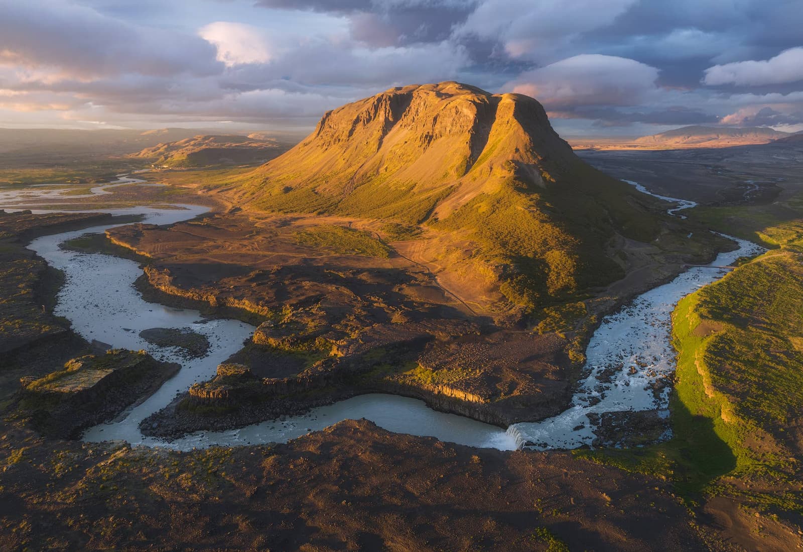
Þjófafoss helps self-drivers decide whether a quieter waterfall below Búrfell and Hekla deserves a detour, especially when Þjórsárdalur, Hjálparfoss, or the broader Þjórsá river corridor is already shaping the day.
Waterfall facts
Þjófafoss is worth considering when your day already points toward Þjórsárdalur, Búrfell, or Hekla. It is less persuasive as a lone detour from the better-known South Iceland waterfall line.
The stop gives you a broad Þjórsá waterfall, dark lava edges, and open mountain context instead of the polished theatre of Iceland's headline cascades. That makes it a good match for self-drivers who like quieter places and route texture.
If your day still needs Hjálparfoss, Gjáin Valley, or Þjóðveldisbærinn at Stöng, plan those decisions first. Þjófafoss works best when it adds a short, atmospheric pause rather than controlling the whole day.
The view is simple but memorable: water spreading across dark rock, a blue-green pool below, rough lava around the river, and a wide inland sky.
Þjófafoss does not depend only on height. Its appeal comes from the contrast between the pale water, the Merkurhraun lava-field setting, and the sense that the river has opened into a rougher interior landscape.
The visit is usually short, but it rewards a slower look. In good visibility, the mountain backdrop makes the waterfall feel tied to the wider Hekla and Þjórsárdalur landscape rather than to one isolated viewpoint.
Þjófafoss sits in a river landscape shaped by Búrfell, Þjórsá, and hydropower infrastructure. That context matters because the waterfall can feel more or less forceful depending on water management and conditions.
World Waterfall Database and local travel sources describe Þjófafoss as part of the regulated Þjórsá system. Landsvirkjun's Búrfell information gives the broader hydropower setting, which helps explain why this waterfall should be judged by place and atmosphere, not only by volume.
For travelers, the practical point is not technical. Do not expect the same force in every photo or season. Let the setting, the pool, the mountain view, and your route decide whether the stop earns its time.
Þjófafoss is strongest when it belongs to a South Iceland side day rather than a checklist sprint. Hekla gives the horizon drama; Þjórsárdalur gives the nearby stops.
A good version of the day might compare Þjófafoss with Hjálparfoss, Gjáin Valley, and the reconstructed farm at Þjóðveldisbærinn at Stöng. If the route is already leaning toward Hekla, the waterfall adds a low-effort landscape pause.
If you are choosing between this and the broader Þjórsá river corridor, use Þjófafoss for a compact waterfall scene and Þjórsá for the larger river-planning question. Urriðafoss is the easier lower-river comparison when your route stays closer to the Ring Road.
Treat Þjófafoss as a rural viewpoint stop where weather, road comfort, visibility, and local restrictions can matter more than the short time at the falls.
Before leaving the main paved route, check official road information, weather forecasts, and safety guidance. If the road, wind, or visibility makes the detour feel awkward, keep the day focused on easier Þjórsárdalur stops.
By ThorPublished Updated
Use official road, weather, and safety sources for live decisions, and use attraction sources for the durable place context.
Broad attraction identity, location, and visitor context.
Background for the managed Þjórsá river setting.
Use before rural detours and changing weather.
Use for wind, visibility, and precipitation checks.
Map
Use nearby places and useful bases before opening directions.
Interactive planning map for Þjófafoss Waterfall Near Hekla
Interactive map
Place context and external map links remain available without loading it.
Planning context
Open the region or practical guide that resolves the next planning decision.
