
Glacier facts
- Type
- UNESCO Global Geopark
- Region
- Central South Iceland
- Best for
- Geology-led South Coast planning
- Time
- Half day to several days
- Access
- Varies by geosite and road
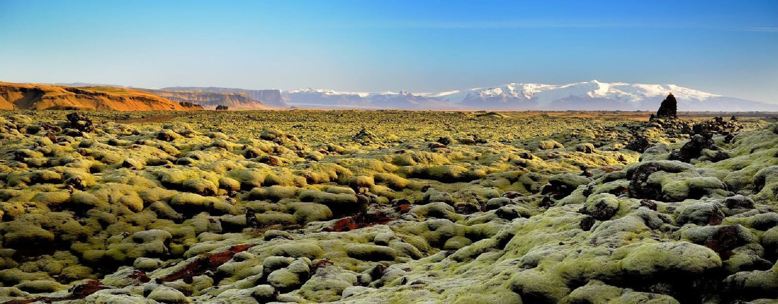
Katla Geopark is a South Coast UNESCO Global Geopark, useful for travelers who want Vík, black sand beaches, glaciers, lava fields, and canyons to make sense as one connected landscape.
Glacier facts
Yes, when you want the South Coast to feel connected instead of like a row of unrelated stops.
Katla Geopark is not one viewpoint, one trail, or one ticketed attraction. It is a large UNESCO Global Geopark wrapped around some of the South Coast's most volcanic and glacial landscapes, including Vík-area black sand, Mýrdalsjökull, lava fields, canyons, and older eruption terrain.
That makes it most useful as a way to choose better stops. If your day already includes Reynisfjara, Dyrhólaey, Hjörleifshöfði, or Mýrdalssandur, the geopark explains why black sand, sea cliffs, outlet glaciers, and flood plains sit so close together.
It is less useful if you want a single address to visit between waterfalls. In that case, choose one clear stop near Vík or Skógar, then keep the broader geopark context in the background.
The geopark label connects active volcanoes, ice caps, old lava flows, outwash plains, coastal cliffs, and local communities.
Katla volcano lies beneath Mýrdalsjökull, and the wider volcanic system has shaped the surrounding lowlands, sands, rivers, and coast. The result is a travel area where scenery that looks separate on a map often shares the same geological story.
For travelers, the practical version is simple: the geopark gives the South Coast between Skógar, Vík, Kirkjubæjarklaustur, and the highland edge more depth. A black beach is not just a beach; a canyon is not just a canyon; a mossy lava field is evidence of a much bigger volcanic landscape.
The secondary reason to pause is cultural. The Katla Visitor Centre in Vík and UNESCO's community-focused framing make the area more than scenic terrain, especially if you want a weather-flexible way to understand local geology before or after outdoor stops.
Do not try to cover every geosite. Choose the version of Katla Geopark that matches your route, season, vehicle, and energy.
For most first-time South Coast travelers, the easiest Katla Geopark experience is around Vík. Pair Reynisfjara or Víkurfjara with Dyrhólaey, then add Hjörleifshöfði or Yoda Cave only if conditions and timing leave room.
If you want ice, Sólheimajökull gives a clear outlet-glacier example on the western side of Mýrdalsjökull. Treat glacier walking, ice caves, and snow or ice travel as guided or specialist decisions, not casual add-ons.
If you want deeper lava and canyon context, Fjaðrárgljúfur, Eldgjá, and Lakagígar shift the day toward longer driving, seasonal roads, and more careful route planning. They can be excellent, but they do not fit every South Coast schedule.
| If you want | Start with | Watch for |
|---|---|---|
| A short Vík-area introduction | Reynisfjara, Dyrhólaey, or Hjörleifshöfði | Surf, wind, cliff edges, and daylight |
| Glacier context | Sólheimajökull or Mýrdalsjökull viewpoints | Guided access, weather, and equipment needs |
| Canyons and lava history | Fjaðrárgljúfur, Eldgjá, or Lakagígar | Road conditions, closures, and longer driving |
| A weather-flexible layer | Katla Visitor Centre in Vík | Opening details and local exhibition fit |
Katla Geopark can be a half-day theme, a full Vík-area day, or a slower multi-day South Coast layer.
With limited time, use the geopark as context for a compact Vík cluster: Reynisfjara or Dyrhólaey, a quick look at the Vík coastline, and maybe Hjörleifshöfði or Mýrdalssandur if the day is not overloaded.
With a full day around Vík, the area becomes more convincing. You can slow down, compare black-sand coastlines, add the visitor centre, and keep a weather backup rather than forcing every stop into a fast Ring Road push.
With several South Coast days, the geopark starts to change the route. Fjaðrárgljúfur, Skaftáreldahraun, Lakagígar, and highland-edge landscapes can become the main reason to stay longer between Vík and Kirkjubæjarklaustur.
The geopark is easy to reach in broad terms, but individual places can be very different on the same day.
Route 1 carries many travelers through the geopark, so it can look simple from a distance. The practical reality changes by site: Reynisfjara has ocean and warning-sign risk, Fjaðrárgljúfur has cliff-edge and path protection rules, glacier areas need specialist care, and highland or crater roads can require much more margin.
Use the geopark to make route choices cleaner, especially when deciding how much time to spend around Vík.
On a fast South Coast day from Reykjavík, Katla Geopark is mostly a background idea behind the stops you already know: Skógafoss, Reynisfjara, Dyrhólaey, and Vík. That is enough if your trip has limited time.
On a slower self-drive, the geopark argues for staying near Vík or Kirkjubæjarklaustur instead of treating the area as a pass-through. That gives room for weather changes, smaller geosites, and a better balance between famous coast and quieter lava or canyon stops.
If your main question is route order, use the South Coast Road Trip before adding more geosites. Katla Geopark is strongest when it improves the day, not when it turns a good route into an overloaded checklist.
By ThorPublished Updated
Use official and regional sources for the details that can change by site, weather, road, or season.
Use for geopark identity, geosite descriptions, maps, and local visitor context.
Use for regional geosite listings and South Coast visitor context.
Use before adding gravel, highland-edge, or long detour stops.
Use before exposed beaches, cliffs, glaciers, and long South Coast drives.
These are the practical questions that usually cause confusion before a South Coast trip.
It is a large multi-site geopark. Most visitors experience it through selected places such as Vík, Reynisfjara, Dyrhólaey, Mýrdalsjökull, Fjaðrárgljúfur, or lava-field geosites.
No. Katla Ice Cave is one guided glacier experience in the wider Katla and Mýrdalsjökull area. The geopark also includes beaches, canyons, lava fields, volcanoes, villages, and cultural sites.
Yes for many roadside, village, beach, and viewpoint stops, but glacier travel, ice caves, highland roads, and sensitive geosites require extra checks or guided support.
Map
Use nearby places and useful bases before opening directions.
Interactive planning map for Katla Geopark
Interactive map
Place context and external map links remain available without loading it.
Planning context
Open the region or practical guide that resolves the next planning decision.
