Coast snapshot
- Type
- Clifftop lighthouse viewpoint
- Region
- South Coast, near Vík
- Best for
- Views, birds, and photos
- Time
- 30 to 75 minutes
- Access
- Check reserve and road notices
Dyrhólaey Lighthouse helps South Coast travelers decide whether the upper headland adds enough clifftop views, birdlife, route context, and practical value beyond the broader Dyrhólaey and Reynisfjara stops.
Coast snapshot
Choose the upper headland when the lighthouse view adds something your broader Dyrhólaey stop would otherwise miss.
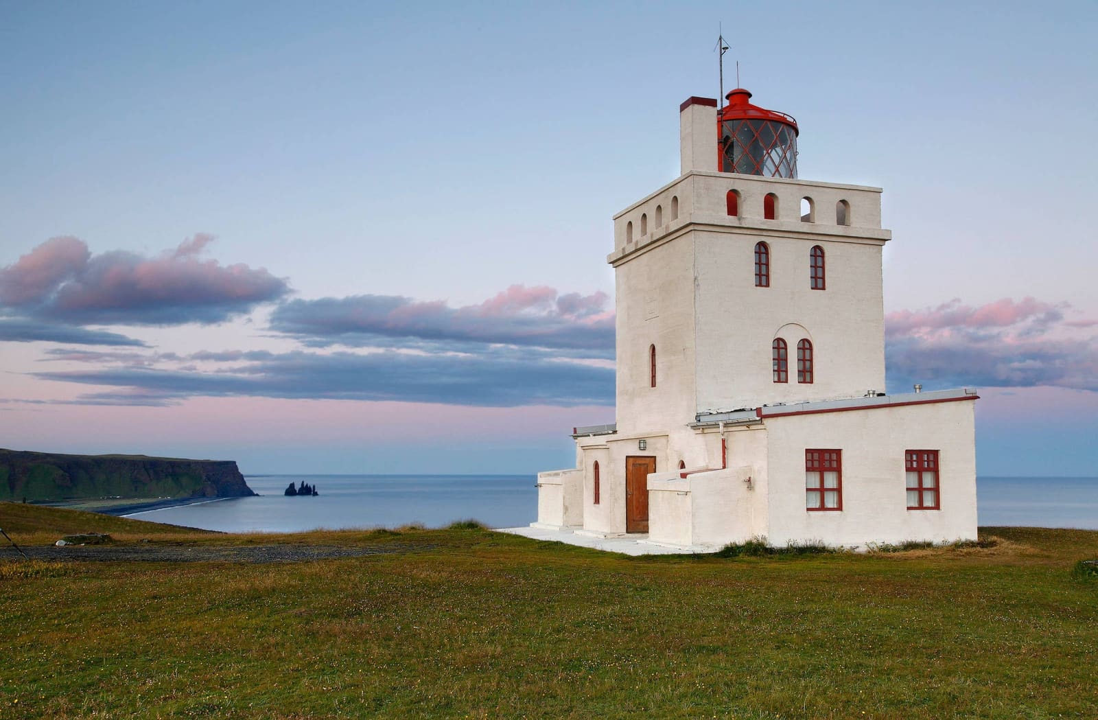
Dyrhólaey Lighthouse is most useful when you want the high, open version of the Dyrhólaey experience: white tower, black coast, Atlantic wind, bird cliffs, and views back toward Reynisfjara and Vík í Mýrdal.
If you are already using the broader Dyrhólaey guide, treat this page as the upper-headland decision. The lighthouse is not a long museum-style visit; it is the viewpoint that makes the headland feel higher, wider, and more exposed.
Leave it out when low cloud, fierce wind, or a packed South Coast day would turn the detour into a rushed photo stop. In that case, focus on one strong Vík-area experience instead of trying to collect every nearby viewpoint.
The upper viewpoint turns nearby places into one readable South Coast scene.
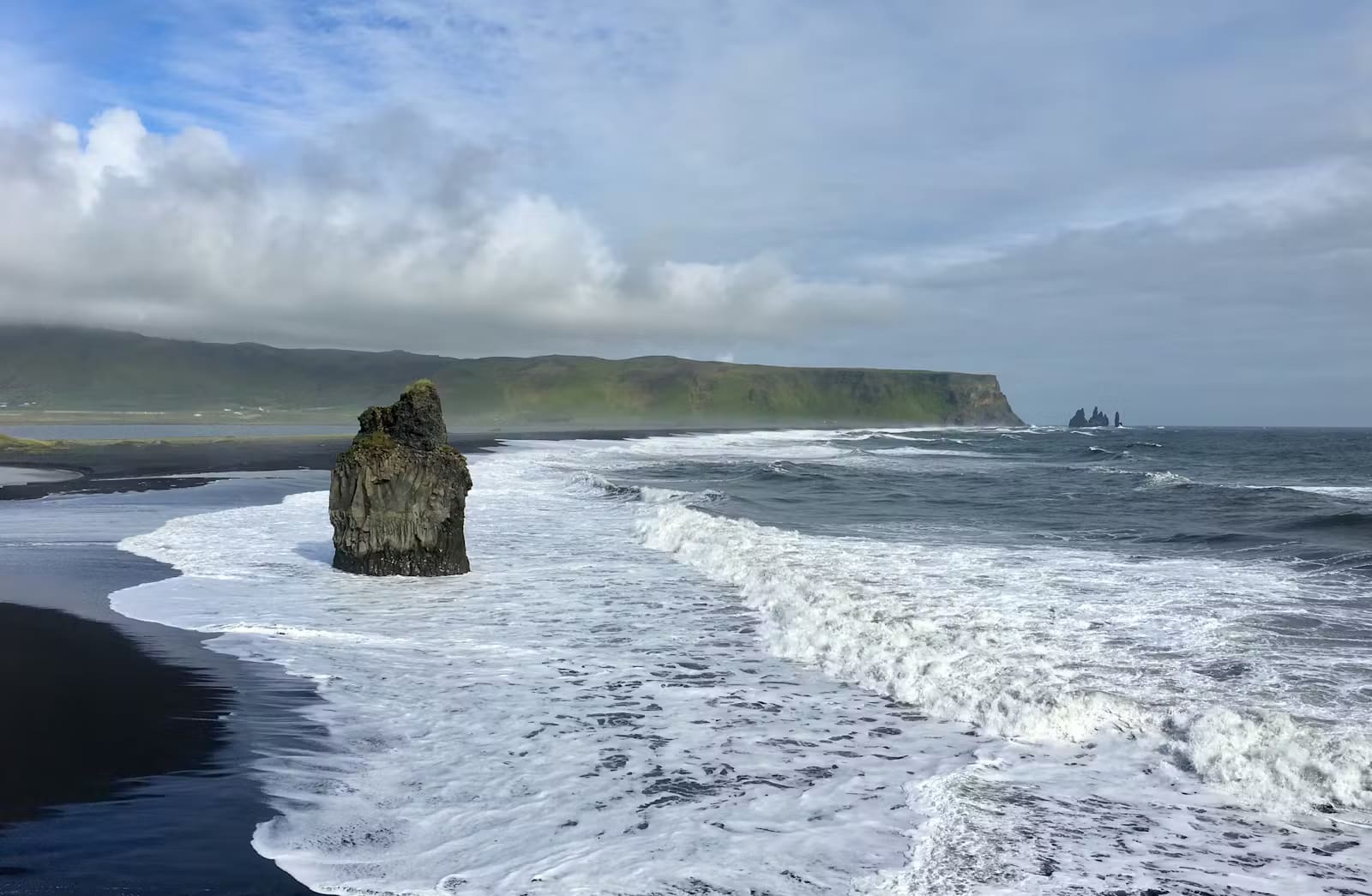
From the lighthouse area, the coastline opens into layers: the black-sand edge, offshore stacks, the lower Dyrhólaey cliffs, and the Vík-side horizon. That height is the main reason to come up here rather than only staying near the lower area.
The view is also practical. It helps you decide whether the day still needs beach-level time at Reynisfjara, a slower pause in Vík í Mýrdal, or a cleaner move onward along the South Coast.
The lighthouse gives the headland a clear landmark and a slightly deeper history than the sea-arch view alone.
The present concrete lighthouse was built in 1927 after an earlier 1910 iron-frame structure. That history matters because the building is not just a white object for photos; it marks a working coastal-navigation story on one of the most exposed edges of South Iceland.
The view is the real reason to come. On a clear day, the upper headland can pull together the arch, offshore stacks, black-sand shoreline, bird cliffs, and the Vík-side coast in a way that the lower area cannot.
It also changes the mood of the stop. The lower Dyrhólaey area feels closer to beach, surf, and cliffs; the lighthouse feels more open, wind-shaped, and horizon-led.
Use the lighthouse for height and orientation, then let nearby places handle beach texture, sea stacks, or food-and-base logistics.
The cleanest pairing is lighthouse first or last, with Reynisfjara taking the beach-level role. Reynisfjara gives basalt, surf power, and sea-stack scale; Dyrhólaey Lighthouse gives the overhead view and a safer way to understand the coastline from above.
Kirkjufjara Black Sand Beach and Reynisdrangar help explain the same coast from different angles, but they should not all be forced into one rushed hour. Pick the stop that answers the question your day still has open.
This is a protected, exposed coastal site, so conditions matter more than the distance from the Ring Road suggests.
Dyrhólaey is a nature reserve, and bird protection can affect where and when visitors may move through the area. Use marked roads and paths, respect posted signs, and confirm official protected-area details before building the stop around bird season.
Wind is not background weather here. Gusts can make the clifftop feel very different from the parking area, and visibility can decide whether the upper viewpoint is worth the effort at all.
Before turning off the Ring Road, check official road information and the weather forecast, especially when driving in winter, shoulder season, or fast-changing coastal conditions.
The right timing depends on whether the lighthouse is your main viewpoint or one part of a wider headland visit.
For a lighthouse-led stop, keep the plan simple: reach the upper viewpoint, look back along the black-sand coast, and leave enough margin for wind, photos, and a careful return.
If you also want the lower Dyrhólaey area, treat the visit as a broader headland stop rather than a quick lighthouse detour. That makes more sense when your South Coast day is built around Vík-area scenery instead of long eastbound distance.
On a tight schedule, choose one clear role for the stop. The lighthouse gives height and a landmark; the lower area and nearby beaches give more immediate surf, cliff, and black-sand texture.
These are the practical questions that usually decide whether the lighthouse belongs in the day.
It is part of the Dyrhólaey headland experience. Use the lighthouse page for the upper viewpoint, and the broader Dyrhólaey guide for the full headland decision.
Many travelers only need about 30 to 75 minutes for the upper-headland stop, but allow more time if you are walking slowly, photographing birds, or combining it with lower Dyrhólaey.
No. Dyrhólaey is known for birdlife, but sightings, access, and viewing distance depend on season, protection rules, weather, and responsible behavior around nesting areas.
By ThorPublished Updated
Use official and regional sources for the details that can change after a page like this is published.
Use for place context, road number, and regional visitor framing.
Use for reserve context, lighthouse history, and official notices.
Use before driving to exposed South Coast viewpoints.
Use for wind, visibility, and fast-changing coastal conditions.
Map
Use nearby places and useful bases before opening directions.
Interactive planning map for Dyrhólaey Lighthouse
Interactive map
Place context and external map links remain available without loading it.
Nearby coast
Use nearby places to balance scenery, safety, wildlife seasons, and how much time the coast deserves.
Planning context
Open the region or practical guide that resolves the next planning decision.
Next step
Use the next page that helps turn this stop into a practical route decision.