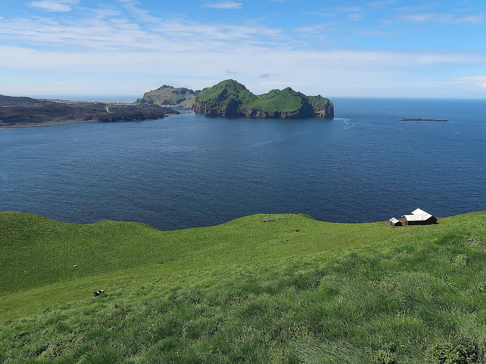
Bjarnarey is an uninhabited volcanic island in Vestmannaeyjar, with steep sea cliffs, grassy slopes and seasonal seabirds. It lies near Heimaey, but the ferry does not take you there: seeing it from a boat and landing on the island are different plans.
Coast snapshot
Type
Uninhabited volcanic island and seabird habitat
Setting
Vestmannaeyjar, south of Elliðaey and east of Heimaey
Access
Separate sea crossing; the Heimaey ferry is not a Bjarnarey landing service
Wildlife
Seasonal seabirds; sightings and close approaches are not guaranteed
Map pin
Island location only, not parking, a departure point or an approved landing
In this guide
Bjarnarey’s cliffs and place in Vestmannaeyjar
Bjarnarey lies just south of Elliðaey in the Westman Islands. Steep cliffs surround its grassy interior, where the volcanic cone Bunki gives the island its distinctive height.
The island has no permanent settlement. Its seabirds, volcanic cliffs and exposed position make it a place to view within the wider archipelago, with any landing planned separately. Some local boat descriptions spell the name Bjarnaey.
Boat, weather, and sea conditions shape the experience
Tight mainland South Coast route
Usually skip
Ferry and boat time can crowd out easier stops
Birdwatching or photography focus
Worth considering with local guidance
Do not treat puffins or close access as fixed promises
Give Vestmannaeyjar enough time to be worthwhile even if sea conditions keep you on Heimaey. A view of Bjarnarey should add to that island day, not be its only purpose.
Bunki, sea cliffs and seasonal birdlife
Bjarnarey’s grassy slopes rise above abrupt sea cliffs. The local school’s geography guide describes Bunki as a volcanic cone with a depression near its summit.
The same guide describes only limited ways up from the shore. This is not an ordinary marked coastal walk or a place to assume easy access from a sightseeing boat. A description of an ascent is not permission or practical guidance for attempting it.
Puffins and other seabirds are part of the island’s appeal, but sightings depend on season and conditions. Keep your distance from birds and nesting ground, and follow the skipper’s decisions about where a boat can approach.
Look for volcanic cliffs and grass-covered slopes as well as birds.
Keep Elliðaey separate from Bjarnarey; the famous isolated-house photograph is associated with Elliðaey.
Treat the sea views and Heimaey photographs below as wider archipelago context.
Arrange any landing explicitly; a boat passing an island does not imply access ashore.
Icelandic overview of the volcanic island chain and Heimaey as its inhabited island.
Passengers in a yellow RIB boat beside the Westman Islands’ cliffs.Sea stacks and cliffs show the wider archipelago landscape.A grass-covered island ringed by sea cliffs.
The Heimaey ferry and Bjarnarey access are separate
Herjólfur connects the mainland with Heimaey. A ferry ticket does not include a crossing to Bjarnarey, and taking a car to Heimaey does not create road access to the smaller island.
Seeing Bjarnarey from the water and setting foot on it are different arrangements. Confirm whether any proposed outing passes the island or includes a landing, whether access permission is covered, and what boarding, terrain and mobility requirements apply. Do not assume a landing is available simply because a route names Bjarnarey.
The map marks the island’s geographic location. It does not identify parking, a boat departure point or a safe landing. Use your confirmed departure instructions for navigation, and keep time for the return ferry.
A yellow RIB boat passes a settled shoreline in Vestmannaeyjar.A sea-level view shows the exposed cliffs of the wider archipelago.
Keep enough time for Heimaey and the return crossing
Heimaey offers harbor walks, volcanic history and coastal views even when a further sea crossing is unsuitable.
Leave space in the day for the mainland ferry, any separate outing and the return crossing. A short boat duration is only one part of the trip; boarding requirements, weather and changes to the ferry timetable can affect the whole plan.
If your time is limited, compare that commitment with the South Coast Road Trip. Staying on the mainland may leave more time at individual sights than combining a tightly scheduled ferry crossing with another boat journey.
Consider Bjarnarey when Vestmannaeyjar is already a priority.
Keep Heimaey as a worthwhile plan if the sea outing changes.
Choose nearby Heimaey sights rather than adding distant mainland stops to the same day.
Check the ferry’s latest notice before driving to the mainland terminal.
Heimaey is the inhabited base for a Westman Islands visit.Heimaey offers volcanic scenery and town walks if a further crossing does not fit.
Check the crossing, conditions and access arrangements
Use Herjólfur’s latest announcements as well as its timetable. Wind and sea conditions can change a departure even when a published schedule looks convenient.
Confirm the mainland departure harbor, sailing times and check-in requirements directly with the ferry. For any onward crossing, confirm the actual route, whether going ashore is included and whether the outing suits everyone in your group. Keep a Heimaey-only plan available.
There is no useful fixed visit duration for Bjarnarey without a confirmed arrangement. Plan around the crossing you have actually agreed, rather than treating an island map pin as a quick sightseeing stop.
Use official safety guidance for exposed coastal, boat, and weather-dependent travel.
Bjarnarey Island FAQ
Can you visit Bjarnarey Island?
Seeing Bjarnarey from a boat is different from landing there. Confirm any landing, access permission and physical requirements separately with the people arranging the crossing. The Herjólfur ferry serves Heimaey, not Bjarnarey.
Is Bjarnarey the same as Elliðaey?
No. They are separate Vestmannaeyjar islands, with Bjarnarey south of Elliðaey. The famous isolated-house photograph is associated with Elliðaey.
Is Bjarnarey good for puffins?
Bjarnarey is associated with puffin colonies, but wildlife viewing depends on season, weather, sea conditions, and the route. Plan for birdlife context, not a guaranteed close encounter.
Should I add Bjarnarey to a one-day South Coast trip?
Usually no. It makes more sense when you are already giving Vestmannaeyjar meaningful time. A short mainland day normally gets easier value from waterfalls, beaches, and cliff viewpoints.
Bjarnarey is an offshore island, not a road destination or landing point. Herjólfur serves Heimaey; viewing Bjarnarey or going ashore requires a separate arrangement.
Region
South Iceland
Works well with
South Coast
Useful base
Vík
Interactive planning map for Bjarnarey Island
Interactive map
Load the map when you need it
Place context and external map links remain available without loading it.
Planning context
Use the wider destination guides
Open the region or practical guide that resolves the next planning decision.