
Geology snapshot
- Type
- Ambiguous river-name guide
- Region
- Hveragerði, South Iceland
- Best for
- Town walks and fishing research
- Access
- Use local paths and current notices
- Nearby
- Hveragerði, Reykjafoss, Reykjadalur
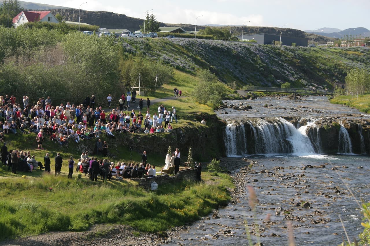
Varmá is a minor warm river name travelers may meet around Hveragerði, useful for town walks, Reykjafoss context, and specialist fishing research rather than a standalone sightseeing detour.
Geology snapshot
Varmá is best read as an ambiguous place-name guide for a warm river around Hveragerði, with a specialist fishing angle and useful town-walk context.
The honest decision is simple: do not make Varmá the main target of a South Iceland day unless you are researching fishing or already spending time in Hveragerði. Most travelers get more value by treating it as context for the town, Reykjafoss, geothermal steam, and nearby walking routes.
The name can also be confusing. Varmá and Varmár-related names appear in more than one Icelandic location, including the capital-region Mosfellsbær area, so confirm the exact map result, operator meeting point, or local notice before navigating.
Hveragerði gives the river its practical visitor context: geothermal ground, short walks, gardens, riverbank history, and nearby services on the South Iceland route.
Visit South Iceland describes Hveragerði as a geothermal town east of Reykjavík and notes trout and salmon in the Varmá river. That matters because the river is part of the town's landscape, not a remote wilderness destination.
The more concrete public stop is Fossflöt, where Hveragerði municipality places the garden beside Varmá and below Reykjafoss. The same local information points to old riverbank remains and a walking path along Varmá, which is the kind of low-key use travelers should expect.
Varmá has a real angling identity, but travelers should treat fishing details as operator- and permit-dependent rather than durable sightseeing facts.
Specialist fishing sources describe Varmá as a small river associated with sea trout, brown trout, char, and fly-fishing. That makes it relevant for anglers, but it does not make the river an open-access casual activity for every visitor.
Before planning around fishing, confirm the current permit route, rules, permitted methods, season, water-quality notices, and any operator instructions. Hveragerði municipality has published local notices about Varmá water quality and fishing restrictions in the past, which is a good reminder not to rely on old travel-page details.
If you are not fishing, Varmá usually works best as one detail inside a stronger Hveragerði, Reykjadalur, or geothermal route plan.
For a short town pause, start with Hveragerði and let Varmá explain the river edge. For a more memorable outdoor plan, compare the time, trail, weather, and bathing checks for Reykjadalur.
If geothermal learning is the goal, Hveragerði Geothermal Park or the Geothermal Energy Exhibition gives a clearer visitor experience. If you are simply driving between Reykjavík and South Iceland, Hellisheiði and Hveragerði are more useful planning anchors than the river name alone.
Regional visitor information supports Hveragerði's geothermal-town identity, South Iceland location, Varmá river mention, and nearby walking context.
Municipal information supports Fossflöt, Varmá, Reykjafoss, old riverbank remains, and walking-path context in Hveragerði.
Official weather information supports checking forecasts before riverside walks or exposed route plans.
Official road information supports checking current driving conditions before relying on a South Iceland stop.
By ThorPublished Updated
Map
Use nearby places and useful bases before opening directions.
Interactive planning map for Varmá River in Hveragerði
Interactive map
Place context and external map links remain available without loading it.
Routes and itineraries
Compare road trips and itineraries that give this place a sensible position in the wider journey.
Planning context
Open the region or practical guide that resolves the next planning decision.

