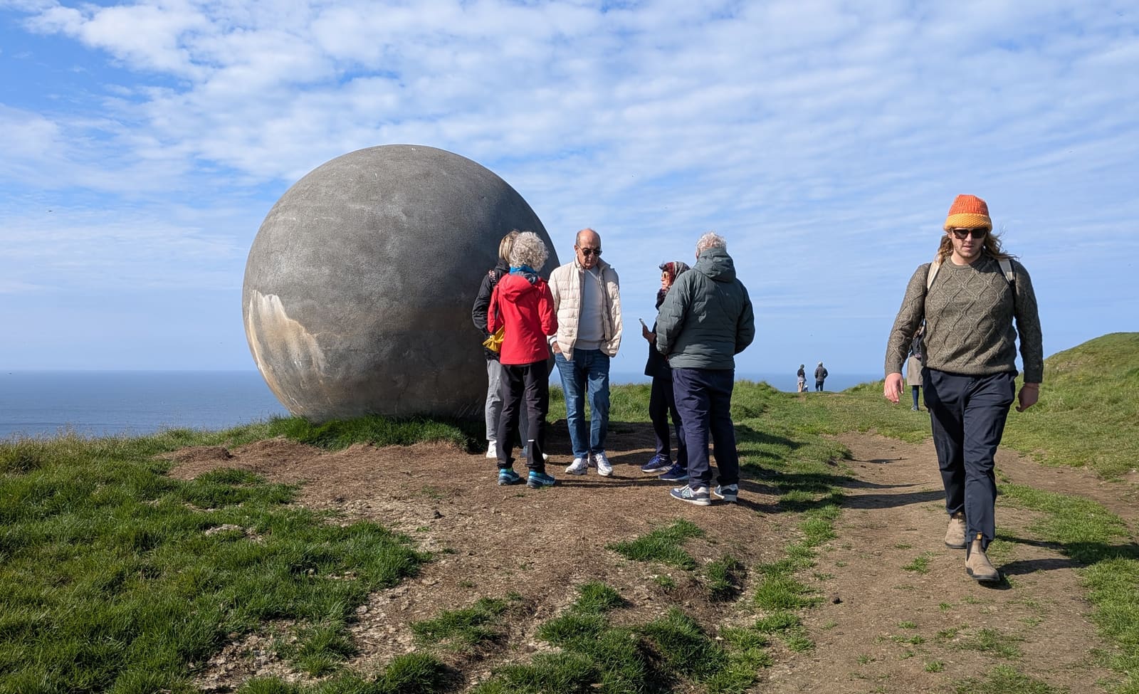
In Iceland, crossing the Arctic Circle usually means a trip to Grímsey. Allow time for sea or air travel and the exposed walk to Orbis et Globus before committing to an island day.
Short stop snapshot
Type
A moving line of latitude
Iceland place
Grímsey, off North Iceland
Landmark
Orbis et Globus sphere
Walking time
Allow around 3 hours for the sphere walk and return; confirm the current route
Access
Ferry or flight, conditions dependent
In this guide
Where is the Arctic Circle in Iceland?
The Arctic Circle crosses Grímsey, an island off North Iceland. Reaching it requires a separate island trip from the mainland.
The Arctic Circle is a line of latitude, not a gate, viewpoint, or visitor center. It marks the southern edge of the area where the sun can stay above or below the horizon for at least one full day each year, depending on the season.
That makes it meaningful, but it also makes it easy to over-plan. In Iceland, the useful traveler question is not whether the Arctic Circle is famous. It is whether you have enough time, weather margin, and interest to reach Grímsey, the North Iceland island where the line gives visitors a concrete place to walk to.
Why Grímsey is the Iceland place that matters
The Orbis et Globus sphere marks the Arctic Circle on Grímsey. Its position changes as the line moves.
Orbis et Globus is the large sphere associated with the Arctic Circle on Grímsey. Official Grímsey and Akureyri information describes it as a movable landmark, because the Arctic Circle itself shifts over time rather than staying fixed at one permanent marker.
In Iceland, the Arctic Circle becomes a travel decision through Grímsey rather than a mainland roadside stop.
This is why the Arctic Circle is strongest as a special-interest North Iceland goal. You are not just ticking off a coordinate. You are committing to an island, an exposed walk, a small community, sea and weather variables, and a slower rhythm than the classic mainland sightseeing circuit.
Allow around three hours to walk to the sphere and back, using the official Grímsey guide as a starting estimate. Confirm the current route locally: the marker moves, and wind, ground conditions and your pace affect the walk. Compare that allowance with the time you will actually have ashore before choosing a same-day return.
When crossing it is worth the effort
The crossing is worthwhile when the concept adds enough meaning to justify a Grímsey day; it is weak as a token detour.
Choose it when the Arctic Circle itself is part of the story you want from Iceland: remote North Atlantic island time, midnight-sun context, seabird cliffs in season, and the feeling of standing at a line most visitors only see on maps.
Be honest with the tradeoff. If your North Iceland time is short, Goðafoss, Mývatn, Húsavík, or Akureyri-side stops usually give more scenery for less logistical risk. The Arctic Circle earns its place when the symbolic crossing and Grímsey atmosphere are the point.
The Arctic Circle trip is strongest when Grímsey's exposed island landscape matters, not only the marker photo.
Transport and weather checks before you commit
The concept is stable; the practical day is not. Check the official channels before locking it into a route.
Grímsey planning usually starts from Dalvík for the ferry or from Akureyri for flight context. Do not rely on old schedules, third-party summaries, or fixed turnaround assumptions. Confirm transport details, sea conditions, weather, local services, and walking expectations before treating the Arctic Circle as the day's anchor.
Sæfari passengers must arrive at least 30 minutes before the scheduled departure. Check both outbound and return arrangements, including the time available on Grímsey; arriving on the island does not guarantee enough time to reach the sphere and get back. Use the Grímsey guide for the wider island visit.
The pin shows approximate Grímsey island context, not the current Arctic Circle or sphere position. There is no road connection from mainland Iceland; arrange ferry or flight access and confirm the walking route locally.
Region
North Iceland
Works well with
North Iceland
Useful base
Húsavík
Interactive planning map for The Arctic Circle
Interactive map
Load the map when you need it
Place context and external map links remain available without loading it.
Planning context
Use the wider destination guides
Open the region or practical guide that resolves the next planning decision.