Coast snapshot
- Type
- Basalt island and lighthouse viewpoint
- Region
- Stykkishólmur, north Snæfellsnes
- Best for
- A short harbor-side climb
- Time
- About 20 to 45 minutes
- Access
- Stairs and exposed gravel paths
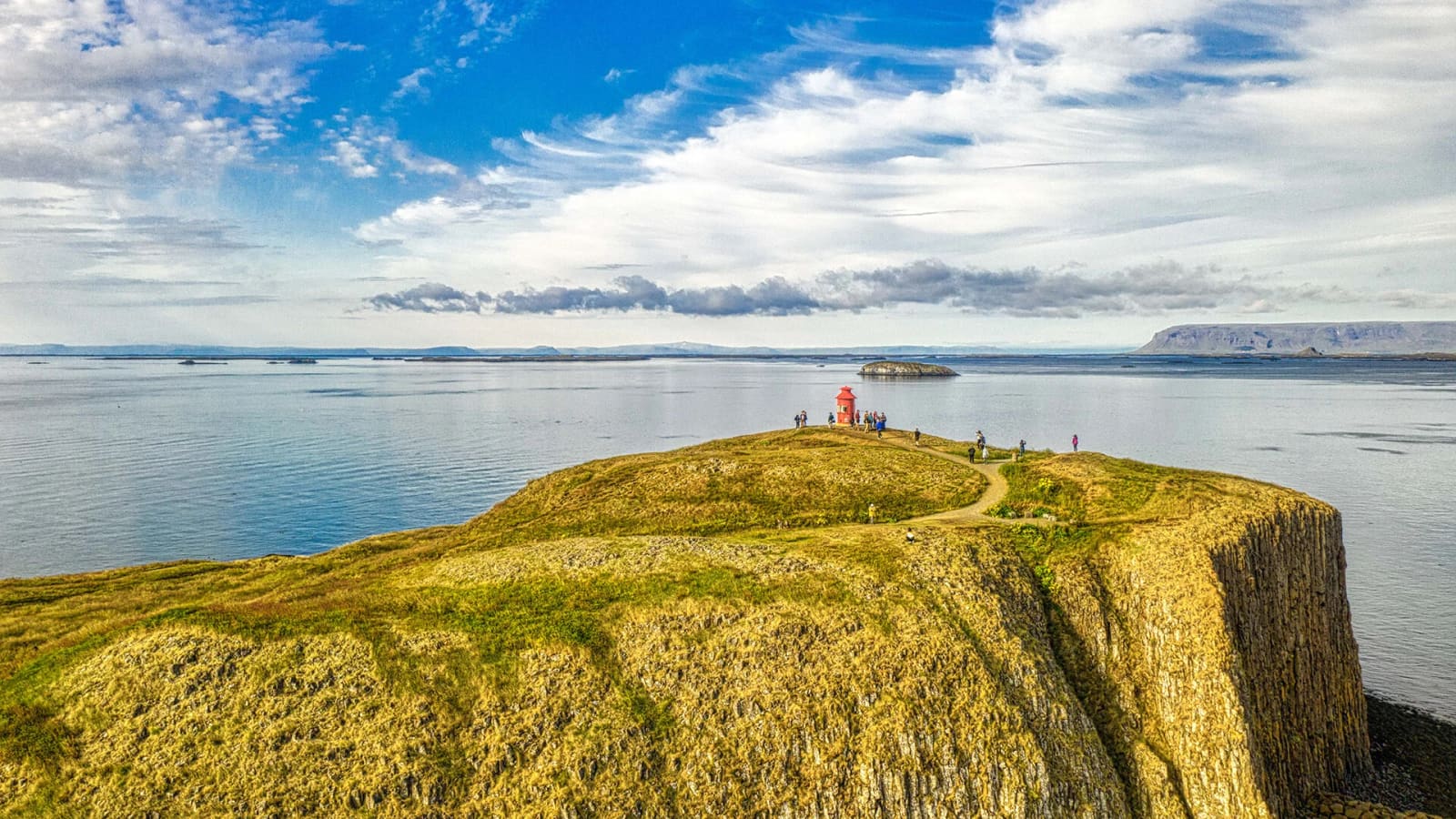
Súgandisey Island is the short basalt viewpoint above Stykkishólmur harbor, best for travelers who want a quick climb, lighthouse photos, and a clearer sense of Breiðafjörður before continuing around Snæfellsnes.
Coast snapshot
Yes, when you are already in Stykkishólmur and want a fast, satisfying view over the harbor, town, and Breiðafjörður. It is less convincing as the reason for a long detour by itself.
Súgandisey is the small basalt island beside Stykkishólmur, connected to the harbor edge and topped by a red lighthouse. The visit is simple: climb above the boats, look back over the town, then turn toward Breiðafjörður and its low islands.
The stop works best when your day already uses the north side of Snæfellsnes. It gives the town a natural high point and a clearer sense of the bay, without demanding the time or logistics of a longer hike.
| Trip shape | Use Súgandisey for | Main tradeoff |
|---|---|---|
| Stykkishólmur stop | Quick harbor and lighthouse viewpoint | Little downside unless weather is rough |
| Full Snæfellsnes loop | A short north-coast stretch | Can crowd time for bigger landscape stops |
| Westbound route | A town-and-bay pause before longer driving | Do not let it replace ferry or road checks |
The walk is short, open, and more exposed than it first looks from the harbor, with stairs, gravel, benches, and changing views as you gain height.
From below, the island feels like part of the harbor wall. On the way up, it becomes a little lookout walk with basalt underfoot, sea wind around the edges, and benches where you can pause without turning the stop into a hike.
The main practical point is exposure. On a calm day the climb feels easy and casual; in stronger wind or icy conditions, the same short path deserves slower footing and a willingness to turn around.
The lighthouse gives Súgandisey its visual marker, but the more useful story is how island, harbor, town, and bay line up from the same small rise.
Visit Stykkishólmur notes that the lighthouse once stood at Grótta near Reykjavík before it was moved to Súgandisey. That detail adds more character than the structure alone: the red tower now acts as a clear summit marker over the town harbor.
The island also helps explain the harbor. Regional visitor information describes Súgandisey as connected to land and tied to Stykkishólmur's setting by the sea, birds, and views across Breiðafjörður.
Use the island as a compact viewpoint before deciding whether the day should stay local, continue west across Snæfellsnes, or slow down around Breiðafjörður.
If you are staying near Stykkishólmur, pair Súgandisey with the harbor and Breiðafjörður rather than racing away immediately. If you are crossing more of the peninsula, compare the time here with bigger anchors such as Kirkjufell and Snæfellsjökull.
Súgandisey is low-friction, but exposed coastal weather can change how comfortable the stairs, gravel, and viewpoint feel.
Check weather before treating the climb as automatic, especially if wind, ice, or poor visibility would make the viewpoint less pleasant. The island is close to town, but the summit feels more exposed than the harbor streets below.
Use official visitor, weather, and road sources when the stop is part of a packed route rather than a flexible town walk.
If Súgandisey is part of a longer Snæfellsnes Peninsula road trip, check road conditions before fixing the north-coast timing. For a casual Stykkishólmur pause, the most important check is usually wind and visibility.
Local visitor information for the island, stairs, viewpoint, and lighthouse.
Regional place listing with location, Road 58 context, and nearby visitor information.
Official road-condition checks before longer self-drive plans.
Official weather source for wind, visibility, and coastal conditions.
By ThorPublished Updated
Map
Use nearby places and useful bases before opening directions.
Interactive planning map for Súgandisey Island
Interactive map
Place context and external map links remain available without loading it.
Nearby coast
Use nearby places to balance scenery, safety, wildlife seasons, and how much time the coast deserves.
Planning context
Open the region or practical guide that resolves the next planning decision.