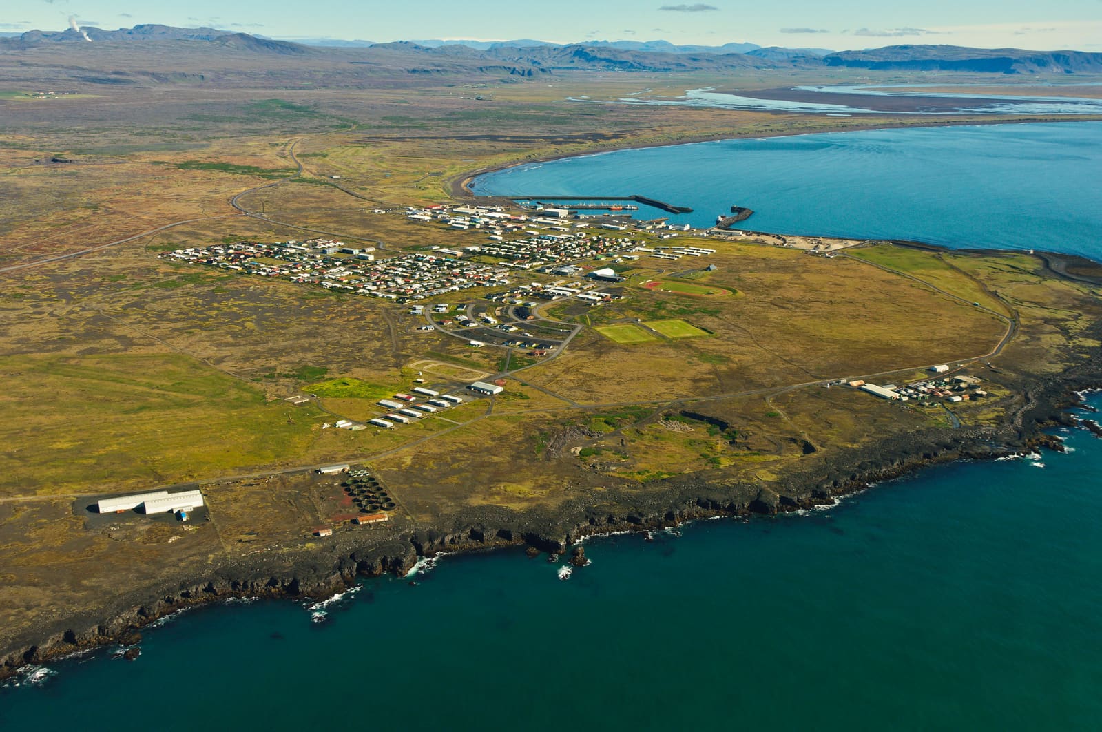
Coast snapshot
- Type
- Coastal village and culture stop
- Region
- South Iceland, near Selfoss
- Best for
- Shore walks, birdlife, local history
- Time
- About 45 to 90 minutes
- Access
- Easy village roads; exposed coast
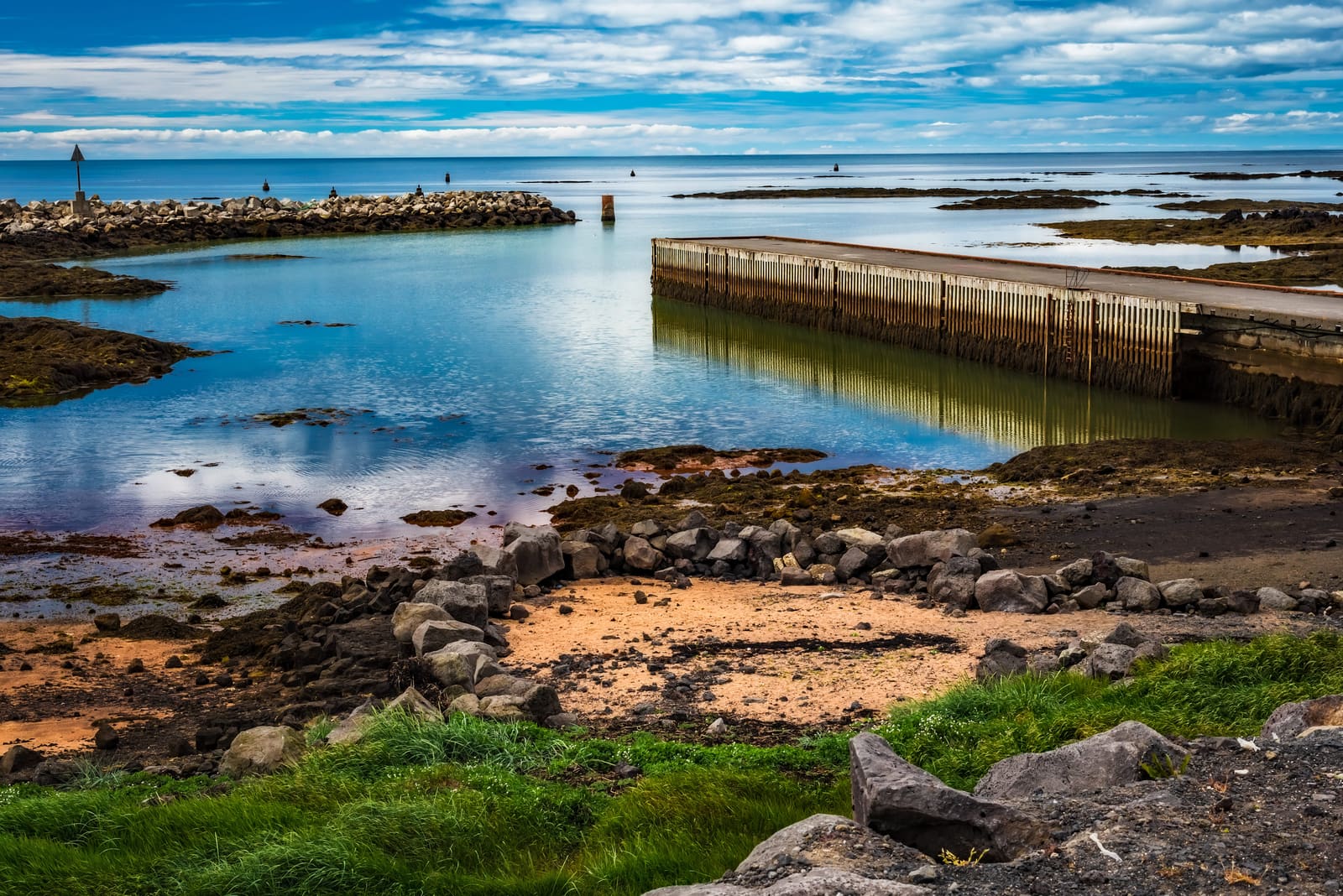
Stokkseyri is a South Iceland coastal village for travelers who want sea air, birdlife, fishing-history texture, and an easy pairing with Eyrarbakki rather than another headline waterfall stop.
Coast snapshot
Stokkseyri earns its time when you want a real South Iceland coastal village pause, not another headline sight squeezed into the same day.
The village works best for travelers already moving through the Selfoss area, the lower Þjórsá coast, or nearby Eyrarbakki. It gives the day sea air, birdlife, fishing-history texture, and a slower local rhythm without demanding a long inland detour.
It is less convincing as a replacement for major South Coast scenery. If your route has not yet made room for the big waterfalls, black-sand coast, or glacier country, Stokkseyri should stay a compact add-on rather than the reason the day gets crowded.
The first impression is low, open, and weather-shaped: houses close to the sea, flat horizons, wetland edges, and a shoreline that can feel very different from inland South Iceland.
Start with the shore rather than a checklist. The exposed coast is the part that makes Stokkseyri feel specific: rocks, tidal water, birds, and a village scale that contrasts with the louder stops farther east.
On a calm day, the stop can feel gentle and spacious. In stronger weather, it becomes more about quick views, short walks, and deciding whether the coast still adds enough to the day.
Stokkseyri sits on a coast shaped by the great Þjórsá lava area, so the shoreline is not only a village view; it is also a low lava-and-sea landscape.
That matters for the visit because the best part is often between named sights. Look for the mix of water, rough shoreline, grass, and birdlife rather than expecting a single viewpoint to do all the work.
If you are continuing east or inland, Stokkseyri pairs naturally with Þjórsá, Aegissidufoss Waterfall, or Caves of Hella only when the driving day still has margin.
Stokkseyri has more than shoreline atmosphere. The former fish-processing buildings and local museum stops give the village a sharper cultural reason to pause.
Menningarverstöðin, the village cultural centre, helps explain why Stokkseyri is not just a row of houses by the sea. The area has held exhibitions and unusual visitor stops, including folklore and wildlife-focused collections, so it can work for travelers who like small local culture.
Þuríðarbúð adds a more grounded fishing-history angle. The rebuilt turf-and-stone hut is tied to Skipper Þuríður, and it gives the coastal setting a human scale that a quick drive-through would miss.
Treat those stops as flexible extras. Check official visitor information before planning around a museum, exhibition, kayak operator, or indoor stop, because details can vary by season, staffing, weather, or maintenance.
The cleanest use is a short coast-road loop from Selfoss, with Stokkseyri and Eyrarbakki sharing the same slow-travel role instead of competing for the whole day.
Choose Stokkseyri first if you want shore, birdlife, and a slightly rougher coastal feel. Choose Eyrarbakki first if old houses, Húsið, and village history are the stronger reason for stopping.
| Plan | Best use | Watch |
|---|---|---|
| Quick pause | Shore and village look-around | Wind can shorten it |
| Two-village loop | Stokkseyri plus Eyrarbakki | Avoid adding too many inland stops |
| Culture focus | Museum or hut plus coast | Confirm visitor details first |
If you are sleeping or refueling around Selfoss, this is one of the easier ways to give the day a coastal edge before returning to Hella, the Golden Circle side, or the wider South Coast.
The village is straightforward to reach, but the quality of the stop depends on weather, coast conditions, and any specific museum or operator plans.
Use for village overview and local visitor context.
Use before longer South Iceland self-drive days.
Use for wind, warnings, and coastal walking conditions.
Use for general travel-safety guidance.
By ThorPublished Updated
Map
Use nearby places and useful bases before opening directions.
Interactive planning map for Stokkseyri
Interactive map
Place context and external map links remain available without loading it.
Nearby coast
Use nearby places to balance scenery, safety, wildlife seasons, and how much time the coast deserves.
Planning context
Open the region or practical guide that resolves the next planning decision.
Next step
Use the next page that helps turn this stop into a practical route decision.