Town snapshot
- Type
- Ferry port and route hinge
- Region
- Southern Westfjords by Vatnsfjörður
- Best role
- Breiðafjörður crossing handoff
- Time
- 15-45 minutes beyond ferry needs
- Nearby
- Flatey, Patreksfjörður, and Flókalundur
Brjánslækur Port is a small ferry landing most useful for travelers crossing Breiðafjörður or entering the southern Westfjords, helping you decide whether to keep moving, pause briefly, or add the nearby geology and settlement-history layer.
Town snapshot
Usually it is a route hinge first and a sightseeing stop second. It becomes worth slowing down for when the Baldur crossing is part of the plan or when you want a little more context before driving deeper into the southern Westfjords.
Brjánslækur is not the kind of place that competes with Látrabjarg or Rauðasandur on pure spectacle. Its value is practical and specific: the dock where the Baldur ferry links Stykkishólmur, Flatey, and the southern Westfjords.
That makes the stop useful when the crossing changes your route, saves a longer drive, or gives the day a natural pause before Patreksfjörður and the roads beyond. It is less convincing if you are already on land and looking for a separate detour only to see the port itself.
Photo guide
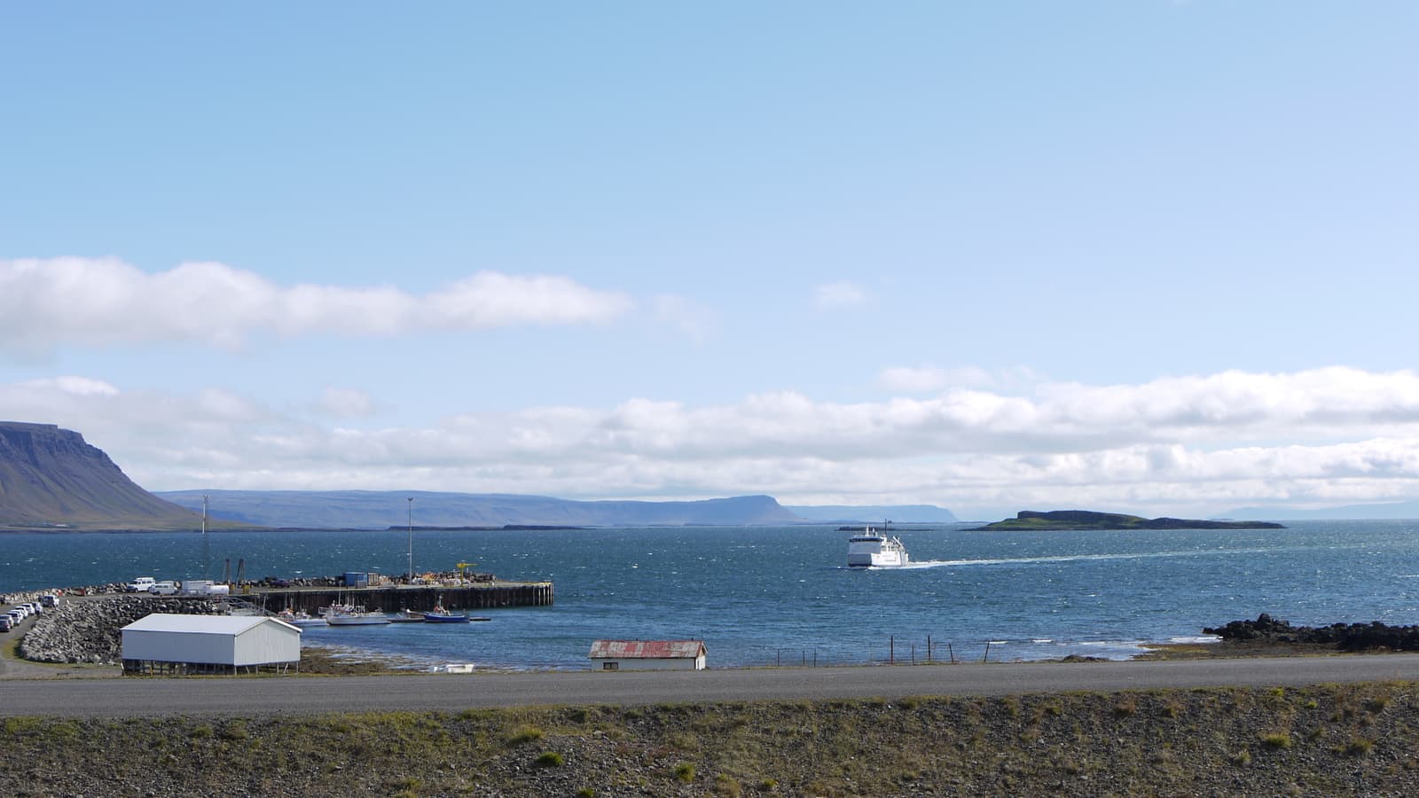
A compact card crop still reads as a real harbor landing, not a generic bay.
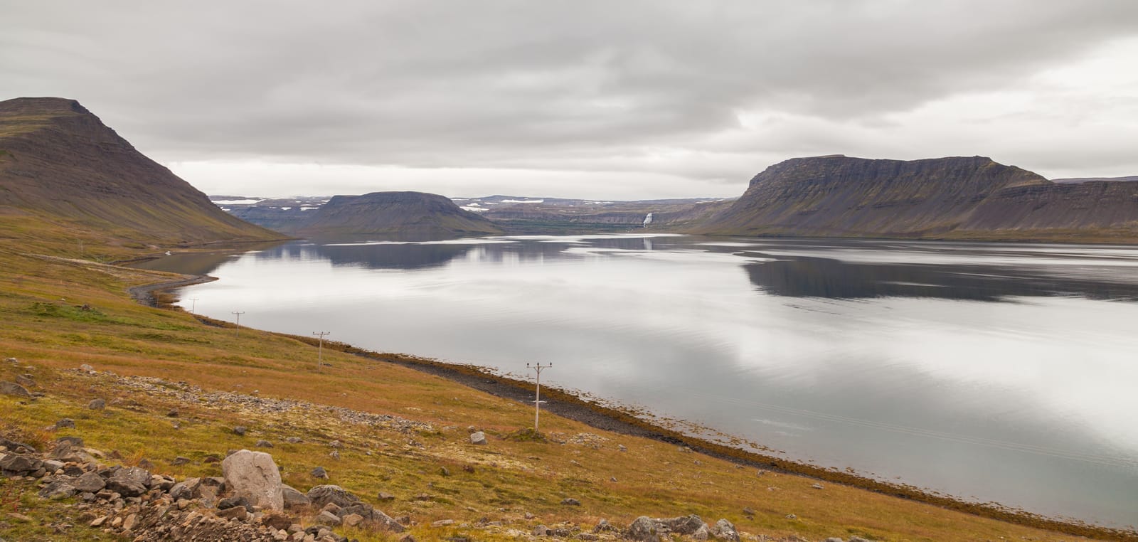
Expect a small ferry landing on the Barðaströnd side of Breiðafjörður, with open shoreline, road context, and a sense that you are entering a quieter corner of the Westfjords rather than arriving at a built-up harbor town.
The place feels sparse and functional. You come here for the crossing, the shoreline setting, and the onward decision, not for a long waterfront wander. That is exactly why the stop can work well: it is clear about its job in the route.
Municipal harbor information places Brjánslækjarhöfn in western Vatnsfjörður, while the regional ferry listing frames it as the southern Westfjords landing for Baldur. In practice, that means a short arrival zone with a much bigger planning role than its physical scale suggests.
The strongest case for Brjánslækur is not the dock itself. It is the way the Baldur ferry can reshape a route between Snæfellsnes, Flatey, and the Westfjords.
If you are crossing from Stykkishólmur, Brjánslækur feels like a clean gateway into the southern Westfjords. If you stop in Flatey on the way, the landing also becomes the point where a calm island crossing turns back into road planning.
| Situation | Why it works | When to keep it lighter |
|---|---|---|
| Arriving by Baldur | It gives a natural handoff into the southern Westfjords. | Do not overload the same day with too many remote follow-up stops. |
| Crossing from Snæfellsnes | It can turn a long relocation into a more interesting bay crossing. | Check official operator details before relying on the crossing. |
| Driving nearby already | It can be a short pause with some local context. | It is not strong enough to justify a separate detour on its own. |
Brjánslækur becomes more interesting when you see it as more than a dock. The nearby fossil canyon and the Flókatóftir story add geology and early-settlement context without pretending the port itself is a major cultural site.
Visit Westfjords and the protected-area authority both support Surtarbrandsgil as a protected fossil site in the Brjánslækur area. That matters because it gives the stop a tangible landscape story, not just transport utility.
The same protected-area material places Flókatóftir above the harbor and ties the site to the Hrafna-Flóki tradition in Vatnsfjörður. For most travelers, this is not a separate headline attraction. It is a good reason to understand why the landing area has more historical depth than a quick look at the ferry ramp suggests.
If the ferry is the only reason you are here, a short stop is enough. If the route has room for context, Brjánslækur can hold a little extra time before you continue toward Patreksfjörður or the wider southern Westfjords.
Most travelers do not need to carve out a long visit for the port itself. What matters more is preserving enough margin after the crossing so your next leg does not become rushed. That is especially true if the day still points toward Patreksfjörður, Rauðasandur, or later Westfjords drives.
If you are curious about the nearby geology or settlement context, add a modest buffer rather than turning the port into an all-day stop. The page works best when it helps you keep the route realistic.
Check official ferry details, road conditions, weather, and any protected-area access guidance before treating Brjánslækur as a fixed timing anchor.
The operator is the source of truth for ferry schedules and booking details. Road and weather sources matter just as much once you leave the dock, because the southern Westfjords can turn a simple map line into a slower day than expected.
If you want to add the nearby Surtarbrandsgil angle, confirm official access details there as well. The protected-area guidance makes clear that this is not a place to assume open, independent access without checking first.
Use the operator for ferry details and booking checks.
Regional context for the Brjánslækur landing and vehicle-booking reminder.
Check southern Westfjords road conditions before leaving the ferry.
Check wind, visibility, and warnings before tying the day to the landing.
Use official travel-safety guidance when conditions or plans are uncertain.
By ThorPublished Updated
Map
Use nearby places and useful bases before opening directions.
Interactive planning map for Brjánslækur Port
Interactive map
Place context and external map links remain available without loading it.
Planning context
Open the region or practical guide that resolves the next planning decision.
Next step
Use the next page that helps turn this stop into a practical route decision.